Map of Wychall Road
| Postcodes | ||
|---|---|---|
| Icon | Postcodes for Wychall Road | |
| Walking Distances | ||
| Distance Info | Green Circle = 10 Minutes Walk (800 metres) | |
About Wychall Road
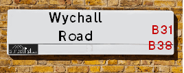
Wychall Road is a street located in the city of Birmingham. The street has a length of approximately 1,019 metres.
Wychall Road is located within the Birmingham District (B) Council's jurisdiction. They provide various services, like refuse collection, and manage council tax collection. It's situated in the West Midlands region of the UK.
Wychall Road has been assigned the Unique Street Reference Number of 2701200 and 2701199 in the National Street Gazetteer.
Wychall Road is located within the county of West Midlands, situated in the West Midlands region of the UK. It's 100.83 miles North West from central London., 5.3 miles South West from Birmingham, 18.76 miles North East from Worcester and 18.81 miles West from Coventry.

Do you know why this road is called Wychall Road?
What's it like to live here?
Ask the community a question about Wychall Road.
Do you have any questions, memories to share or know any facts about Wychall Road? We'd love to know more.
Also on streetlist.co.uk, can you help?
Eldroth Road
15th April 2024
I wondered if anyone has any old pictures of Wenning Bank House in the 1940’s and also Lane Side before of the same era .. we visited today with my Mum in law as she used to live at both these properties. Also any photos of the schools around that time .. thank you.
Can You Help?Napps Way
15th April 2024
Why is the road called Napps Way (belonging to Napp, but minus an
apostrophe as is usual with such nomenclature)? Moreover, who or
what is, or was, “Napp” in the respective, possessive case?
Several years ago, I met an elderly man (probably in his late-eighties)
who lives on Bentham Drive, Liverpool 16, and during a conversation
with him whilst in a Northwest Passenger Transport Ambulance on the
way to the former RLUH (Royal Liverpool University Hospital), he told
me that he could remember (when he was a boy, living in Childwall,
Liverpool 16) that, “Where Napps Way is now, during WW2, there was
a two-man gun emplacement on the, then, open land to protect the
railway line passing over Childwall Valley Road - next to the railway
bridge - when suddenly, as they were loading a live “shell” into the gun’s
breach, the aforementioned “shell” accidentally exploded in the gun’s
breach killing both of the two soldiers, that had been manning the gun,
instantly! (Very sad, of course, but could - perhaps - two ghosts relating
to those two, very unfortunately and prematurely-killed soldiers have
haunted that place of their deaths ever since - and have any residents
of Napps Way - formerly and in its latest incarnation - seen two, WW2
(uniformed) soldiers unexpectedly appear in or near their homes?)
Mauritius Road
15th April 2024
Why is Mauritius Road so called, since when and by whom? Does Greenwich have any particular links with Mauritius? Very interested to know. 🤞🏼
Can You Help?Estate Agents near Wychall Road
| Name | Address | Website |
|---|---|---|
| Robert Oulsnam & Company | 51 Church Road, Northfield, Birmingham, B31 2LB | |
| Dixons | 830 Bristol Road South, Northfield, Birmingham, West Midlands, B31 2NS | |
| Evans Estate Agents | 886a Bristol Road South Northfield Birmingham B31 2NS | Visit Website |
Location Details
| Wychall Road | |
|---|---|

| |
| Latitude | 52.409629 |
| Longitude | -1.953992 |
| OS Easting (X): | 403129 |
| OS Northing (Y): | 279112 |
| OS Grid Reference: | SP031791 |
Neighbourhood Policing |
| Police Force: West Midlands |
 View Neighbourhood Crime and Policing View Neighbourhood Crime and Policing |
| Find a Local Neighbourhood Watch Scheme |
Frequently asked Questions for Wychall Road
What Council (Local Authority) is Wychall Road in?
Wychall Road is located within the local authority area of Birmingham Council which is a Metropolitan District.
What Parish Council is Wychall Road in?
Wychall Road is in an unparished area.
What Electoral Ward is Wychall Road in?
Wychall Road is located within the ward of King's Norton North.
What County is Wychall Road in?
Wychall Road is located within the ceremonial county of West Midlands.
What Constituency is Wychall Road in?
Wychall Road is located within the constituency of Birmingham &Northfield.
What Part of the UK is Wychall Road in?
Wychall Road is located within the West Midlands (England) region of the United Kingdom.
What County Council area is Wychall Road in?
Wychall Road is located within the West Midlands Council area.
What Police Force area is Wychall Road in?
Wychall Road is located within the West Midlands Police area.
Roads that have a Junction with Wychall Road
| Street | Junction Type |
|---|---|
| Norman Road | junction |
| Hollow Croft | junction |
| Middlemore Road | junction |
| Staple Lodge Road | junction |
| Popes Lane | junction |
| Wychall Lane | junction |
| Chaddesley Road | junction |
Sunset and Sunrise times for Wychall Road
| Sunrise | 05:49 |
|---|---|
| Sunset | 20:22 |
Latest Weather Conditions for Wychall Road
| Observed at Weather Station: | Coleshill 23 April 2024 at 07:00 (12.17 miles away) |
|---|---|
| Current Weather: | Overcast |
| Temperature and Humidity: | 6.2°C (83.8%) |
| Wind Direction and Speed: | NNW (6 mph) |
Population Statistics
| ONS Area Code | E00046738, E00046743, E00046226 & E00046236 |
|---|---|
| ONS Area Name | Multi-Ethnic Suburbia, Semi-Detached Ageing, Established Renting Families & Private Renting Young Families |
| Average Age | 41.85 & 31.13 |
| Area Population | 1531.00 & 2060.00 |
| Male Population | 776.00 & 957.00 (48%) |
| Female Population | 755.00 & 1103.00 (52%) |
| Benefit Claimants | 28 & 95 (3%) |
| LSOA Code: | E01009205 &E01009117 |
|---|---|
| LSOA Name: | Birmingham 120A &Birmingham 126A |
| SOA Code: | 3d &7a |
| SOA Name: | |
| MSOA Code: | E02001946 &E02001952 |
| MSOA Name: | Birmingham 120 &Birmingham 126 |
Nearest Supermarkets
| Tesco West Heath Birmingham Express |
|---|
| 6 Redhill Rd, Birmingham, B31 3LD |
| 0345 675 6907 |
| Distance: 0.72 Miles |
| Directions from Wychall Road to Tesco West Heath Birmingham Express |
| Iceland Northfield G |
|---|
| Unit 12 Grosvenor Centre, Northfield, Birmingham, B31 2JU |
| 01214780890 |
| Distance: 0.77 Miles |
| Directions from Wychall Road to Iceland Northfield G |
| Sainsburys Northfield |
|---|
| Frankley Beeches Road, Birmingham, England, B31 5AA |
| 0121 476 9133 |
| Distance: 0.89 Miles |
| Directions from Wychall Road to Sainsburys Northfield |
| Tesco Birmingham Bournville Esso Express |
|---|
| Linden Rd, Birmingham, B30 1PA |
| 0345 675 6997 |
| Distance: 1.3 Miles |
| Directions from Wychall Road to Tesco Birmingham Bournville Esso Express |
Telephone Information
| Area Code |
|---|
| Area Code: 0121 - Birmingham |
| Area Code: 01527 - Redditch |
| Area Code: 01384 - Dudley |
Broadband Information
| Speed | Average Speed | Median Speed | Maximum Speed | Next-generation access (NGA) | Number of Connections |
|---|---|---|---|---|---|
| Greater than 2 Mbps | 7 | 7.1 | 9.1 | N | 4 |
Local Government
| Local Council Details |
|---|
| Within the area of Birmingham |
| Visit the Council's Website |
| Council House, Victoria Square, Birmingham &B1 1BB |
| Send email |
| Telephone Number: 0121 303 1111 |
| Local Member of Parliament |
|---|
| Within the Westminster Parliamentary Constituency of Birmingham &Northfield |
| The Member of Parliament is Gary Sambrook |
| Details for the MP Gary Sambrook on parliament.uk |
| Details for the MP Gary Sambrook on theyworkforyou.com |
| In the 2019 General Election Gary Sambrook won with a majority of 1,640 the result was Con gain from Lab. The total electorate was 73,694 |
| Wards, Parish Councils and County Councils |
|---|
| Ward: King's Norton North Ward |
| Ceremonial County: West Midlands |
Nearest Schools
England Primary Schools
Kings Norton Junior and Infant School
Address: Kings Norton Junior and Infant School, Pershore Road South, Kings Norton, Birmingham, West Midlands, B30 3EU
Distance: 1.09 miles
Contact:
Turves Green Primary School
Address: Turves Green Primary School, Northfield, Birmingham, West Midlands, B31 4BP
Distance: 0.91 miles
Contact:
Cofton Primary School
Address: Cofton Primary School, Wootton Road, West Heath, Birmingham, West Midlands, B31 4ST
Distance: 1.49 miles
Contact: 01214753374
Bellfield Junior School
Address: Bellfield Junior School, Vineyard Road, Northfield, Birmingham, West Midlands, B31 1PT
Distance: 0.94 miles
Contact: 01214642895
Bellfield Infant School (NC)
Address: Bellfield Infant School (NC), Vineyard Road, Birmingham, West Midlands, B31 1PT
Distance: 0.94 miles
Contact: 01214644855
St Laurence Church Infant School
Address: St Laurence Church Infant School, Bunbury Road, Northfield, Birmingham, West Midlands, B31 2DJ
Distance: 0.47 miles
Contact: 01214642888
St Laurence Church Junior School
Address: St Laurence Church Junior School, Bunbury Road, Northfield, Birmingham, West Midlands, B31 2DJ
Distance: 0.47 miles
Contact: 01214646499
The Meadows Primary School
Address: The Meadows Primary School, Bristol Road South, Northfield, Bristol Road South, Northfield, Birmingham, West Midlands, B31 2SW
Distance: 1.21 miles
Contact: 01216753203
St Joseph's Catholic Primary School
Address: St Joseph's Catholic Primary School, Selly Oak Road, Kings Norton, Birmingham, West Midlands, B30 1HN
Distance: 1.07 miles
Contact: 01214582458
Fairway Primary Academy
Address: Fairway Primary Academy, Muirfield Gardens, Kings Norton, Birmingham, West Midlands, B38 8XQ
Distance: 0.54 miles
Contact: 01214643200
Wychall Primary School
Address: Wychall Primary School, Middle Field Road, Northfield, Birmingham, West Midlands, B31 3EH
Distance: 0.24 miles
Contact: 01214644255
West Heath Primary School
Address: West Heath Primary School, Rednal Road, West Heath Primary, Birmingham, West Midlands, B38 8HU
Distance: 0.68 miles
Contact: 01214584257
St John Fisher Catholic Primary School
Address: St John Fisher Catholic Primary School, Alvechurch Road, West Heath, Birmingham, West Midlands, B31 3PN
Distance: 1.12 miles
Contact:
Turves Green Primary School
Address: Turves Green Primary School, Northfield, Birmingham, West Midlands, B31 4BP
Distance: 0.91 miles
Contact: 01214643686
St Brigid's Catholic Primary School
Address: St Brigid's Catholic Primary School, Frankley Beeches Road, Northfield, Birmingham, West Midlands, B31 5AB
Distance: 0.94 miles
Contact: 01214642364
England Secondary Schools
St Thomas Aquinas Catholic School
Address: St Thomas Aquinas Catholic School, Wychall Lane, Kings Norton, Birmingham, West Midlands, B38 8AP
Distance: 0.30 miles
Contact:
King's Norton Boys' School
Address: King's Norton Boys' School, Northfield Road, King's Norton, Birmingham, West Midlands, B30 1DY
Distance: 0.74 miles
Contact: 01216280010
Turves Green Girls' School
Address: Turves Green Girls' School, Turves Green, Northfield, Birmingham, West Midlands, B31 4BP
Distance: 0.91 miles
Contact:
Turves Green Boys' School
Address: Turves Green Boys' School, Turves Green, Northfield, Birmingham, West Midlands, B31 4BS
Distance: 1.10 miles
Contact:
Ark Kings Academy
Address: Ark Kings Academy, Shannon Road, Kings Norton, Birmingham, West Midlands, B38 9DE
Distance: 1.24 miles
Contact: 01214594451
Kings Norton Girls' School
Address: Kings Norton Girls' School, Selly Oak Road, Kings Norton, Birmingham, West Midlands, B30 1HW
Distance: 1.10 miles
Contact: 01216751305
St Thomas Aquinas Catholic School
Address: St Thomas Aquinas Catholic School, Wychall Lane, Kings Norton, Birmingham, West Midlands, B38 8AP
Distance: 0.30 miles
Contact: 01214644643
Nearest Hospitals
| Name | Address | Postcode | Distance | Map |
|---|
Nearest Dentists
Dentists near Wychall Road
| Name | Address | Postcode | Distance | Map |
|---|
Nearest GP Surgeries
Doctors near Wychall Road
WOODLAND ROAD SURGERY
Address: 57 WOODLAND ROAD, NORTHFIELD, BIRMINGHAM, WEST MIDLANDS, B31 2HZ
Distance: 0.35 miles
Contact: tel: 0121 4751065
WEST HEATH SURGERY - COVID LOCAL VACCINATION SERVICE 2
Address: 196 WEST HEATH ROAD, NORTHFIELD, BIRMINGHAM, B31 3HB
Distance: 0.64 miles
Contact: :
WEST HEATH SURGERY
Address: 196 WEST HEATH ROAD, NORTHFIELD, BIRMINGHAM, WEST MIDLANDS, B31 3HB
Distance: 0.64 miles
Contact: tel: 0121 4761135
WEST HEATH PRIMARY C CTR
Address: WEST HEATH PRIMARY C.CTR, 481 REDNAL ROAD, KINGS NORTON, BIRMINGHAM, WEST MIDLANDS, B38 8AX
Distance: 0.74 miles
Contact: tel: 0121 4658188
WYCHALL LANE SURGERY
Address: 11 WYCHALL LANE, KINGS NORTON, BIRMINGHAM, WEST MIDLANDS, B38 8TE
Distance: 0.78 miles
Contact: tel: 0121 6282345
GRANGE HILL SURGERY
Address: 41 GRANGE HILL ROAD, KINGS NORTON, BIRMINGHAM, WEST MIDLANDS, B38 8RF
Distance: 0.92 miles
Contact: :
Nearest Dispensing Chemists
Pharmacies near Wychall Road
| Name | Address | Postcode | Telephone | Map | Distance in Km |
|---|
Nearest Opticians
Opticians near Wychall Road
SPECSAVERS (NORTHFIELD, BIRMINGHAM)
Address: 790-792 BRISTOL ROAD SOUTH, NORTHFIELD, BIRMINGHAM, WEST MIDLANDS, B31 2NN
Distance: 0.80 miles
Contact: :
THE EYE COLLECTIVE
Address: 892 BRISTOL ROAD SOUTH, NORTHFIELD, BIRMINGHAM, WEST MIDLANDS, B31 2NS
Distance: 0.81 miles
Contact: :
ACTON & LLOYDS LIMITED
Address: 826 BRISTOL ROAD SOUTH, NORTHFIELD, BIRMINGHAM, B31 2NS
Distance: 0.81 miles
Contact: :
BOOTS OPTICIANS (NORTHFIELD)
Address: 816 BRISTOL ROAD SOUTH, NORTHFIELD, BIRMINGHAM, WEST MIDLANDS, B31 2NS
Distance: 0.81 miles
Contact: :
SPECS DIRECT (BRISTOL ROAD)
Address: 871 BRISTOL ROAD SOUTH, NORTHFIELD, BIRMINGHAM, B31 2PA
Distance: 0.83 miles
Contact: :
SCRIVENS OPTICIANS (NORTHFIELD)
Address: 731 BRISTOL ROAD SOUTH, NORTHFIELD, BIRMINGHAM, WEST MIDLANDS, B31 2NG
Distance: 0.84 miles
Contact: :
Transport
Nearest Rail Stations
Northfield Station is 0.51 miles away.
Address: Northfield station, Quarry Lane, Northfield, West Midlands, B31 2PY
Northfield is situated on the Bristol to Brimingham Line.
Northfield Station is staffed on a part time basis.
Kings Norton Station is 0.89 miles away.
Address: Kings Norton station, Pershore Road South, Kings Norton, West Midlands, B30 3EG
Kings Norton is situated on the Bristol to Brimingham Line.
Kings Norton Station is staffed on a part time basis.