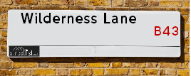
Map of Wilderness Lane
| Postcodes | ||
|---|---|---|
| Icon | Postcodes for Wilderness Lane | |
| Walking Distances | ||
| Distance Info | Green Circle = 10 Minutes Walk (800 metres) | |
About Wilderness Lane
Wilderness Lane is a street located in the town of West Bromwich. The street has a length of approximately 966 metres.
Wilderness Lane is located within the Sandwell District (B) Council's jurisdiction. They provide various services, like refuse collection, and manage council tax collection. It's situated in the West Midlands region of the UK.
Wilderness Lane has been assigned the Unique Street Reference Number of 33653100 in the National Street Gazetteer.
Wilderness Lane is located within the county of West Midlands, situated in the West Midlands region of the UK. It's 106.85 miles North West from central London., 5.46 miles North from Birmingham, 20.86 miles North West from Coventry and 27.65 miles North East from Worcester.

Do you know why this road is called Wilderness Lane?
What's it like to live here?
Ask the community a question about Wilderness Lane.
Do you have any questions, memories to share or know any facts about Wilderness Lane? We'd love to know more.
Also on streetlist.co.uk, can you help?
Eldroth Road
15th April 2024
I wondered if anyone has any old pictures of Wenning Bank House in the 1940’s and also Lane Side before of the same era .. we visited today with my Mum in law as she used to live at both these properties. Also any photos of the schools around that time .. thank you.
Can You Help?Napps Way
15th April 2024
Why is the road called Napps Way (belonging to Napp, but minus an
apostrophe as is usual with such nomenclature)? Moreover, who or
what is, or was, “Napp” in the respective, possessive case?
Several years ago, I met an elderly man (probably in his late-eighties)
who lives on Bentham Drive, Liverpool 16, and during a conversation
with him whilst in a Northwest Passenger Transport Ambulance on the
way to the former RLUH (Royal Liverpool University Hospital), he told
me that he could remember (when he was a boy, living in Childwall,
Liverpool 16) that, “Where Napps Way is now, during WW2, there was
a two-man gun emplacement on the, then, open land to protect the
railway line passing over Childwall Valley Road - next to the railway
bridge - when suddenly, as they were loading a live “shell” into the gun’s
breach, the aforementioned “shell” accidentally exploded in the gun’s
breach killing both of the two soldiers, that had been manning the gun,
instantly! (Very sad, of course, but could - perhaps - two ghosts relating
to those two, very unfortunately and prematurely-killed soldiers have
haunted that place of their deaths ever since - and have any residents
of Napps Way - formerly and in its latest incarnation - seen two, WW2
(uniformed) soldiers unexpectedly appear in or near their homes?)
Mauritius Road
15th April 2024
Why is Mauritius Road so called, since when and by whom? Does Greenwich have any particular links with Mauritius? Very interested to know. 🤞🏼
Can You Help?Estate Agents near Wilderness Lane
| Name | Address | Website |
|---|---|---|
| Jacobs Real Estate | 4 Cross Lane, Great Barr, Birmingham,B43 6LN | |
| Crescent Properties | 7 Newton Road, Great Barr, Birmingham,B43 6AA | Visit Website |
| Just Move Estate Agents & Lettings | 30 Newton Road Great Barr Birmingham B43 6BW | Visit Website |
Hotels near Wilderness Lane
Budget Hotels near Wilderness Lane
| Budget Hotel Name | Distance (miles) |
|---|---|
| 1: Name:Premier Inn Birmingham Great Barr M6 J7 Address:222 Birmingham Road Telephone: Visit Site |
0.30 |
| 2: Name:Travelodge Birmingham Walsall Address:259 Birmingham Rd, Walsall, WS5 3AA Telephone:0844 332 1236 Visit Site |
1.52 |
| 3: Name:Travelodge Birmingham Streetly Address:Chester Rd, Sutton Coldfield, B73 6SP Telephone:0871 559 1805 Visit Site |
2.72 |
| 4: Name:Travelodge Birmingham Perry Barr Address:Aldridge Rd, Perry Barr, Birmingham, B42 2SP Telephone:0871 984 6258 Visit Site |
2.73 |
| 5: Name:Premier Inn Walsall Town Centre Address:Waterfront Telephone: Visit Site |
2.90 |
Location Details
| Wilderness Lane | |
|---|---|

| |
| Latitude | 52.554418 |
| Longitude | -1.941134 |
| OS Easting (X): | 403990 |
| OS Northing (Y): | 295216 |
| OS Grid Reference: | SP040952 |
Ordnance Survey Maps for Wilderness Lane
If you purchase a map through the links below, we may earn an affiliate commission.
| Map Series | link | Ordnance Survey |
| Explorer 1:25,000 220 Birmingham, Walsall, Solihull and Redditch | Check Price on Amazon | |
| Landranger 1:50,000 139 Birmingham and Wolverhampton | Check Price on Amazon |
Neighbourhood Policing |
| Police Force: West Midlands |
 View Neighbourhood Crime and Policing View Neighbourhood Crime and Policing |
| Find a Local Neighbourhood Watch Scheme |
Frequently asked Questions for Wilderness Lane
What Council (Local Authority) is Wilderness Lane in?
Wilderness Lane is located within the local authority area of Sandwell Council which is a Metropolitan District.
What Parish Council is Wilderness Lane in?
Wilderness Lane is in an unparished area.
What Electoral Ward is Wilderness Lane in?
Wilderness Lane is located within the ward of Great Barr with Yew Tree &Charlemont with Grove Vale.
What County is Wilderness Lane in?
Wilderness Lane is located within the ceremonial county of West Midlands.
What Constituency is Wilderness Lane in?
Wilderness Lane is located within the constituency of West Bromwich East.
What Part of the UK is Wilderness Lane in?
Wilderness Lane is located within the West Midlands (England) region of the United Kingdom.
What County Council area is Wilderness Lane in?
Wilderness Lane is located within the West Midlands Council area.
What Police Force area is Wilderness Lane in?
Wilderness Lane is located within the West Midlands Police area.
Roads that have a Junction with Wilderness Lane
| Street | Junction Type |
|---|---|
| Longleat | pseudo node |
| Sycamore Road | junction |
| Peak House Road | junction |
| Gleneagles Drive | junction |
| Ravenhurst Drive | junction |
| Birmingham Road | junction |
Sunset and Sunrise times for Wilderness Lane
| Sunrise | 05:55 |
|---|---|
| Sunset | 20:17 |
Population Statistics
| ONS Area Code | E00050451, E00050427 & E00050460 |
|---|---|
| ONS Area Name | Multi-Ethnic Suburbia & Indian Tech Achievers |
| Average Age | 44.37 & 44.92 |
| Area Population | 1817.00 & 1471.00 |
| Male Population | 896.00 & 730.00 (49%) |
| Female Population | 921.00 & 741.00 (51%) |
| Benefit Claimants | 14 & 20 (1%) |
| LSOA Code: | E01009972 &E01009968 |
|---|---|
| LSOA Name: | Sandwell 006B &Sandwell 006A |
| SOA Code: | 3b |
| SOA Name: | |
| MSOA Code: | E02002048 |
| MSOA Name: | Sandwell 006 |
Nearest Supermarkets
| Iceland Great Barr |
|---|
| 936 Scotts Arms Centre, Walsall Road, Birmingham, B42 1TQ |
| 01213582642 |
| Distance: 0.72 Miles |
| Directions from Wilderness Lane to Iceland Great Barr |
| Asda Queslett |
|---|
| 6 Old Horns Crescent Off Queslet Road, Great Barr, Birmingham, B43 7HA |
| 0121 360 0238 |
| Distance: 1.33 Miles |
| Directions from Wilderness Lane to Asda Queslett |
| Tesco Great Barr Express |
|---|
| Hamstead Rd, Great Barr, B43 5EL |
| 0345 674 6459 |
| Distance: 1.34 Miles |
| Directions from Wilderness Lane to Tesco Great Barr Express |
| Tesco Sandwell Stone Cross Express |
|---|
| 247-249 Walsall Rd, Sandwell, West Bromwich, B71 3HS |
| 0345 026 9705 |
| Distance: 1.91 Miles |
| Directions from Wilderness Lane to Tesco Sandwell Stone Cross Express |
Telephone Information
| Area Code |
|---|
| Area Code: 01922 - Walsall |
| Area Code: 0121 - Birmingham |
| Area Code: 01384 - Dudley |
| Area Code: 01902 - Wolverhampton |
Broadband Information
| Speed | Average Speed | Median Speed | Maximum Speed | Next-generation access (NGA) | Number of Connections |
|---|---|---|---|---|---|
| Greater than 2 Mbps | 21.2 | 13 | >=30 | Y | 12 |
Local Government
| Local Council Details |
|---|
| Within the area of Sandwell |
| Visit the Council's Website |
| Sandwell Council House, PO Box 2374, Oldbury, West Midlands &B69 3DE |
| Send email |
| Telephone Number: 0845 358 2200 |
| Local Member of Parliament |
|---|
| Within the Westminster Parliamentary Constituency of West Bromwich East |
| The Member of Parliament is Nicola Richards |
| Details for the MP Nicola Richards on parliament.uk |
| Details for the MP Nicola Richards on theyworkforyou.com |
| In the 2019 General Election Nicola Richards won with a majority of 1,593 the result was Con gain from Lab. The total electorate was 62,046 |
| Wards, Parish Councils and County Councils |
|---|
| Ward: Great Barr with Yew Tree &Charlemont with Grove Vale Ward |
| Ceremonial County: West Midlands |
Nearest Schools
| Name | Address | Postcode | Telephone | Type | Distance (Km) |
|---|
Data accessed from gov.scot 08-08-2019
Nearest Hospitals
| Name | Address | Postcode | Distance | Map |
|---|
Nearest Dentists
Dentists near Wilderness Lane
| Name | Address | Postcode | Distance | Map |
|---|
Nearest GP Surgeries
Doctors near Wilderness Lane
SCOTT ARMS MEDICAL CENTRE
Address: WHITECREST, GREAT BARR, BIRMINGHAM, B43 6EE
Distance: 0.84 miles
Contact: tel: 0121 3572670
YEW TREE SURGERY
Address: REDWOOD ROAD, WALSALL, WEST MIDLANDS, WS5 4LB
Distance: 0.90 miles
Contact: :
GREAT BARR PRACTICE
Address: 379 QUESLETT ROAD, GREAT BARR, BIRMINGHAM, WEST MIDLANDS, B43 7HB
Distance: 1.15 miles
Contact: tel: 0121 3571250
TANHOUSE NHS CLINIC
Address: HAMSTEAD ROAD, GREAT BARR, BIRMINGHAM, WEST MIDLANDS, B43 5EL
Distance: 1.33 miles
Contact: tel: 0121 3579009
COLLINGWOOD FAMILY PRACTICE
Address: COLLINGWOOD CENTRE, COLLINGWOOD DRIVE, GREAT BARR, BIRMINGHAM, WEST MIDLANDS, B43 7NF
Distance: 1.59 miles
Contact: tel: 0121 3252090
BROADWAY MEDICAL CENTRE
Address: 213 BROADWAY, WALSALL, WEST MIDLANDS, WS1 3HD
Distance: 1.77 miles
Contact: tel: 01922 622064
Nearest Dispensing Chemists
Pharmacies near Wilderness Lane
| Name | Address | Postcode | Telephone | Map | Distance in Km |
|---|
Nearest Opticians
Opticians near Wilderness Lane
COLIN LEE OPTICIANS (GREAT BARR)
Address: 14 NEWTON ROAD, GREAT BARR, BIRMINGHAM, WEST MIDLANDS, B43 6BN
Distance: 0.68 miles
Contact: :
S.P.H OPTICIANS
Address: 32 QUESLETT ROAD, BIRMINGHAM, WEST MIDLANDS, B43 6PL
Distance: 0.71 miles
Contact: :
EYE EXPRESS (BAL DHINSA)
Address: 909 WALSALL ROAD, GREAT BARR, BIRMINGHAM, WEST MIDLANDS, B42 1TN
Distance: 0.76 miles
Contact: :
DEREK GREW OPTICIAN
Address: 99 APPLETON AVENUE, GREAT BARR, BIRMINGHAM, WEST MIDLANDS, B43 5LX
Distance: 0.99 miles
Contact: :
PARK HALL OPTICIANS (WALSALL)
Address: 15 LISKEARD ROAD, WALSALL, WEST MIDLANDS, WS5 3EY
Distance: 1.23 miles
Contact: :
DIRECT VISION OPTICIANS (GREAT BARR)
Address: 122 HILLINGFORD AVENUE, BIRMINGHAM, WEST MIDLANDS, B43 7JU
Distance: 1.54 miles
Contact: :
Transport
Nearest Rail Stations
Tame Bridge Parkway Station is 1.48 miles away.
Address: Tame Bridge Parkway station, Walsall Road, Friar Park, Wednesbury, WS10 0LD
Tame Bridge Parkway is situated on the Chase Line.
Tame Bridge Parkway Station is staffed on a part time basis.
Directions from Wilderness Lane to Tame Bridge Parkway Rail Station
Hamstead (Birmingham) Station is 1.69 miles away.
Address: Hamstead station, Old Walsall Road, Hamstead, West Midlands, B42 1NJ
Hamstead (Birmingham) is situated on the Chase Line.
Hamstead (Birmingham) Station is staffed on a part time basis.
Directions from Wilderness Lane to Hamstead (Birmingham) Rail Station