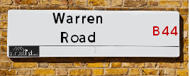
Map of Warren Road
| Postcodes | ||
|---|---|---|
| Icon | Postcodes for Warren Road | |
| Walking Distances | ||
| Distance Info | Green Circle = 10 Minutes Walk (800 metres) | |
About Warren Road
Warren Road is a street located in the city of Birmingham. The street has a length of approximately 568 metres.
Warren Road is located within the Birmingham District (B) Council's jurisdiction. They provide various services, like refuse collection, and manage council tax collection. It's situated in the West Midlands region of the UK.
Warren Road has been assigned the Unique Street Reference Number of 2705290 in the National Street Gazetteer.
Warren Road is located within the county of West Midlands, situated in the West Midlands region of the UK. It's 104.12 miles North West from central London., 4.04 miles North from Birmingham, 18.02 miles North West from Coventry and 27.76 miles North East from Worcester.

Do you know why this road is called Warren Road?
What's it like to live here?
Ask the community a question about Warren Road.
Do you have any questions, memories to share or know any facts about Warren Road? We'd love to know more.
Also on streetlist.co.uk, can you help?
Eldroth Road
15th April 2024
I wondered if anyone has any old pictures of Wenning Bank House in the 1940’s and also Lane Side before of the same era .. we visited today with my Mum in law as she used to live at both these properties. Also any photos of the schools around that time .. thank you.
Can You Help?Napps Way
15th April 2024
Why is the road called Napps Way (belonging to Napp, but minus an
apostrophe as is usual with such nomenclature)? Moreover, who or
what is, or was, “Napp” in the respective, possessive case?
Several years ago, I met an elderly man (probably in his late-eighties)
who lives on Bentham Drive, Liverpool 16, and during a conversation
with him whilst in a Northwest Passenger Transport Ambulance on the
way to the former RLUH (Royal Liverpool University Hospital), he told
me that he could remember (when he was a boy, living in Childwall,
Liverpool 16) that, “Where Napps Way is now, during WW2, there was
a two-man gun emplacement on the, then, open land to protect the
railway line passing over Childwall Valley Road - next to the railway
bridge - when suddenly, as they were loading a live “shell” into the gun’s
breach, the aforementioned “shell” accidentally exploded in the gun’s
breach killing both of the two soldiers, that had been manning the gun,
instantly! (Very sad, of course, but could - perhaps - two ghosts relating
to those two, very unfortunately and prematurely-killed soldiers have
haunted that place of their deaths ever since - and have any residents
of Napps Way - formerly and in its latest incarnation - seen two, WW2
(uniformed) soldiers unexpectedly appear in or near their homes?)
Mauritius Road
15th April 2024
Why is Mauritius Road so called, since when and by whom? Does Greenwich have any particular links with Mauritius? Very interested to know. 🤞🏼
Can You Help?Estate Agents near Warren Road
| Name | Address | Website |
|---|---|---|
| Paul Carr | 225/227 Hawthorn Road, Kingstanding, Birmingham, B44 8PL | Visit Website |
| Dixons | 820 Kingstanding Road, Birmingham, West Midlands, B44 9RT | |
| WeSellPropertiesForFree.com | 392 Walsall Road, Birmingham,B42 2LX |
Hotels near Warren Road
Budget Hotels near Warren Road
| Budget Hotel Name | Distance (miles) |
|---|---|
| 1: Name:Travelodge Birmingham Perry Barr Address:Aldridge Rd, Perry Barr, Birmingham, B42 2SP Telephone:0871 984 6258 Visit Site |
0.91 |
| 2: Name:Travelodge Birmingham Sutton Coldfield Address:Boldmere Rd, Sutton Coldfield, B73 5UP Telephone:0871 984 6108 Visit Site |
1.88 |
| 3: Name:Travelodge Birmingham Streetly Address:Chester Rd, Sutton Coldfield, B73 6SP Telephone:0871 559 1805 Visit Site |
1.97 |
| 4: Name:Holiday Inn Express Birmingham Star City Address:Cuckoo Road, Heartlands Parkway Telephone: Visit Site |
2.58 |
| 5: Name:Premier Inn Birmingham Great Barr M6 J7 Address:222 Birmingham Road Telephone: Visit Site |
2.85 |
Location Details
| Warren Road | |
|---|---|

| |
| Latitude | 52.536294 |
| Longitude | -1.880486 |
| OS Easting (X): | 408105 |
| OS Northing (Y): | 293206 |
| OS Grid Reference: | SP081932 |
Ordnance Survey Maps for Warren Road
If you purchase a map through the links below, we may earn an affiliate commission.
| Map Series | link | Ordnance Survey |
| Explorer 1:25,000 220 Birmingham, Walsall, Solihull and Redditch | Check Price on Amazon | |
| Landranger 1:50,000 139 Birmingham and Wolverhampton | Check Price on Amazon |
Neighbourhood Policing |
| Police Force: West Midlands |
 View Neighbourhood Crime and Policing View Neighbourhood Crime and Policing |
| Find a Local Neighbourhood Watch Scheme |
Frequently asked Questions for Warren Road
What Council (Local Authority) is Warren Road in?
Warren Road is located within the local authority area of Birmingham Council which is a Metropolitan District.
What Parish Council is Warren Road in?
Warren Road is in an unparished area.
What Electoral Ward is Warren Road in?
Warren Road is located within the ward of Kingstanding.
What County is Warren Road in?
Warren Road is located within the ceremonial county of West Midlands.
What Constituency is Warren Road in?
Warren Road is located within the constituency of Birmingham &Perry Barr.
What Part of the UK is Warren Road in?
Warren Road is located within the West Midlands (England) region of the United Kingdom.
What County Council area is Warren Road in?
Warren Road is located within the West Midlands Council area.
What Police Force area is Warren Road in?
Warren Road is located within the West Midlands Police area.
Roads that have a Junction with Warren Road
| Street | Junction Type |
|---|---|
| College Road (A453) | roundabout |
| Idbury Road | junction |
| Hill Crest Grove | junction |
| Hawthorn Road | junction |
| Hawthorn Road | junction |
Sunset and Sunrise times for Warren Road
| Sunrise | 05:57 |
|---|---|
| Sunset | 20:15 |
Latest Weather Conditions for Warren Road
| Observed at Weather Station: | Coleshill 19 April 2024 at 08:00 (8.94 miles away) |
|---|---|
| Current Weather: | Drizzle |
| Temperature and Humidity: | 9.0°C (90.9%) |
| Wind Direction and Speed: | WNW (9 mph) |
Population Statistics
| ONS Area Code | E00046775, E00046779 & E00046773 |
|---|---|
| ONS Area Name | Multi-Ethnic Professionals with Families, Achieving Minorities & Delayed Retirement |
| Average Age | 42.08 |
| Area Population | 1879.00 |
| Male Population | 928.00 (49%) |
| Female Population | 951.00 (51%) |
| Benefit Claimants | 22 (1%) |
| LSOA Code: | E01009231 |
|---|---|
| LSOA Name: | Birmingham 017D |
| SOA Code: | 3b |
| SOA Name: | |
| MSOA Code: | E02001843 |
| MSOA Name: | Birmingham 017 |
Nearest Supermarkets
| Tesco Kingstanding Birmingham Express |
|---|
| 236 Hawthorn Rd, Kingstanding, B44 8PP |
| 0345 675 7467 |
| Distance: 0.37 Miles |
| Directions from Warren Road to Tesco Kingstanding Birmingham Express |
| Iceland Kingstanding |
|---|
| 557 Kingstanding Road, Kingstanding Circle, Birmingham, B44 9TA |
| 01213558026 |
| Distance: 1.03 Miles |
| Directions from Warren Road to Iceland Kingstanding |
| Tesco New Oscott Extra |
|---|
| 11 Princess Alice Dr, Sutton Coldfield, B73 6RB |
| 0345 677 9493 |
| Distance: 1.31 Miles |
| Directions from Warren Road to Tesco New Oscott Extra |
| Asda Perry Barr |
|---|
| Walsall Road, Birmingham, B42 1AB |
| 0121 344 4550 |
| Distance: 1.53 Miles |
| Directions from Warren Road to Asda Perry Barr |
Telephone Information
| Dialling Code | Telephone Exchange | Telephone Cabinet | Fibre to the Cabinet or Fibre to the Premises |
|---|---|---|---|
| 0121 | ERDINGTON - CMERD | P94 | FTTC |
Broadband Information
| Speed | Average Speed | Median Speed | Maximum Speed | Next-generation access (NGA) | Number of Connections |
|---|---|---|---|---|---|
| Less than 2 Mbps | 24.6 | 20 | >=30 | Y | 11 |
Local Government
| Local Council Details |
|---|
| Within the area of Birmingham |
| Visit the Council's Website |
| Council House, Victoria Square, Birmingham &B1 1BB |
| Send email |
| Telephone Number: 0121 303 1111 |
| Local Member of Parliament |
|---|
| Within the Westminster Parliamentary Constituency of Birmingham &Perry Barr |
| The Member of Parliament is Khalid Mahmood |
| Details for the MP Khalid Mahmood on parliament.uk |
| Details for the MP Khalid Mahmood on theyworkforyou.com |
| In the 2019 General Election Khalid Mahmood won with a majority of 15,317 the result was Lab hold. The total electorate was 72,006 |
| Wards, Parish Councils and County Councils |
|---|
| Ward: Kingstanding Ward |
| Ceremonial County: West Midlands |
Nearest Schools
| Name | Address | Postcode | Telephone | Type | Distance (Km) |
|---|
Data accessed from gov.scot 08-08-2019
Nearest Hospitals
| Name | Address | Postcode | Distance | Map |
|---|
Nearest Dentists
Dentists near Warren Road
| Name | Address | Postcode | Distance | Map |
|---|
Nearest GP Surgeries
Doctors near Warren Road
COLLEGE ROAD SURGERY
Address: 452 COLLEGE ROAD, BIRMINGHAM, B44 0HL
Distance: 0.27 miles
Contact: tel: 0121 3738842
HILLCREST SURGERY
Address: DYAS ROAD SURGERY, 6 DYAS ROAD, KINGSTANDING, BIRMINGHAM, WEST MIDLANDS, B44 8SF
Distance: 0.45 miles
Contact: tel: 01213731885
AYLESBURY SURGERY
Address: AYLESBURY HOUSE, WARREN FARM ROAD, BIRMINGHAM, B44 0DX
Distance: 0.49 miles
Contact: tel: 0845 6750563
KINGSMOUNT MEDICAL CENTRE
Address: 444 KINGSTANDING ROAD, KINGSTANDING, BIRMINGHAM, WEST MIDLANDS, B44 9SA
Distance: 0.49 miles
Contact: :
THE DOVE MEDICAL PRACTICE
Address: 60 DOVEDALE ROAD, BIRMINGHAM, WEST MIDLANDS, B23 5DD
Distance: 0.67 miles
Contact: tel: 0121 4655739
COTMORE SURGERY
Address: 169 OLD OSCOTT LANE, GREAT BARR, BIRMINGHAM, WEST MIDLANDS, B44 8TU
Distance: 0.74 miles
Contact: tel: 0121 3605409
Nearest Dispensing Chemists
Pharmacies near Warren Road
| Name | Address | Postcode | Telephone | Map | Distance in Km |
|---|
Nearest Opticians
Opticians near Warren Road
JONES OPTICIANS
Address: 103 HAWTHORN ROAD, KINGSTANDING, BIRMINGHAM, WEST MIDLANDS, B44 8QT
Distance: 0.13 miles
Contact: :
SCRIVENS OPTICIANS (HAWTHORN ROAD)
Address: 231 HAWTHORN ROAD, KINGSTANDING, BIRMINGHAM, WEST MIDLANDS, B44 8PL
Distance: 0.35 miles
Contact: :
ADOS SIGHTCARE LTD
Address: 1 RIDGEWOOD GARDENS, GREAT BARR, BIRMINGHAM, WEST MIDLANDS, B44 8JG
Distance: 0.39 miles
Contact: :
R J OWEN OPTICIANS
Address: 10 WARREN FARM ROAD, BIRMINGHAM, WEST MIDLANDS, B44 0QU
Distance: 0.42 miles
Contact: :
ANWAR S
Address: 10 WARREN FARM ROAD, BIRMINGHAM, WEST MIDLANDS, B44 0QU
Distance: 0.42 miles
Contact: :
THE SPECTACLE COMPANY
Address: 766 KINGSTANDING ROAD, BIRMINGHAM, WEST MIDLANDS, B44 9ST
Distance: 1.10 miles
Contact: :
Transport
Nearest Rail Stations
Perry Barr Station is 1.64 miles away.
Address: Perry Barr station, Birchfield Road, Perry Barr, West Midlands, B20 3JE
Perry Barr is situated on the Chase Line.
Perry Barr Station is staffed on a part time basis.
Witton (West Midlands) Station is 1.67 miles away.
Address: Witton station, Witton Road, Birmingham, West Midlands, B6 7BA
Witton (West Midlands) is situated on the Chase Line.
Witton (West Midlands) Station is staffed on a part time basis.
Directions from Warren Road to Witton (West Midlands) Rail Station