Map of New Inns Lane
| Postcodes | ||
|---|---|---|
| Icon | Postcodes for New Inns Lane | |
| Walking Distances | ||
| Distance Info | Green Circle = 10 Minutes Walk (800 metres) | |
About New Inns Lane
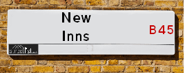
New Inns Lane is a street located in the city of Birmingham. It uses the postcode B45 9TS. The street has a length of approximately 1,150 metres.
New Inns Lane is located within the Birmingham District (B) Council's jurisdiction. They provide various services, like refuse collection, and manage council tax collection. It's situated in the West Midlands region of the UK.
New Inns Lane has been assigned the Unique Street Reference Number of 2700120 and 2759209 in the National Street Gazetteer.
New Inns Lane is located within the county of Worcestershire, situated in the West Midlands region of the UK. It's 102.86 miles North West from central London., 7.56 miles South West from Birmingham, 16.56 miles North East from Worcester and 21.84 miles West from Coventry.

Do you know why this road is called New Inns Lane?
What's it like to live here?
Ask the community a question about New Inns Lane.
Do you have any questions, memories to share or know any facts about New Inns Lane? We'd love to know more.
Also on streetlist.co.uk, can you help?
Eldroth Road
15th April 2024
I wondered if anyone has any old pictures of Wenning Bank House in the 1940’s and also Lane Side before of the same era .. we visited today with my Mum in law as she used to live at both these properties. Also any photos of the schools around that time .. thank you.
Can You Help?Napps Way
15th April 2024
Why is the road called Napps Way (belonging to Napp, but minus an
apostrophe as is usual with such nomenclature)? Moreover, who or
what is, or was, “Napp” in the respective, possessive case?
Several years ago, I met an elderly man (probably in his late-eighties)
who lives on Bentham Drive, Liverpool 16, and during a conversation
with him whilst in a Northwest Passenger Transport Ambulance on the
way to the former RLUH (Royal Liverpool University Hospital), he told
me that he could remember (when he was a boy, living in Childwall,
Liverpool 16) that, “Where Napps Way is now, during WW2, there was
a two-man gun emplacement on the, then, open land to protect the
railway line passing over Childwall Valley Road - next to the railway
bridge - when suddenly, as they were loading a live “shell” into the gun’s
breach, the aforementioned “shell” accidentally exploded in the gun’s
breach killing both of the two soldiers, that had been manning the gun,
instantly! (Very sad, of course, but could - perhaps - two ghosts relating
to those two, very unfortunately and prematurely-killed soldiers have
haunted that place of their deaths ever since - and have any residents
of Napps Way - formerly and in its latest incarnation - seen two, WW2
(uniformed) soldiers unexpectedly appear in or near their homes?)
Mauritius Road
15th April 2024
Why is Mauritius Road so called, since when and by whom? Does Greenwich have any particular links with Mauritius? Very interested to know. 🤞🏼
Can You Help?Estate Agents near New Inns Lane
| Name | Address | Website |
|---|---|---|
| Gordon Jones | 137 New Road, Rubery, Birmingham, B45 9JR | Visit Website |
| Robert Oulsnam & Company | 189 New Road, Rubery, Birmingham, B45 9JP | |
| Arden Estates | 112-114 New Road, Rubery, Rednal, Birmingham, B45 9HY | Visit Website |
We have found 1 postcode for New Inns Lane
Hotels near New Inns Lane
Budget Hotels near New Inns Lane
| Budget Hotel Name | Distance (miles) |
|---|---|
| 1: Name:Premier Inn Birmingham South Rubery Address:Great Park Telephone: Visit Site |
0.80 |
| 2: Name:Premier Inn Birmingham South Longbridge Station Address:1 High Street Telephone: Visit Site |
1.77 |
| 3: Name:Travelodge Birmingham Frankley M5 Southbound Address:Moto Service Area, Illey Ln, M5 Motorway, Frankley, Birmingham, B32 4AR Telephone:0871 984 6067 Visit Site |
2.07 |
| 4: Name:Travelodge Bromsgrove Marlbrook Address:462 Birmingham Rd, Marlbrook, Bromsgrove, B61 0HR Telephone:0871 559 1809 Visit Site |
2.59 |
| 5: Name:Travelodge Birmingham Halesowen Address:Whitehall Rd, Birmingham, B63 3HY Telephone:0871 984 6488 Visit Site |
3.71 |
Location Details
| New Inns Lane | |
|---|---|

| |
| Latitude | 52.400558 |
| Longitude | -2.025698 |
| OS Easting (X): | 398251 |
| OS Northing (Y): | 278102 |
| OS Grid Reference: | SO983781 |
Ordnance Survey Maps for New Inns Lane
If you purchase a map through the links below, we may earn an affiliate commission.
| Map Series | link | Ordnance Survey |
| Explorer 1:25,000 219 Wolverhampton and Dudley, Stourbridge and Kidderminster | Check Price on Amazon | |
| Landranger 1:50,000 139 Birmingham and Wolverhampton | Check Price on Amazon |
Neighbourhood Policing |
| Police Force: West Mercia |
 View Neighbourhood Crime and Policing View Neighbourhood Crime and Policing |
| Find a Local Neighbourhood Watch Scheme |
Frequently asked Questions for New Inns Lane
What Council (Local Authority) is New Inns Lane in?
New Inns Lane is located within the local authority area of Bromsgrove Council which is a District Council.
What Parish Council is New Inns Lane in?
New Inns Lane is in an unparished area.
What Electoral Ward is New Inns Lane in?
New Inns Lane is located within the ward of Rubery North.
What County is New Inns Lane in?
New Inns Lane is located within the ceremonial county of Worcestershire.
What Constituency is New Inns Lane in?
New Inns Lane is located within the constituency of Bromsgrove.
What Part of the UK is New Inns Lane in?
New Inns Lane is located within the West Midlands (England) region of the United Kingdom.
What County Council area is New Inns Lane in?
New Inns Lane is located within the Worcestershire Council area.
What Police Force area is New Inns Lane in?
New Inns Lane is located within the West Mercia Police area.
Roads that have a Junction with New Inns Lane
| Street | Junction Type |
|---|---|
| Gannow Green Lane | junction |
| Thurloe Crescent | junction |
| Cross Farms Lane | junction |
| Round Saw Croft | junction |
| Rubery Lane South | junction |
Sunset and Sunrise times for New Inns Lane , B45 9TS
| Sunrise | 05:56 |
|---|---|
| Sunset | 20:17 |
Latest Weather Conditions for New Inns Lane, B45 9TS
| Observed at Weather Station: | Coleshill 19 April 2024 at 23:00 (15.21 miles away) |
|---|---|
| Current Weather: | Overcast |
| Temperature and Humidity: | 4.4°C (66.9%) |
| Wind Direction and Speed: | NNE (6 mph) |
Population Statistics
| ONS Area Code | E00164087 |
|---|---|
| ONS Area Name | Semi-Detached Ageing |
| Average Age | 47.93 |
| Area Population | 1517.00 |
| Male Population | 752.00 (50%) |
| Female Population | 765.00 (50%) |
| Benefit Claimants | 8 (1%) |
| LSOA Code: | E01032171 |
|---|---|
| LSOA Name: | Bromsgrove 003C |
| SOA Code: | 8b |
| SOA Name: | |
| MSOA Code: | E02006698 |
| MSOA Name: | Bromsgrove 003 |
Nearest Supermarkets
| Morrisons Birmingham - Rubery |
|---|
| Rubery, Birmingham B45 9AH |
| 0121 460 1940 |
| Distance: 0.81 Miles |
| Directions from New Inns Lane to Morrisons Birmingham - Rubery |
| Tesco Birmingham Frankley Express |
|---|
| 414 Frankley Beeches Rd, Birmingham, B31 5NJ |
| 0345 675 7182 |
| Distance: 1.37 Miles |
| Directions from New Inns Lane to Tesco Birmingham Frankley Express |
| Sainsburys Longbridge |
|---|
| Longbridge Lane, Birmingham, England, B31 2TW |
| 0121 623 7030 |
| Distance: 1.81 Miles |
| Directions from New Inns Lane to Sainsburys Longbridge |
| Sainsburys Northfield |
|---|
| Frankley Beeches Road, Birmingham, England, B31 5AA |
| 0121 476 9133 |
| Distance: 2.32 Miles |
| Directions from New Inns Lane to Sainsburys Northfield |
Telephone Information
| Area Code |
|---|
| Area Code: 01527 - Redditch |
| Area Code: 01384 - Dudley |
| Area Code: 0121 - Birmingham |
| Area Code: 01562 - Kidderminster |
Broadband Information
| Speed | Average Speed | Median Speed | Maximum Speed | Next-generation access (NGA) | Number of Connections |
|---|---|---|---|---|---|
| Less than 2 Mbps | 16.4 | 13 | >=30 | Y | 31 |
Local Government
| Local Council Details |
|---|
| Within the area of Bromsgrove |
| Visit the Council's Website |
| The Council House, Burcot Lane, Bromsgrove, Worcestershire &B60 1AA |
| Send email |
| Telephone Number: 01527 873 232 |
| Local Member of Parliament |
|---|
| Within the Westminster Parliamentary Constituency of Bromsgrove |
| The Member of Parliament is Sajid Javid |
| Details for the MP Sajid Javid on parliament.uk |
| Details for the MP Sajid Javid on theyworkforyou.com |
| In the 2019 General Election Sajid Javid won with a majority of 23,106 the result was Con hold. The total electorate was 75,078 |
| Wards, Parish Councils and County Councils |
|---|
| Ward: Rubery North Ward |
| Ceremonial County: Worcestershire |
Nearest Schools
| Name | Address | Postcode | Telephone | Type | Distance (Km) |
|---|
Data accessed from gov.scot 08-08-2019
Nearest Hospitals
| Name | Address | Postcode | Distance | Map |
|---|
Nearest Dentists
Dentists near New Inns Lane
| Name | Address | Postcode | Distance | Map |
|---|
Nearest GP Surgeries
Doctors near New Inns Lane
FRANKLEY HEALTH CENTRE
Address: 125 NEW STREET, RUBERY, REDNAL, BIRMINGHAM, WEST MIDLANDS, B45 0EU
Distance: 0.48 miles
Contact: tel: 0121 4538211
CORNHILL SURGERY
Address: 65 NEW ROAD, RUBERY, REDNAL, BIRMINGHAM, WEST MIDLANDS, B45 9JT
Distance: 0.58 miles
Contact: tel: 0121 4533591
NEW ROAD SURGERY
Address: 104-106 NEW ROAD, RUBERY, RUBERY, REDNAL, BIRMINGHAM, WEST MIDLANDS, B45 9HY
Distance: 0.59 miles
Contact: tel: 0121 4533584
LEACH HEATH MEDICAL CENTRE
Address: 32 LEACH HEATH LANE, RUBERY, REDNAL, BIRMINGHAM, WEST MIDLANDS, B45 9BU
Distance: 0.79 miles
Contact: tel: 0121 4533516
HOLLYMOOR MEDICAL CENTRE
Address: MANOR PARK GROVE, NORTHFIELD, BIRMINGHAM, WEST MIDLANDS, B31 5ER
Distance: 1.16 miles
Contact: tel: 0121 4769191
ST HELIERS MEDICAL PRACTICE
Address: 15 ST. HELIERS ROAD, BIRMINGHAM, B31 1QT
Distance: 2.27 miles
Contact: tel: 0121 4781850
Nearest Dispensing Chemists
Pharmacies near New Inns Lane
| Name | Address | Postcode | Telephone | Map | Distance in Km |
|---|
Nearest Opticians
Opticians near New Inns Lane
THE EYE COLLECTIVE - RUBERY
Address: 161 NEW ROAD, RUBERY, REDNAL, BIRMINGHAM, WEST MIDLANDS, B45 9JW
Distance: 0.56 miles
Contact: :
ROBINSON OPTICS LTD
Address: 135 NEW ROAD, RUBERY, REDNAL, BIRMINGHAM, WEST MIDLANDS, B45 9JR
Distance: 0.56 miles
Contact: :
SPEX4U
Address: 174 NEW ROAD, RUBERY, REDNAL, BIRMINGHAM, WEST MIDLANDS, B45 9JA
Distance: 0.61 miles
Contact: :
M&S OPTICIANS - LONGBRIDGE
Address: 20 HIGH STREET, NORTHFIELD, BIRMINGHAM, B31 2UQ
Distance: 1.76 miles
Contact: :
SPECSAVERS OPTICIANS (LONGBRIDGE)
Address: LONGBRIDGE TOWN CENTRE, 11 HIGH STREET, NORTHFIELD, BIRMINGHAM, WEST MIDLANDS, B31 2UQ
Distance: 1.76 miles
Contact: :
MATTOO DAVINDER (HELIERS ROAD)
Address: NORTHFIELD HEALTH CENTRE, 15 ST. HELIERS ROAD, BIRMINGHAM, WEST MIDLANDS, B31 1QT
Distance: 2.27 miles
Contact: :
Transport
Nearest Rail Stations
Longbridge Station is 1.89 miles away.
Address: Longbridge station, Longbridge Lane, Birmingham, West Midlands, B31 2TW
Longbridge is situated on the Bristol to Brimingham Line.
Longbridge Station is staffed on a part time basis.
Northfield Station is 2.58 miles away.
Address: Northfield station, Quarry Lane, Northfield, West Midlands, B31 2PY
Northfield is situated on the Bristol to Brimingham Line.
Northfield Station is staffed on a part time basis.