Map of Coventry Road
| Postcodes | ||
|---|---|---|
| Icon | Postcodes for Coventry Road | |
| Walking Distances | ||
| Distance Info | Green Circle = 10 Minutes Walk (800 metres) | |
About Coventry Road
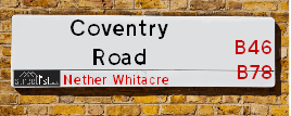
Coventry Road is a street located in the village of Kingsbury and near the village of Kingsbury. The street has a length of approximately 4,733 metres.
Coventry Road is located within the North Warwickshire District (B) Council's jurisdiction. They provide various services, like refuse collection, and manage council tax collection. It's situated in the West Midlands region of the UK.
Coventry Road has been assigned the Unique Street Reference Numbers of 28401234, 28400249 and 28400250 in the National Street Gazetteer.
Coventry Road is located within the county of Warwickshire, situated in the West Midlands region of the UK. It's 98.47 miles North West from central London., 10.71 miles North East from Birmingham, 11.9 miles North West from Coventry and 23.6 miles West from Leicester.

Do you know why this road is called Coventry Road?
What's it like to live here?
Ask the community a question about Coventry Road.
Do you have any questions, memories to share or know any facts about Coventry Road? We'd love to know more.
Also on streetlist.co.uk, can you help?
Eldroth Road
15th April 2024
I wondered if anyone has any old pictures of Wenning Bank House in the 1940’s and also Lane Side before of the same era .. we visited today with my Mum in law as she used to live at both these properties. Also any photos of the schools around that time .. thank you.
Can You Help?Napps Way
15th April 2024
Why is the road called Napps Way (belonging to Napp, but minus an
apostrophe as is usual with such nomenclature)? Moreover, who or
what is, or was, “Napp” in the respective, possessive case?
Several years ago, I met an elderly man (probably in his late-eighties)
who lives on Bentham Drive, Liverpool 16, and during a conversation
with him whilst in a Northwest Passenger Transport Ambulance on the
way to the former RLUH (Royal Liverpool University Hospital), he told
me that he could remember (when he was a boy, living in Childwall,
Liverpool 16) that, “Where Napps Way is now, during WW2, there was
a two-man gun emplacement on the, then, open land to protect the
railway line passing over Childwall Valley Road - next to the railway
bridge - when suddenly, as they were loading a live “shell” into the gun’s
breach, the aforementioned “shell” accidentally exploded in the gun’s
breach killing both of the two soldiers, that had been manning the gun,
instantly! (Very sad, of course, but could - perhaps - two ghosts relating
to those two, very unfortunately and prematurely-killed soldiers have
haunted that place of their deaths ever since - and have any residents
of Napps Way - formerly and in its latest incarnation - seen two, WW2
(uniformed) soldiers unexpectedly appear in or near their homes?)
Mauritius Road
15th April 2024
Why is Mauritius Road so called, since when and by whom? Does Greenwich have any particular links with Mauritius? Very interested to know. 🤞🏼
Can You Help?Estate Agents near Coventry Road
| Name | Address | Website |
|---|---|---|
| First Choice Property Centre | Wynn House, 60 High Street, Coleshill,B46 1AZ | Visit Website |
| Chambers Property | Albion Terrace, Water Orton, Birmingham, B46 1ST | Visit Website |
| Waters & Co. | 81 High Street, Coleshill, Birmingham, B46 3AG | Visit Website |
We have found 9 postcodes for Coventry Road
Hotels near Coventry Road
Budget Hotels near Coventry Road
| Budget Hotel Name | Distance (miles) |
|---|---|
| 1: Name:Premier Inn Tamworth South Address:Watling Street Telephone: Visit Site |
4.10 |
| 2: Name:Travelodge Tamworth M42 Address:Tamworth Motorway Services Area, M42, Wilnecote, Tamworth, B77 5PS Telephone:0871 984 6109 Visit Site |
4.40 |
| 3: Name:Travelodge Birmingham Castle Bromwich Address:Chester Rd, Birmingham, B36 0AG Telephone:0871 559 1813 Visit Site |
5.29 |
| 4: Name:Holiday Inn Express Tamworth Address:Leisure Island, Riverdrive Telephone: Visit Site |
5.67 |
| 5: Name:Premier Inn Birmingham North Sutton Coldfield Address:Whitehouse Common Road Telephone: Visit Site |
5.71 |
Location Details
| Coventry Road | |
|---|---|

| |
| Latitude | 52.547560 |
| Longitude | -1.673260 |
| OS Easting (X): | 422154 |
| OS Northing (Y): | 294502 |
| OS Grid Reference: | SP222945 |
Ordnance Survey Maps for Coventry Road
If you purchase a map through the links below, we may earn an affiliate commission.
| Map Series | link | Ordnance Survey |
| Explorer 1:25,000 232 Nuneaton and Tamworth | Check Price on Amazon | Buy Direct from the Ordnance Survey |
| Landranger 1:50,000 139 Birmingham and Wolverhampton | Check Price on Amazon |
Neighbourhood Policing |
| Police Force: Warwickshire |
 View Neighbourhood Crime and Policing View Neighbourhood Crime and Policing |
| Find a Local Neighbourhood Watch Scheme |
Frequently asked Questions for Coventry Road
What Council (Local Authority) is Coventry Road in?
Coventry Road is located within the local authority area of North Warwickshire Council which is a District Council.
What Parish Council is Coventry Road in?
Coventry Road is located within the area of Kingsbury Parish Council.
What Electoral Ward is Coventry Road in?
Coventry Road is located within the ward of Kingsbury &Hurley and Wood End.
What County is Coventry Road in?
Coventry Road is located within the ceremonial county of Warwickshire.
What Constituency is Coventry Road in?
Coventry Road is located within the constituency of North Warwickshire.
What Part of the UK is Coventry Road in?
Coventry Road is located within the West Midlands (England) region of the United Kingdom.
What County Council area is Coventry Road in?
Coventry Road is located within the Warwickshire Council area.
What Police Force area is Coventry Road in?
Coventry Road is located within the Warwickshire Police area.
Roads that have a Junction with Coventry Road
| Street | Junction Type |
|---|---|
| Mill Crescent | junction |
| Mill Crescent | junction |
| Church Lane | junction |
| Tamworth Road (A51) | junction |
| Kingsbury Road (A4097) | roundabout |
| Piccadilly Way | roundabout |
| Piccadilly Way | roundabout |
| Gate Lane | junction |
| Dog Lane | junction |
Sunset and Sunrise times for Coventry Road
| Sunrise | 05:56 |
|---|---|
| Sunset | 20:14 |
Latest Weather Conditions for Coventry Road
| Observed at Weather Station: | Coleshill 19 April 2024 at 03:00 (4.71 miles away) |
|---|---|
| Current Weather: | Overcast |
| Temperature and Humidity: | 10.3°C (81.5%) |
| Wind Direction and Speed: | WNW (13 mph) |
Population Statistics
| ONS Area Code | E00158210, E00168278, E00168277, E00158207, E00158208 & E00158209 |
|---|---|
| ONS Area Name | Older Workers and Retirement, White Suburban Communities, Rural White-Collar Workers, Ageing Industrious Workers & Outer City Hardship |
| Average Age | 44.49 & 38.60 |
| Area Population | 1851.00 & 2583.00 |
| Male Population | 883.00 & 1299.00 (49%) |
| Female Population | 968.00 & 1284.00 (51%) |
| Benefit Claimants | 9 & 21 (1%) |
| LSOA Code: | E01031033 &E01031031 |
|---|---|
| LSOA Name: | North Warwickshire 004C &North Warwickshire 002D |
| SOA Code: | 5d |
| SOA Name: | |
| MSOA Code: | E02006471 &E02006469 |
| MSOA Name: | North Warwickshire 004 &North Warwickshire 002 |
Nearest Supermarkets
| Tesco Water Orton Express |
|---|
| 8 Station Buildings, Birmingham Rd, Birmingham, B46 1SR |
| 0345 026 9273 |
| Distance: 3.52 Miles |
| Directions from Coventry Road to Tesco Water Orton Express |
| Morrisons Coleshill |
|---|
| Park Road, Coleshill B46 1AS |
| 01675 462256 |
| Distance: 3.69 Miles |
| Directions from Coventry Road to Morrisons Coleshill |
| Tesco Dosthill Esso Express |
|---|
| High St, Dosthill, Tamworth, B77 1LE |
| 0345 675 7075 |
| Distance: 3.71 Miles |
| Directions from Coventry Road to Tesco Dosthill Esso Express |
| Morrisons Tamworth |
|---|
| Marlborough Way, Tamworth B77 2NY |
| 01827 284082 |
| Distance: 4.38 Miles |
| Directions from Coventry Road to Morrisons Tamworth |
Telephone Information
| Area Code |
|---|
| Area Code: 01675 - Coleshill |
| Area Code: 01827 - Tamworth |
| Area Code: 01676 - Meriden |
Broadband Information
| Speed | Average Speed | Median Speed | Maximum Speed | Next-generation access (NGA) | Number of Connections |
|---|---|---|---|---|---|
| Greater than 2 Mbps | 15.8 | 17.2 | 20.4 | N | 13 |
Local Government
| Local Council Details |
|---|
| Within the area of North Warwickshire |
| Visit the Council's Website |
| South Street, Atherstone, Warwickshire &CV9 1DE |
| Send email |
| Telephone Number: 01827 715 341 |
| Local Member of Parliament |
|---|
| Within the Westminster Parliamentary Constituency of North Warwickshire |
| The Member of Parliament is Craig Tracey |
| Details for the MP Craig Tracey on parliament.uk |
| Details for the MP Craig Tracey on theyworkforyou.com |
| In the 2019 General Election Craig Tracey won with a majority of 17,956 the result was Con hold. The total electorate was 70,271 |
| Wards, Parish Councils and County Councils |
|---|
| Ward: Kingsbury &Hurley and Wood End Ward |
| Ceremonial County: Warwickshire |
Nearest Schools
| Name | Address | Postcode | Telephone | Type | Distance (Km) |
|---|
Data accessed from gov.scot 08-08-2019
Nearest Hospitals
| Name | Address | Postcode | Distance | Map |
|---|
Nearest Dentists
Dentists near Coventry Road
| Name | Address | Postcode | Distance | Map |
|---|
Nearest GP Surgeries
Doctors near Coventry Road
PEAR TREE SURGERY
Address: 28 MEADOW CLOSE, KINGSBURY, TAMWORTH, STAFFORDSHIRE, B78 2NR
Distance: 1.15 miles
Contact: tel: 01827 872755
THE SURGERY
Address: 103 KNOWLE HILL, HURLEY, ATHERSTONE, WARWICKSHIRE, CV9 2JA
Distance: 1.58 miles
Contact: tel: 01827 872490
DOSTHILL SURGERY
Address: CADOGAN ROAD, DOSTHILL, TAMWORTH, STAFFORDSHIRE, B77 1PQ
Distance: 3.54 miles
Contact: :
SATIS HOUSE
Address: 10 BIRMINGHAM ROAD, WATER ORTON, BIRMINGHAM, WEST MIDLANDS, B46 1TH
Distance: 3.75 miles
Contact: tel: 0121 7767572
HAZELWOOD PRACTICE - COVID LOCAL VACCINATION SERVICE
Address: 27 PARKFIELD ROAD, COLESHILL, BIRMINGHAM, B46 3LD
Distance: 3.77 miles
Contact: :
HAZELWOOD GROUP PRACTICE
Address: 27 PARKFIELD ROAD, COLESHILL, BIRMINGHAM, WEST MIDLANDS, B46 3LD
Distance: 3.77 miles
Contact: tel: 01675 463165
Nearest Dispensing Chemists
Pharmacies near Coventry Road
| Name | Address | Postcode | Telephone | Map | Distance in Km |
|---|
Nearest Opticians
Opticians near Coventry Road
SCRIVENS OPTICIANS (COLESHILL)
Address: 91 HIGH STREET, COLESHILL, BIRMINGHAM, WEST MIDLANDS, B46 3AG
Distance: 3.59 miles
Contact: :
4977 MINWORTH
Address: ASDA STORES LTD, WALMLEY ASH ROAD, MINWORTH, SUTTON COLDFIELD, WEST MIDLANDS, B76 1XL
Distance: 4.59 miles
Contact: :
COVENTRY 2 DOMICILIARY SPECSAVERS LIMITED
Address: 165 MERIDEN DRIVE, BIRMINGHAM, B37 6BT
Distance: 4.78 miles
Contact: :
COMPLETE COMMUNITY CARE OPTICIANS (SUTTON)
Address: OAK HOUSE, 9 NEW LEASOW, SUTTON COLDFIELD, WEST MIDLANDS, B76 1YL
Distance: 4.88 miles
Contact: :
MW PHILLIPS OPTICIANS
Address: 30 ELLERBECK, WILNECOTE, TAMWORTH, B77 4JA
Distance: 4.93 miles
Contact: :
I M HADFIELD OPTOMETRISTS - KINGSHURST
Address: 20 THE PARADE, KINGSHURST, BIRMINGHAM, WEST MIDLANDS, B37 6BA
Distance: 4.93 miles
Contact: :
Transport
Nearest Rail Stations
Coleshill Parkway Station is 2.60 miles away.
Address: Coleshill Parkway station, Station Road, Coleshill, Warwickshire, B46 1JZ
Coleshill Parkway is situated on the Birmingham to Peterborough Line.
Coleshill Parkway Station is staffed on a part time basis.
Directions from Coventry Road to Coleshill Parkway Rail Station
Water Orton Station is 3.55 miles away.
Address: Water Orton station, Marsh Lane, Water Orton, Warwickshire, B46 1NE
Water Orton is situated on the Birmingham to Peterborough Line|Birmingham to Nottingham Line.
Water Orton Station is an unstaffed station.