Map of Maxstoke Lane
| Postcodes | ||
|---|---|---|
| Icon | Postcodes for Maxstoke Lane | |
| Walking Distances | ||
| Distance Info | Green Circle = 10 Minutes Walk (800 metres) | |
About Maxstoke Lane
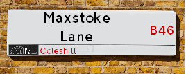
Maxstoke Lane is a street located in the town of Coleshill and near the town of Coleshill. The street has a length of approximately 2,000 metres.
Maxstoke Lane is located within the North Warwickshire District (B) Council's jurisdiction. They provide various services, like refuse collection, and manage council tax collection. It's situated in the West Midlands region of the UK.
Maxstoke Lane has been assigned the Unique Street Reference Number of 28400547 and 28400224 in the National Street Gazetteer.
Maxstoke Lane is located within the county of Warwickshire, situated in the West Midlands region of the UK. It's 96.41 miles North West from central London., 8.86 miles East from Birmingham, 9.81 miles North West from Coventry and 25.57 miles South West from Leicester.

Do you know why this road is called Maxstoke Lane?
What's it like to live here?
Ask the community a question about Maxstoke Lane.
Do you have any questions, memories to share or know any facts about Maxstoke Lane? We'd love to know more.
Also on streetlist.co.uk, can you help?
Eldroth Road
15th April 2024
I wondered if anyone has any old pictures of Wenning Bank House in the 1940’s and also Lane Side before of the same era .. we visited today with my Mum in law as she used to live at both these properties. Also any photos of the schools around that time .. thank you.
Can You Help?Napps Way
15th April 2024
Why is the road called Napps Way (belonging to Napp, but minus an
apostrophe as is usual with such nomenclature)? Moreover, who or
what is, or was, “Napp” in the respective, possessive case?
Several years ago, I met an elderly man (probably in his late-eighties)
who lives on Bentham Drive, Liverpool 16, and during a conversation
with him whilst in a Northwest Passenger Transport Ambulance on the
way to the former RLUH (Royal Liverpool University Hospital), he told
me that he could remember (when he was a boy, living in Childwall,
Liverpool 16) that, “Where Napps Way is now, during WW2, there was
a two-man gun emplacement on the, then, open land to protect the
railway line passing over Childwall Valley Road - next to the railway
bridge - when suddenly, as they were loading a live “shell” into the gun’s
breach, the aforementioned “shell” accidentally exploded in the gun’s
breach killing both of the two soldiers, that had been manning the gun,
instantly! (Very sad, of course, but could - perhaps - two ghosts relating
to those two, very unfortunately and prematurely-killed soldiers have
haunted that place of their deaths ever since - and have any residents
of Napps Way - formerly and in its latest incarnation - seen two, WW2
(uniformed) soldiers unexpectedly appear in or near their homes?)
Mauritius Road
15th April 2024
Why is Mauritius Road so called, since when and by whom? Does Greenwich have any particular links with Mauritius? Very interested to know. 🤞🏼
Can You Help?Estate Agents near Maxstoke Lane
| Name | Address | Website |
|---|---|---|
| Green Grey - Selling property, Coleshill | 140 High Street, Coleshill, B46 3BJ | |
| Bairstow Eves | 94 High Street, Coleshill, Birmingham, West Midlands, B46 3BL | Visit Website |
| Waters & Co. | 81 High Street, Coleshill, Birmingham, B46 3AG | Visit Website |
Location Details
| Maxstoke Lane | |
|---|---|

| |
| Latitude | 52.494508 |
| Longitude | -1.692759 |
| OS Easting (X): | 420857 |
| OS Northing (Y): | 288596 |
| OS Grid Reference: | SP209886 |
Neighbourhood Policing |
| Police Force: Warwickshire |
 View Neighbourhood Crime and Policing View Neighbourhood Crime and Policing |
| Find a Local Neighbourhood Watch Scheme |
Frequently asked Questions for Maxstoke Lane
What Council (Local Authority) is Maxstoke Lane in?
Maxstoke Lane is located within the local authority area of North Warwickshire Council which is a District Council.
What Parish Council is Maxstoke Lane in?
Maxstoke Lane is located within the area of Coleshill Parish Council.
What Electoral Ward is Maxstoke Lane in?
Maxstoke Lane is located within the ward of Coleshill South.
What County is Maxstoke Lane in?
Maxstoke Lane is located within the ceremonial county of Warwickshire.
What Constituency is Maxstoke Lane in?
Maxstoke Lane is located within the constituency of North Warwickshire.
What Part of the UK is Maxstoke Lane in?
Maxstoke Lane is located within the West Midlands (England) region of the United Kingdom.
What County Council area is Maxstoke Lane in?
Maxstoke Lane is located within the Warwickshire Council area.
What Police Force area is Maxstoke Lane in?
Maxstoke Lane is located within the Warwickshire Police area.
Roads that have a Junction with Maxstoke Lane
| Street | Junction Type |
|---|---|
| High Street (B4117) | junction |
| Wyndshiels | junction |
| The Drive | junction |
| Arnolds Lane | junction |
| Coleshill Road | pseudo node |
Sunset and Sunrise times for Maxstoke Lane
| Sunrise | 05:48 |
|---|---|
| Sunset | 20:21 |
Latest Weather Conditions for Maxstoke Lane
| Observed at Weather Station: | Coleshill 23 April 2024 at 20:00 (1.01 miles away) |
|---|---|
| Current Weather: | Overcast |
| Temperature and Humidity: | 6.8°C (74.3%) |
| Wind Direction and Speed: | N (2 mph) |
Population Statistics
| ONS Area Code | E00158139 & E00158137 |
|---|---|
| ONS Area Name | Multi-Ethnic Professionals with Families & Self-Sufficient Retirement |
| Average Age | 47.24 |
| Area Population | 1572.00 |
| Male Population | 741.00 (47%) |
| Female Population | 831.00 (53%) |
| Benefit Claimants | 17 (1%) |
| LSOA Code: | E01031021 |
|---|---|
| LSOA Name: | North Warwickshire 006C |
| SOA Code: | 5a |
| SOA Name: | |
| MSOA Code: | E02006473 |
| MSOA Name: | North Warwickshire 006 |
Nearest Supermarkets
| Morrisons Coleshill |
|---|
| Park Road, Coleshill B46 1AS |
| 01675 462256 |
| Distance: 0.8 Miles |
| Directions from Maxstoke Lane to Morrisons Coleshill |
| Iceland Chelmsley Wood |
|---|
| 79 Cedar Walk, Chelmsley Wood Centre, Birmingham, B37 5TU |
| 01217888105 |
| Distance: 2.2 Miles |
| Directions from Maxstoke Lane to Iceland Chelmsley Wood |
| Asda Chelmsley Wood |
|---|
| 341 Bosworth Drive, Solihull, B37 5EX |
| 0121 788 5700 |
| Distance: 2.29 Miles |
| Directions from Maxstoke Lane to Asda Chelmsley Wood |
| Tesco Water Orton Express |
|---|
| 8 Station Buildings, Birmingham Rd, Birmingham, B46 1SR |
| 0345 026 9273 |
| Distance: 2.63 Miles |
| Directions from Maxstoke Lane to Tesco Water Orton Express |
Telephone Information
| Area Code |
|---|
| Area Code: 01675 - Coleshill |
| Area Code: 01676 - Meriden |
| Area Code: 0121 - Birmingham |
Local Government
| Local Council Details |
|---|
| Within the area of North Warwickshire |
| Visit the Council's Website |
| South Street, Atherstone, Warwickshire &CV9 1DE |
| Send email |
| Telephone Number: 01827 715 341 |
| Local Member of Parliament |
|---|
| Within the Westminster Parliamentary Constituency of North Warwickshire |
| The Member of Parliament is Craig Tracey |
| Details for the MP Craig Tracey on parliament.uk |
| Details for the MP Craig Tracey on theyworkforyou.com |
| In the 2019 General Election Craig Tracey won with a majority of 17,956 the result was Con hold. The total electorate was 70,271 |
| Wards, Parish Councils and County Councils |
|---|
| Ward: Coleshill South Ward |
| Ceremonial County: Warwickshire |
Nearest Schools
England Primary Schools
St Edward's Catholic Primary School
Address: St Edward's Catholic Primary School, Packington Lane, Coleshill, Birmingham, Warwickshire, B46 3JE
Distance: 0.76 miles
Contact:
High Meadow Community School
Address: High Meadow Community School, High Meadow Community School, Norton Road, Coleshill, Warwickshire, B46 1ES
Distance: 1.20 miles
Contact: 01675462312
Coleshill CofE Primary School
Address: Coleshill CofE Primary School, Wingfield Road, Coleshill, Birmingham, West Midlands, B46 3LL
Distance: 0.70 miles
Contact:
England Secondary Schools
The Coleshill School
Address: The Coleshill School, Coventry Road, Coleshill, Birmingham, Warwickshire, B46 3EX
Distance: 0.86 miles
Contact: 01675462435
Nearest Hospitals
| Name | Address | Postcode | Distance | Map |
|---|
Nearest Dentists
Dentists near Maxstoke Lane
| Name | Address | Postcode | Distance | Map |
|---|
Nearest GP Surgeries
Doctors near Maxstoke Lane
HAZELWOOD PRACTICE - COVID LOCAL VACCINATION SERVICE
Address: 27 PARKFIELD ROAD, COLESHILL, BIRMINGHAM, B46 3LD
Distance: 0.61 miles
Contact: :
HAZELWOOD GROUP PRACTICE
Address: 27 PARKFIELD ROAD, COLESHILL, BIRMINGHAM, WEST MIDLANDS, B46 3LD
Distance: 0.61 miles
Contact: tel: 01675 463165
CROFT MEDICAL CENTRE
Address: 1 POMEROY WAY, CHELMSLEY WOOD, BIRMINGHAM, WEST MIDLANDS, B37 7WB
Distance: 1.90 miles
Contact: tel: 0121 2707180
KINGSHURST MEDICAL PRACTICE
Address: 40 GILSON WAY, KINGSHURST, BIRMINGHAM, WEST MIDLANDS, B37 6BE
Distance: 2.32 miles
Contact: tel: 01217 175350
GREEN LANE SURGERY
Address: SMITHS WOOD MEDICAL CTR, BURTONS WAY, SMITHS WOOD, BIRMINGHAM, WEST MIDLANDS, B36 0SZ
Distance: 2.44 miles
Contact: tel: 0121 7495115
ARRAN MEDICAL CENTRE
Address: BURTONS WAY, BIRMINGHAM, WEST MIDLANDS, B36 0SZ
Distance: 2.44 miles
Contact: tel: 0121 7704043
Nearest Dispensing Chemists
Pharmacies near Maxstoke Lane
| Name | Address | Postcode | Telephone | Map | Distance in Km |
|---|
Nearest Opticians
Opticians near Maxstoke Lane
SCRIVENS OPTICIANS (COLESHILL)
Address: 91 HIGH STREET, COLESHILL, BIRMINGHAM, WEST MIDLANDS, B46 3AG
Distance: 0.70 miles
Contact: :
COVENTRY 2 DOMICILIARY SPECSAVERS LIMITED
Address: 165 MERIDEN DRIVE, BIRMINGHAM, B37 6BT
Distance: 2.18 miles
Contact: :
SPECSAVERS (CHELMSLEY WOOD, BIRMINGHAM)
Address: 2-4 GREENWOOD SQUARE, BIRMINGHAM, WEST MIDLANDS, B37 5TR
Distance: 2.21 miles
Contact: :
BOOTS OPTICIANS (CHELMSLEY WOOD)
Address: 11 COPPICE WAY, CHELMSLEY WOOD, BIRMINGHAM, WEST MIDLANDS, B37 5TX
Distance: 2.23 miles
Contact: :
I M HADFIELD OPTOMETRISTS - KINGSHURST
Address: 20 THE PARADE, KINGSHURST, BIRMINGHAM, WEST MIDLANDS, B37 6BA
Distance: 2.44 miles
Contact: :
COOK OPTICIANS
Address: 6 HURST LANE, CASTLE BROMWICH, BIRMINGHAM, WEST MIDLANDS, B34 7HR
Distance: 3.02 miles
Contact: :
Transport
Nearest Rail Stations
Coleshill Parkway Station is 1.65 miles away.
Address: Coleshill Parkway station, Station Road, Coleshill, Warwickshire, B46 1JZ
Coleshill Parkway is situated on the Birmingham to Peterborough Line.
Coleshill Parkway Station is staffed on a part time basis.
Directions from Maxstoke Lane to Coleshill Parkway Rail Station
Water Orton Station is 2.69 miles away.
Address: Water Orton station, Marsh Lane, Water Orton, Warwickshire, B46 1NE
Water Orton is situated on the Birmingham to Peterborough Line|Birmingham to Nottingham Line.
Water Orton Station is an unstaffed station.