Map of Tamworth Road
| Postcodes | ||
|---|---|---|
| Icon | Postcodes for Tamworth Road | |
| Walking Distances | ||
| Distance Info | Green Circle = 10 Minutes Walk (800 metres) | |
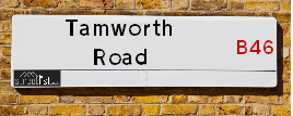
About Tamworth Road
Tamworth Road is a street located in the village of Fillongley and near the village of New Arley and near Newtown and near the village of Over Whitacre. The street has a length of approximately 4,208 metres.
Tamworth Road is located within the North Warwickshire District (B) Council's jurisdiction. They provide various services, like refuse collection, and manage council tax collection. It's situated in the West Midlands region of the UK.
Tamworth Road has been assigned the Unique Street Reference Numbers of 28400860, 28400858, 28400863 and 28401200 in the National Street Gazetteer.
Tamworth Road is located within the county of Warwickshire, situated in the West Midlands region of the UK. It's 93.99 miles North West from central London., 7.45 miles North West from Coventry, 12.67 miles East from Birmingham and 21.98 miles South West from Leicester.

Do you know why this road is called Tamworth Road?
What's it like to live here?
Ask the community a question about Tamworth Road.
Do you have any questions, memories to share or know any facts about Tamworth Road? We'd love to know more.
Also on streetlist.co.uk, can you help?
Eldroth Road
15th April 2024
I wondered if anyone has any old pictures of Wenning Bank House in the 1940’s and also Lane Side before of the same era .. we visited today with my Mum in law as she used to live at both these properties. Also any photos of the schools around that time .. thank you.
Can You Help?Napps Way
15th April 2024
Why is the road called Napps Way (belonging to Napp, but minus an
apostrophe as is usual with such nomenclature)? Moreover, who or
what is, or was, “Napp” in the respective, possessive case?
Several years ago, I met an elderly man (probably in his late-eighties)
who lives on Bentham Drive, Liverpool 16, and during a conversation
with him whilst in a Northwest Passenger Transport Ambulance on the
way to the former RLUH (Royal Liverpool University Hospital), he told
me that he could remember (when he was a boy, living in Childwall,
Liverpool 16) that, “Where Napps Way is now, during WW2, there was
a two-man gun emplacement on the, then, open land to protect the
railway line passing over Childwall Valley Road - next to the railway
bridge - when suddenly, as they were loading a live “shell” into the gun’s
breach, the aforementioned “shell” accidentally exploded in the gun’s
breach killing both of the two soldiers, that had been manning the gun,
instantly! (Very sad, of course, but could - perhaps - two ghosts relating
to those two, very unfortunately and prematurely-killed soldiers have
haunted that place of their deaths ever since - and have any residents
of Napps Way - formerly and in its latest incarnation - seen two, WW2
(uniformed) soldiers unexpectedly appear in or near their homes?)
Mauritius Road
15th April 2024
Why is Mauritius Road so called, since when and by whom? Does Greenwich have any particular links with Mauritius? Very interested to know. 🤞🏼
Can You Help?Estate Agents near Tamworth Road
| Name | Address | Website |
|---|---|---|
| Bayzos Estate Agents | Bayzos Estate Agents, Heart of England Conference Centre, Meriden Road Fillongley CV7 8DX | Visit Website |
| Citizen Housing Group | Tamworth Road, Keresley End, Coventry, CV7 8JG | |
| Green Grey - Selling property, Coleshill | 140 High Street, Coleshill, B46 3BJ |
Location Details
| Tamworth Road | |
|---|---|

| |
| Latitude | 52.499050 |
| Longitude | -1.602670 |
| OS Easting (X): | 426969 |
| OS Northing (Y): | 289131 |
| OS Grid Reference: | SP270891 |
Neighbourhood Policing |
| Police Force: Warwickshire |
 View Neighbourhood Crime and Policing View Neighbourhood Crime and Policing |
| Find a Local Neighbourhood Watch Scheme |
Frequently asked Questions for Tamworth Road
What Council (Local Authority) is Tamworth Road in?
Tamworth Road is located within the local authority area of North Warwickshire Council which is a District Council.
What Parish Council is Tamworth Road in?
Tamworth Road is located within the area of Fillongley & Arley Parish Council.
What Electoral Ward is Tamworth Road in?
Tamworth Road is located within the ward of Fillongley &Arley and Whitacre.
What County is Tamworth Road in?
Tamworth Road is located within the ceremonial county of Warwickshire.
What Constituency is Tamworth Road in?
Tamworth Road is located within the constituency of North Warwickshire &Nuneaton.
What Part of the UK is Tamworth Road in?
Tamworth Road is located within the West Midlands (England) region of the United Kingdom.
What County Council area is Tamworth Road in?
Tamworth Road is located within the Warwickshire Council area.
What Police Force area is Tamworth Road in?
Tamworth Road is located within the Warwickshire Police area.
Roads that have a Junction with Tamworth Road
| Street | Junction Type |
|---|---|
| Nuneaton Road (B4114) | junction |
| Nuneaton Road (B4114) | junction |
| Slowley Hill (B4098) | junction |
| Station Road | junction |
| Mill Lane | junction |
| Black Hall Lane | junction |
Sunset and Sunrise times for Tamworth Road
| Sunrise | 05:47 |
|---|---|
| Sunset | 20:21 |
Latest Weather Conditions for Tamworth Road
| Observed at Weather Station: | Coleshill 23 April 2024 at 11:00 (3.86 miles away) |
|---|---|
| Current Weather: | Light rain |
| Temperature and Humidity: | 8.1°C (75.6%) |
| Wind Direction and Speed: | N (11 mph) |
Population Statistics
| ONS Area Code | E00158170, E00158173 & E00158061 |
|---|---|
| ONS Area Name | Rural White-Collar Workers & Rural Life |
| Average Age | 43.85, 47.81 & 43.80 |
| Area Population | 1866.00, 1472.00 & 1218.00 |
| Male Population | 961.00, 742.00 & 613.00 (51%) |
| Female Population | 905.00, 730.00 & 605.00 (49%) |
| Benefit Claimants | 13, 7 & 6 (1%) |
| LSOA Code: | E01031028, E01031027 &E01031007 |
|---|---|
| LSOA Name: | North Warwickshire 007D, North Warwickshire 007C &North Warwickshire 007B |
| SOA Code: | 2d, 2a &2b |
| SOA Name: | |
| MSOA Code: | E02006474 |
| MSOA Name: | North Warwickshire 007 |
Nearest Supermarkets
| Waitrose At Corley South Services - |
|---|
| M6 Motorway, Junction 3 and 4, Highfield Lane, Coventry, Warwickshire |
| CV7 8NR |
| Distance: 3.01 Miles |
| Directions from Tamworth Road to Waitrose At Corley South Services - |
| Waitrose At Corley North Services |
|---|
| M6 Motorway, Junction 3/4, Highfield Lane, Corley, Coventry, Warwickshire |
| CV7 8NR |
| Distance: 3.01 Miles |
| Directions from Tamworth Road to Waitrose At Corley North Services |
| Morrisons Coleshill |
|---|
| Park Road, Coleshill B46 1AS |
| 01675 462256 |
| Distance: 4.53 Miles |
| Directions from Tamworth Road to Morrisons Coleshill |
| Tesco Nuneaton Croft Rd Express |
|---|
| 240 Croft Rd, Nuneaton, CV10 7DP |
| 0345 026 9045 |
| Distance: 4.89 Miles |
| Directions from Tamworth Road to Tesco Nuneaton Croft Rd Express |
Telephone Information
| Area Code |
|---|
| Area Code: 01675 - Coleshill |
| Area Code: 01676 - Meriden |
| Area Code: 024 - Coventry |
Local Government
| Local Council Details |
|---|
| Within the area of North Warwickshire |
| Visit the Council's Website |
| South Street, Atherstone, Warwickshire &CV9 1DE |
| Send email |
| Telephone Number: 01827 715 341 |
| Local Member of Parliament |
|---|
| Within the Westminster Parliamentary Constituency of North Warwickshire &Nuneaton |
| The Member of Parliament is Craig Tracey &Marcus Jones |
| Details for the MP Craig Tracey &Marcus Jones on parliament.uk |
| Details for the MP Craig Tracey &Marcus Jones on theyworkforyou.com |
| In the 2019 General Election Craig Tracey &Marcus Jones won with a majority of 17,956 the result was Con hold. The total electorate was 70,271 |
| Wards, Parish Councils and County Councils |
|---|
| Ward: Fillongley &Arley and Whitacre Ward |
| Ceremonial County: Warwickshire |
Nearest Schools
England Primary Schools
Bournebrook CofE Primary School
Address: Bournebrook CofE Primary School, Coventry Road, Fillongley, Coventry, West Midlands, CV7 8ET
Distance: 1.38 miles
Contact: 01676540390
Nearest Hospitals
| Name | Address | Postcode | Distance | Map |
|---|
Nearest Dentists
Dentists near Tamworth Road
| Name | Address | Postcode | Distance | Map |
|---|
Nearest GP Surgeries
Doctors near Tamworth Road
SPRING HILL MEDICAL CENTRE
Address: PHIL COLLINS WAY, ARLEY, COVENTRY, WEST MIDLANDS, CV7 8FD
Distance: 1.07 miles
Contact: tel: 01676 540395
PARK LEYS MEDICAL PRACTICE
Address: THE SURGERY, COVENTRY ROAD, COVENTRY, WEST MIDLANDS, CV7 8EQ
Distance: 1.60 miles
Contact: :
GALLEY COMMON MEDICAL CENTRE
Address: VALLEY ROAD, GALLEY COMMON, NUNEATON, WARWICKSHIRE, CV10 9NH
Distance: 3.31 miles
Contact: tel: 02476 397264
THE SURGERY
Address: CHESTERTON DRIVE, GALLEY COMMON, NUNEATON, WARWICKSHIRE, CV10 9QR
Distance: 3.59 miles
Contact: tel: 02476 394427
PARK LEYS MEDICAL PRACTICE
Address: BENNETTS ROAD NORTH, KERESLEY END, COVENTRY, WEST MIDLANDS, CV7 8LA
Distance: 3.73 miles
Contact: :
HAZELWOOD PRACTICE - COVID LOCAL VACCINATION SERVICE
Address: 27 PARKFIELD ROAD, COLESHILL, BIRMINGHAM, B46 3LD
Distance: 4.38 miles
Contact: :
Nearest Dispensing Chemists
Pharmacies near Tamworth Road
| Name | Address | Postcode | Telephone | Map | Distance in Km |
|---|
Nearest Opticians
Opticians near Tamworth Road
SCRIVENS OPTICIANS (COLESHILL)
Address: 91 HIGH STREET, COLESHILL, BIRMINGHAM, WEST MIDLANDS, B46 3AG
Distance: 4.38 miles
Contact: :
GORMLEY M ECONOM-EYES COVENTRY
Address: 254 SADLER ROAD, COVENTRY, WEST MIDLANDS, CV6 2LP
Distance: 5.57 miles
Contact: :
BOOTS OPTICIANS (BEDWORTH)
Address: 8 CONGREVE WALK, BEDWORTH, WARWICKSHIRE, CV12 8LY
Distance: 5.59 miles
Contact: :
SMITH & VARLEY OPTICIANS
Address: 22 ALL SAINTS SQUARE, BEDWORTH, WARWICKSHIRE, CV12 8ND
Distance: 5.60 miles
Contact: :
SPECSAVERS (BEDWORTH)
Address: 22 ALL SAINTS SQUARE, BEDWORTH, WARWICKSHIRE, CV12 8ND
Distance: 5.60 miles
Contact: :
SPECSAVERS (NUNEATON)
Address: 15ATHE ROPEWALK SHOPPING CENTRE, CHAPEL STREET, NUNEATON, WARWICKSHIRE, CV11 5TZ
Distance: 5.81 miles
Contact: :
Transport
Nearest Rail Stations
Coleshill Parkway Station is 4.60 miles away.
Address: Coleshill Parkway station, Station Road, Coleshill, Warwickshire, B46 1JZ
Coleshill Parkway is situated on the Birmingham to Peterborough Line.
Coleshill Parkway Station is staffed on a part time basis.
Directions from Tamworth Road to Coleshill Parkway Rail Station
Bermuda Park Station is 5.43 miles away.
Address: Bermuda Park station, St Georges Way, Bermuda Industrial Estate, Nuneaton, CV10 7JS
Bermuda Park is situated on the Coventry to Nuneaton Line.
Bermuda Park Station is an unstaffed station.