Map of Tower Road
| Postcodes | ||
|---|---|---|
| Icon | Postcodes for Tower Road | |
| Walking Distances | ||
| Distance Info | Green Circle = 10 Minutes Walk (800 metres) | |
About Tower Road
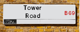
Tower Road is a street located in the town of Rowley Regis. The street has a length of approximately 1,089 metres.
Tower Road is located within the Sandwell District (B) Council's jurisdiction. They provide various services, like refuse collection, and manage council tax collection. It's situated in the West Midlands region of the UK.
Tower Road has been assigned the Unique Street Reference Number of 33648660 in the National Street Gazetteer.
Tower Road is located within the county of West Midlands, situated in the West Midlands region of the UK. It's 107.65 miles North West from central London., 6.08 miles West from Birmingham, 22.65 miles North from Worcester and 23.37 miles West from Coventry.

Do you know why this road is called Tower Road?
What's it like to live here?
Ask the community a question about Tower Road.
Do you have any questions, memories to share or know any facts about Tower Road? We'd love to know more.
Also on streetlist.co.uk, can you help?
Eldroth Road
15th April 2024
I wondered if anyone has any old pictures of Wenning Bank House in the 1940’s and also Lane Side before of the same era .. we visited today with my Mum in law as she used to live at both these properties. Also any photos of the schools around that time .. thank you.
Can You Help?Napps Way
15th April 2024
Why is the road called Napps Way (belonging to Napp, but minus an
apostrophe as is usual with such nomenclature)? Moreover, who or
what is, or was, “Napp” in the respective, possessive case?
Several years ago, I met an elderly man (probably in his late-eighties)
who lives on Bentham Drive, Liverpool 16, and during a conversation
with him whilst in a Northwest Passenger Transport Ambulance on the
way to the former RLUH (Royal Liverpool University Hospital), he told
me that he could remember (when he was a boy, living in Childwall,
Liverpool 16) that, “Where Napps Way is now, during WW2, there was
a two-man gun emplacement on the, then, open land to protect the
railway line passing over Childwall Valley Road - next to the railway
bridge - when suddenly, as they were loading a live “shell” into the gun’s
breach, the aforementioned “shell” accidentally exploded in the gun’s
breach killing both of the two soldiers, that had been manning the gun,
instantly! (Very sad, of course, but could - perhaps - two ghosts relating
to those two, very unfortunately and prematurely-killed soldiers have
haunted that place of their deaths ever since - and have any residents
of Napps Way - formerly and in its latest incarnation - seen two, WW2
(uniformed) soldiers unexpectedly appear in or near their homes?)
Mauritius Road
15th April 2024
Why is Mauritius Road so called, since when and by whom? Does Greenwich have any particular links with Mauritius? Very interested to know. 🤞🏼
Can You Help?Estate Agents near Tower Road
| Name | Address | Website |
|---|---|---|
| Tom Giles & Co | 11 Church Street, Oldbury, B69 3AD | Visit Website |
| Paul Jackson | 19 Birmingham Street, Oldbury,B69 4DT | Visit Website |
| Innovate Estate Agents | 18 Birmingham Street, Oldbury, B69 4DS | Visit Website |
We have found 9 postcodes for Tower Road
Location Details
| Tower Road | |
|---|---|

| |
| Latitude | 52.501436 |
| Longitude | -2.040774 |
| OS Easting (X): | 397232 |
| OS Northing (Y): | 289323 |
| OS Grid Reference: | SO972893 |
Ordnance Survey Maps for Tower Road
If you purchase a map through the links below, we may earn an affiliate commission.
| Map Series | link | Ordnance Survey |
| Explorer 1:25,000 219 Wolverhampton and Dudley, Stourbridge and Kidderminster | Check Price on Amazon | |
| Landranger 1:50,000 139 Birmingham and Wolverhampton | Check Price on Amazon |
Neighbourhood Policing |
| Police Force: West Midlands |
 View Neighbourhood Crime and Policing View Neighbourhood Crime and Policing |
| Find a Local Neighbourhood Watch Scheme |
Frequently asked Questions for Tower Road
What Council (Local Authority) is Tower Road in?
Tower Road is located within the local authority area of Sandwell Council which is a Metropolitan District.
What Parish Council is Tower Road in?
Tower Road is in an unparished area.
What Electoral Ward is Tower Road in?
Tower Road is located within the ward of Tividale.
What County is Tower Road in?
Tower Road is located within the ceremonial county of West Midlands.
What Constituency is Tower Road in?
Tower Road is located within the constituency of West Bromwich West.
What Part of the UK is Tower Road in?
Tower Road is located within the West Midlands (England) region of the United Kingdom.
What County Council area is Tower Road in?
Tower Road is located within the West Midlands Council area.
What Police Force area is Tower Road in?
Tower Road is located within the West Midlands Police area.
Roads that have a Junction with Tower Road
| Street | Junction Type |
|---|---|
| City Road | junction |
| Gilbert Avenue | junction |
| Lye Cross Road | junction |
| Sampson Close | junction |
| Falcon Place | junction |
| Park Close | junction |
| Tower Rise | junction |
| Hawfield Road | junction |
| Walker Avenue | junction |
| St Brades Close | junction |
| Strawberry Close | junction |
| Timothy Road | junction |
| Dovey Road | junction |
| New Birmingham Road | junction |
| New Birmingham Road (A4123) | junction |
Sunset and Sunrise times for Tower Road
| Sunrise | 05:47 |
|---|---|
| Sunset | 20:24 |
Latest Weather Conditions for Tower Road
| Observed at Weather Station: | Coleshill 24 April 2024 at 19:00 (14.87 miles away) |
|---|---|
| Current Weather: | Cloudy |
| Temperature and Humidity: | 7.2°C (62.1%) |
| Wind Direction and Speed: | ENE (2 mph) |
Population Statistics
| ONS Area Code | E00050978, E00050967, E00050981, E00050970, E00050977 & E00050980 |
|---|---|
| ONS Area Name | Multi-Ethnic Suburbia, Hard-Pressed Ethnic Mix & Outer City Hardship |
| Average Age | 40.55, 34.99 & 39.66 |
| Area Population | 1523.00, 1599.00 & 1531.00 |
| Male Population | 767.00, 751.00 & 725.00 (48%) |
| Female Population | 756.00, 848.00 & 806.00 (52%) |
| Benefit Claimants | 18, 47 & 54 (3%) |
| LSOA Code: | E01010079, E01010084 &E01010077 |
|---|---|
| LSOA Name: | Sandwell 022B, Sandwell 022G &Sandwell 022A |
| SOA Code: | 5b &4c |
| SOA Name: | |
| MSOA Code: | E02002064 |
| MSOA Name: | Sandwell 022 |
Nearest Supermarkets
| Iceland Oldbury Food Warehouse |
|---|
| UNIT 9, OLDBURY GREEN RETAIL PARK, OLDBURY, WEST MIDLANDS, B69 3DD |
| 01215446391 |
| Distance: 0.85 Miles |
| Directions from Tower Road to Iceland Oldbury Food Warehouse |
| Sainsburys Oldbury |
|---|
| Freeth Street, Oldbury, England, B69 3DB |
| 0121 6237070 |
| Distance: 0.98 Miles |
| Directions from Tower Road to Sainsburys Oldbury |
| Asda Oldbury |
|---|
| Wolverhampton Road, Oldbury, B69 4PU |
| 0121 569 7300 |
| Distance: 1.2 Miles |
| Directions from Tower Road to Asda Oldbury |
| Tesco Rowley Regis Express |
|---|
| 26 Rowley Village, Rowley Regis, B65 9AS |
| 0345 026 9366 |
| Distance: 1.39 Miles |
| Directions from Tower Road to Tesco Rowley Regis Express |
Telephone Information
| Area Code |
|---|
| Area Code: 01384 - Dudley |
| Area Code: 01922 - Walsall |
| Area Code: 0121 - Birmingham |
| Area Code: 01902 - Wolverhampton |
Broadband Information
| Speed | Average Speed | Median Speed | Maximum Speed | Next-generation access (NGA) | Number of Connections |
|---|---|---|---|---|---|
| Less than 2 Mbps | 25.5 | 20 | >=30 | Y | 7 |
Local Government
| Local Council Details |
|---|
| Within the area of Sandwell |
| Visit the Council's Website |
| Sandwell Council House, PO Box 2374, Oldbury, West Midlands &B69 3DE |
| Send email |
| Telephone Number: 0845 358 2200 |
| Local Member of Parliament |
|---|
| Within the Westminster Parliamentary Constituency of West Bromwich West |
| The Member of Parliament is Shaun Bailey |
| Details for the MP Shaun Bailey on parliament.uk |
| Details for the MP Shaun Bailey on theyworkforyou.com |
| In the 2019 General Election Shaun Bailey won with a majority of 3,799 the result was Con gain from Lab Coop. The total electorate was 64,517 |
| Wards, Parish Councils and County Councils |
|---|
| Ward: Tividale Ward |
| Ceremonial County: West Midlands |
Nearest Schools
England Primary Schools
Causeway Green Primary School
Address: Causeway Green Primary School, Penncricket Lane, Oldbury, West Midlands, B68 8LX
Distance: 1.59 miles
Contact: 01215592068
Blackheath Primary School
Address: Blackheath Primary School, Blackheath Primary School Britannia Road, Rowley Regis, West Midlands, B65 9NF
Distance: 1.52 miles
Contact: 01215591033
Rood End Primary School
Address: Rood End Primary School, Rood End Road, Oldbury, West Midlands, B68 8SQ
Distance: 1.76 miles
Contact: 01215521866
Langley Primary School
Address: Langley Primary School, Titford Road, Oldbury, West Midlands, B69 4QB
Distance: 1.26 miles
Contact: 01215521744
St Francis Xavier Catholic Primary School
Address: St Francis Xavier Catholic Primary School, McKean Road, Oldbury, West Midlands, B69 4BA
Distance: 1.23 miles
Contact: 01212745975
St Francis Xavier Catholic Primary School
Address: St Francis Xavier Catholic Primary School, McKean Road, Oldbury, West Midlands, B69 4BA
Distance: 1.23 miles
Contact:
Christ Church CofE Primary School
Address: Christ Church CofE Primary School, Albert Street, Oldbury, West Midlands, B69 4DE
Distance: 1.13 miles
Contact: 01215523625
Rounds Green Primary School
Address: Rounds Green Primary School, Brades Road, Oldbury, West Midlands, B69 2DP
Distance: 0.60 miles
Contact:
St James CofE Primary School
Address: St James CofE Primary School, Wolverley Crescent, Oldbury, West Midlands, B69 1BG
Distance: 0.73 miles
Contact: 01215525491
Rowley Hall Primary School
Address: Rowley Hall Primary School, Windsor Road, Sandwell, Rowley Regis, West Midlands, B65 9HU
Distance: 0.86 miles
Contact: 01215591400
Grace Mary Primary School
Address: Grace Mary Primary School, Hawfield Road, Tividale, Oldbury, West Midlands, B69 1LD
Distance: 0.03 miles
Contact: 01384255910
Oakham Primary School
Address: Oakham Primary School, Darbys Hill Road, Tividale, Oldbury, West Midlands, B69 1SG
Distance: 0.35 miles
Contact: 01384254368
Springfield Primary School
Address: Springfield Primary School, Dudley Road, Rowley Regis, West Midlands, B65 8JY
Distance: 1.04 miles
Contact: 01215591333
Tividale Community Primary School
Address: Tividale Community Primary School, Dudley Road West, Tividale, Oldbury, West Midlands, B69 2HT
Distance: 0.89 miles
Contact: 01215571765
Tividale Hall Primary School
Address: Tividale Hall Primary School, Regent Road, Tividale, Oldbury, West Midlands, B69 1TR
Distance: 0.85 miles
Contact: 01384254865
Burnt Tree Primary School
Address: Burnt Tree Primary School, Hill Road, Tividale, Oldbury, West Midlands, B69 2LN
Distance: 1.03 miles
Contact: 01215572967
Sacred Heart Primary School
Address: Sacred Heart Primary School, Sedgley Road East, Tipton, West Midlands, DY4 8UH
Distance: 1.55 miles
Contact: 01215571511
St Joseph's Catholic Primary School
Address: St Joseph's Catholic Primary School, Hillcrest Road, Dudley, West Midlands, DY2 7PW
Distance: 1.47 miles
Contact: 01384889424
Kates Hill Primary School
Address: Kates Hill Primary School, Peel Street, Dudley, West Midlands, DY2 7HP
Distance: 1.35 miles
Contact: 01384900670
Kates Hill Community Primary School
Address: Kates Hill Community Primary School, Peel Street, Dudley, West Midlands, DY2 7HP
Distance: 1.35 miles
Contact:
Sledmere Primary School
Address: Sledmere Primary School, The School Drive, Off Buffery Road, Dudley, West Midlands, DY2 8EH
Distance: 1.54 miles
Contact:
England Secondary Schools
Oldbury Academy
Address: Oldbury Academy, Pound Road, Oldbury, West Midlands, B68 8NE
Distance: 1.94 miles
Contact: 01215333750
St Michael's Church of England High School
Address: St Michael's Church of England High School, Curral Road, Rowley Regis, West Midlands, B65 9AN
Distance: 1.27 miles
Contact: 01215616881
Ormiston Sandwell Community Academy
Address: Ormiston Sandwell Community Academy, Lower City Road, Oldbury, West Midlands, B69 2HE
Distance: 0.59 miles
Contact: 01215525501
Nearest Hospitals
| Name | Address | Postcode | Distance | Map |
|---|
Nearest Dentists
Dentists near Tower Road
| Name | Address | Postcode | Distance | Map |
|---|
Nearest GP Surgeries
Doctors near Tower Road
PORTWAY FAMILY PRACTICE
Address: PORTWAY LIFESTYLE CENTRE, NEWBURY LANE, OLDBURY, WEST MIDLANDS, B69 1HE
Distance: 0.51 miles
Contact: tel: 0121 6123424
PORTWAY LIFESTYLE CENTRE - COVID LOCAL VACCINATION SERVICE 2
Address: PORTWAY LIFESTYLE CENTRE, NEWBURY LANE, OLDBURY, B69 1HE
Distance: 0.51 miles
Contact: :
WHITEHEATH MEDICAL CENTRE
Address: BADSEY ROAD, OLDBURY, WEST MIDLANDS, B69 1EJ
Distance: 0.63 miles
Contact: :
WHITEHEATH MEDICAL CENTRE - COVID LOCAL VACCINATION SERVICE 2
Address: BADSEY ROAD, OLDBURY, B69 1EJ
Distance: 0.63 miles
Contact: :
OAKHAM SURGERY
Address: 213 REGENT ROAD, TIVIDALE, OLDBURY, WEST MIDLANDS, B69 1RZ
Distance: 0.76 miles
Contact: :
HAWES LANE SURGERY
Address: HAWES LANE, ROWLEY REGIS, WEST MIDLANDS, B65 9AF
Distance: 1.11 miles
Contact: tel: 0121 5595159
Nearest Dispensing Chemists
Pharmacies near Tower Road
| Name | Address | Postcode | Telephone | Map | Distance in Km |
|---|
Nearest Opticians
Opticians near Tower Road
PORTWAY OPTICIANS
Address: 51A NEW BIRMINGHAM ROAD, TIVIDALE, OLDBURY, WEST MIDLANDS, B69 2JQ
Distance: 0.35 miles
Contact: :
ON CALL OPTICIANS
Address: 61 TRAFALGAR ROAD, TIVIDALE, OLDBURY, WEST MIDLANDS, B69 1RE
Distance: 0.52 miles
Contact: :
ON CALL EYECARE LTD
Address: 61 TRAFALGAR ROAD, TIVIDALE, OLDBURY, B69 1RE
Distance: 0.52 miles
Contact: :
SCRIVENS OPTICIANS (OLDBURY)
Address: 9 BIRMINGHAM STREET, OLDBURY, WEST MIDLANDS, B69 4DT
Distance: 1.07 miles
Contact: :
THE RIGHT VISION OPHTHALMIC OPTICIANS
Address: 34 BIRMINGHAM STREET, OLDBURY, WEST MIDLANDS, B69 4DS
Distance: 1.10 miles
Contact: :
C. CACOULLIS OPTICIANS - OLDBURY
Address: 31 BIRMINGHAM STREET, OLDBURY, WEST MIDLANDS, B69 4DY
Distance: 1.13 miles
Contact: :
Transport
Nearest Rail Stations
Sandwell & Dudley Station is 1.32 miles away.
Address: Sandwell & Dudley station, Bromford Road, West Bromwich, West Midlands, B70 7JD
Sandwell & Dudley is situated on the Rugby�Birmingham�Stafford line|West Coast Main Line.
Sandwell & Dudley Station is staffed on a full time basis.
Directions from Tower Road to Sandwell & Dudley Rail Station
Langley Green Station is 1.59 miles away.
Address: Langley Green station, Western Road, Langley Green, West Midlands, B69 4LZ
Langley Green is situated on the Birmingham to Worcester via Kidderminster line.
Langley Green Station is staffed on a part time basis.