Map of Coles Lane
| Postcodes | ||
|---|---|---|
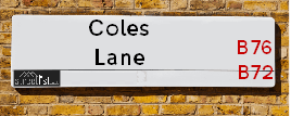
| Icon | Postcodes for Coles Lane | |
| Walking Distances | ||
| Distance Info | Green Circle = 10 Minutes Walk (800 metres) | |
About Coles Lane
Coles Lane is a street located in the town of Royal Sutton Coldfield. The street has a length of approximately 735 metres.
Coles Lane is located within the Birmingham District (B) Council's jurisdiction. They provide various services, like refuse collection, and manage council tax collection. It's situated in the West Midlands region of the UK.
Coles Lane has been assigned the Unique Street Reference Number of 2707192 in the National Street Gazetteer.
Coles Lane is located within the county of West Midlands, situated in the West Midlands region of the UK. It's 103.18 miles North West from central London., 6.32 miles North East from Birmingham, 16.61 miles North West from Coventry and 29.18 miles South West from Derby.

Do you know why this road is called Coles Lane?
What's it like to live here?
Ask the community a question about Coles Lane.
Do you have any questions, memories to share or know any facts about Coles Lane? We'd love to know more.
Also on streetlist.co.uk, can you help?
Eldroth Road
15th April 2024
I wondered if anyone has any old pictures of Wenning Bank House in the 1940’s and also Lane Side before of the same era .. we visited today with my Mum in law as she used to live at both these properties. Also any photos of the schools around that time .. thank you.
Can You Help?Napps Way
15th April 2024
Why is the road called Napps Way (belonging to Napp, but minus an
apostrophe as is usual with such nomenclature)? Moreover, who or
what is, or was, “Napp” in the respective, possessive case?
Several years ago, I met an elderly man (probably in his late-eighties)
who lives on Bentham Drive, Liverpool 16, and during a conversation
with him whilst in a Northwest Passenger Transport Ambulance on the
way to the former RLUH (Royal Liverpool University Hospital), he told
me that he could remember (when he was a boy, living in Childwall,
Liverpool 16) that, “Where Napps Way is now, during WW2, there was
a two-man gun emplacement on the, then, open land to protect the
railway line passing over Childwall Valley Road - next to the railway
bridge - when suddenly, as they were loading a live “shell” into the gun’s
breach, the aforementioned “shell” accidentally exploded in the gun’s
breach killing both of the two soldiers, that had been manning the gun,
instantly! (Very sad, of course, but could - perhaps - two ghosts relating
to those two, very unfortunately and prematurely-killed soldiers have
haunted that place of their deaths ever since - and have any residents
of Napps Way - formerly and in its latest incarnation - seen two, WW2
(uniformed) soldiers unexpectedly appear in or near their homes?)
Mauritius Road
15th April 2024
Why is Mauritius Road so called, since when and by whom? Does Greenwich have any particular links with Mauritius? Very interested to know. 🤞🏼
Can You Help?Estate Agents near Coles Lane
| Name | Address | Website |
|---|---|---|
| Acres | 28 Beeches Walk, Sutton Coldfield, B73 6HN | Visit Website |
| Hunters | 32a Beeches Walk, Sutton Coldfield, B73 6HN | Visit Website |
| Newton Fallowell | 14 Beeches Walk Sutton Coldfield Birmingham B73 6HN | Visit Website |
Hotels near Coles Lane
Budget Hotels near Coles Lane
| Budget Hotel Name | Distance (miles) |
|---|---|
| 1: Name:Travelodge Birmingham Sutton Coldfield Address:Boldmere Rd, Sutton Coldfield, B73 5UP Telephone:0871 984 6108 Visit Site |
1.02 |
| 2: Name:Premier Inn Birmingham North Sutton Coldfield Address:Whitehouse Common Road Telephone: Visit Site |
1.41 |
| 3: Name:Travelodge Birmingham Streetly Address:Chester Rd, Sutton Coldfield, B73 6SP Telephone:0871 559 1805 Visit Site |
2.58 |
| 4: Name:Travelodge Birmingham Fort Dunlop Address:Fort Dunlop, Fort Pkwy, Birmingham, B24 9FD Telephone:0871 984 6312 Visit Site |
3.14 |
| 5: Name:Holiday Inn Express Birmingham - Castle Bromwich Address:1200 Chester Rd, Castle Bromwich Telephone: Visit Site |
3.29 |
Location Details
| Coles Lane | |
|---|---|

| |
| Latitude | 52.555761 |
| Longitude | -1.819177 |
| OS Easting (X): | 412258 |
| OS Northing (Y): | 295379 |
| OS Grid Reference: | SP123954 |
Ordnance Survey Maps for Coles Lane
If you purchase a map through the links below, we may earn an affiliate commission.
| Map Series | link | Ordnance Survey |
| Explorer 1:25,000 220 Birmingham, Walsall, Solihull and Redditch | Check Price on Amazon | |
| Landranger 1:50,000 139 Birmingham and Wolverhampton | Check Price on Amazon |
Neighbourhood Policing |
| Police Force: West Midlands |
 View Neighbourhood Crime and Policing View Neighbourhood Crime and Policing |
| Find a Local Neighbourhood Watch Scheme |
Frequently asked Questions for Coles Lane
What Council (Local Authority) is Coles Lane in?
Coles Lane is located within the local authority area of Birmingham Council which is a Metropolitan District.
What Parish Council is Coles Lane in?
Coles Lane is in an unparished area.
What Electoral Ward is Coles Lane in?
Coles Lane is located within the ward of Sutton Trinity.
What County is Coles Lane in?
Coles Lane is located within the ceremonial county of West Midlands.
What Constituency is Coles Lane in?
Coles Lane is located within the constituency of Sutton Coldfield.
What Part of the UK is Coles Lane in?
Coles Lane is located within the West Midlands (England) region of the United Kingdom.
What County Council area is Coles Lane in?
Coles Lane is located within the West Midlands Council area.
What Police Force area is Coles Lane in?
Coles Lane is located within the West Midlands Police area.
Roads that have a Junction with Coles Lane
| Street | Junction Type |
|---|---|
| Rowan Road | junction |
| East View Road | pseudo node |
| Ebrook Road | junction |
| Shipton Road | junction |
| Douglas Road | junction |
| Maple Road | junction |
| Elms Road | junction |
| Shirley Drive | junction |
| While Road | junction |
Sunset and Sunrise times for Coles Lane
| Sunrise | 05:57 |
|---|---|
| Sunset | 20:15 |
Latest Weather Conditions for Coles Lane
| Observed at Weather Station: | Coleshill 19 April 2024 at 19:00 (7.57 miles away) |
|---|---|
| Current Weather: | Overcast |
| Temperature and Humidity: | 8.0°C (89.5%) |
| Wind Direction and Speed: | N (2 mph) |
Population Statistics
| ONS Area Code | E00047808, E00047802, E00047815 & E00047806 |
|---|---|
| ONS Area Name | White Professionals, Multi-Ethnic Suburbia & Industrious Transitions |
| Average Age | 38.79 & 37.91 |
| Area Population | 1467.00 & 1431.00 |
| Male Population | 736.00 & 715.00 (50%) |
| Female Population | 731.00 & 716.00 (50%) |
| Benefit Claimants | 10 & 19 (1%) |
| LSOA Code: | E01009453 &E01009451 |
|---|---|
| LSOA Name: | Birmingham 009C &Birmingham 009B |
| SOA Code: | 3b &3d |
| SOA Name: | |
| MSOA Code: | E02001835 |
| MSOA Name: | Birmingham 009 |
Nearest Supermarkets
| Iceland Sutton Cfield |
|---|
| Maney Corner, Birmingham Road, Sutton Coldfield, B72 1QL |
| 01213557665 |
| Distance: 0.3 Miles |
| Directions from Coles Lane to Iceland Sutton Cfield |
| Tesco Birmingham Rd Sutton Express |
|---|
| 3 Maney Corner, Birmingham Rd, Sutton Coldfield, B72 1QL |
| 0345 675 7047 |
| Distance: 0.32 Miles |
| Directions from Coles Lane to Tesco Birmingham Rd Sutton Express |
| Little Waitrose Sutton Coldfield |
|---|
| 83 The Parade, Sutton Coldfield, West Midlands, B72 1PL |
| 01213 553866 |
| Distance: 0.44 Miles |
| Directions from Coles Lane to Little Waitrose Sutton Coldfield |
| Sainsburys Sutton Coldfield Boldmere Road Local |
|---|
| 36-38 Boldmere Road, Sutton Coldfield, England, B73 5TD |
| 1213551483 |
| Distance: 1.04 Miles |
| Directions from Coles Lane to Sainsburys Sutton Coldfield Boldmere Road Local |
Telephone Information
| Dialling Code | Telephone Exchange | Telephone Cabinet | Fibre to the Cabinet or Fibre to the Premises |
|---|---|---|---|
| 0121 | SUTTON COLDFIELD - CMSUT | P67 | FTTC |
Broadband Information
| Speed | Average Speed | Median Speed | Maximum Speed | Next-generation access (NGA) | Number of Connections |
|---|---|---|---|---|---|
| Greater than 2 Mbps | >=30 | 25 | >=30 | Y | 27 |
Local Government
| Local Council Details |
|---|
| Within the area of Birmingham |
| Visit the Council's Website |
| Council House, Victoria Square, Birmingham &B1 1BB |
| Send email |
| Telephone Number: 0121 303 1111 |
| Local Member of Parliament |
|---|
| Within the Westminster Parliamentary Constituency of Sutton Coldfield |
| The Member of Parliament is Andrew Mitchell |
| Details for the MP Andrew Mitchell on parliament.uk |
| Details for the MP Andrew Mitchell on theyworkforyou.com |
| In the 2019 General Election Andrew Mitchell won with a majority of 19,272 the result was Con hold. The total electorate was 75,638 |
| Wards, Parish Councils and County Councils |
|---|
| Ward: Sutton Trinity Ward |
| Ceremonial County: West Midlands |
Nearest Schools
| Name | Address | Postcode | Telephone | Type | Distance (Km) |
|---|
Data accessed from gov.scot 08-08-2019
Nearest Hospitals
| Name | Address | Postcode | Distance | Map |
|---|
Nearest Dentists
Dentists near Coles Lane
| Name | Address | Postcode | Distance | Map |
|---|
Nearest GP Surgeries
Doctors near Coles Lane
THE MANOR PRACTICE
Address: 61 HOLLAND ROAD, SUTTON COLDFIELD, WEST MIDLANDS, B72 1RL
Distance: 0.25 miles
Contact: tel: 0121 3542032
VESEY PRACTICE
Address: JAMES PRESTON HEALTH CENTRE, 61 HOLLAND ROAD, SUTTON COLDFIELD, WEST MIDLANDS, B72 1RL
Distance: 0.25 miles
Contact: :
THE HAWTHORNS SURGERY - COVID LOCAL VACCINATION SERVICE
Address: THE HAWTHORNS SURGERY, 331 BIRMINGHAM ROAD, SUTTON COLDFIELD, B72 1DL
Distance: 1.21 miles
Contact: :
THE HAWTHORNS SURGERY
Address: 331 BIRMINGHAM ROAD, SUTTON COLDFIELD, B72 1DL
Distance: 1.21 miles
Contact: tel: 0121 3732211
ASHFIELD SURGERY
Address: 8 WALMLEY ROAD, SUTTON COLDFIELD, B76 1QN
Distance: 1.32 miles
Contact: tel: 0121 3513238
FALCON MEDICAL CENTRE
Address: 93 CARHAMPTON ROAD, SUTTON COLDFIELD, WEST MIDLANDS, B75 7PG
Distance: 1.34 miles
Contact: :
Nearest Dispensing Chemists
Pharmacies near Coles Lane
| Name | Address | Postcode | Telephone | Map | Distance in Km |
|---|
Nearest Opticians
Opticians near Coles Lane
NEIL BERRY OPTICIAN (SUTTON COLDFIELD)
Address: 6 HOLLAND STREET, SUTTON COLDFIELD, WEST MIDLANDS, B72 1RR
Distance: 0.30 miles
Contact: :
SCRIVENS OPTICIANS (SUTTON COLDFIELD)
Address: 115 PARADE, SUTTON COLDFIELD, WEST MIDLANDS, B72 1PU
Distance: 0.40 miles
Contact: :
BOOTS OPTICIANS (SUTTON COLDFIELD)
Address: 44-46 GRACECHURCH SHOPPING CENTRE, THE PARADE, SUTTON COLDFIELD, WEST MIDLANDS, B72 1PD
Distance: 0.49 miles
Contact: :
BOOTS OPTICIANS (SUTTON COLDFIELD)
Address: 24 THE PARADE, SUTTON COLDFIELD, WEST MIDLANDS, B72 1PD
Distance: 0.49 miles
Contact: :
SPECSAVERS (SUTTON COLDFIELD)
Address: UNIT 4, RED ROSE CENTRE, 57B LOWER PARADE, SUTTON COLDFIELD, WEST MIDLANDS, B72 1XX
Distance: 0.50 miles
Contact: :
VISION EXPRESS (GRACECHURCH)
Address: 198 GRACECHURCH SHOPPING CENTRE, SUTTON COLDFIELD, WEST MIDLANDS, B72 1PA
Distance: 0.51 miles
Contact: :
Transport
Nearest Rail Stations
Sutton Coldfield Station is 0.68 miles away.
Address: Sutton Coldfield station, Railway Road, Sutton Coldfield, West Midlands, B73 6AY
Sutton Coldfield is situated on the Bristol to Brimingham Line.
Sutton Coldfield Station is staffed on a part time basis.
Wylde Green Station is 0.84 miles away.
Address: Wylde Green station, Station Road, Wylde Green, West Midlands, B73 5LA
Wylde Green is situated on the Bristol to Brimingham Line.
Wylde Green Station is staffed on a part time basis.