Map of Peddimore Lane
| Postcodes | ||
|---|---|---|
| Icon | Postcodes for Peddimore Lane | |
| Walking Distances | ||
| Distance Info | Green Circle = 10 Minutes Walk (800 metres) | |
About Peddimore Lane
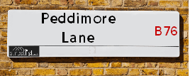
Peddimore Lane is a street located near the city of Birmingham. It uses the postcode B76 9AA. The street has a length of approximately 590 metres.
Peddimore Lane is located within the Birmingham District (B) Council's jurisdiction. They provide various services, like refuse collection, and manage council tax collection. It's situated in the West Midlands region of the UK.
Peddimore Lane has been assigned the Unique Street Reference Number of 2707624 in the National Street Gazetteer.
Peddimore Lane is located within the county of West Midlands, situated in the West Midlands region of the UK. It's 100.82 miles North West from central London., 6.64 miles North East from Birmingham, 14.23 miles North West from Coventry and 27.9 miles West from Leicester.

Do you know why this road is called Peddimore Lane?
What's it like to live here?
Ask the community a question about Peddimore Lane.
Do you have any questions, memories to share or know any facts about Peddimore Lane? We'd love to know more.
Also on streetlist.co.uk, can you help?
Eldroth Road
15th April 2024
I wondered if anyone has any old pictures of Wenning Bank House in the 1940’s and also Lane Side before of the same era .. we visited today with my Mum in law as she used to live at both these properties. Also any photos of the schools around that time .. thank you.
Can You Help?Napps Way
15th April 2024
Why is the road called Napps Way (belonging to Napp, but minus an
apostrophe as is usual with such nomenclature)? Moreover, who or
what is, or was, “Napp” in the respective, possessive case?
Several years ago, I met an elderly man (probably in his late-eighties)
who lives on Bentham Drive, Liverpool 16, and during a conversation
with him whilst in a Northwest Passenger Transport Ambulance on the
way to the former RLUH (Royal Liverpool University Hospital), he told
me that he could remember (when he was a boy, living in Childwall,
Liverpool 16) that, “Where Napps Way is now, during WW2, there was
a two-man gun emplacement on the, then, open land to protect the
railway line passing over Childwall Valley Road - next to the railway
bridge - when suddenly, as they were loading a live “shell” into the gun’s
breach, the aforementioned “shell” accidentally exploded in the gun’s
breach killing both of the two soldiers, that had been manning the gun,
instantly! (Very sad, of course, but could - perhaps - two ghosts relating
to those two, very unfortunately and prematurely-killed soldiers have
haunted that place of their deaths ever since - and have any residents
of Napps Way - formerly and in its latest incarnation - seen two, WW2
(uniformed) soldiers unexpectedly appear in or near their homes?)
Mauritius Road
15th April 2024
Why is Mauritius Road so called, since when and by whom? Does Greenwich have any particular links with Mauritius? Very interested to know. 🤞🏼
Can You Help?Estate Agents near Peddimore Lane
| Name | Address | Website |
|---|---|---|
| Green & Company | 34 Walmley Road, Walmley Sutton Coldfield, B76 1QN | Visit Website |
| Paul Carr | 32 Walmley Road, Walmley, Sutton Coldfield, B76 1QN | |
| Acres | 49 Walmley Road, Walmley, Sutton Coldfield, West Midlands, B76 1NP | Visit Website |
We have found 1 postcode for Peddimore Lane
Location Details
| Peddimore Lane | |
|---|---|

| |
| Latitude | 52.535332 |
| Longitude | -1.773445 |
| OS Easting (X): | 415365 |
| OS Northing (Y): | 293116 |
| OS Grid Reference: | SP154931 |
Neighbourhood Policing |
| Police Force: West Midlands |
 View Neighbourhood Crime and Policing View Neighbourhood Crime and Policing |
| Find a Local Neighbourhood Watch Scheme |
Frequently asked Questions for Peddimore Lane
What Council (Local Authority) is Peddimore Lane in?
Peddimore Lane is located within the local authority area of Birmingham Council which is a Metropolitan District.
What Parish Council is Peddimore Lane in?
Peddimore Lane is in an unparished area.
What Electoral Ward is Peddimore Lane in?
Peddimore Lane is located within the ward of Sutton Walmley & Minworth.
What County is Peddimore Lane in?
Peddimore Lane is located within the ceremonial county of West Midlands.
What Constituency is Peddimore Lane in?
Peddimore Lane is located within the constituency of Sutton Coldfield.
What Part of the UK is Peddimore Lane in?
Peddimore Lane is located within the West Midlands (England) region of the United Kingdom.
What County Council area is Peddimore Lane in?
Peddimore Lane is located within the West Midlands Council area.
What Police Force area is Peddimore Lane in?
Peddimore Lane is located within the West Midlands Police area.
Roads that have a Junction with Peddimore Lane
| Street | Junction Type |
|---|---|
| Lindridge Drive | junction |
| Walmley Ash Lane | junction |
Sunset and Sunrise times for Peddimore Lane , B76 9AA
| Sunrise | 05:46 |
|---|---|
| Sunset | 20:23 |
Latest Weather Conditions for Peddimore Lane, B76 9AA
| Observed at Weather Station: | Coleshill 24 April 2024 at 05:00 (5.22 miles away) |
|---|---|
| Current Weather: | Overcast |
| Temperature and Humidity: | 4.9°C (92.5%) |
| Wind Direction and Speed: | NW (1 mph) |
Population Statistics
| ONS Area Code | E00047803 |
|---|---|
| ONS Area Name | Delayed Retirement |
| Average Age | 43.98 |
| Area Population | 1635.00 |
| Male Population | 807.00 (49%) |
| Female Population | 828.00 (51%) |
| Benefit Claimants | 8 (0%) |
| LSOA Code: | E01009450 |
|---|---|
| LSOA Name: | Birmingham 012E |
| SOA Code: | 8c |
| SOA Name: | |
| MSOA Code: | E02001838 |
| MSOA Name: | Birmingham 012 |
Nearest Supermarkets
| Asda Minworth |
|---|
| Walmley Ash Road, Sutton Coldfield, B76 1XL |
| 0121 313 7100 |
| Distance: 0.38 Miles |
| Directions from Peddimore Lane to Asda Minworth |
| Sainsburys Castle Vale |
|---|
| Castle Vale Retail Park, Chester Road, Castle Vale, Birmingham, England, B35 6HB |
| 0121 776 7425 |
| Distance: 1.56 Miles |
| Directions from Peddimore Lane to Sainsburys Castle Vale |
| Tesco Water Orton Express |
|---|
| 8 Station Buildings, Birmingham Rd, Birmingham, B46 1SR |
| 0345 026 9273 |
| Distance: 1.78 Miles |
| Directions from Peddimore Lane to Tesco Water Orton Express |
| Tesco Castle Bromwich Green Ln Express |
|---|
| 136-140 Green Ln, Castle Bromwich, Birmingham, B36 0BX |
| 0345 026 9107 |
| Distance: 2.06 Miles |
| Directions from Peddimore Lane to Tesco Castle Bromwich Green Ln Express |
Telephone Information
| Area Code |
|---|
| Area Code: 01675 - Coleshill |
| Area Code: 0121 - Birmingham |
| Area Code: 01827 - Tamworth |
| Area Code: 01676 - Meriden |
Broadband Information
| Speed | Average Speed | Median Speed | Maximum Speed | Next-generation access (NGA) | Number of Connections |
|---|---|---|---|---|---|
| Less than 2 Mbps | 5.1 | 5.7 | 6.4 | N | 10 |
Local Government
| Local Council Details |
|---|
| Within the area of Birmingham |
| Visit the Council's Website |
| Council House, Victoria Square, Birmingham &B1 1BB |
| Send email |
| Telephone Number: 0121 303 1111 |
| Local Member of Parliament |
|---|
| Within the Westminster Parliamentary Constituency of Sutton Coldfield |
| The Member of Parliament is Andrew Mitchell |
| Details for the MP Andrew Mitchell on parliament.uk |
| Details for the MP Andrew Mitchell on theyworkforyou.com |
| In the 2019 General Election Andrew Mitchell won with a majority of 19,272 the result was Con hold. The total electorate was 75,638 |
| Wards, Parish Councils and County Councils |
|---|
| Ward: Sutton Walmley & Minworth Ward |
| Ceremonial County: West Midlands |
Nearest Schools
England Primary Schools
St Gerard's RC Junior and Infant School
Address: St Gerard's RC Junior and Infant School, Yatesbury Avenue, Castle Vale, Birmingham, West Midlands, B35 6LB
Distance: 1.06 miles
Contact: 01214642613
Walmley Infant School
Address: Walmley Infant School, Walmley Ash Road, Walmley, Sutton Coldfield, West Midlands, B76 1JB
Distance: 0.73 miles
Contact: 01213511355
Walmley Junior School
Address: Walmley Junior School, Walmley Ash Road, Sutton Coldfield, West Midlands, B76 1JB
Distance: 0.73 miles
Contact: 01213511346
Topcliffe Primary School
Address: Topcliffe Primary School, Hawkinge Drive, Castle Vale, Birmingham, West Midlands, B35 6BS
Distance: 1.32 miles
Contact:
Gunter Primary School
Address: Gunter Primary School, Gunter Road, Birmingham, West Midlands, B24 0RU
Distance: 1.73 miles
Contact: 01214642367
Penns Primary School
Address: Penns Primary School, Berwood Road, Sutton Coldfield, West Midlands, B72 1BS
Distance: 1.76 miles
Contact: 01214648014
Minworth Junior and Infant School
Address: Minworth Junior and Infant School, Water Orton Lane, Minworth, SUTTON COLDFIELD, West Midlands, B76 9BU
Distance: 0.52 miles
Contact: 01213511345
Pegasus Primary School
Address: Pegasus Primary School, Turnhouse Road, Castle Vale, Birmingham, West Midlands, B35 6PR
Distance: 1.02 miles
Contact: 01214644293
The Deanery Church of England Primary School
Address: The Deanery Church of England Primary School, Fox Hollies Road, Walmley, Sutton Coldfield, West Midlands, B76 2RD
Distance: 1.05 miles
Contact: 01213516441
Topcliffe Primary School
Address: Topcliffe Primary School, Hawkinge Drive, Castle Vale, Birmingham, West Midlands, B35 6BS
Distance: 1.32 miles
Contact: 01216756296
England Secondary Schools
Greenwood Academy
Address: Greenwood Academy, Farnborough Road, Castle Vale, Birmingham, West Midlands, B35 7NL
Distance: 1.15 miles
Contact: 01214646101
Nearest Hospitals
| Name | Address | Postcode | Distance | Map |
|---|
Nearest Dentists
Dentists near Peddimore Lane
| Name | Address | Postcode | Distance | Map |
|---|
Nearest GP Surgeries
Doctors near Peddimore Lane
ASHFIELD SURGERY
Address: 8 WALMLEY ROAD, SUTTON COLDFIELD, B76 1QN
Distance: 1.17 miles
Contact: tel: 0121 3513238
EDEN COURT MEDICAL PRACTICE
Address: 200 TANGMERE DRIVE, CASTLE VALE, BIRMINGHAM, WEST MIDLANDS, B35 6EE
Distance: 1.47 miles
Contact: tel: 0121 7488200
SHAH ZAMAN SURGERY - COVID LOCAL VACCINATION SERVICE
Address: SHAH ZAMAN SURGERY, CASTLE VALE PRIMARY CARE CENTRE, 70 TANGMERE DRIVE, CASTLE VALE, BIRMINGHAM, B35 7QX
Distance: 1.55 miles
Contact: :
SHAH ZAMAN SURGERY
Address: 70 TANGMERE DRIVE, BIRMINGHAM, B35 7QX
Distance: 1.55 miles
Contact: tel: 0121 4651500
SATIS HOUSE
Address: 10 BIRMINGHAM ROAD, WATER ORTON, BIRMINGHAM, WEST MIDLANDS, B46 1TH
Distance: 1.65 miles
Contact: tel: 0121 7767572
PARKFIELD MEDICAL CENTRE
Address: 10 PARKFIELD DRIVE, CASTLE BROMWICH, BIRMINGHAM, WEST MIDLANDS, B36 9EJ
Distance: 1.80 miles
Contact: tel: 0121 7495757
Nearest Dispensing Chemists
Pharmacies near Peddimore Lane
| Name | Address | Postcode | Telephone | Map | Distance in Km |
|---|
Nearest Opticians
Opticians near Peddimore Lane
4977 MINWORTH
Address: ASDA STORES LTD, WALMLEY ASH ROAD, MINWORTH, SUTTON COLDFIELD, WEST MIDLANDS, B76 1XL
Distance: 0.32 miles
Contact: :
COMPLETE COMMUNITY CARE OPTICIANS (SUTTON)
Address: OAK HOUSE, 9 NEW LEASOW, SUTTON COLDFIELD, WEST MIDLANDS, B76 1YL
Distance: 0.66 miles
Contact: :
CHARLES MORRIS OPTICIANS
Address: 28 WALMLEY ROAD, SUTTON COLDFIELD, WEST MIDLANDS, B76 1QN
Distance: 1.17 miles
Contact: :
CASTLE VALE SPECSAVERS LIMITED
Address: CASTLE VALE SHOPPING CENTRE, CASTLE VALE RETAIL PARK, CHESTER ROAD, BIRMINGHAM, B35 6HB
Distance: 1.60 miles
Contact: :
EYE CENTRE OPTICIAN (REDDICAP HEATH)
Address: 53C REDDICAP HEATH ROAD, SUTTON COLDFIELD, WEST MIDLANDS, B75 7DX
Distance: 2.09 miles
Contact: :
A B OPTICS LTD (SUTTON COLDFIELD)
Address: 358 BIRMINGHAM ROAD, WYLDE GREEN, SUTTON COLDFIELD, WEST MIDLANDS, B72 1YH
Distance: 2.26 miles
Contact: :
Transport
Nearest Rail Stations
Water Orton Station is 1.72 miles away.
Address: Water Orton station, Marsh Lane, Water Orton, Warwickshire, B46 1NE
Water Orton is situated on the Birmingham to Peterborough Line|Birmingham to Nottingham Line.
Water Orton Station is an unstaffed station.
Chester Road Station is 2.48 miles away.
Address: Chester Road station, Station Approach, Chester Road, Sutton Coldfield, B73 5JS
Chester Road is situated on the Bristol to Brimingham Line.
Chester Road Station is staffed on a part time basis.