Map of Robey's Lane
| Postcodes | ||
|---|---|---|
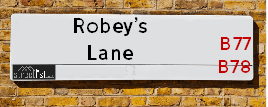
| Icon | Postcodes for Robey's Lane | |
| Walking Distances | ||
| Distance Info | Green Circle = 10 Minutes Walk (800 metres) | |
About Robey's Lane
Robey's Lane is a street located near the town of Tamworth. The street has a length of approximately 1,964 metres.
Robey's Lane is located within the North Warwickshire District (B) Council's jurisdiction. They provide various services, like refuse collection, and manage council tax collection. It's situated in the West Midlands region of the UK.
Robey's Lane has been assigned the Unique Street Reference Number of 28400736 in the National Street Gazetteer.
Robey's Lane is located within the county of Warwickshire, situated in the West Midlands region of the UK. It's 101.54 miles North West from central London., 15.25 miles North East from Birmingham, 16.15 miles North from Coventry and 21.16 miles West from Leicester.

Do you know why this road is called Robey's Lane?
What's it like to live here?
Ask the community a question about Robey's Lane.
Do you have any questions, memories to share or know any facts about Robey's Lane? We'd love to know more.
Also on streetlist.co.uk, can you help?
Eldroth Road
15th April 2024
I wondered if anyone has any old pictures of Wenning Bank House in the 1940’s and also Lane Side before of the same era .. we visited today with my Mum in law as she used to live at both these properties. Also any photos of the schools around that time .. thank you.
Can You Help?Napps Way
15th April 2024
Why is the road called Napps Way (belonging to Napp, but minus an
apostrophe as is usual with such nomenclature)? Moreover, who or
what is, or was, “Napp” in the respective, possessive case?
Several years ago, I met an elderly man (probably in his late-eighties)
who lives on Bentham Drive, Liverpool 16, and during a conversation
with him whilst in a Northwest Passenger Transport Ambulance on the
way to the former RLUH (Royal Liverpool University Hospital), he told
me that he could remember (when he was a boy, living in Childwall,
Liverpool 16) that, “Where Napps Way is now, during WW2, there was
a two-man gun emplacement on the, then, open land to protect the
railway line passing over Childwall Valley Road - next to the railway
bridge - when suddenly, as they were loading a live “shell” into the gun’s
breach, the aforementioned “shell” accidentally exploded in the gun’s
breach killing both of the two soldiers, that had been manning the gun,
instantly! (Very sad, of course, but could - perhaps - two ghosts relating
to those two, very unfortunately and prematurely-killed soldiers have
haunted that place of their deaths ever since - and have any residents
of Napps Way - formerly and in its latest incarnation - seen two, WW2
(uniformed) soldiers unexpectedly appear in or near their homes?)
Mauritius Road
15th April 2024
Why is Mauritius Road so called, since when and by whom? Does Greenwich have any particular links with Mauritius? Very interested to know. 🤞🏼
Can You Help?Estate Agents near Robey's Lane
| Name | Address | Website |
|---|---|---|
| Mark Webster & Company | 29 Bridge Street, Polesworth, Tamworth, Staffordshire, B78 1DR | Visit Website |
| Next Place Property Agents Limited | 112 Glascote Road Glascote Tamworth B77 2AF | Visit Website |
| Calders Residential | 1 Victoria Road, Tamworth, B79 7HL | Visit Website |
Location Details
| Robey's Lane | |
|---|---|

| |
| Latitude | 52.628421 |
| Longitude | -1.634530 |
| OS Easting (X): | 424734 |
| OS Northing (Y): | 303508 |
| OS Grid Reference: | SK247035 |
Neighbourhood Policing |
| Police Force: Warwickshire |
 View Neighbourhood Crime and Policing View Neighbourhood Crime and Policing |
| Find a Local Neighbourhood Watch Scheme |
Frequently asked Questions for Robey's Lane
What Council (Local Authority) is Robey's Lane in?
Robey's Lane is located within the local authority area of North Warwickshire Council which is a District Council.
What Parish Council is Robey's Lane in?
Robey's Lane is located within the area of Shuttington Parish Council.
What Electoral Ward is Robey's Lane in?
Robey's Lane is located within the ward of Newton Regis and Warton.
What County is Robey's Lane in?
Robey's Lane is located within the ceremonial county of Warwickshire.
What Constituency is Robey's Lane in?
Robey's Lane is located within the constituency of North Warwickshire.
What Part of the UK is Robey's Lane in?
Robey's Lane is located within the West Midlands (England) region of the United Kingdom.
What County Council area is Robey's Lane in?
Robey's Lane is located within the Warwickshire Council area.
What Police Force area is Robey's Lane in?
Robey's Lane is located within the Warwickshire Police area.
Roads that have a Junction with Robey's Lane
| Street | Junction Type |
|---|---|
| Glascote Road (B5000) | junction |
Sunset and Sunrise times for Robey's Lane
| Sunrise | 05:47 |
|---|---|
| Sunset | 20:21 |
Latest Weather Conditions for Robey's Lane
| Observed at Weather Station: | Coleshill 23 April 2024 at 12:00 (10.51 miles away) |
|---|---|
| Current Weather: | Drizzle |
| Temperature and Humidity: | 7.9°C (76.5%) |
| Wind Direction and Speed: | N (11 mph) |
Population Statistics
| ONS Area Code | E00158226 |
|---|---|
| ONS Area Name | Industrious Transitions |
| Average Age | 43.38 |
| Area Population | 1977.00 |
| Male Population | 965.00 (49%) |
| Female Population | 1012.00 (51%) |
| Benefit Claimants | 12 (1%) |
| LSOA Code: | E01031035 |
|---|---|
| LSOA Name: | North Warwickshire 001A |
| SOA Code: | 2d |
| SOA Name: | |
| MSOA Code: | E02006468 |
| MSOA Name: | North Warwickshire 001 |
Nearest Supermarkets
| Tesco Amington Express |
|---|
| 284 Tamworth Rd, Amington, Tamworth, B77 3DG |
| 0345 026 9425 |
| Distance: 1.11 Miles |
| Directions from Robey's Lane to Tesco Amington Express |
| Morrisons Tamworth |
|---|
| Marlborough Way, Tamworth B77 2NY |
| 01827 284082 |
| Distance: 2.07 Miles |
| Directions from Robey's Lane to Morrisons Tamworth |
| Iceland Tamworth |
|---|
| 48/50 Ankerside Centre, Tamworth, West Midlands, B79 7LG |
| 0182750465 |
| Distance: 2.49 Miles |
| Directions from Robey's Lane to Iceland Tamworth |
| Morrisons Tamworth - Upper Gungate |
|---|
| Upper Gungate, Tamworth B79 7NU |
| 01827 312 620 |
| Distance: 2.53 Miles |
| Directions from Robey's Lane to Morrisons Tamworth - Upper Gungate |
Telephone Information
| Dialling Code | Telephone Exchange | Telephone Cabinet | Fibre to the Cabinet or Fibre to the Premises |
|---|---|---|---|
| 01827 | POLESWORTH - EMPOLSW | P19 | FTTC |
Broadband Information
| Speed | Average Speed | Median Speed | Maximum Speed | Next-generation access (NGA) | Number of Connections |
|---|---|---|---|---|---|
| Less than 2 Mbps | 3.7 | 3.9 | 5.7 | Y | 5 |
Local Government
| Local Council Details |
|---|
| Within the area of North Warwickshire |
| Visit the Council's Website |
| South Street, Atherstone, Warwickshire &CV9 1DE |
| Send email |
| Telephone Number: 01827 715 341 |
| Local Member of Parliament |
|---|
| Within the Westminster Parliamentary Constituency of North Warwickshire |
| The Member of Parliament is Craig Tracey |
| Details for the MP Craig Tracey on parliament.uk |
| Details for the MP Craig Tracey on theyworkforyou.com |
| In the 2019 General Election Craig Tracey won with a majority of 17,956 the result was Con hold. The total electorate was 70,271 |
| Wards, Parish Councils and County Councils |
|---|
| Ward: Newton Regis and Warton Ward |
| Ceremonial County: Warwickshire |
Nearest Schools
England Primary Schools
The Nethersole CofE Academy
Address: The Nethersole CofE Academy, High Street, Polesworth, Tamworth, B78 1DZ
Distance: 1.24 miles
Contact: 01827892357
Birchwood Primary School
Address: Birchwood Primary School, Birchwood Avenue, Dordon, Tamworth, Staffordshire, B78 1QU
Distance: 1.56 miles
Contact: 01827892913
Three Peaks Primary Academy
Address: Three Peaks Primary Academy, Fossdale Road, Wilnecote, Tamworth, Staffordshire, B77 4HN
Distance: 1.33 miles
Contact: 01827896424
Stoneydelph Primary School
Address: Stoneydelph Primary School, Crowden Road, Wilnecote, Tamworth, Staffordshire, B77 4LS
Distance: 1.14 miles
Contact:
Landau Forte Academy Greenacres
Address: Landau Forte Academy Greenacres, Levett Road, Amington, Tamworth, Staffordshire, B77 4AB
Distance: 0.99 miles
Contact: 01827300490
Glascote Academy
Address: Glascote Academy, Silverlink Road, Glascote, Tamworth, Staffordshire, B77 2EA
Distance: 1.16 miles
Contact: 01827213210
Florendine Primary School
Address: Florendine Primary School, Florendine Street, Amington, Tamworth, Staffordshire, B77 3DD
Distance: 1.20 miles
Contact: 01827429011
The Woodlands Community Primary School
Address: The Woodlands Community Primary School, Canning Road, Glascote, Tamworth, Staffordshire, B77 3JX
Distance: 1.52 miles
Contact:
England Secondary Schools
Landau Forte Academy, Amington
Address: Landau Forte Academy, Amington, Woodland Road, Amington, Tamworth, Staffordshire, B77 4FF
Distance: 1.17 miles
Contact: 01827301800
Nearest Hospitals
| Name | Address | Postcode | Distance | Map |
|---|
Nearest Dentists
Dentists near Robey's Lane
| Name | Address | Postcode | Distance | Map |
|---|
Nearest GP Surgeries
Doctors near Robey's Lane
TRINITY SURGERY
Address: 55 ELLERBECK, WILNECOTE, TAMWORTH, B77 4JA
Distance: 1.02 miles
Contact: :
DR KHARE'S SURGERY
Address: STONEYDELPH MEDICAL CTR, ELLERBECK, STONYDELPH, TAMWORTH, STAFFORDSHIRE, B77 4JA
Distance: 1.02 miles
Contact: tel: 01827 892809
STONYDELPH MEDICAL PRACTICE
Address: STONYDELPH HEALTH CENTRE, ELLERBECK, STONEYDELPH, TAMWORTH, STAFFORDSHIRE, B77 4JA
Distance: 1.02 miles
Contact: tel: 01827 899919
STONYDELPH MEDICAL PRACTICE
Address: ELLERBECK, WILNECOTE, TAMWORTH, B77 4JA
Distance: 1.02 miles
Contact: :
POLESWORTH HEALTH CENTRE - COVID LOCAL VACCINATION SERVICE 3
Address: HIGH STREET, POLESWORTH, TAMWORTH, B78 1DU
Distance: 1.08 miles
Contact: :
POLESWORTH HEALTH CENTRE - COVID LOCAL VACCINATION SERVICE
Address: POLESWORTH, TAMWORTH, B78 1DU
Distance: 1.08 miles
Contact: :
Nearest Dispensing Chemists
Pharmacies near Robey's Lane
| Name | Address | Postcode | Telephone | Map | Distance in Km |
|---|
Nearest Opticians
Opticians near Robey's Lane
MW PHILLIPS OPTICIANS
Address: 30 ELLERBECK, WILNECOTE, TAMWORTH, B77 4JA
Distance: 1.02 miles
Contact: :
A B OPTICS LTD (TAMWORTH)
Address: 25 BRIDGE STREET, POLESWORTH, TAMWORTH, STAFFORDSHIRE, B78 1DR
Distance: 1.03 miles
Contact: :
SPECSAVERS (TAMWORTH)
Address: UNIT 19, 35, THE ANKERSIDE SHOPPING CENTRE, GEORGE STREET, TAMWORTH, STAFFORDSHIRE, B79 7LG
Distance: 2.49 miles
Contact: :
VISION EXPRESS (TAMWORTH)
Address: 45 ANKERSIDE SHOPPING CENTRE, GEORGE STREET, TAMWORTH, STAFFORDSHIRE, B79 7LG
Distance: 2.49 miles
Contact: :
JENKS OPTICIANS (TAMWORTH)
Address: 31 GEORGE STREET, TAMWORTH, STAFFORDSHIRE, B79 7LJ
Distance: 2.49 miles
Contact: :
EYE SOCIETY CORP
Address: 7 LITTLE CHURCH LANE, TAMWORTH, B79 7AX
Distance: 2.52 miles
Contact: :
Transport
Nearest Rail Stations
Polesworth Station is 1.05 miles away.
Address: Polesworth station, Orchard Close, Polesworth, Staffordshire, B78 1BX
Polesworth is situated on the Trent Valley line|West Coast Main Line and is managed by Grand Central North West.
Polesworth Station is an unstaffed station.
Wilnecote (Staffs) Station is 2.24 miles away.
Address: Wilnecote station, Watling Street, Tamworth, Staffordshire, B77 5AL
Wilnecote (Staffs) is situated on the Birmingham to Nottingham Line.
Wilnecote (Staffs) Station is an unstaffed station.
Directions from Robey's Lane to Wilnecote (Staffs) Rail Station