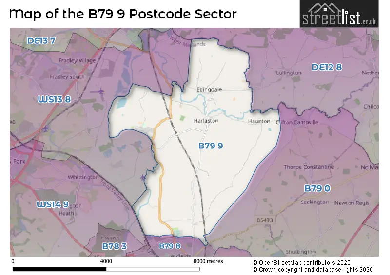
The B79 9 postcode sector stands on the Derbyshire and Staffordshire border.
Did you know? According to the 2021 Census, the B79 9 postcode sector is home to a bustling 2,240 residents!
Given that each sector allows for 400 unique postcode combinations. Letters C, I, K, M, O and V are not allowed in the last two letters of a postcode. With 92 postcodes already in use, this leaves 308 units available.
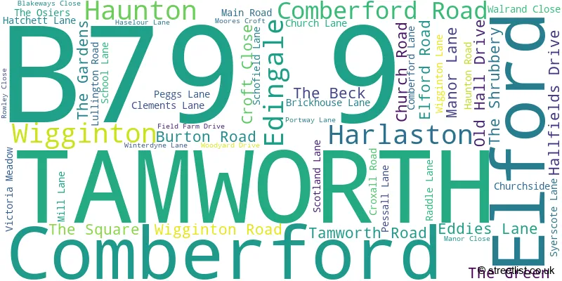
The largest settlement in the B79 9 postal code is Elford followed by Edingale, and Wigginton.
The B79 9 Postcode shares a border with WS14 9 (LICHFIELD, Whittington, Whittington Barracks), DE12 8 (Netherseal, Walton-on-Trent, Coton-in-the-Elms), WS13 8 (LICHFIELD, Fradley, Streethay), B79 0 (TAMWORTH, Warton, Clifton Campville) and B79 8 (TAMWORTH).
The sector is within the post town of TAMWORTH.
B79 9 is a postcode sector within the B79 postcode district which is within the B Birmingham postcode area.
The Royal Mail delivery office for the B79 9 postal sector is the Tamworth Delivery Office.
The area of the B79 9 postcode sector is 14.12 square miles which is 36.58 square kilometres or 9,039.52 square acres.

Map of the B79 9 Postcode Sector
Explore the B79 9 postcode sector by using our free interactive map.
| B | 7 | 9 | - | 9 | X | X |
| B | 7 | 9 | Space | 9 | Letter | Letter |
Official List of Streets
Edingale (15 Streets)
Elford (18 Streets)
Harlaston (7 Streets)
Wigginton (6 Streets)
TAMWORTH (3 Streets)
Comberford (4 Streets)
Haunton (1 Streets)
Unofficial Streets or Alternative Spellings
TAMWORTH
BROOKLIME WAY MANSTON VIEW SMITH VALENewton Regis
ASHBY ROAD ADIE CLOSE BIRD LANE CARTER CLOSE CHURCH HOLLOW EDDEN CLOSE ELSON VALE GREEN LANE HODGETTS VIEW HOLLAND COURT LYCETT LANE MEMORIAL DRIVE SAMUEL PARKES VALE SHAW CLOSE THE AVENUE TOLLGATE LANE WIGGINGTON LANE WILLOW BOTTOM LANECroxall
CROXALL ROADWeather Forecast for B79 9
Press Button to Show Forecast for National Memorial Arboretum Alrewas
| Time Period | Icon | Description | Temperature | Rain Probability | Wind |
|---|---|---|---|---|---|
| 03:00 to 06:00 | Clear night | 3.0°C (feels like 0.0°C) | 0.00% | NW 4 mph | |
| 06:00 to 09:00 | Sunny day | 3.0°C (feels like 1.0°C) | 0.00% | NW 4 mph | |
| 09:00 to 12:00 | Sunny day | 8.0°C (feels like 6.0°C) | 1.00% | N 7 mph | |
| 12:00 to 15:00 | Cloudy | 11.0°C (feels like 9.0°C) | 7.00% | N 9 mph | |
| 15:00 to 18:00 | Overcast | 11.0°C (feels like 9.0°C) | 8.00% | N 9 mph | |
| 18:00 to 21:00 | Cloudy | 10.0°C (feels like 9.0°C) | 5.00% | NE 7 mph | |
| 21:00 to 00:00 | Overcast | 7.0°C (feels like 6.0°C) | 8.00% | NNE 4 mph |
Press Button to Show Forecast for National Memorial Arboretum Alrewas
| Time Period | Icon | Description | Temperature | Rain Probability | Wind |
|---|---|---|---|---|---|
| 00:00 to 03:00 | Cloudy | 6.0°C (feels like 5.0°C) | 4.00% | ENE 4 mph | |
| 03:00 to 06:00 | Overcast | 6.0°C (feels like 5.0°C) | 9.00% | NE 2 mph | |
| 06:00 to 09:00 | Overcast | 5.0°C (feels like 4.0°C) | 9.00% | NNE 4 mph | |
| 09:00 to 12:00 | Overcast | 7.0°C (feels like 5.0°C) | 44.00% | NE 9 mph | |
| 12:00 to 15:00 | Overcast | 9.0°C (feels like 7.0°C) | 11.00% | NE 7 mph | |
| 15:00 to 18:00 | Overcast | 10.0°C (feels like 8.0°C) | 11.00% | NE 9 mph | |
| 18:00 to 21:00 | Cloudy | 9.0°C (feels like 8.0°C) | 8.00% | NE 7 mph | |
| 21:00 to 00:00 | Partly cloudy (night) | 6.0°C (feels like 4.0°C) | 3.00% | ENE 4 mph |
Press Button to Show Forecast for National Memorial Arboretum Alrewas
| Time Period | Icon | Description | Temperature | Rain Probability | Wind |
|---|---|---|---|---|---|
| 00:00 to 03:00 | Cloudy | 4.0°C (feels like 2.0°C) | 8.00% | ENE 4 mph | |
| 03:00 to 06:00 | Overcast | 4.0°C (feels like 3.0°C) | 12.00% | N 2 mph | |
| 06:00 to 09:00 | Overcast | 5.0°C (feels like 4.0°C) | 16.00% | NNW 4 mph | |
| 09:00 to 12:00 | Cloudy | 7.0°C (feels like 6.0°C) | 15.00% | SSW 4 mph | |
| 12:00 to 15:00 | Overcast | 10.0°C (feels like 8.0°C) | 21.00% | ENE 7 mph | |
| 15:00 to 18:00 | Overcast | 10.0°C (feels like 9.0°C) | 21.00% | NE 9 mph | |
| 18:00 to 21:00 | Light rain | 10.0°C (feels like 8.0°C) | 45.00% | N 7 mph | |
| 21:00 to 00:00 | Cloudy | 8.0°C (feels like 7.0°C) | 12.00% | NNE 4 mph |
Press Button to Show Forecast for National Memorial Arboretum Alrewas
| Time Period | Icon | Description | Temperature | Rain Probability | Wind |
|---|---|---|---|---|---|
| 00:00 to 03:00 | Cloudy | 7.0°C (feels like 6.0°C) | 10.00% | NNE 7 mph | |
| 03:00 to 06:00 | Cloudy | 6.0°C (feels like 4.0°C) | 7.00% | NE 7 mph | |
| 06:00 to 09:00 | Cloudy | 6.0°C (feels like 4.0°C) | 7.00% | NNE 7 mph | |
| 09:00 to 12:00 | Overcast | 9.0°C (feels like 6.0°C) | 11.00% | NNE 11 mph | |
| 12:00 to 15:00 | Overcast | 10.0°C (feels like 8.0°C) | 11.00% | NE 11 mph | |
| 15:00 to 18:00 | Cloudy | 11.0°C (feels like 9.0°C) | 8.00% | NNE 9 mph | |
| 18:00 to 21:00 | Cloudy | 10.0°C (feels like 8.0°C) | 8.00% | NNE 9 mph | |
| 21:00 to 00:00 | Partly cloudy (night) | 7.0°C (feels like 5.0°C) | 2.00% | NE 7 mph |
Schools and Places of Education Within the B79 9 Postcode Sector
St Leonard's CofE (A) Primary School
Voluntary aided school
Syerscote Lane, Tamworth, Staffordshire, B79 9DX
Head: Mrs Kirsty Cullen
Ofsted Rating: Good
Inspection: 2022-07-14 (646 days ago)
Website: Visit St Leonard's CofE (A) Primary School Website
Phone: 01827213995
Number of Pupils: 131
The Howard Primary School
Academy converter
The Square, Tamworth, Staffordshire, B79 9DB
Head: Headteacher Jonathan Wynn
Ofsted Rating: Good
Inspection: 2018-06-13 (2138 days ago)
Website: Visit The Howard Primary School Website
Phone: 01827383292
Number of Pupils: 61
The Rawlett School (An Aet Academy)
Academy converter
Comberford Road, Tamworth, Staffordshire, B79 9AA
Head: Mrs Rebecca Walker
Ofsted Rating: Requires improvement
Inspection: 2022-11-30 (507 days ago)
Website: Visit The Rawlett School (An Aet Academy) Website
Phone: 0182757178
Number of Pupils: 1074
House Prices in the B79 9 Postcode Sector
| Type of Property | 2018 Average | 2018 Sales | 2017 Average | 2017 Sales | 2016 Average | 2016 Sales | 2015 Average | 2015 Sales |
|---|---|---|---|---|---|---|---|---|
| Detached | £460,325 | 24 | £511,688 | 16 | £469,611 | 24 | £393,903 | 16 |
| Semi-Detached | £232,600 | 10 | £292,000 | 5 | £251,195 | 10 | £269,314 | 11 |
| Terraced | £213,317 | 3 | £214,100 | 5 | £226,158 | 6 | £198,290 | 5 |
| Flats | £0 | 0 | £0 | 0 | £0 | 0 | £0 | 0 |
Important Postcodes B79 9 in the Postcode Sector
B79 9AA is the postcode for SMALL BLOCK, The Rawlett School - An AET Academy, Comberford Road, and The Rawlett School - An AET Academy, Comberford Road
B79 9DB is the postcode for Staffordshire County Council, Howard County Primary School, The Square
B79 9DX is the postcode for Staffordshire County Council, St. Leonards C E Primary School, Syerscote Lane
| The B79 9 Sector is within these Local Authorities |
|
|---|---|
| The B79 9 Sector is within these Counties |
|
| The B79 9 Sector is within these Water Company Areas |
|