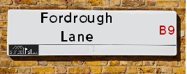
Map of Fordrough Lane
| Postcodes | ||
|---|---|---|
| Icon | Postcodes for Fordrough Lane | |
| Walking Distances | ||
| Distance Info | Green Circle = 10 Minutes Walk (800 metres) | |
About Fordrough Lane
Fordrough Lane is a street located in the city of Birmingham. The street has a length of approximately 597 metres.
Fordrough Lane is located within the Birmingham District (B) Council's jurisdiction. They provide various services, like refuse collection, and manage council tax collection. It's situated in the West Midlands region of the UK.
Fordrough Lane has been assigned the Unique Street Reference Number of 2706021 in the National Street Gazetteer.
Fordrough Lane is located within the county of West Midlands, situated in the West Midlands region of the UK. It's 100.55 miles North West from central London., 2.2 miles East from Birmingham, 15.22 miles West from Coventry and 25.34 miles North East from Worcester.

Do you know why this road is called Fordrough Lane?
What's it like to live here?
Ask the community a question about Fordrough Lane.
Do you have any questions, memories to share or know any facts about Fordrough Lane? We'd love to know more.
Also on streetlist.co.uk, can you help?
Eldroth Road
15th April 2024
I wondered if anyone has any old pictures of Wenning Bank House in the 1940’s and also Lane Side before of the same era .. we visited today with my Mum in law as she used to live at both these properties. Also any photos of the schools around that time .. thank you.
Can You Help?Napps Way
15th April 2024
Why is the road called Napps Way (belonging to Napp, but minus an
apostrophe as is usual with such nomenclature)? Moreover, who or
what is, or was, “Napp” in the respective, possessive case?
Several years ago, I met an elderly man (probably in his late-eighties)
who lives on Bentham Drive, Liverpool 16, and during a conversation
with him whilst in a Northwest Passenger Transport Ambulance on the
way to the former RLUH (Royal Liverpool University Hospital), he told
me that he could remember (when he was a boy, living in Childwall,
Liverpool 16) that, “Where Napps Way is now, during WW2, there was
a two-man gun emplacement on the, then, open land to protect the
railway line passing over Childwall Valley Road - next to the railway
bridge - when suddenly, as they were loading a live “shell” into the gun’s
breach, the aforementioned “shell” accidentally exploded in the gun’s
breach killing both of the two soldiers, that had been manning the gun,
instantly! (Very sad, of course, but could - perhaps - two ghosts relating
to those two, very unfortunately and prematurely-killed soldiers have
haunted that place of their deaths ever since - and have any residents
of Napps Way - formerly and in its latest incarnation - seen two, WW2
(uniformed) soldiers unexpectedly appear in or near their homes?)
Mauritius Road
15th April 2024
Why is Mauritius Road so called, since when and by whom? Does Greenwich have any particular links with Mauritius? Very interested to know. 🤞🏼
Can You Help?Estate Agents near Fordrough Lane
| Name | Address | Website |
|---|---|---|
| Property Link | 448-450 Bordesley Green, Birmingham,B9 5NS | Visit Website |
| M.T. Properties 4 U Ltd | 554 Green Lane, Bordesley Green, Birmingham,B9 5QQ | Visit Website |
| Edward Lloyds Estates & Property Management | 266 Alum Rock Road, Alum Rock, Birmingham,B8 3DD |
Location Details
| Fordrough Lane | |
|---|---|

| |
| Latitude | 52.480489 |
| Longitude | -1.849114 |
| OS Easting (X): | 410246 |
| OS Northing (Y): | 287003 |
| OS Grid Reference: | SP102870 |
Neighbourhood Policing |
| Police Force: West Midlands |
 View Neighbourhood Crime and Policing View Neighbourhood Crime and Policing |
| Find a Local Neighbourhood Watch Scheme |
Frequently asked Questions for Fordrough Lane
What Council (Local Authority) is Fordrough Lane in?
Fordrough Lane is located within the local authority area of Birmingham Council which is a Metropolitan District.
What Parish Council is Fordrough Lane in?
Fordrough Lane is in an unparished area.
What Electoral Ward is Fordrough Lane in?
Fordrough Lane is located within the ward of Bordesley & Highgate.
What County is Fordrough Lane in?
Fordrough Lane is located within the ceremonial county of West Midlands.
What Constituency is Fordrough Lane in?
Fordrough Lane is located within the constituency of Birmingham &Hodge Hill.
What Part of the UK is Fordrough Lane in?
Fordrough Lane is located within the West Midlands (England) region of the United Kingdom.
What County Council area is Fordrough Lane in?
Fordrough Lane is located within the West Midlands Council area.
What Police Force area is Fordrough Lane in?
Fordrough Lane is located within the West Midlands Police area.
Roads that have a Junction with Fordrough Lane
| Street | Junction Type |
|---|---|
| Cherrywood Road | junction |
| Fordrough Avenue | junction |
| Priorygate Way | junction |
| Bordesley Green (B4128) | junction |
Sunset and Sunrise times for Fordrough Lane
| Sunrise | 05:46 |
|---|---|
| Sunset | 20:23 |
Latest Weather Conditions for Fordrough Lane
| Observed at Weather Station: | Coleshill 23 April 2024 at 23:00 (6.74 miles away) |
|---|---|
| Current Weather: | Overcast |
| Temperature and Humidity: | 6.3°C (80.3%) |
| Wind Direction and Speed: | WNW (2 mph) |
Population Statistics
| ONS Area Code | E00046649 & E00046615 |
|---|---|
| ONS Area Name | Pakistani Communities |
| LSOA Code: | E01033647 |
|---|---|
| LSOA Name: | Birmingham 058E |
| SOA Code: | 7b |
| SOA Name: | |
| MSOA Code: | E02001884 |
| MSOA Name: | Birmingham 058 |
Nearest Supermarkets
| Asda Bordesley Green |
|---|
| 271 Bordesley Green, Birmingham, B9 5EY |
| 0121 480 1800 |
| Distance: 0.22 Miles |
| Directions from Fordrough Lane to Asda Bordesley Green |
| Morrisons Birmingham - Small Heath |
|---|
| 280 Coventry Road, Small Heath, Birmingham B10 0XA |
| 0121 771 2224 |
| Distance: 0.84 Miles |
| Directions from Fordrough Lane to Morrisons Birmingham - Small Heath |
| Iceland Birmingham St Andrews |
|---|
| Unit 5 St Andrews Shp Prk, 270 Coventry Road, Birmingham, B10 0XA |
| 01217738537 |
| Distance: 0.89 Miles |
| Directions from Fordrough Lane to Iceland Birmingham St Andrews |
| Asda Small Heath |
|---|
| 859 Coventry Road, Small Heath, B10 0HH |
| 0121 766 7374 |
| Distance: 1.16 Miles |
| Directions from Fordrough Lane to Asda Small Heath |
Telephone Information
| Area Code |
|---|
| Area Code: 0121 - Birmingham |
| Area Code: 01675 - Coleshill |
| Area Code: 01922 - Walsall |
| Area Code: 01676 - Meriden |
Broadband Information
| Speed | Average Speed | Median Speed | Maximum Speed | Next-generation access (NGA) | Number of Connections |
|---|---|---|---|---|---|
| Greater than 2 Mbps | 7 | 6.8 | 10.2 | Y | 9 |
Local Government
| Local Council Details |
|---|
| Within the area of Birmingham |
| Visit the Council's Website |
| Council House, Victoria Square, Birmingham &B1 1BB |
| Send email |
| Telephone Number: 0121 303 1111 |
| Local Member of Parliament |
|---|
| Within the Westminster Parliamentary Constituency of Birmingham &Hodge Hill |
| The Member of Parliament is Liam Byrne |
| Details for the MP Liam Byrne on parliament.uk |
| Details for the MP Liam Byrne on theyworkforyou.com |
| In the 2019 General Election Liam Byrne won with a majority of 28,655 the result was Lab hold. The total electorate was 78,295 |
| Wards, Parish Councils and County Councils |
|---|
| Ward: Bordesley & Highgate Ward |
| Ceremonial County: West Midlands |
Nearest Schools
England Primary Schools
St Cuthbert's RC Junior and Infant (NC) School
Address: St Cuthbert's RC Junior and Infant (NC) School, Gumbleberrys Close, Off Cotterills Lane, Stechford, Birmingham, West Midlands, B8 2PS
Distance: 1.38 miles
Contact: 01216752205
Corpus Christi Catholic Primary School
Address: Corpus Christi Catholic Primary School, Lyttelton Road, Stechford, Birmingham, West Midlands, B33 8BL
Distance: 1.54 miles
Contact: 01216752784
Blakesley Hall Primary School
Address: Blakesley Hall Primary School, Yardley Green Road, Stechford, Birmingham, West Midlands, B33 8TH
Distance: 1.42 miles
Contact: 01217832148
Stechford Primary School
Address: Stechford Primary School, Albert Road, Stechford, Birmingham, B33 8SJ
Distance: 1.52 miles
Contact: 01214643245
Thornton Primary School
Address: Thornton Primary School, Thornton Road, Ward End, Birmingham, West Midlands, B8 2LQ
Distance: 1.17 miles
Contact: 01213270824
St Bernadette's Catholic Primary School
Address: St Bernadette's Catholic Primary School, Hobmoor Road, Yardley, Birmingham, West Midlands, B25 8QL
Distance: 1.23 miles
Contact: 01217837232
Sladefield Infant School
Address: Sladefield Infant School, Bamville Road, Ward End, Birmingham, West Midlands, B8 2TJ
Distance: 1.04 miles
Contact: 01213270662
St Benedict's Primary School
Address: St Benedict's Primary School, St Benedict's Road, Birmingham, West Midlands, B10 9DP
Distance: 0.98 miles
Contact: 01214646420
Holy Family Catholic Primary School
Address: Holy Family Catholic Primary School, Coventry Road, Small Heath, Birmingham, West Midlands, B10 0HT
Distance: 1.04 miles
Contact: 01216752670
Bordesley Green Primary School
Address: Bordesley Green Primary School, Marchmont Road, Birmingham, West Midlands, B9 5XX
Distance: 0.47 miles
Contact: 01217721601
Somerville Primary (NC) School
Address: Somerville Primary (NC) School, Somerville Road, Small Heath, Birmingham, West Midlands, B10 9EN
Distance: 0.71 miles
Contact: 01216750956
Marlborough Junior School
Address: Marlborough Junior School, Green Lane, Small Heath, Birmingham, West Midlands, B10 9NY
Distance: 0.49 miles
Contact:
Marlborough Infant School
Address: Marlborough Infant School, Marlborough Road, Small Heath, Birmingham, West Midlands, B10 9NY
Distance: 0.49 miles
Contact:
Shaw Hill Primary School
Address: Shaw Hill Primary School, Anthony Road, Alum Rock, Birmingham, West Midlands, B8 3AN
Distance: 0.48 miles
Contact: 01214642131
The Rosary Catholic Primary School
Address: The Rosary Catholic Primary School, Bridge Road, Saltley, Birmingham, West Midlands, B8 3SF
Distance: 0.24 miles
Contact:
Highfield Junior and Infant School
Address: Highfield Junior and Infant School, Highfield Road, Saltley, Birmingham, West Midlands, B8 3QF
Distance: 0.92 miles
Contact:
Adderley Primary School
Address: Adderley Primary School, Arden Road, Saltley, Birmingham, West Midlands, B8 1DZ
Distance: 0.55 miles
Contact: 01214641500
Bordesley Village Primary School
Address: Bordesley Village Primary School, Emmeline Street, Bordesley Village, Birmingham, West Midlands, B9 4NG
Distance: 0.92 miles
Contact:
Arden Primary School
Address: Arden Primary School, Baker Street, Sparkhill, Birmingham, West Midlands, B11 4SF
Distance: 1.83 miles
Contact: 01216757702
Regents Park Community Primary School
Address: Regents Park Community Primary School, Arthur Street, Small Heath, Birmingham, West Midlands, B10 0NJ
Distance: 1.04 miles
Contact: 01214646746
St Saviour's C of E Primary School
Address: St Saviour's C of E Primary School, Alum Rock Road, Saltley, Birmingham, West Midlands, B8 1JB
Distance: 0.86 miles
Contact: 01214646923
St Matthew's CofE Primary School
Address: St Matthew's CofE Primary School, Duddeston Manor Road, Nechells, Birmingham, West Midlands, B7 4JR
Distance: 1.38 miles
Contact: 01213591602
St Vincent's Catholic Primary School
Address: St Vincent's Catholic Primary School, Vauxhall Grove, Vauxhall, St Vincent's Catholic Primary School, BIRMINGHAM, West Midlands, B7 4HP
Distance: 1.16 miles
Contact: 01216752359
St Anne's Catholic Primary School
Address: St Anne's Catholic Primary School, Lowe Street, Camp Hill, Birmingham, West Midlands, B12 0ER
Distance: 1.47 miles
Contact: 01216755037
St Joseph's Catholic Primary School
Address: St Joseph's Catholic Primary School, Rocky Lane, Nechells, Birmingham, West Midlands, B7 5HA
Distance: 1.43 miles
Contact:
Oasis Academy Hobmoor
Address: Oasis Academy Hobmoor, Wash Lane, Yardley, Birmingham, West Midlands, B25 8FD
Distance: 1.54 miles
Contact: 01216753269
Alston Primary School
Address: Alston Primary School, Alston Road, Bordesley Green East, Birmingham, West Midlands, B9 5UN
Distance: 0.81 miles
Contact: 01214641569
Nansen Primary School
Address: Nansen Primary School, Naseby Road, Birmingham, West Midlands, B8 3HG
Distance: 0.71 miles
Contact: 01213893787
Parkfield Community School
Address: Parkfield Community School, Parkfield Road, Saltley, Birmingham, West Midlands, B8 3AX
Distance: 0.37 miles
Contact: 01214641131
Highfield Junior and Infant School
Address: Highfield Junior and Infant School, Highfield Road, Saltley, Birmingham, West Midlands, B8 3QF
Distance: 0.92 miles
Contact: 01216471708
Wyndcliffe Primary School
Address: Wyndcliffe Primary School, Little Green Lane, Bordesley Green, Birmingham, West Midlands, B9 5BG
Distance: 0.56 miles
Contact: 01214644241
Montgomery Primary Academy
Address: Montgomery Primary Academy, White Road, Sparkbrook, Birmingham, West Midlands, B11 1EH
Distance: 1.39 miles
Contact: 01214649115
Bordesley Village Primary School
Address: Bordesley Village Primary School, Emmeline Street, Bordesley Village, Birmingham, West Midlands, B9 4NG
Distance: 0.92 miles
Contact: 01216751392
Harper Bell Seventh-day Adventist School
Address: Harper Bell Seventh-day Adventist School, 29 Ravenhurst Street, Camp Hill, Birmingham, West Midlands, B12 0EJ
Distance: 1.51 miles
Contact: 01216937742
England Secondary Schools
Starbank School
Address: Starbank School, Starbank Road, Birmingham, West Midlands, B10 9LR
Distance: 1.00 miles
Contact:
Holy Trinity Catholic School
Address: Holy Trinity Catholic School, Oakley Road, Small Heath, Birmingham, West Midlands, B10 0AX
Distance: 1.11 miles
Contact:
Small Heath School
Address: Small Heath School, Muntz Street, Small Heath, Birmingham, West Midlands, B10 9RX
Distance: 0.58 miles
Contact:
Bordesley Green Girls' School & Sixth Form
Address: Bordesley Green Girls' School & Sixth Form, Bordesley Green Road, Birmingham, B9 4TR
Distance: 0.38 miles
Contact: 01214641881
Washwood Heath Academy
Address: Washwood Heath Academy, Burney Lane, Stechford, Birmingham, West Midlands, B8 2AS
Distance: 1.32 miles
Contact: 01216757272
Starbank School
Address: Starbank School, Hob Moor Road, Birmingham, B10 9BT
Distance: 0.88 miles
Contact: 01214642638
Saltley Academy
Address: Saltley Academy, Belchers Lane, Bordesley Green, Birmingham, West Midlands, B9 5RX
Distance: 0.76 miles
Contact: 01215666555
Ark Victoria Academy
Address: Ark Victoria Academy, Talbot Way, Small Heath, Birmingham, West Midlands, B10 0HJ
Distance: 1.23 miles
Contact: 01213934459
Waverley School
Address: Waverley School, Yardley Green Road, Bordesley Green, Birmingham, West Midlands, B9 5QA
Distance: 0.79 miles
Contact: 01215666600
Waverley Studio College
Address: Waverley Studio College, 470 Belchers Lane, Bordesley Green, Birmingham, West Midlands, B9 5SX
Distance: 0.63 miles
Contact: 01215666622
Rockwood Academy
Address: Rockwood Academy, Naseby Road, Alum Rock, Birmingham, West Midlands, B8 3HG
Distance: 0.71 miles
Contact: 01215666500
Eden Boys' Leadership Academy, Birmingham East
Address: Eden Boys' Leadership Academy, Birmingham East, 441 Alum Rock Road, Birmingham, West Midlands, B8 3DT
Distance: 0.58 miles
Contact: 01216577200
Holy Trinity Catholic School
Address: Holy Trinity Catholic School, Oakley Road, Small Heath, Birmingham, West Midlands, B10 0AX
Distance: 1.11 miles
Contact: 01217720184
Al-Hijrah School
Address: Al-Hijrah School, Burbidge Road, Bordesley Green, Birmingham, West Midlands, B9 4US
Distance: 0.24 miles
Contact:
Small Heath Leadership Academy
Address: Small Heath Leadership Academy, Muntz Street, Small Heath, Birmingham, West Midlands, B10 9RX
Distance: 0.58 miles
Contact: 01214647997
Ark Boulton Academy
Address: Ark Boulton Academy, Golden Hillock Road, Sparkhill, Birmingham, West Midlands, B11 2QG
Distance: 1.60 miles
Contact: 01217738156
Heartlands Academy
Address: Heartlands Academy, Great Francis Street, Nechells, Birmingham, West Midlands, B7 4QR
Distance: 1.22 miles
Contact: 01214643931
Aston University Engineering Academy
Address: Aston University Engineering Academy, 1 Lister Street, Birmingham, West Midlands, B7 4AG
Distance: 1.62 miles
Contact: 01213800570
Ark St Alban's Academy
Address: Ark St Alban's Academy, Conybere Street, Birmingham, West Midlands, B12 0YH
Distance: 1.90 miles
Contact: 01214461300
England Higher Schools
The National College for Advanced Transport and Infrastructure
Address: The National College for Advanced Transport and Infrastructure, 2 Lister Street, Birmingham, West Midlands, B7 4AG
Distance: 1.62 miles
Contact:
Nearest Hospitals
| Name | Address | Postcode | Distance | Map |
|---|
Nearest Dentists
Dentists near Fordrough Lane
| Name | Address | Postcode | Distance | Map |
|---|
Nearest GP Surgeries
Doctors near Fordrough Lane
BORDESLEY GREEN SURGERY
Address: 143-145 BORDESLEY GREEN, BORDESLEY GREEN, BIRMINGHAM, WEST MIDLANDS, B9 5EG
Distance: 0.36 miles
Contact: tel: 0121 7661335
HAMD MEDICAL PRACTICE
Address: 4 CLODESHALL ROAD, BIRMINGHAM, WEST MIDLANDS, B8 3SW
Distance: 0.48 miles
Contact: tel: 0121 2705540
WASHWOOD HEATH HEALTH CENTRE - COVID LOCAL VACCINATION SERVICE 3
Address: CLODESHALL ROAD, SALTLEY, BIRMINGHAM, B8 3SW
Distance: 0.48 miles
Contact: :
OAKLEAF
Address: OAKLEAF MEDICAL PRACTICE, 4 CLODESHALL ROAD, SALTLEY, BIRMINGHAM, WEST MIDLANDS, B8 3SW
Distance: 0.48 miles
Contact: tel: 0121 2700015
OMNIA PRACTICE
Address: 73 YARDLEY GREEN ROAD, BORDESLEY GREEN, BIRMINGHAM, WEST MIDLANDS, B9 5PU
Distance: 0.54 miles
Contact: tel: 0845 0724618
YARDLEY GREEN MEDICAL CENTRE
Address: 77 YARDLEY GREEN ROAD, BORDESLEY GREEN, BIRMINGHAM, WEST MIDLANDS, B9 5PU
Distance: 0.54 miles
Contact: tel: 0121 7733737
Nearest Dispensing Chemists
Pharmacies near Fordrough Lane
| Name | Address | Postcode | Telephone | Map | Distance in Km |
|---|
Nearest Opticians
Opticians near Fordrough Lane
EYESAVERS OPTICIANS LTD
Address: 467 BORDESLEY GREEN, BIRMINGHAM, WEST MIDLANDS, B9 5XF
Distance: 0.32 miles
Contact: :
RIGHTSPEX OPTICIANS
Address: 329 GREEN LANE, SMALL HEATH, BIRMINGHAM, WEST MIDLANDS, B9 5PW
Distance: 0.45 miles
Contact: :
VISIONCRAFT
Address: 41 YARDLEY GREEN ROAD, BORDESLEY GREEN, BIRMINGHAM, WEST MIDLANDS, B9 5PU
Distance: 0.54 miles
Contact: :
THE I CLINIC ALUM ROCK ROAD
Address: 227A ALUM ROCK ROAD, BIRMINGHAM, B8 3BH
Distance: 0.56 miles
Contact: :
THE I CLINIC - BIRMINGHAM
Address: 27 ALUM ROCK ROAD, BIRMINGHAM, WEST MIDLANDS, B8 3BH
Distance: 0.56 miles
Contact: :
IMRAN MASOOM
Address: 227 ALUM ROCK ROAD, BIRMINGHAM, B8 3BH
Distance: 0.56 miles
Contact: :
Transport
Nearest Rail Stations
Adderley Park Station is 0.34 miles away.
Address: Adderley Park station, Bordesley Green Road, Birmingham, West Midlands, B9 4TG
Adderley Park is situated on the Rugby�Birmingham�Stafford line|West Coast Main Line.
Adderley Park Station is staffed on a part time basis.
Directions from Fordrough Lane to Adderley Park Rail Station
Duddeston Station is 1.08 miles away.
Address: Duddeston station, Duddeston Mill Road, Duddeston, West Midlands, B7 4ST
Duddeston is situated on the Chase Line|Bristol to Brimingham Line.
Duddeston Station is staffed on a part time basis.