Map of Lawley Middleway
| Postcodes | ||
|---|---|---|
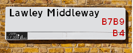
| Icon | Postcodes for Lawley Middleway | |
| Walking Distances | ||
| Distance Info | Green Circle = 10 Minutes Walk (800 metres) | |
About Lawley Middleway
Lawley Middleway is a street located in the city of Birmingham. The street has a length of approximately 999 metres.
Lawley Middleway is located within the Birmingham District (B) Council's jurisdiction. They provide various services, like refuse collection, and manage council tax collection. It's situated in the West Midlands region of the UK.
Lawley Middleway has been assigned the Unique Street Reference Numbers of 2701926, 2759002 and 2708628 in the National Street Gazetteer.
Lawley Middleway is located within the county of West Midlands, situated in the West Midlands region of the UK. It's 101.66 miles North West from central London., 0.94 miles East from Birmingham, 16.52 miles West from Coventry and 24.72 miles North East from Worcester.

Do you know why this road is called Lawley Middleway?
What's it like to live here?
Ask the community a question about Lawley Middleway.
Do you have any questions, memories to share or know any facts about Lawley Middleway? We'd love to know more.
Also on streetlist.co.uk, can you help?
Eldroth Road
15th April 2024
I wondered if anyone has any old pictures of Wenning Bank House in the 1940’s and also Lane Side before of the same era .. we visited today with my Mum in law as she used to live at both these properties. Also any photos of the schools around that time .. thank you.
Can You Help?Napps Way
15th April 2024
Why is the road called Napps Way (belonging to Napp, but minus an
apostrophe as is usual with such nomenclature)? Moreover, who or
what is, or was, “Napp” in the respective, possessive case?
Several years ago, I met an elderly man (probably in his late-eighties)
who lives on Bentham Drive, Liverpool 16, and during a conversation
with him whilst in a Northwest Passenger Transport Ambulance on the
way to the former RLUH (Royal Liverpool University Hospital), he told
me that he could remember (when he was a boy, living in Childwall,
Liverpool 16) that, “Where Napps Way is now, during WW2, there was
a two-man gun emplacement on the, then, open land to protect the
railway line passing over Childwall Valley Road - next to the railway
bridge - when suddenly, as they were loading a live “shell” into the gun’s
breach, the aforementioned “shell” accidentally exploded in the gun’s
breach killing both of the two soldiers, that had been manning the gun,
instantly! (Very sad, of course, but could - perhaps - two ghosts relating
to those two, very unfortunately and prematurely-killed soldiers have
haunted that place of their deaths ever since - and have any residents
of Napps Way - formerly and in its latest incarnation - seen two, WW2
(uniformed) soldiers unexpectedly appear in or near their homes?)
Mauritius Road
15th April 2024
Why is Mauritius Road so called, since when and by whom? Does Greenwich have any particular links with Mauritius? Very interested to know. 🤞🏼
Can You Help?Estate Agents near Lawley Middleway
| Name | Address | Website |
|---|---|---|
| Birmingham City Student Homes | 4 Cardigan Street, Birmingham, B4 7BD | |
| House Sales Direct | International House, The McLaren Building, 46 The Priory Queensway, Birmingham, B4 7LR | |
| Savills Lettings | Allegro Exchange Square, 46 The Priory Queensway, Birmingham B4 7LR | Visit Website |
Hotels near Lawley Middleway
Budget Hotels near Lawley Middleway
| Budget Hotel Name | Distance (miles) |
|---|---|
| 1: Name:Premier Inn Birmingham City Aston Address:Richard Street Telephone: Visit Site |
0.55 |
| 2: Name:Premier Inn Birmingham Central East Address:Richard Street Telephone: Visit Site |
0.55 |
| 3: Name:Travelodge Birmingham Central Moor Street Address:Carrs Ln, Birmingham, B4 7SS Telephone:0871 984 6489 Visit Site |
0.63 |
| 4: Name:Premier Inn Birmingham City Centre - New Street Address:Birmingham Exchange Buildings, Stephenson Place Telephone: Visit Site |
0.81 |
| 5: Name:Travelodge Birmingham Central Bull Ring Address:Upper Dean St, Birmingham, B5 4SG Telephone:0871 984 6468 Visit Site |
0.83 |
Location Details
| Lawley Middleway | |
|---|---|

| |
| Latitude | 52.483403 |
| Longitude | -1.880010 |
| OS Easting (X): | 408147 |
| OS Northing (Y): | 287323 |
| OS Grid Reference: | SP081873 |
Ordnance Survey Maps for Lawley Middleway
If you purchase a map through the links below, we may earn an affiliate commission.
| Map Series | link | Ordnance Survey |
| Explorer 1:25,000 220 Birmingham, Walsall, Solihull and Redditch | Check Price on Amazon | |
| Landranger 1:50,000 139 Birmingham and Wolverhampton | Check Price on Amazon |
Neighbourhood Policing |
| Police Force: West Midlands |
 View Neighbourhood Crime and Policing View Neighbourhood Crime and Policing |
| Find a Local Neighbourhood Watch Scheme |
Frequently asked Questions for Lawley Middleway
What Council (Local Authority) is Lawley Middleway in?
Lawley Middleway is located within the local authority area of Birmingham Council which is a Metropolitan District.
What Parish Council is Lawley Middleway in?
Lawley Middleway is in an unparished area.
What Electoral Ward is Lawley Middleway in?
Lawley Middleway is located within the ward of Bordesley & Highgate &Nechells.
What County is Lawley Middleway in?
Lawley Middleway is located within the ceremonial county of West Midlands.
What Constituency is Lawley Middleway in?
Lawley Middleway is located within the constituency of Birmingham &Ladywood.
What Part of the UK is Lawley Middleway in?
Lawley Middleway is located within the West Midlands (England) region of the United Kingdom.
What County Council area is Lawley Middleway in?
Lawley Middleway is located within the West Midlands Council area.
What Police Force area is Lawley Middleway in?
Lawley Middleway is located within the West Midlands Police area.
Roads that have a Junction with Lawley Middleway
| Street | Junction Type |
|---|---|
| Dartmouth Middleway (A4540) | junction |
| Nechells Parkway (A47) | junction |
| Nechells Parkway (A47) | junction |
| Forster Street | junction |
| Vauxhall Road (B4132) | roundabout |
| Curzon Street | roundabout |
| Garrison Street | junction |
| Landor Street | junction |
| Landor Street | junction |
| Montague Street | junction |
Sunset and Sunrise times for Lawley Middleway
| Sunrise | 05:59 |
|---|---|
| Sunset | 20:13 |
Latest Weather Conditions for Lawley Middleway
| Observed at Weather Station: | Coleshill 18 April 2024 at 15:00 (8.04 miles away) |
|---|---|
| Current Weather: | Overcast |
| Temperature and Humidity: | 11.6°C (53.4%) |
| Wind Direction and Speed: | WSW (9 mph) |
Population Statistics
| ONS Area Code | E00046656, E00046627 & E00175614 |
|---|---|
| ONS Area Name | Asian Terraces and Flats, Striving Service Workers & Student Communal Living |
| Average Age | 30.36 & |
| Area Population | 1415.00 & |
| Male Population | 700.00 & (49%) |
| Female Population | 715.00 & (51%) |
| Benefit Claimants | 65 & (5%) |
| LSOA Code: | E01009199 &E01033561 |
|---|---|
| LSOA Name: | Birmingham 052D &Birmingham 050E |
| SOA Code: | 7b &1a |
| SOA Name: | |
| MSOA Code: | E02001878 &E02001876 |
| MSOA Name: | Birmingham 052 &Birmingham 050 |
Nearest Supermarkets
| Tesco University Express |
|---|
| Aston St, Aston University, Birmingham, B4 7ET |
| Distance: 0.46 Miles |
| Directions from Lawley Middleway to Tesco University Express |
| Tesco Birmingham Corporation St Express |
|---|
| Rsvp Bar, Old Square, Corporation St, Birmingham, B4 6TB |
| 0345 026 9379 |
| Distance: 0.59 Miles |
| Directions from Lawley Middleway to Tesco Birmingham Corporation St Express |
| Sainsburys Birmingham Priory Queensway Local |
|---|
| 30 Priory Queensway, Birmingham, England, B4 6BS |
| 1212129535 |
| Distance: 0.61 Miles |
| Directions from Lawley Middleway to Sainsburys Birmingham Priory Queensway Local |
| Tesco Birmingham Carrs Ln Express |
|---|
| Carrs Ln, Birmingham, Birmingham, B4 7SS |
| 0345 610 2756 |
| Distance: 0.63 Miles |
| Directions from Lawley Middleway to Tesco Birmingham Carrs Ln Express |
Telephone Information
| Area Code |
|---|
| Area Code: 0121 - Birmingham |
| Area Code: 01675 - Coleshill |
| Area Code: 01922 - Walsall |
| Area Code: 01384 - Dudley |
Local Government
| Local Council Details |
|---|
| Within the area of Birmingham |
| Visit the Council's Website |
| Council House, Victoria Square, Birmingham &B1 1BB |
| Send email |
| Telephone Number: 0121 303 1111 |
| Local Member of Parliament |
|---|
| Within the Westminster Parliamentary Constituency of Birmingham &Ladywood |
| The Member of Parliament is Shabana Mahmood |
| Details for the MP Shabana Mahmood on parliament.uk |
| Details for the MP Shabana Mahmood on theyworkforyou.com |
| In the 2019 General Election Shabana Mahmood won with a majority of 28,582 the result was Lab hold. The total electorate was 74,912 |
| Wards, Parish Councils and County Councils |
|---|
| Ward: Bordesley & Highgate &Nechells Ward |
| Ceremonial County: West Midlands |
Nearest Schools
| Name | Address | Postcode | Telephone | Type | Distance (Km) |
|---|
Data accessed from gov.scot 08-08-2019
Nearest Hospitals
| Name | Address | Postcode | Distance | Map |
|---|
Nearest Dentists
Dentists near Lawley Middleway
| Name | Address | Postcode | Distance | Map |
|---|
Nearest GP Surgeries
Doctors near Lawley Middleway
BABYLON GP AT HAND BIRMINGHAM
Address: 121 GLOVER STREET, BIRMINGHAM, B9 4EY
Distance: 0.44 miles
Contact: tel: 0330 8082217
ASTON UNIVERSITY STUDENT HEALTH CENTRE
Address: VISION SCIENCES BUILDING, ASTON UNIVERSITY, THE ASTON TRIANGLE, BIRMINGHAM, WEST MIDLANDS, B4 7ET
Distance: 0.51 miles
Contact: :
BIRMINGHAM HEARTLANDS SURGERY
Address: GRAY STREET, BIRMINGHAM, WEST MIDLANDS, B9 4LS
Distance: 0.54 miles
Contact: :
HALCYON MEDICAL
Address: UNIT 8, 24 MARTINEAU PLACE, BIRMINGHAM, B2 4UH
Distance: 0.69 miles
Contact: tel: 01212 039999
THE NECHELLS PRACTICE - COVID LOCAL VACCINATION SERVICE
Address: 63 RUPERT STREET, BIRMINGHAM, B7 5DT
Distance: 0.73 miles
Contact: :
NECHELLS PRACTICE
Address: BLOOMSBURY HEALTH CENTRE, 63 RUPERT STREET, NECHELLS, BIRMINGHAM, WEST MIDLANDS, B7 5DT
Distance: 0.73 miles
Contact: tel: 0121 4223111
Nearest Dispensing Chemists
Pharmacies near Lawley Middleway
| Name | Address | Postcode | Telephone | Map | Distance in Km |
|---|
Nearest Opticians
Opticians near Lawley Middleway
HOME EYE CLINIC LTD
Address: 41 LANDOR STREET, BIRMINGHAM, WEST MIDLANDS, B8 1AE
Distance: 0.48 miles
Contact: :
ASTON UNIVERSITY EYE CLINIC
Address: THE ASTON TRIANGLE, BIRMINGHAM, B4 7ET
Distance: 0.51 miles
Contact: :
OPTEGRA BIRMINGHAM EYE HOSPITAL
Address: ASTON UNIVERSITY CAMPUS, COLESHILL STREET, BIRMINGHAM, WEST MIDLANDS, B4 7ET
Distance: 0.51 miles
Contact: :
ASTON UNIVERSITY OPTOMETRY
Address: ASTON UNIVERSITY, THE ASTON TRIANGLE, BIRMINGHAM, WEST MIDLANDS, B4 7ET
Distance: 0.51 miles
Contact: :
THE ASTON UNIVERSITY OPTOMETRY CLINIC
Address: VISION SCIENCE BUILDING, ASTON UNIVERSITY, BIRMINGHAM, WEST MIDLANDS, B4 7ET
Distance: 0.51 miles
Contact: :
VISION CARE FOR HOMELESS PEOPLE (SIFA FIRESIDE)
Address: SIFA FIRESIDE, 48-52 ALLCOCK STREET, BIRMINGHAM, WEST MIDLANDS, B9 4DY
Distance: 0.52 miles
Contact: :
Transport
Nearest Rail Stations
Duddeston Station is 0.50 miles away.
Address: Duddeston station, Duddeston Mill Road, Duddeston, West Midlands, B7 4ST
Duddeston is situated on the Chase Line|Bristol to Brimingham Line.
Duddeston Station is staffed on a part time basis.
Birmingham Moor Street Station is 0.60 miles away.
Address: Birmingham Moor Street station, Queensway, Birmingham, West Midlands, B4 7UL
Birmingham Moor Street is situated on the Chiltern Main Line|Birmingham to Peterborough Line|Chase Line|Bristol to Brimingham Line|North Warwickshire (Shakespeare Line) Line|Rugby�Birmingham�Stafford line|West Coast Main Line and is managed by Chiltern Railway.
Birmingham Moor Street Station is staffed on a part time basis.
Directions from Lawley Middleway to Birmingham Moor Street Rail Station