Map of St Bernard's Road
| Postcodes | ||
|---|---|---|
| Icon | Postcodes for St Bernard's Road | |
| Walking Distances | ||
| Distance Info | Green Circle = 10 Minutes Walk (800 metres) | |
About St Bernard's Road
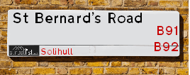
St Bernard's Road is a street located in the town of Solihull. The street has a length of approximately 1,966 metres.
St Bernard's Road is located within the Solihull District (B) Council's jurisdiction. They provide various services, like refuse collection, and manage council tax collection. It's situated in the West Midlands region of the UK.
St Bernard's Road has been assigned the Unique Street Reference Number of 35000584 and 35080136 in the National Street Gazetteer.
St Bernard's Road is located within the county of West Midlands, situated in the West Midlands region of the UK. It's 96.97 miles North West from central London., 5.18 miles South East from Birmingham, 12.79 miles West from Coventry and 23.86 miles North East from Worcester.

Do you know why this road is called St Bernard's Road?
What's it like to live here?
Ask the community a question about St Bernard's Road.
Do you have any questions, memories to share or know any facts about St Bernard's Road? We'd love to know more.
Also on streetlist.co.uk, can you help?
Eldroth Road
15th April 2024
I wondered if anyone has any old pictures of Wenning Bank House in the 1940’s and also Lane Side before of the same era .. we visited today with my Mum in law as she used to live at both these properties. Also any photos of the schools around that time .. thank you.
Can You Help?Napps Way
15th April 2024
Why is the road called Napps Way (belonging to Napp, but minus an
apostrophe as is usual with such nomenclature)? Moreover, who or
what is, or was, “Napp” in the respective, possessive case?
Several years ago, I met an elderly man (probably in his late-eighties)
who lives on Bentham Drive, Liverpool 16, and during a conversation
with him whilst in a Northwest Passenger Transport Ambulance on the
way to the former RLUH (Royal Liverpool University Hospital), he told
me that he could remember (when he was a boy, living in Childwall,
Liverpool 16) that, “Where Napps Way is now, during WW2, there was
a two-man gun emplacement on the, then, open land to protect the
railway line passing over Childwall Valley Road - next to the railway
bridge - when suddenly, as they were loading a live “shell” into the gun’s
breach, the aforementioned “shell” accidentally exploded in the gun’s
breach killing both of the two soldiers, that had been manning the gun,
instantly! (Very sad, of course, but could - perhaps - two ghosts relating
to those two, very unfortunately and prematurely-killed soldiers have
haunted that place of their deaths ever since - and have any residents
of Napps Way - formerly and in its latest incarnation - seen two, WW2
(uniformed) soldiers unexpectedly appear in or near their homes?)
Mauritius Road
15th April 2024
Why is Mauritius Road so called, since when and by whom? Does Greenwich have any particular links with Mauritius? Very interested to know. 🤞🏼
Can You Help?Estate Agents near St Bernard's Road
| Name | Address | Website |
|---|---|---|
| Rowley & Co | 191 Warwick Road, Solihull,B92 7AW | Visit Website |
| Solihull Sales and Lettings | 46B Castle Lane, Solihull, B92 8DD | Visit Website |
| Encasa | 57 Warwick Road, Olton Hollow, Solihull, B92 7HS | Visit Website |
We have found 17 postcodes for St Bernard's Road
Location Details
| St Bernard's Road | |
|---|---|

| |
| Latitude | 52.429296 |
| Longitude | -1.809731 |
| OS Easting (X): | 412935 |
| OS Northing (Y): | 281315 |
| OS Grid Reference: | SP129813 |
Ordnance Survey Maps for St Bernard's Road
If you purchase a map through the links below, we may earn an affiliate commission.
| Map Series | link | Ordnance Survey |
| Explorer 1:25,000 220 Birmingham, Walsall, Solihull and Redditch | Check Price on Amazon | |
| Landranger 1:50,000 139 Birmingham and Wolverhampton | Check Price on Amazon |
Neighbourhood Policing |
| Police Force: West Midlands |
| Find a Local Neighbourhood Watch Scheme |
Frequently asked Questions for St Bernard's Road
What Council (Local Authority) is St Bernard's Road in?
St Bernard's Road is located within the local authority area of Solihull Council which is a Metropolitan District.
What Parish Council is St Bernard's Road in?
St Bernard's Road is in an unparished area.
What Electoral Ward is St Bernard's Road in?
St Bernard's Road is located within the ward of Olton.
What County is St Bernard's Road in?
St Bernard's Road is located within the ceremonial county of West Midlands.
What Constituency is St Bernard's Road in?
St Bernard's Road is located within the constituency of Solihull.
What Part of the UK is St Bernard's Road in?
St Bernard's Road is located within the West Midlands (England) region of the United Kingdom.
What County Council area is St Bernard's Road in?
St Bernard's Road is located within the West Midlands Council area.
What Police Force area is St Bernard's Road in?
St Bernard's Road is located within the West Midlands Police area.
Roads that have a Junction with St Bernard's Road
| Street | Junction Type |
|---|---|
| Hawkeswell Close | junction |
| Ulverley Green Road | junction |
| Mereside Way | junction |
| Woodshires Road | junction |
| Kineton Green Road | roundabout |
| Greyfriars Close | junction |
| Monastery Drive | junction |
| Clairvaux Gardens | junction |
| Streetsbrook Road (B4025) | roundabout |
Sunset and Sunrise times for St Bernard's Road
| Sunrise | 05:42 |
|---|---|
| Sunset | 20:27 |
Latest Weather Conditions for St Bernard's Road
| Observed at Weather Station: | Coleshill 25 April 2024 at 23:00 (6.17 miles away) |
|---|---|
| Current Weather: | Overcast |
| Temperature and Humidity: | 4.4°C (94.4%) |
| Wind Direction and Speed: | N (0 mph) |
Population Statistics
| ONS Area Code | E00051454, E00051456, E00051439, E00051434 & E00051435 |
|---|---|
| ONS Area Name | Delayed Retirement, Indian Tech Achievers & Communal Retirement |
| Average Age | 44.39, 49.63 & 43.19 |
| Area Population | 1711.00, 1584.00 & 1383.00 |
| Male Population | 844.00, 737.00 & 666.00 (48%) |
| Female Population | 867.00, 847.00 & 717.00 (52%) |
| Benefit Claimants | 10 & 7 (1%) |
| LSOA Code: | E01010175, E01010179 &E01010176 |
|---|---|
| LSOA Name: | Solihull 013B, Solihull 014D &Solihull 014C |
| SOA Code: | 3b, 3c &8a |
| SOA Name: | |
| MSOA Code: | E02002093 &E02002094 |
| MSOA Name: | Solihull 013 &Solihull 014 |
Nearest Supermarkets
| Tesco Solihull Esso Express |
|---|
| 11 Warwick Rd, Olton, Solihull, B92 7HS |
| 0345 677 9809 |
| Distance: 0.92 Miles |
| Directions from St Bernard's Road to Tesco Solihull Esso Express |
| Tesco Hall Green Superstore |
|---|
| 21-35 Stratford Rd, Shirley, Solihull, B90 3LU |
| 0345 677 9325 |
| Distance: 1.12 Miles |
| Directions from St Bernard's Road to Tesco Hall Green Superstore |
| Iceland Acocks Green |
|---|
| 1133 Warwick Road, Acocks Green, Birmingham, B27 6RA |
| 01217077977 |
| Distance: 1.29 Miles |
| Directions from St Bernard's Road to Iceland Acocks Green |
| Waitrose Hall Green |
|---|
| 1332 Stratford Road, Hall Green, Birmingham, West Midlands, B28 9EF |
| 01217 784253 |
| Distance: 1.35 Miles |
| Directions from St Bernard's Road to Waitrose Hall Green |
Telephone Information
| Area Code |
|---|
| Area Code: 0121 - Birmingham |
| Area Code: 01564 - Lapworth |
| Area Code: 01675 - Coleshill |
| Area Code: 01676 - Meriden |
Local Government
| Local Council Details |
|---|
| Within the area of Solihull |
| Visit the Council's Website |
| PO Box 18, Council House, Solihull, West Midlands &B91 3QS |
| Send email |
| Telephone Number: 0121 704 6000 |
| Local Member of Parliament |
|---|
| Within the Westminster Parliamentary Constituency of Solihull |
| The Member of Parliament is Julian Knight |
| Details for the MP Julian Knight on parliament.uk |
| Details for the MP Julian Knight on theyworkforyou.com |
| In the 2019 General Election Julian Knight won with a majority of 21,273 the result was Con hold. The total electorate was 78,760 |
| Wards, Parish Councils and County Councils |
|---|
| Ward: Olton Ward |
| Ceremonial County: West Midlands |
Nearest Schools
England Primary Schools
Gilbertstone Primary School
Address: Gilbertstone Primary School, Clay Lane, Birmingham, West Midlands, B26 1EH
Distance: 1.75 miles
Contact: 01214644664
Holy Souls Catholic Primary School
Address: Holy Souls Catholic Primary School, Mallard Close, Acocks Green, Birmingham, West Midlands, B27 6BN
Distance: 1.33 miles
Contact:
Severne Junior Infant and Nursery School
Address: Severne Junior Infant and Nursery School, Severne Road, Acocks Green, Birmingham, West Midlands, B27 7HR
Distance: 0.63 miles
Contact: 01217062743
Lakey Lane Junior and Infant School
Address: Lakey Lane Junior and Infant School, Lakey Lane, Hall Green, Birmingham, West Midlands, B28 8RY
Distance: 0.94 miles
Contact: 01214641990
St Ambrose Barlow Catholic Primary School
Address: St Ambrose Barlow Catholic Primary School, 841 Shirley Road, Hall Green, Birmingham, West Midlands, B28 9JJ
Distance: 1.18 miles
Contact: 01214642791
Hall Green Junior School
Address: Hall Green Junior School, Stratford Road, Hall Green, Birmingham, West Midlands, B28 9AJ
Distance: 1.48 miles
Contact: 01214643840
Greswold Primary School
Address: Greswold Primary School, Buryfield Road, Solihull, West Midlands, B91 2AZ
Distance: 1.24 miles
Contact: 01217054738
Ulverley School
Address: Ulverley School, Rodney Road, Solihull, West Midlands, B92 8RZ
Distance: 1.17 miles
Contact:
St Andrew's Catholic Primary School
Address: St Andrew's Catholic Primary School, Windrush Close, Solihull, West Midlands, B92 8QL
Distance: 1.31 miles
Contact:
Olton Primary School
Address: Olton Primary School, Lyndon Road, Olton, Solihull, West Midlands, B92 7QF
Distance: 1.24 miles
Contact: 01217062644
Oak Cottage Primary School
Address: Oak Cottage Primary School, Greswolde Road, Solihull, West Midlands, B91 1DY
Distance: 0.37 miles
Contact: 01217049123
St Margaret's Church of England Voluntary Aided Primary School
Address: St Margaret's Church of England Voluntary Aided Primary School, Richmond Road, Olton, Solihull, West Midlands, B92 7RR
Distance: 1.00 miles
Contact:
Sharmans Cross Junior School
Address: Sharmans Cross Junior School, Sharmans Cross Road, Solihull, West Midlands, B91 1PH
Distance: 1.06 miles
Contact: 01217052379
Blossomfield Infant and Nursery School
Address: Blossomfield Infant and Nursery School, Eastcote Close, Shirley, Solihull, West Midlands, B90 3QX
Distance: 1.27 miles
Contact: 01217445522
Langley Primary School
Address: Langley Primary School, St Bernard's Road, Olton, Solihull, West Midlands, B92 7DJ
Distance: 0.32 miles
Contact:
Kineton Green Primary School
Address: Kineton Green Primary School, Kineton Green Road, Olton, Solihull, West Midlands, B92 7EB
Distance: 0.41 miles
Contact: 01217063873
Our Lady of Compassion Catholic Primary School
Address: Our Lady of Compassion Catholic Primary School, Kineton Green Road, Solihull, West Midlands, B92 7EG
Distance: 0.17 miles
Contact:
Streetsbrook Infant and Early Years Academy
Address: Streetsbrook Infant and Early Years Academy, Ralph Road, Shirley, Solihull, West Midlands, B90 3LB
Distance: 1.01 miles
Contact: 01217445245
Streetsbrook Infant and Nursery School
Address: Streetsbrook Infant and Nursery School, Ralph Road, Shirley, Solihull, West Midlands, B90 3LB
Distance: 1.01 miles
Contact:
The Oaklands Primary School
Address: The Oaklands Primary School, Dolphin Lane, Acocks Green, Birmingham, West Midlands, B27 7BT
Distance: 0.89 miles
Contact: 01217062168
Acocks Green Primary School
Address: Acocks Green Primary School, Westley Road, Acocks Green, Birmingham, West Midlands, B27 7UQ
Distance: 1.35 miles
Contact:
Robin Hood Academy
Address: Robin Hood Academy, Pitmaston Road, Hall Green, Birmingham, West Midlands, B28 9PP
Distance: 0.97 miles
Contact: 01214642187
Haslucks Green School
Address: Haslucks Green School, Haslucks Green Road, Shirley, Solihull, West Midlands, B90 2EJ
Distance: 1.54 miles
Contact: 01217442088
England Secondary Schools
Archbishop Ilsley Catholic School
Address: Archbishop Ilsley Catholic School, Victoria Road, Acocks Green, Birmingham, West Midlands, B27 7XY
Distance: 1.19 miles
Contact:
Lode Heath School
Address: Lode Heath School, Lode Lane, Solihull, West Midlands, B91 2HW
Distance: 1.39 miles
Contact: 01217041421
Lyndon School
Address: Lyndon School, Daylesford Road, Solihull, West Midlands, B92 8EJ
Distance: 1.56 miles
Contact: 01217433402
Langley School
Address: Langley School, Kineton Green Road, Olton, Solihull, West Midlands, B92 7ER
Distance: 0.10 miles
Contact: 01217069771
Ninestiles, an Academy
Address: Ninestiles, an Academy, Hartfield Crescent, Acocks Green, Birmingham, West Midlands, B27 7QG
Distance: 1.19 miles
Contact: 01216281311
England Higher Schools
Solihull College & University Centre
Address: Solihull College & University Centre, Blossomfield Campus, Blossomfield Road, Solihull, West Midlands, B91 1SB
Distance: 1.55 miles
Contact: 01216787000
Nearest Hospitals
| Name | Address | Postcode | Distance | Map |
|---|
Nearest Dentists
Dentists near St Bernard's Road
| Name | Address | Postcode | Distance | Map |
|---|
Nearest GP Surgeries
Doctors near St Bernard's Road
SWANSWELL MEDICAL CENTRE
Address: 370 GOSPEL LANE, ACOCKS GREEN, BIRMINGHAM, WEST MIDLANDS, B27 7AL
Distance: 0.36 miles
Contact: tel: 0121 7065676
ST. MARGARETS MEDICAL PRACTICE
Address: 8 ST. MARGARETS ROAD, SOLIHULL, WEST MIDLANDS, B92 7JS
Distance: 0.61 miles
Contact: tel: 0121 7060307
NORTHBROOK HEALTH CENTRE
Address: 93 NORTHBROOK ROAD, SHIRLEY, SOLIHULL, WEST MIDLANDS, B90 3LX
Distance: 0.82 miles
Contact: tel: 0121 7465000
THE JACEY PRACTICE
Address: 93 NORTHBROOK ROAD, SHIRLEY, SOLIHULL, B90 3LX
Distance: 0.82 miles
Contact: :
SHIRLEY ROAD HEALTH CENTRE
Address: 189 SHIRLEY ROAD, ACOCKS GREEN, BIRMINGHAM, WEST MIDLANDS, B27 7NP
Distance: 0.99 miles
Contact: :
VICTORIA ROAD SURGERY
Address: 21 VICTORIA ROAD, ACOCKS GREEN, BIRMINGHAM, WEST MIDLANDS, B27 7XZ
Distance: 1.13 miles
Contact: tel: 0121 7061129
Nearest Dispensing Chemists
Pharmacies near St Bernard's Road
| Name | Address | Postcode | Telephone | Map | Distance in Km |
|---|
Nearest Opticians
Opticians near St Bernard's Road
MANJINDER KHATRA T/A HOME EYE TEST OPTICIANS - SOLIHULL
Address: 228 KINETON GREEN ROAD, SOLIHULL, WEST MIDLANDS, B92 7ER
Distance: 0.10 miles
Contact: :
HESSA OPTICIANS (GRANGE ROAD)
Address: 105 GRANGE ROAD, SOLIHULL, WEST MIDLANDS, B91 1BZ
Distance: 0.15 miles
Contact: :
WALFORD & ROUND OPTICIANS (SOLIHULL)
Address: DOVEHOUSE PARADE, 363 WARWICK ROAD, SOLIHULL, WEST MIDLANDS, B91 1BQ
Distance: 0.50 miles
Contact: :
EYECARE AT HOME
Address: 431A STREETSBROOK ROAD, SOLIHULL, WEST MIDLANDS, B91 1RE
Distance: 0.98 miles
Contact: :
OPTICAL EYE LUSIONS
Address: 1514 STRATFORD ROAD, HALL GREEN, BIRMINGHAM, WEST MIDLANDS, B28 9ET
Distance: 1.17 miles
Contact: :
THE EYECARE EXPERTS LTD
Address: 794 SHIRLEY ROAD, HALL GREEN, BIRMINGHAM, B28 9LL
Distance: 1.19 miles
Contact: :
Transport
Nearest Rail Stations
Olton Station is 0.68 miles away.
Address: Olton station, Warwick Road, Solihull, West Midlands, B92 7AR
Olton is situated on the Chiltern Main Line.
Olton Station is staffed on a part time basis.
Solihull Station is 1.37 miles away.
Address: Solihull station, Station Approach, Solihull, West Midlands, B91 1LE
Solihull is situated on the Chiltern Main Line and is managed by Chiltern Railway.
Solihull Station is an unstaffed station.