Map of Spring Lane
| Postcodes | ||
|---|---|---|
| Icon | Postcodes for Spring Lane | |
| Walking Distances | ||
| Distance Info | Green Circle = 10 Minutes Walk (800 metres) | |
About Spring Lane
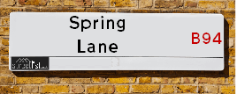
Spring Lane is a street located in the village of Hockley Heath and near the village of Hockley Heath and in the village of Lapworth. The street has a length of approximately 2,555 metres.
Spring Lane is located within the Stratford-on-Avon District, Solihull District (B) and Warwick District Council's jurisdiction. They provide various services, like refuse collection, and manage council tax collection. It's situated in the West Midlands region of the UK.
Spring Lane has been assigned the Unique Street Reference Numbers of 38301869, 35004489, 35080140, 42301375 and 38301870 in the National Street Gazetteer.
Spring Lane is located within the county of Warwickshire, situated in the West Midlands region of the UK. It's 92.34 miles North West from central London., 10.54 miles South East from Birmingham, 12.27 miles West from Coventry and 21.4 miles North East from Worcester.

Do you know why this road is called Spring Lane?
What's it like to live here?
Ask the community a question about Spring Lane.
Do you have any questions, memories to share or know any facts about Spring Lane? We'd love to know more.
Also on streetlist.co.uk, can you help?
Eldroth Road
15th April 2024
I wondered if anyone has any old pictures of Wenning Bank House in the 1940’s and also Lane Side before of the same era .. we visited today with my Mum in law as she used to live at both these properties. Also any photos of the schools around that time .. thank you.
Can You Help?Napps Way
15th April 2024
Why is the road called Napps Way (belonging to Napp, but minus an
apostrophe as is usual with such nomenclature)? Moreover, who or
what is, or was, “Napp” in the respective, possessive case?
Several years ago, I met an elderly man (probably in his late-eighties)
who lives on Bentham Drive, Liverpool 16, and during a conversation
with him whilst in a Northwest Passenger Transport Ambulance on the
way to the former RLUH (Royal Liverpool University Hospital), he told
me that he could remember (when he was a boy, living in Childwall,
Liverpool 16) that, “Where Napps Way is now, during WW2, there was
a two-man gun emplacement on the, then, open land to protect the
railway line passing over Childwall Valley Road - next to the railway
bridge - when suddenly, as they were loading a live “shell” into the gun’s
breach, the aforementioned “shell” accidentally exploded in the gun’s
breach killing both of the two soldiers, that had been manning the gun,
instantly! (Very sad, of course, but could - perhaps - two ghosts relating
to those two, very unfortunately and prematurely-killed soldiers have
haunted that place of their deaths ever since - and have any residents
of Napps Way - formerly and in its latest incarnation - seen two, WW2
(uniformed) soldiers unexpectedly appear in or near their homes?)
Mauritius Road
15th April 2024
Why is Mauritius Road so called, since when and by whom? Does Greenwich have any particular links with Mauritius? Very interested to know. 🤞🏼
Can You Help?Estate Agents near Spring Lane
| Name | Address | Website |
|---|---|---|
| Bromford, Coming Soon - Blythe Valley | Central Boulevard, Blythe Valley Park, Solihull, B90 8AG | Visit Website |
| Veritas Homes Ltd | Central Boulevard, Blythe Valley Park, Solihull, B90 8AG | Visit Website |
| Crest Nicholson | Woodlands Park, Solihull, B90 8AT | Visit Website |
Hotels near Spring Lane
Budget Hotels near Spring Lane
| Budget Hotel Name | Distance (miles) |
|---|---|
| 1: Name:Premier Inn Solihull Hockley Heath M42 Address:Stratford Road Telephone: Visit Site |
0.85 |
| 2: Name:Premier Inn Solihull South M42 Address:Stratford Road Telephone: Visit Site |
2.88 |
| 3: Name:Premier Inn Solihull Town Centre Address:Station Road Telephone: Visit Site |
4.78 |
| 4: Name:Premier Inn Birmingham South Hall Green Address:Stratford Road Telephone: Visit Site |
5.82 |
| 5: Name:Travelodge Birmingham Maypole Address:Maypole Lane, Birmingham, B14 5JF Telephone:0871 559 1896 Visit Site |
6.04 |
Location Details
| Spring Lane | |
|---|---|

| |
| Latitude | 52.345685 |
| Longitude | -1.781007 |
| OS Easting (X): | 414916 |
| OS Northing (Y): | 272022 |
| OS Grid Reference: | SP149720 |
Ordnance Survey Maps for Spring Lane
If you purchase a map through the links below, we may earn an affiliate commission.
| Map Series | link | Ordnance Survey |
| Explorer 1:25,000 220 Birmingham, Walsall, Solihull and Redditch | Check Price on Amazon | |
| Landranger 1:50,000 139 Birmingham and Wolverhampton | Check Price on Amazon |
Neighbourhood Policing |
| Police Force: Warwickshire &West Midlands |
| Find a Local Neighbourhood Watch Scheme |
Frequently asked Questions for Spring Lane
What Council (Local Authority) is Spring Lane in?
Spring Lane is located within the local authority area of Stratford-on-Avon, Warwick &Solihull Council which is a District Council &Metropolitan District.
What Parish Council is Spring Lane in?
Spring Lane is located within the area of Tanworth-in-Arden, Lapworth & Hockley Heath Parish Council.
What Electoral Ward is Spring Lane in?
Spring Lane is located within the ward of Tanworth-in-Arden, Kenilworth Abbey & Arden &Dorridge and Hockley Heath.
What County is Spring Lane in?
Spring Lane is located within the ceremonial county of Warwickshire.
What Constituency is Spring Lane in?
Spring Lane is located within the constituency of Stratford-on-Avon, Kenilworth and Southam &Meriden.
What Part of the UK is Spring Lane in?
Spring Lane is located within the West Midlands (England) region of the United Kingdom.
What County Council area is Spring Lane in?
Spring Lane is located within the Warwickshire &West Midlands Council area.
What Police Force area is Spring Lane in?
Spring Lane is located within the Warwickshire &West Midlands Police area.
Roads that have a Junction with Spring Lane
| Street | Junction Type |
|---|---|
| Pound House Lane (B4101) | junction |
| Cut Throat Lane | junction |
| Cut Throat Lane | junction |
| Nuthurst Lane | junction |
| Belton Close | junction |
| Stratford Road (A3400) | junction |
| Church Lane | junction |
| Wharf Lane | junction |
Sunset and Sunrise times for Spring Lane
| Sunrise | 05:57 |
|---|---|
| Sunset | 20:14 |
Latest Weather Conditions for Spring Lane
| Observed at Weather Station: | Coleshill 19 April 2024 at 09:00 (10.06 miles away) |
|---|---|
| Current Weather: | Light rain |
| Temperature and Humidity: | 10.0°C (84.4%) |
| Wind Direction and Speed: | NW (13 mph) |
Population Statistics
| ONS Area Code | E00159295, E00159502, E00051504 & E00051503 |
|---|---|
| ONS Area Name | Agricultural Communities, Rural White-Collar Workers, Ageing in Suburbia & Comfortable Suburbia |
| Average Age | 46.54, 46.10 & 43.21 |
| Area Population | 1861.00, 1469.00 & 1604.00 |
| Male Population | 886.00, 737.00 & 800.00 (49%) |
| Female Population | 975.00, 732.00 & 804.00 (51%) |
| Benefit Claimants | 3 (0%) |
| LSOA Code: | E01031244, E01031282 &E01010189 |
|---|---|
| LSOA Name: | Stratford-on-Avon 001C, Warwick 004B &Solihull 029E |
| SOA Code: | 2b &8c |
| SOA Name: | |
| MSOA Code: | E02006504, E02006522 &E02002109 |
| MSOA Name: | Stratford-on-Avon 001, Warwick 004 &Solihull 029 |
Nearest Supermarkets
| Tesco Dorridge Express |
|---|
| 3-7 Arden Buildings, Station Rd, Solihull, B93 8HH |
| 0345 026 9271 |
| Distance: 2.22 Miles |
| Directions from Spring Lane to Tesco Dorridge Express |
| Sainsburys Dorridge |
|---|
| 375 Station Road, Dorridge, Solihull, England, B93 8FG |
| 01564 719010 |
| Distance: 2.26 Miles |
| Directions from Spring Lane to Sainsburys Dorridge |
| Tesco Solihull Extra |
|---|
| 1505 Stratford Rd, Shirley, Solihull, B90 4EN |
| 0345 677 9624 |
| Distance: 2.71 Miles |
| Directions from Spring Lane to Tesco Solihull Extra |
| Tesco Knowle Metro |
|---|
| 40-44 St Johns Way, Knowle, Solihull, B93 0LE |
| 0345 677 9394 |
| Distance: 3.54 Miles |
| Directions from Spring Lane to Tesco Knowle Metro |
Telephone Information
| Area Code |
|---|
| Area Code: 01564 - Lapworth |
| Area Code: 01527 - Redditch |
| Area Code: 01676 - Meriden |
Broadband Information
| Speed | Average Speed | Median Speed | Maximum Speed | Next-generation access (NGA) | Number of Connections |
|---|---|---|---|---|---|
| Less than 2 Mbps | 2.9 | 3.2 | 4.2 | N | 13 |
Local Government
| Local Council Details |
|---|
| Within the area of Stratford-on-Avon, Warwick &Solihull |
| Visit the Council's Website |
| Visit the Council's Website |
| Elizabeth House, Church Street, Stratford upon Avon, Warwickshire, CV37 6HX, Riverside House, Milverton Hill, Leamington Spa, CV32 5HZ, PO Box 18, Council House, Solihull, West Midlands &B91 3QS |
| Send email |
| Telephone Number: 01789 267 575, 01926 450 000 &0121 704 6000 |
| Local Member of Parliament |
|---|
| Within the Westminster Parliamentary Constituency of Stratford-on-Avon, Kenilworth and Southam &Meriden |
| The Member of Parliament is Nadhim Zahawi, Jeremy Wright &Saqib Bhatti |
| Details for the MP Nadhim Zahawi, Jeremy Wright &Saqib Bhatti on parliament.uk |
| Details for the MP Nadhim Zahawi, Jeremy Wright &Saqib Bhatti on theyworkforyou.com |
| In the 2019 General Election Nadhim Zahawi, Jeremy Wright &Saqib Bhatti won with a majority of 19,972 the result was Con hold. The total electorate was 74,037 |
| Wards, Parish Councils and County Councils |
|---|
| Ward: Tanworth-in-Arden, Kenilworth Abbey & Arden &Dorridge and Hockley Heath Ward |
| Ceremonial County: Warwickshire |
Nearest Schools
| Name | Address | Postcode | Telephone | Type | Distance (Km) |
|---|
Data accessed from gov.scot 08-08-2019
Nearest Hospitals
| Name | Address | Postcode | Distance | Map |
|---|
Nearest Dentists
Dentists near Spring Lane
| Name | Address | Postcode | Distance | Map |
|---|
Nearest GP Surgeries
Doctors near Spring Lane
DORRIDGE SURGERY
Address: DOCTORS SURGERY, 3 AVENUE ROAD, DORRIDGE, SOLIHULL, WEST MIDLANDS, B93 8LH
Distance: 2.23 miles
Contact: tel: 01564 776262
LAPWORTH SURGERY
Address: OLD WARWICK ROAD, LAPWORTH, SOLIHULL, WEST MIDLANDS, B94 6LH
Distance: 2.29 miles
Contact: tel: 01564 783983
TANWORTH-IN-ARDEN MED CTR
Address: THE BIRCHES, BROAD LANE, TANWORTH-IN-ARDEN, SOLIHULL, WEST MIDLANDS, B94 5DP
Distance: 2.53 miles
Contact: tel: 01564 742274
THE VILLAGE SURGERY
Address: CHESWICK WAY, CHESWICK GREEN, SHIRLEY, SOLIHULL, WEST MIDLANDS, B90 4JA
Distance: 2.68 miles
Contact: :
ARDEN MEDICAL CENTRE
Address: DOWNING CLOSE, STATION ROAD, KNOWLE, SOLIHULL, WEST MIDLANDS, B93 0QA
Distance: 2.81 miles
Contact: tel: 01564 739194
MONKSPATH SURGERY - COVID LOCAL VACCINATION SERVICE 2
Address: FARMHOUSE WAY, SHIRLEY, SOLIHULL, B90 4EH
Distance: 3.16 miles
Contact: :
Nearest Dispensing Chemists
Pharmacies near Spring Lane
| Name | Address | Postcode | Telephone | Map | Distance in Km |
|---|
Nearest Opticians
Opticians near Spring Lane
ALAN TYLER OPTICIANS (DORRIDGE)
Address: 11 ARDEN BUILDINGS, STATION ROAD, DORRIDGE, SOLIHULL, WEST MIDLANDS, B93 8HH
Distance: 2.22 miles
Contact: :
FORENSIC EYECARE LIMITED
Address: 176 EARLSWOOD COMMON, EARLSWOOD, SOLIHULL, WARWICKSHIRE, B94 5SQ
Distance: 2.34 miles
Contact: :
VISION EXPRESS AT TESCO (SOLIHULL SHIRLEY)
Address: 1505 STRATFORD ROAD, SHIRLEY, SOLIHULL, WEST MIDLANDS, B90 4EN
Distance: 2.60 miles
Contact: :
EYE C HEALTHCARE (SOLIHULL)
Address: 11 HORTON GROVE, SHIRLEY, SOLIHULL, WEST MIDLANDS, B90 4UZ
Distance: 2.79 miles
Contact: :
J & D MASON OPTICIANS (SOLIHULL)
Address: 18 FARMHOUSE WAY, SHIRLEY, SOLIHULL, WEST MIDLANDS, B90 4EH
Distance: 3.16 miles
Contact: :
VISION EXPRESS (SOLIHULL)
Address: 1642 HIGH STREET, KNOWLE, SOLIHULL, WEST MIDLANDS, B93 0NA
Distance: 3.53 miles
Contact: :
Transport
Nearest Rail Stations
Dorridge Station is 2.18 miles away.
Address: Dorridge station, Station Approach, Dorridge, West Midlands, B93 8JA
Dorridge is situated on the Chiltern Main Line and is managed by Chiltern Railway.
Dorridge Station is staffed on a part time basis.
Danzey Station is 2.25 miles away.
Address: Danzey station, off Danzey Green Lane, Danzey Green, Warwickshire, B94 5BE
Danzey is situated on the North Warwickshire (Shakespeare Line) Line.
Danzey Station is an unstaffed station.