Map of Tanworth Lane
| Postcodes | ||
|---|---|---|
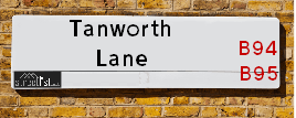
| Icon | Postcodes for Tanworth Lane | |
| Walking Distances | ||
| Distance Info | Green Circle = 10 Minutes Walk (800 metres) | |
About Tanworth Lane
Tanworth Lane is a street located near Hallend and near the town of Henley-in-Arden and near Kemps Green. The street has a length of approximately 3,196 metres.
Tanworth Lane is located within the Stratford-on-Avon District Council's jurisdiction. They provide various services, like refuse collection, and manage council tax collection. It's situated in the West Midlands region of the UK.
Tanworth Lane has been assigned the Unique Street Reference Number of 38302013 and 38302015 in the National Street Gazetteer.
Tanworth Lane is located within the county of Warwickshire, situated in the West Midlands region of the UK. It's 91.57 miles North West from central London., 12.17 miles South from Birmingham, 13.73 miles South West from Coventry and 19.86 miles North East from Worcester.

Do you know why this road is called Tanworth Lane?
What's it like to live here?
Ask the community a question about Tanworth Lane.
Do you have any questions, memories to share or know any facts about Tanworth Lane? We'd love to know more.
Also on streetlist.co.uk, can you help?
Eldroth Road
15th April 2024
I wondered if anyone has any old pictures of Wenning Bank House in the 1940’s and also Lane Side before of the same era .. we visited today with my Mum in law as she used to live at both these properties. Also any photos of the schools around that time .. thank you.
Can You Help?Napps Way
15th April 2024
Why is the road called Napps Way (belonging to Napp, but minus an
apostrophe as is usual with such nomenclature)? Moreover, who or
what is, or was, “Napp” in the respective, possessive case?
Several years ago, I met an elderly man (probably in his late-eighties)
who lives on Bentham Drive, Liverpool 16, and during a conversation
with him whilst in a Northwest Passenger Transport Ambulance on the
way to the former RLUH (Royal Liverpool University Hospital), he told
me that he could remember (when he was a boy, living in Childwall,
Liverpool 16) that, “Where Napps Way is now, during WW2, there was
a two-man gun emplacement on the, then, open land to protect the
railway line passing over Childwall Valley Road - next to the railway
bridge - when suddenly, as they were loading a live “shell” into the gun’s
breach, the aforementioned “shell” accidentally exploded in the gun’s
breach killing both of the two soldiers, that had been manning the gun,
instantly! (Very sad, of course, but could - perhaps - two ghosts relating
to those two, very unfortunately and prematurely-killed soldiers have
haunted that place of their deaths ever since - and have any residents
of Napps Way - formerly and in its latest incarnation - seen two, WW2
(uniformed) soldiers unexpectedly appear in or near their homes?)
Mauritius Road
15th April 2024
Why is Mauritius Road so called, since when and by whom? Does Greenwich have any particular links with Mauritius? Very interested to know. 🤞🏼
Can You Help?Estate Agents near Tanworth Lane
| Name | Address | Website |
|---|---|---|
| The Agents Property Consultants | 116a High Street, Henley-In-Arden,B95 5PS | |
| LettingaProperty.com | 10 Arden Court, William James Way, Henley-In-Arden, B95 5GF | Visit Website |
| LettingaProperty.com, Nationwide - Lettings | 10 Arden Court, William James Way, Henley-In-Arden, B95 5GF | Visit Website |
Location Details
| Tanworth Lane | |
|---|---|

| |
| Latitude | 52.315313 |
| Longitude | -1.796369 |
| OS Easting (X): | 413879 |
| OS Northing (Y): | 268641 |
| OS Grid Reference: | SP139686 |
Ordnance Survey Maps for Tanworth Lane
If you purchase a map through the links below, we may earn an affiliate commission.
| Map Series | link | Ordnance Survey |
| Explorer 1:25,000 220 Birmingham, Walsall, Solihull and Redditch | Check Price on Amazon | |
| Landranger 1:50,000 139 Birmingham and Wolverhampton | Check Price on Amazon | |
| Landranger 1:50,000 151 Stratford-upon-Avon | Check Price on Amazon | Buy Direct from the Ordnance Survey |
Neighbourhood Policing |
| Police Force: Warwickshire |
 View Neighbourhood Crime and Policing View Neighbourhood Crime and Policing |
| Find a Local Neighbourhood Watch Scheme |
Frequently asked Questions for Tanworth Lane
What Council (Local Authority) is Tanworth Lane in?
Tanworth Lane is located within the local authority area of Stratford-on-Avon Council which is a District Council.
What Parish Council is Tanworth Lane in?
Tanworth Lane is located within the area of Tanworth-in-Arden Parish Council.
What Electoral Ward is Tanworth Lane in?
Tanworth Lane is located within the ward of Henley-in-Arden &Tanworth-in-Arden.
What County is Tanworth Lane in?
Tanworth Lane is located within the ceremonial county of Warwickshire.
What Constituency is Tanworth Lane in?
Tanworth Lane is located within the constituency of Stratford-on-Avon.
What Part of the UK is Tanworth Lane in?
Tanworth Lane is located within the West Midlands (England) region of the United Kingdom.
What County Council area is Tanworth Lane in?
Tanworth Lane is located within the Warwickshire Council area.
What Police Force area is Tanworth Lane in?
Tanworth Lane is located within the Warwickshire Police area.
Roads that have a Junction with Tanworth Lane
| Street | Junction Type |
|---|---|
| Ramshill Lane | junction |
| Birmingham Road (A3400) | junction |
Sunset and Sunrise times for Tanworth Lane
| Sunrise | 05:45 |
|---|---|
| Sunset | 20:25 |
Latest Weather Conditions for Tanworth Lane
| Observed at Weather Station: | Coleshill 25 April 2024 at 18:00 (12.25 miles away) |
|---|---|
| Current Weather: | Overcast |
| Temperature and Humidity: | 7.0°C (81.2%) |
| Wind Direction and Speed: | NNE (5 mph) |
Population Statistics
| ONS Area Code | E00159306 & E00159300 |
|---|---|
| ONS Area Name | Detached Rural Retirement & Established Farming Communities |
| Average Age | 46.54 |
| Area Population | 1861.00 |
| Male Population | 886.00 (48%) |
| Female Population | 975.00 (52%) |
| Benefit Claimants | 3 (0%) |
| LSOA Code: | E01031244 |
|---|---|
| LSOA Name: | Stratford-on-Avon 001C |
| SOA Code: | 2b |
| SOA Name: | |
| MSOA Code: | E02006504 |
| MSOA Name: | Stratford-on-Avon 001 |
Nearest Supermarkets
| Tesco Dorridge Express |
|---|
| 3-7 Arden Buildings, Station Rd, Solihull, B93 8HH |
| 0345 026 9271 |
| Distance: 4.39 Miles |
| Directions from Tanworth Lane to Tesco Dorridge Express |
| Sainsburys Dorridge |
|---|
| 375 Station Road, Dorridge, Solihull, England, B93 8FG |
| 01564 719010 |
| Distance: 4.42 Miles |
| Directions from Tanworth Lane to Sainsburys Dorridge |
| Morrisons Redditch |
|---|
| Warwick Highway, Redditch B98 0SW |
| 01527 503484 |
| Distance: 4.78 Miles |
| Directions from Tanworth Lane to Morrisons Redditch |
| Tesco Solihull Extra |
|---|
| 1505 Stratford Rd, Shirley, Solihull, B90 4EN |
| 0345 677 9624 |
| Distance: 4.79 Miles |
| Directions from Tanworth Lane to Tesco Solihull Extra |
Telephone Information
| Area Code |
|---|
| Area Code: 01564 - Lapworth |
| Area Code: 01527 - Redditch |
Local Government
| Local Council Details |
|---|
| Within the area of Stratford-on-Avon |
| Visit the Council's Website |
| Elizabeth House, Church Street, Stratford upon Avon, Warwickshire &CV37 6HX |
| Send email |
| Telephone Number: 01789 267 575 |
| Local Member of Parliament |
|---|
| Within the Westminster Parliamentary Constituency of Stratford-on-Avon |
| The Member of Parliament is Nadhim Zahawi |
| Details for the MP Nadhim Zahawi on parliament.uk |
| Details for the MP Nadhim Zahawi on theyworkforyou.com |
| In the 2019 General Election Nadhim Zahawi won with a majority of 19,972 the result was Con hold. The total electorate was 74,037 |
| Wards, Parish Councils and County Councils |
|---|
| Ward: Henley-in-Arden &Tanworth-in-Arden Ward |
| Ceremonial County: Warwickshire |
Nearest Schools
England Primary Schools
Tanworth-in-Arden CofE Primary School
Address: Tanworth-in-Arden CofE Primary School, The Green, Tanworth-in-Arden, Solihull, Warwickshire, B94 5AJ
Distance: 2.04 miles
Contact: 01564742284
Nearest Hospitals
| Name | Address | Postcode | Distance | Map |
|---|
Nearest Dentists
Dentists near Tanworth Lane
| Name | Address | Postcode | Distance | Map |
|---|
Nearest GP Surgeries
Doctors near Tanworth Lane
HENLEY-IN-ARDEN MED CTR
Address: PRINCE HARRY ROAD, HENLEY-IN-ARDEN, WEST MIDLANDS, B95 5GD
Distance: 1.86 miles
Contact: tel: 01564 792434
TANWORTH-IN-ARDEN MED CTR
Address: THE BIRCHES, BROAD LANE, TANWORTH-IN-ARDEN, SOLIHULL, WEST MIDLANDS, B94 5DP
Distance: 2.71 miles
Contact: tel: 01564 742274
LAPWORTH SURGERY
Address: OLD WARWICK ROAD, LAPWORTH, SOLIHULL, WEST MIDLANDS, B94 6LH
Distance: 3.27 miles
Contact: tel: 01564 783983
WINYATES HEALTH CENTRE
Address: WINYATES CENTRE, WINYATES WAY, REDDITCH, WORCESTERSHIRE, B98 0NR
Distance: 4.23 miles
Contact: tel: 01527 513888
WINYATES HEALTH CENTRE - COVID LOCAL VACCINATION SERVICE 2
Address: WINYATES CENTRE, WINYATES WAY, REDDITCH, B98 0NR
Distance: 4.23 miles
Contact: :
THE SURGERY
Address: STATION ROAD, WARWICK, CLAVERDON, WARWICKSHIRE, CV35 8PH
Distance: 4.36 miles
Contact: tel: 01926 842205
Nearest Dispensing Chemists
Pharmacies near Tanworth Lane
| Name | Address | Postcode | Telephone | Map | Distance in Km |
|---|
Nearest Opticians
Opticians near Tanworth Lane
TISSINGTON OPTICIANS (SOLIHULL)
Address: 133 HIGH STREET, HENLEY-IN-ARDEN, WEST MIDLANDS, B95 5AU
Distance: 1.71 miles
Contact: :
FORENSIC EYECARE LIMITED
Address: 176 EARLSWOOD COMMON, EARLSWOOD, SOLIHULL, WARWICKSHIRE, B94 5SQ
Distance: 3.00 miles
Contact: :
WINYATES OPTICIANS
Address: UNIT 8, 17 WINYATES SHOPPING CENTRE, REDDITCH, WORCESTERSHIRE, B98 0NR
Distance: 4.23 miles
Contact: :
ALAN TYLER OPTICIANS (DORRIDGE)
Address: 11 ARDEN BUILDINGS, STATION ROAD, DORRIDGE, SOLIHULL, WEST MIDLANDS, B93 8HH
Distance: 4.39 miles
Contact: :
MATTOO DAVINDER (BEOLEY)
Address: CHURCH HILL FARM, BEOLEY, REDDITCH, WORCESTERSHIRE, B98 9AR
Distance: 4.53 miles
Contact: :
VISION EXPRESS AT TESCO (SOLIHULL SHIRLEY)
Address: 1505 STRATFORD ROAD, SHIRLEY, SOLIHULL, WEST MIDLANDS, B90 4EN
Distance: 4.68 miles
Contact: :
Transport
Nearest Rail Stations
Danzey Station is 1.22 miles away.
Address: Danzey station, off Danzey Green Lane, Danzey Green, Warwickshire, B94 5BE
Danzey is situated on the North Warwickshire (Shakespeare Line) Line.
Danzey Station is an unstaffed station.
Henley-in-Arden Station is 1.75 miles away.
Address: Henley-in-Arden station, Station Road, Henley-in-Arden, Warwickshire, B95 5JF
Henley-in-Arden is situated on the North Warwickshire (Shakespeare Line) Line.
Henley-in-Arden Station is an unstaffed station.
Directions from Tanworth Lane to Henley-in-Arden Rail Station