Map of Hadlow Close
| Street Crime (updated 06/04/2024) | ||
|---|---|---|
| Location Note | Central Point of Street - Not Actual Location | |
| MSOA Info | For MSOA E02006730 (Statistical Neighbourhood) | |
| Click Hint | Click on a Circle for a detailed breakdown below map. | |
| Crime Levels |
Green = Very Low Yellow = Low Orange = High Red = Very High |
|
| Postcodes | ||
| Icon | Postcodes for Hadlow Close | |
| Walking Distances | ||
| Distance Info | Green Circle = 10 Minutes Walk (800 metres) | |
About Hadlow Close
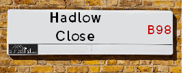
Hadlow Close is a street located in the town of Redditch. It uses the postcode B98 7FU. The street has a length of approximately 179 metres.
The street is not publicly maintained and is unadopted which means that a private body or even the householder could be responsible for the repair and upkeep of the highway. Check the status with your local council or enquire if the street is covered by a PUSWA (public utilities street works act).
Hadlow Close is located within the Redditch District (B) Council's jurisdiction. They provide various services, like refuse collection, and manage council tax collection. It's situated in the West Midlands region of the UK.
Hadlow Close has been assigned the Unique Street Reference Number of 31102641 in the National Street Gazetteer.
Hadlow Close is located within the county of Worcestershire, situated in the West Midlands region of the UK. It's 95.12 miles North West from central London., 13.13 miles South from Birmingham, 14.03 miles North East from Worcester and 19.56 miles South West from Coventry.
Hadlow Close is within the Post Town of REDDITCH.

Do you know why this road is called Hadlow Close?
What's it like to live here?
Ask the community a question about Hadlow Close.
Do you have any questions, memories to share or know any facts about Hadlow Close? We'd love to know more.
Also on streetlist.co.uk, can you help?
Eldroth Road
15th April 2024
I wondered if anyone has any old pictures of Wenning Bank House in the 1940’s and also Lane Side before of the same era .. we visited today with my Mum in law as she used to live at both these properties. Also any photos of the schools around that time .. thank you.
Can You Help?Napps Way
15th April 2024
Why is the road called Napps Way (belonging to Napp, but minus an
apostrophe as is usual with such nomenclature)? Moreover, who or
what is, or was, “Napp” in the respective, possessive case?
Several years ago, I met an elderly man (probably in his late-eighties)
who lives on Bentham Drive, Liverpool 16, and during a conversation
with him whilst in a Northwest Passenger Transport Ambulance on the
way to the former RLUH (Royal Liverpool University Hospital), he told
me that he could remember (when he was a boy, living in Childwall,
Liverpool 16) that, “Where Napps Way is now, during WW2, there was
a two-man gun emplacement on the, then, open land to protect the
railway line passing over Childwall Valley Road - next to the railway
bridge - when suddenly, as they were loading a live “shell” into the gun’s
breach, the aforementioned “shell” accidentally exploded in the gun’s
breach killing both of the two soldiers, that had been manning the gun,
instantly! (Very sad, of course, but could - perhaps - two ghosts relating
to those two, very unfortunately and prematurely-killed soldiers have
haunted that place of their deaths ever since - and have any residents
of Napps Way - formerly and in its latest incarnation - seen two, WW2
(uniformed) soldiers unexpectedly appear in or near their homes?)
Mauritius Road
15th April 2024
Why is Mauritius Road so called, since when and by whom? Does Greenwich have any particular links with Mauritius? Very interested to know. 🤞🏼
Can You Help?House Sales in Hadlow Close
| Year | High | Low | Average | Sales |
|---|---|---|---|---|
| 2015 | £194,995 | £221,995 | £232,762 | 15 |
| 2016 | £405,000 | £288,500 | £276,632 | 11 |
| 2017 | £290,000 | £290,000 | £290,000 | 1 |
| 2018 | £305,000 | £305,000 | £305,000 | 1 |
| 2019 | £225,000 | £275,000 | £250,000 | 2 |
| 2020 | £315,000 | £315,000 | £315,000 | 1 |
| 2021 | £268,000 | £310,000 | £298,667 | 3 |
Contains HM Land Registry data © Crown copyright and database right 2024. This data is licensed under the Open Government Licence v3.0.
Estate Agents near Hadlow Close
| Name | Address | Website |
|---|---|---|
| Arden Estates | 373 Evesham Road, Redditch, B97 5JA | Visit Website |
| Lamberts Sales and Lettings | 11 Alcester Street, Redditch, B98 8AE | |
| Shipways | 3 Alcester Street, Redditch, B98 8AE |
We have found 1 postcode for Hadlow Close
Budget Hotels near Hadlow Close
| Budget Hotel Name | Distance (miles) |
|---|---|
| 1: Name:Holiday Inn Express Birmingham Redditch Address:2 Hewell Road Telephone: Visit Holiday Inn Express Birmingham Redditch on booking.com |
1.41 |
| 2: Name:Premier Inn Redditch North A441 Address:Bordesley Lane Telephone: Visit Premier Inn Redditch North A441 on booking.com |
1.83 |
| 3: Name:Premier Inn Redditch West A448 Address:Birchfield Road Telephone: Visit Premier Inn Redditch West A448 on booking.com |
2.34 |
| 4: Name:Travelodge Bromsgrove Address:2 Finstall Rd, Bromsgrove, B60 2DZ Telephone:0871 984 8484 Visit Travelodge Bromsgrove on booking.com |
5.48 |
| 5: Name:Premier Inn Bromsgrove Central Address:Birmingham Road Telephone: Visit Premier Inn Bromsgrove Central on booking.com |
6.09 |
Location Details
| Hadlow Close | |
|---|---|

| |
| Latitude | 52.290012 |
| Longitude | -1.929545 |
| OS Easting (X): | 404805 |
| OS Northing (Y): | 265809 |
| OS Grid Reference: | SP048658 |
Ordnance Survey Maps for Hadlow Close
If you purchase a map through the links below, we may earn an affiliate commission.
| Map Series | link | Ordnance Survey |
| Explorer 1:25,000 220 Birmingham, Walsall, Solihull and Redditch | Check Price on Amazon | |
| Landranger 1:50,000 150 Worcester & The Malverns | Check Price on Amazon | Buy Direct from the Ordnance Survey |
Neighbourhood Policing |
| Police Force: West Mercia |
 View Neighbourhood Crime and Policing View Neighbourhood Crime and Policing |
| Find a Local Neighbourhood Watch Scheme |
Frequently asked Questions for Hadlow Close
What Council (Local Authority) is Hadlow Close in?
Hadlow Close is located within the local authority area of Redditch Council which is a District Council.
What Parish Council is Hadlow Close in?
Hadlow Close is in an unparished area.
What Electoral Ward is Hadlow Close in?
Hadlow Close is located within the ward of Greenlands.
What County is Hadlow Close in?
Hadlow Close is located within the ceremonial county of Worcestershire.
What Constituency is Hadlow Close in?
Hadlow Close is located within the constituency of Redditch.
What Part of the UK is Hadlow Close in?
Hadlow Close is located within the West Midlands (England) region of the United Kingdom.
What County Council area is Hadlow Close in?
Hadlow Close is located within the Worcestershire Council area.
What Police Force area is Hadlow Close in?
Hadlow Close is located within the West Mercia Police area.
Roads that have a Junction with Hadlow Close
| Street | Junction Type |
|---|---|
| Harris Close | junction |
Sunset and Sunrise times for Hadlow Close , B98 7FU
| Sunrise | 05:47 |
|---|---|
| Sunset | 20:23 |
Latest Weather Conditions for Hadlow Close, B98 7FU
| Observed at Weather Station: | Pershore 24 April 2024 at 12:00 (10.87 miles away) |
|---|---|
| Current Weather: | Overcast |
| Temperature and Humidity: | 10.5°C (47.3%) |
| Wind Direction and Speed: | NW (7 mph) |
Population Statistics
| ONS Area Code | E00164516 |
|---|---|
| ONS Area Name | Hard-Pressed European Settlers |
| Average Age | 39.71 |
| Area Population | 1603.00 |
| Male Population | 801.00 (50%) |
| Female Population | 802.00 (50%) |
| Benefit Claimants | 17 (1%) |
| LSOA Code: | E01032254 |
|---|---|
| LSOA Name: | Redditch 010D |
| SOA Code: | 4c |
| SOA Name: | |
| MSOA Code: | E02006730 |
| MSOA Name: | Redditch 010 |
Nearest Supermarkets
| Tesco Redditch Extra |
|---|
| Coldfield Dr, Oakenshaw, Redditch, B98 7RU |
| 0345 677 9569 |
| Distance: 0.32 Miles |
| Directions from Hadlow Close to Tesco Redditch Extra |
| Tesco Lodge Park Express |
|---|
| 7-9 Shakespeare Ave, Lodge Park, Redditch, B98 7LB |
| 0345 026 9070 |
| Distance: 0.67 Miles |
| Directions from Hadlow Close to Tesco Lodge Park Express |
| Asda Redditch |
|---|
| Jinnah Road, Redditch, B98 7ER |
| 01527 509341 |
| Distance: 0.79 Miles |
| Directions from Hadlow Close to Asda Redditch |
| Iceland Redditch |
|---|
| Trafford Park Ind. Estate, Trescott Road, Redditch, B98 7AH |
| 01527585364 |
| Distance: 1.05 Miles |
| Directions from Hadlow Close to Iceland Redditch |
Telephone Information
| Area Code |
|---|
| Area Code: 01527 - Redditch |
| Area Code: 01564 - Lapworth |
Local Government
| Local Council Details |
|---|
| Within the area of Redditch |
| Visit the Council's Website |
| Town Hall, Walter Stranz Square, Redditch, Worcestershire &B98 8AH |
| Send email |
| Telephone Number: 0152 764 252 |
| Local Member of Parliament |
|---|
| Within the Westminster Parliamentary Constituency of Redditch |
| The Member of Parliament is Rachel Maclean |
| Details for the MP Rachel Maclean on parliament.uk |
| Details for the MP Rachel Maclean on theyworkforyou.com |
| In the 2019 General Election Rachel Maclean won with a majority of 16,036 the result was Con hold. The total electorate was 65,391 |
| Wards, Parish Councils and County Councils |
|---|
| Ward: Greenlands Ward |
| Parish: Unparished area |
| Ceremonial County: Worcestershire |
Nearest Schools
England Secondary Schools
Ipsley CofE Middle School
Address: Ipsley CofE Middle School, Winyates Way, Winyates, Redditch, B98 0UB
Distance: 1.60 miles
Contact: 01527525725
St Bede's Catholic Middle School
Address: St Bede's Catholic Middle School, Holloway Lane, Redditch, Worcestershire, B98 7HA
Distance: 0.87 miles
Contact: 01527525916
Arrow Vale High School
Address: Arrow Vale High School, Matchborough Way, Redditch, B98 0GF
Distance: 1.45 miles
Contact: 01527526800
Tudor Grange Academy Redditch
Address: Tudor Grange Academy Redditch, Woodrow Drive, Redditch, Worcestershire, B98 7UH
Distance: 1.01 miles
Contact: 01527523088
Trinity High School and Sixth Form Centre
Address: Trinity High School and Sixth Form Centre, Easemore Road, Redditch, Worcestershire, B98 8HB
Distance: 1.32 miles
Contact: 01527585859
Woodfield Academy
Address: Woodfield Academy, Studley Road, Redditch, Worcestershire, B98 7HH
Distance: 0.55 miles
Contact: 01527527081
Walkwood Church of England Middle School
Address: Walkwood Church of England Middle School, Feckenham Road, Headless Cross, Redditch, Worcestershire, B97 5AQ
Distance: 1.04 miles
Contact: 01527543361
St Augustine's Catholic High School
Address: St Augustine's Catholic High School, Stonepits Lane, Hunt End, Redditch, Worcestershire, B97 5LX
Distance: 1.47 miles
Contact: 01527550400
England Primary Schools
Mappleborough Green CofE Primary School
Address: Mappleborough Green CofE Primary School, Henley Road, Mappleborough Green, Studley, Warwickshire, B80 7DR
Distance: 2.37 miles
Contact: 01527852240
Roman Way First School
Address: Roman Way First School, Colts Lane, Winyates West, Redditch, Worcestershire, B98 0LH
Distance: 1.67 miles
Contact:
Studley Community Infants' School
Address: Studley Community Infants' School, High Street, Studley, Warwickshire, B80 7HJ
Distance: 1.84 miles
Contact:
St Thomas More Catholic First School
Address: St Thomas More Catholic First School, Woodrow Centre, Studley Road, Redditch, Worcestershire, B98 7RY
Distance: 0.62 miles
Contact:
Moons Moat First School
Address: Moons Moat First School, Cleeve Close, Church Hill, Redditch, Worcestershire, B98 9HR
Distance: 1.86 miles
Contact: 0152761498
St George's CofE First School
Address: St George's CofE First School, Stevenson Avenue, Redditch, Worcestershire, B98 8LU
Distance: 1.06 miles
Contact:
Woodrow First School
Address: Woodrow First School, Longdon Close, Woodrow South, Redditch, Worcestershire, B98 7UZ
Distance: 0.60 miles
Contact: 01527527619
St Stephen's CofE First School
Address: St Stephen's CofE First School, Mabey Avenue, Redditch, Worcestershire, B98 8HW
Distance: 1.60 miles
Contact:
Oak Hill First School
Address: Oak Hill First School, Wirehill Drive, Lodge Park, Redditch, Worcestershire, B98 7JU
Distance: 0.54 miles
Contact: 01527528523
Astwood Bank Primary School
Address: Astwood Bank Primary School, Church Road, Astwood Bank, Redditch, Worcestershire, B96 6EH
Distance: 1.85 miles
Contact: 01527959084
Astwood Bank First School
Address: Astwood Bank First School, Church Road, Astwood Bank, Redditch, Worcestershire, B96 6EH
Distance: 1.85 miles
Contact:
St Luke's CofE First School
Address: St Luke's CofE First School, Plymouth Road North, Southcrest, Redditch, Worcestershire, B97 4NU
Distance: 0.82 miles
Contact: 01527541219
Holyoakes Field First School
Address: Holyoakes Field First School, Bridge Street, Redditch, Worcestershire, B97 6HH
Distance: 1.47 miles
Contact:
The Vaynor First School
Address: The Vaynor First School, Tennyson Road, Headless Cross, Redditch, Worcestershire, B97 5BL
Distance: 0.98 miles
Contact: 01527543187
Crabbs Cross Academy
Address: Crabbs Cross Academy, Evesham Road, Crabbs Cross, Redditch, Worcestershire, B97 5JH
Distance: 0.82 miles
Contact: 01527543624
Webheath Academy Primary School
Address: Webheath Academy Primary School, Downsell Road, Webheath, Redditch, Worcestershire, B97 5RJ
Distance: 1.74 miles
Contact: 01527544820
England Higher Schools
Heart of Worcestershire College
Address: Heart of Worcestershire College, Peakman Campus, Peakman Street, Redditch, Worcestershire, B98 8DW
Distance: 1.27 miles
Contact: 08448802500
Nearest Hospitals
| Alexandra Hospital |
|---|
| Address: Woodrow Drive, Redditch, B98 7UB, |
| NHS Sector |
| Worcestershire Acute Hospitals NHS Trust |
| Telephone: 01527 503 030 |
| Visit Hospital Website |
| Distance: 1.64 (miles) |
| Directions from to Alexandra Hospital |
| Princess of Wales Community Hospital - Worcestershire Health and Care NHS Trust |
|---|
| Address: Princess of Wales Community Hospital, Stourbridge Road, Bromsgrove, B61 0BB, |
| NHS Sector |
| Worcestershire Health and Care NHS Trust |
| Telephone: 01527 488000 |
| Visit Hospital Website |
| Distance: 10.47 (miles) |
| Directions from to Princess of Wales Community Hospital - Worcestershire Health and Care NHS Trust |
| Cygnet Wast Hills |
|---|
| Address: Wasthill Lane, Kings Norton, Birmingham, B38 9ET, |
| NHS Sector |
| Cygnet Health Care Limited |
| Telephone: 0121 458 2263 |
| Visit Hospital Website |
| Distance: 10.57 (miles) |
| Directions from to Cygnet Wast Hills |
Nearest Dentists
Dentists near Hadlow Close
KINGFISHER DENTAL SURGERY
Address: 272 EVESHAM ROAD, REDDITCH, WORCESTERSHIRE, B97 5EP
Distance: 0.68 miles
Contact: :
CRABBS CROSS DENTAL SURGERY
Address: EVESHAM ROAD, REDDITCH, WORCESTERSHIRE, B97 5JB
Distance: 0.76 miles
Contact: :
HEADLESS CROSS DENTAL PRACTICE
Address: 3-5 BIRCHFIELD ROAD, REDDITCH, WORCESTERSHIRE, B97 4LB
Distance: 0.79 miles
Contact: :
DENTAL SURGERY
Address: 107 ARCHER ROAD, REDDITCH, WORCESTERSHIRE, B98 8DJ
Distance: 1.22 miles
Contact: :
OASIS DENTAL CARE
Address: 53 BROMSGROVE ROAD, REDDITCH, WORCESTERSHIRE, B97 4RH
Distance: 1.34 miles
Contact: :
SMALLWOOD DENTAL CLINIC
Address: SMALLWOOD HOUSE, CHURCH GREEN WEST, REDDITCH, WORCESTERSHIRE, B97 4BD
Distance: 1.35 miles
Contact: :
Nearest GP Surgeries
Doctors near Hadlow Close
THE BRIDGE SURGERY
Address: 8 EVESHAM ROAD, REDDITCH, WORCESTERSHIRE, B97 4LA
Distance: 0.75 miles
Contact: tel: 01527 555600
CRABBS CROSS MEDICAL CENTRE
Address: THE MEDICAL CENTRE, 39 KENILWORTH CLOSE, CRABBS CROSS, REDDITCH, WORCESTERSHIRE, B97 5JX
Distance: 0.84 miles
Contact: tel: 01527 402149
CRABBS CROSS SURGERY
Address: 1 KENILWORTH CLOSE, CRABBS CROSS, REDDITCH, B97 5JX
Distance: 0.84 miles
Contact: tel: 01527 544610
THE DOW SURGERY
Address: WILLIAM STREET, REDDITCH, WORCESTERSHIRE, B97 4AJ
Distance: 1.32 miles
Contact: tel: 01527 62285
ST STEPHEN'S MEDICAL PARTNERSHIP
Address: ST. STEPHENS SURGERY, ADELAIDE STREET, REDDITCH, WORCESTERSHIRE, B97 4AL
Distance: 1.35 miles
Contact: tel: 01527 595600
ELGAR HOUSE
Address: CHURCH ROAD, REDDITCH, WORCESTERSHIRE, B97 4AB
Distance: 1.38 miles
Contact: tel: 01527 69261
Nearest Dispensing Chemists
Pharmacies near Hadlow Close
TESCO INSTORE PHARMACY
Address: COLDFIELD DRIVE, REDDITCH, WORCESTERSHIRE, B98 7RU
Distance: 0.33 miles
Contact: tel: 01527 535847
WOODROW PHARMACY
Address: 9 WOODROW CENTRE, REDDITCH, WORCESTERSHIRE, B98 7RY
Distance: 0.62 miles
Contact: tel: 01527 501143
KNIGHTS HEADLESS CROSS PHARMACY
Address: 65 EVESHAM ROAD, HEADLESS CROSS, REDDITCH, WORCESTERSHIRE, B97 4JX
Distance: 0.72 miles
Contact: tel: 01527 545194
KNIGHTS CRABBS CROSS PHARMACY
Address: 434 EVESHAM ROAD, CRABBS CROSS, REDDITCH, WORCESTERSHIRE, B97 5JB
Distance: 0.76 miles
Contact: tel: 01527 402146
HOMEWARD PHARMACY
Address: C/O CEVA LOGISTICS LTD, PIPERS ROAD, PARK FARM INDUSTRIAL ESTATE, REDDITCH, B98 0HU
Distance: 1.12 miles
Contact: tel: 01225 580289
BOOTS
Address: UNIT 1-4, KINGFISHER WALK, KINGFISHER SHOPPING CENTRE, REDDITCH, WORCESTERSHIRE, B97 4EY
Distance: 1.24 miles
Contact: tel: 01527 68166
Nearest Opticians
Opticians near Hadlow Close
REDDITCH EXTRA
Address: COLDFIELD DRIVE, OAKENSHAW, REDDITCH, WORCESTERSHIRE, B98 7RU
Distance: 0.33 miles
Contact: :
4845 REDDITCH
Address: ASDA OPTICIANS, JINNAH ROAD, SMALLWOOD, REDDITCH, B98 7ER
Distance: 0.77 miles
Contact: :
EYEDEALS DIRECT
Address: 9 EVESHAM WALK, KINGFISHER SHOPPING CENTRE, REDDITCH, WORCESTERSHIRE, B97 4ET
Distance: 1.22 miles
Contact: :
SPECSAVERS (REDDITCH)
Address: 13 NEW WALK, KINGFISHER SHOPPING CENTRE, REDDITCH, WORCESTERSHIRE, B97 4YP
Distance: 1.22 miles
Contact: :
VISION EXPRESS (REDDITCH)
Address: UNIT 7, NEW WALK, KINGFISHER SHOPPING CENTRE, REDDITCH, WORCESTERSHIRE, B97 4YP
Distance: 1.22 miles
Contact: :
BAINBRIDGE OPTOMETRISTS LTD
Address: UNIT 14, KINGFISHER WALK, KINGFISHER SHOPPING CENTRE, REDDITCH, B97 4EY
Distance: 1.24 miles
Contact: :
Transport
Nearest Rail Stations
Redditch Station is 1.31 miles away.
Address: Redditch station, Bromsgrove Road, Redditch, Worcestershire, B97 4RB
Redditch is situated on the Bristol to Brimingham Line.
Redditch Station is staffed on a part time basis.
Alvechurch Station is 4.20 miles away.
Address: Alvechurch station, Station Road, Alvechurch, Worcestershire, B48 7SE
Alvechurch is situated on the Bristol to Brimingham Line.
Alvechurch Station is an unstaffed station.