Map of Old Wells Road
| Postcodes | ||
|---|---|---|
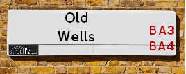
| Icon | Postcodes for Old Wells Road | |
| Walking Distances | ||
| Distance Info | Green Circle = 10 Minutes Walk (800 metres) | |
About Old Wells Road
Old Wells Road is a street located near the village of Leigh upon Mendip. It uses the postcode BA4 4GD. The street has a length of approximately 5,362 metres.
Old Wells Road is located within the Mendip District Council's jurisdiction. They provide various services, like refuse collection, and manage council tax collection. It's situated in the South West region of the UK.
Old Wells Road has been assigned the Unique Street Reference Number of 25003129 and 25008162 in the National Street Gazetteer.
Old Wells Road is located within the county of Somerset, situated in the South West region of the UK. It's 103.43 miles West from central London., 12.95 miles South West from Trowbridge, 17.61 miles South from Bristol and 20.37 miles North East from Yeovil.

Do you know why this road is called Old Wells Road?
What's it like to live here?
Ask the community a question about Old Wells Road.
Do you have any questions, memories to share or know any facts about Old Wells Road? We'd love to know more.
Also on streetlist.co.uk, can you help?
Eldroth Road
15th April 2024
I wondered if anyone has any old pictures of Wenning Bank House in the 1940’s and also Lane Side before of the same era .. we visited today with my Mum in law as she used to live at both these properties. Also any photos of the schools around that time .. thank you.
Can You Help?Napps Way
15th April 2024
Why is the road called Napps Way (belonging to Napp, but minus an
apostrophe as is usual with such nomenclature)? Moreover, who or
what is, or was, “Napp” in the respective, possessive case?
Several years ago, I met an elderly man (probably in his late-eighties)
who lives on Bentham Drive, Liverpool 16, and during a conversation
with him whilst in a Northwest Passenger Transport Ambulance on the
way to the former RLUH (Royal Liverpool University Hospital), he told
me that he could remember (when he was a boy, living in Childwall,
Liverpool 16) that, “Where Napps Way is now, during WW2, there was
a two-man gun emplacement on the, then, open land to protect the
railway line passing over Childwall Valley Road - next to the railway
bridge - when suddenly, as they were loading a live “shell” into the gun’s
breach, the aforementioned “shell” accidentally exploded in the gun’s
breach killing both of the two soldiers, that had been manning the gun,
instantly! (Very sad, of course, but could - perhaps - two ghosts relating
to those two, very unfortunately and prematurely-killed soldiers have
haunted that place of their deaths ever since - and have any residents
of Napps Way - formerly and in its latest incarnation - seen two, WW2
(uniformed) soldiers unexpectedly appear in or near their homes?)
Mauritius Road
15th April 2024
Why is Mauritius Road so called, since when and by whom? Does Greenwich have any particular links with Mauritius? Very interested to know. 🤞🏼
Can You Help?Estate Agents near Old Wells Road
| Name | Address | Website |
|---|---|---|
| Charles Barnard | 35 High Street, Shepton Mallet, BA4 5AQ | Visit Website |
| Stonebridge | 33 High Street, Shepton Mallet, BA4 5AQ | Visit Website |
| Cooper & Tanner | 32 High Street, Shepton Mallet, BA4 5AS |
We have found 1 postcode for Old Wells Road
Location Details
| Old Wells Road | |
|---|---|

| |
| Latitude | 51.214141 |
| Longitude | -2.454584 |
| OS Easting (X): | 368252 |
| OS Northing (Y): | 146259 |
| OS Grid Reference: | ST683463 |
Neighbourhood Policing |
| Police Force: Avon And Somerset |
| Find a Local Neighbourhood Watch Scheme |
Frequently asked Questions for Old Wells Road
What Council (Local Authority) is Old Wells Road in?
Old Wells Road is located within the local authority area of Mendip Council which is a District Council.
What Parish Council is Old Wells Road in?
Old Wells Road is located within the area of Leigh-on-Mendip Parish Council.
What Electoral Ward is Old Wells Road in?
Old Wells Road is located within the ward of Coleford and Holcombe.
What County is Old Wells Road in?
Old Wells Road is located within the ceremonial county of Somerset.
What Constituency is Old Wells Road in?
Old Wells Road is located within the constituency of Somerton and Frome.
What Part of the UK is Old Wells Road in?
Old Wells Road is located within the South West (England) region of the United Kingdom.
What County Council area is Old Wells Road in?
Old Wells Road is located within the Somerset Council area.
What Police Force area is Old Wells Road in?
Old Wells Road is located within the Avon and Somerset Police area.
Roads that have a Junction with Old Wells Road
| Street | Junction Type |
|---|---|
| Leigh Road | junction |
| Green Lane | junction |
| Hollybush Lane | junction |
| Luxton's Lane | junction |
| Blacker's Lane | junction |
| Fental Lane | junction |
| Long Cross Bottom | junction |
Sunset and Sunrise times for Old Wells Road , BA4 4GD
| Sunrise | 05:54 |
|---|---|
| Sunset | 20:21 |
Latest Weather Conditions for Old Wells Road, BA4 4GD
| Observed at Weather Station: | Yeovilton 23 April 2024 at 20:00 (16.48 miles away) |
|---|---|
| Current Weather: | Partly cloudy (night) |
| Temperature and Humidity: | 9.0°C (64.7%) |
| Wind Direction and Speed: | ENE (6 mph) |
Population Statistics
| ONS Area Code | E00147801 |
|---|---|
| ONS Area Name | Ageing Rural Flat Tenants |
| Average Age | 40.81 |
| Area Population | 1487.00 |
| Male Population | 745.00 (50%) |
| Female Population | 742.00 (50%) |
| Benefit Claimants | 4 (0%) |
| LSOA Code: | E01029020 |
|---|---|
| LSOA Name: | Mendip 010A |
| SOA Code: | 2a |
| SOA Name: | |
| MSOA Code: | E02006056 |
| MSOA Name: | Mendip 010 |
Nearest Supermarkets
| Tesco Shepton Mallet Superstore |
|---|
| Townsend Shopping Park, Townsend, Shepton Mallet, BA4 5EG |
| 0345 671 9389 |
| Distance: 4.52 Miles |
| Directions from Old Wells Road to Tesco Shepton Mallet Superstore |
| Sainsburys Midsomer Norton |
|---|
| The Hollies, High Street, Midsomer Norton, Radstock, England, BA3 2DT |
| 01761 416180 |
| Distance: 5.14 Miles |
| Directions from Old Wells Road to Sainsburys Midsomer Norton |
| Sainsburys Frome |
|---|
| Wessex Fields, Frome, England, BA11 4DH |
| 01373 453554 |
| Distance: 5.24 Miles |
| Directions from Old Wells Road to Sainsburys Frome |
| Tesco Midsomer Norton Superstore |
|---|
| Old Mills, Paulton, Bristol, BS39 7SW |
| 0345 677 9458 |
| Distance: 5.75 Miles |
| Directions from Old Wells Road to Tesco Midsomer Norton Superstore |
Telephone Information
| Area Code |
|---|
| Area Code: 01749 - Shepton Mallet |
| Area Code: 01373 - Frome |
| Area Code: 01761 - Temple Cloud |
Local Government
| Local Council Details |
|---|
| Within the area of Mendip |
| Visit the Council's Website |
| Council Offices, Cannards Grave Road, Shepton Mallet, Somerset &BA4 5BT |
| Send email |
| Telephone Number: 03333 043333 |
| Local Member of Parliament |
|---|
| Within the Westminster Parliamentary Constituency of Somerton and Frome |
| The Member of Parliament is David Warburton |
| Details for the MP David Warburton on parliament.uk |
| Details for the MP David Warburton on theyworkforyou.com |
| In the 2019 General Election David Warburton won with a majority of 19,213 the result was Con hold. The total electorate was 85,866 |
| Wards, Parish Councils and County Councils |
|---|
| Ward: Coleford and Holcombe Ward |
| Ceremonial County: Somerset |
Nearest Schools
England Primary Schools
Leigh-Upon-Mendip First School
Address: Leigh-Upon-Mendip First School, Leigh Street, Leigh-upon-Mendip, Radstock, Somerset, BA3 5QQ
Distance: 0.80 miles
Contact:
Stoke St Michael Primary School
Address: Stoke St Michael Primary School, Moonshill Road, Stoke St Michael, Radstock, Somerset, BA3 5LG
Distance: 1.37 miles
Contact: 01749840470
Nearest Hospitals
| Name | Address | Postcode | Distance | Map |
|---|
Nearest Dentists
Dentists near Old Wells Road
| Name | Address | Postcode | Distance | Map |
|---|
Nearest GP Surgeries
Doctors near Old Wells Road
MENDIP COUNTRY PRACTICE
Address: CHURCH STREET, COLEFORD, RADSTOCK, AVON, BA3 5NQ
Distance: 1.89 miles
Contact: tel: 01373 812244
OAKHILL SURGERY
Address: PONDSMEAD, SHEPTON ROAD, OAKHILL, RADSTOCK, AVON, BA3 5HT
Distance: 3.07 miles
Contact: tel: 01749 840233
CHILCOMPTON SURGERY
Address: CARTERS WAY, CHILCOMPTON, RADSTOCK, AVON, BA3 4XH
Distance: 3.88 miles
Contact: :
HASKINS - COVID LOCAL VACCINATION SERVICE 2
Address: HASKINS RETAIL CENTRE, TOWNSEND, SHEPTON MALLET, BA4 5AX
Distance: 4.40 miles
Contact: :
PARK MEDICAL PRACTICE
Address: CANNARDS GRAVE ROAD, SHEPTON MALLET, SOMERSET, BA4 5RT
Distance: 4.44 miles
Contact: tel: 01749 334383
GROVE HOUSE SURGERY
Address: WEST SHEPTON, SHEPTON MALLET, SOMERSET, BA4 5UH
Distance: 4.84 miles
Contact: tel: 01749 342314
Nearest Dispensing Chemists
Pharmacies near Old Wells Road
| Name | Address | Postcode | Telephone | Map | Distance in Km |
|---|
Nearest Opticians
Opticians near Old Wells Road
EYE-TECH OPTICIANS
Address: 2 THE ISLAND, MIDSOMER NORTON, RADSTOCK, AVON, BA3 2HQ
Distance: 5.07 miles
Contact: :
SPECSAVERS MIDSOMER NORTON
Address: 119 HIGH STREET, MIDSOMER NORTON, RADSTOCK, BA3 2DA
Distance: 5.10 miles
Contact: :
EDWARDS OPTICIANS LTD
Address: 2 MANSBROOK HOUSE, 15 HIGH STREET, MIDSOMER NORTON, RADSTOCK, AVON, BA3 2HW
Distance: 5.10 miles
Contact: :
SCRIVENS OPTICIANS (MIDSOMER NORTON)
Address: 26 HIGH STREET, MIDSOMER NORTON, RADSTOCK, AVON, BA3 2DW
Distance: 5.17 miles
Contact: :
LOVAT SHORT OPTOMETRISTS
Address: 2 THE STREET, RADSTOCK, AVON, BA3 3PL
Distance: 5.38 miles
Contact: :
EYE-TECH OPTICIANS
Address: 25 MARKET PLACE, FROME, SOMERSET, BA11 1AH
Distance: 5.87 miles
Contact: :
Transport
Nearest Rail Stations
Frome Station is 6.32 miles away.
Address: Frome station, Station Approach, off Wallbridge, Frome, Somerset, BA11 1RE
Frome is situated on the Reading to Taunton Line and is managed by Great Western Railway.
Frome Station is staffed on a part time basis.
Bruton Station is 7.09 miles away.
Address: Bruton station, Station Approach Road, Bruton, Somerset, BA10 0EH
Bruton is situated on the Reading to Taunton Line|Heart of Wessex Line and is managed by Great Western Railway.
Bruton Station is an unstaffed station.