Map of Wells Road
| Postcodes | ||
|---|---|---|
| Icon | Postcodes for Wells Road | |
| Walking Distances | ||
| Distance Info | Green Circle = 10 Minutes Walk (800 metres) | |
About Wells Road
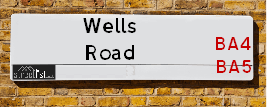
Wells Road is a street located near the town of Shepton Mallet. It uses the postcode BA4 5FF. The street has a length of approximately 1,601 metres.
Wells Road is located within the Mendip District Council's jurisdiction. They provide various services, like refuse collection, and manage council tax collection. It's situated in the South West region of the UK.
Wells Road has been assigned the Unique Street Reference Number of 25003541 and 25002149 in the National Street Gazetteer.
Wells Road is located within the county of Somerset, situated in the South West region of the UK. It's 108.52 miles West from central London., 17.65 miles North from Yeovil, 17.86 miles South West from Trowbridge and 18.02 miles South from Bristol.

Do you know why this road is called Wells Road?
What's it like to live here?
Ask the community a question about Wells Road.
Do you have any questions, memories to share or know any facts about Wells Road? We'd love to know more.
Also on streetlist.co.uk, can you help?
Eldroth Road
15th April 2024
I wondered if anyone has any old pictures of Wenning Bank House in the 1940’s and also Lane Side before of the same era .. we visited today with my Mum in law as she used to live at both these properties. Also any photos of the schools around that time .. thank you.
Can You Help?Napps Way
15th April 2024
Why is the road called Napps Way (belonging to Napp, but minus an
apostrophe as is usual with such nomenclature)? Moreover, who or
what is, or was, “Napp” in the respective, possessive case?
Several years ago, I met an elderly man (probably in his late-eighties)
who lives on Bentham Drive, Liverpool 16, and during a conversation
with him whilst in a Northwest Passenger Transport Ambulance on the
way to the former RLUH (Royal Liverpool University Hospital), he told
me that he could remember (when he was a boy, living in Childwall,
Liverpool 16) that, “Where Napps Way is now, during WW2, there was
a two-man gun emplacement on the, then, open land to protect the
railway line passing over Childwall Valley Road - next to the railway
bridge - when suddenly, as they were loading a live “shell” into the gun’s
breach, the aforementioned “shell” accidentally exploded in the gun’s
breach killing both of the two soldiers, that had been manning the gun,
instantly! (Very sad, of course, but could - perhaps - two ghosts relating
to those two, very unfortunately and prematurely-killed soldiers have
haunted that place of their deaths ever since - and have any residents
of Napps Way - formerly and in its latest incarnation - seen two, WW2
(uniformed) soldiers unexpectedly appear in or near their homes?)
Mauritius Road
15th April 2024
Why is Mauritius Road so called, since when and by whom? Does Greenwich have any particular links with Mauritius? Very interested to know. 🤞🏼
Can You Help?Estate Agents near Wells Road
| Name | Address | Website |
|---|---|---|
| Cooper & Tanner | 32 High Street, Shepton Mallet, BA4 5AS | |
| Charles Barnard | 35 High Street, Shepton Mallet, BA4 5AQ | Visit Website |
| Stonebridge | 33 High Street, Shepton Mallet, BA4 5AQ | Visit Website |
We have found 1 postcode for Wells Road
Location Details
| Wells Road | |
|---|---|

| |
| Latitude | 51.193295 |
| Longitude | -2.567242 |
| OS Easting (X): | 360366 |
| OS Northing (Y): | 143996 |
| OS Grid Reference: | ST604440 |
Ordnance Survey Maps for Wells Road
If you purchase a map through the links below, we may earn an affiliate commission.
| Map Series | link | Ordnance Survey |
| Explorer 1:25,000 142 Shepton Mallet and Mendip Hills East | Check Price on Amazon | Buy Direct from the Ordnance Survey |
| Landranger 1:50,000 183 Yeovil & Frome | Check Price on Amazon | Buy Direct from the Ordnance Survey |
Neighbourhood Policing |
| Police Force: Avon And Somerset |
 View Neighbourhood Crime and Policing View Neighbourhood Crime and Policing |
| Find a Local Neighbourhood Watch Scheme |
Frequently asked Questions for Wells Road
What Council (Local Authority) is Wells Road in?
Wells Road is located within the local authority area of Mendip Council which is a District Council.
What Parish Council is Wells Road in?
Wells Road is located within the area of Shepton Mallet Parish Council.
What Electoral Ward is Wells Road in?
Wells Road is located within the ward of Shepton West.
What County is Wells Road in?
Wells Road is located within the ceremonial county of Somerset.
What Constituency is Wells Road in?
Wells Road is located within the constituency of Wells.
What Part of the UK is Wells Road in?
Wells Road is located within the South West (England) region of the United Kingdom.
What County Council area is Wells Road in?
Wells Road is located within the Somerset Council area.
What Police Force area is Wells Road in?
Wells Road is located within the Avon and Somerset Police area.
Roads that have a Junction with Wells Road
| Street | Junction Type |
|---|---|
| Shepton Road (A371) | pseudo node |
| Back Lane | junction |
| St Peters Road | junction |
| Pike Hill (A371) | junction |
Sunset and Sunrise times for Wells Road , BA4 5FF
| Sunrise | 05:53 |
|---|---|
| Sunset | 20:23 |
Latest Weather Conditions for Wells Road, BA4 5FF
| Observed at Weather Station: | Yeovilton 24 April 2024 at 18:00 (13.32 miles away) |
|---|---|
| Current Weather: | Partly cloudy (day) |
| Temperature and Humidity: | 11.4°C (48.1%) |
| Wind Direction and Speed: | NNW (7 mph) |
Population Statistics
| ONS Area Code | E00148036 |
|---|---|
| ONS Area Name | Rural Life |
| Average Age | 39.69 |
| Area Population | 1664.00 |
| Male Population | 822.00 (49%) |
| Female Population | 842.00 (51%) |
| Benefit Claimants | 6 (0%) |
| LSOA Code: | E01029065 |
|---|---|
| LSOA Name: | Mendip 009C |
| SOA Code: | 8c |
| SOA Name: | |
| MSOA Code: | E02006055 |
| MSOA Name: | Mendip 009 |
Nearest Supermarkets
| Tesco Shepton Mallet Superstore |
|---|
| Townsend Shopping Park, Townsend, Shepton Mallet, BA4 5EG |
| 0345 671 9389 |
| Distance: 0.87 Miles |
| Directions from Wells Road to Tesco Shepton Mallet Superstore |
| Morrisons Wells |
|---|
| Parkwood Estate (off East Somerset Way), Wells BA5 1SQ |
| 01749 679174 |
| Distance: 3.59 Miles |
| Directions from Wells Road to Morrisons Wells |
| Tesco Wells Superstore |
|---|
| Tucker St, Wells, BA5 2DZ |
| 0345 677 9710 |
| Distance: 3.78 Miles |
| Directions from Wells Road to Tesco Wells Superstore |
| Waitrose Wells |
|---|
| Whiting Way, Wells, BA5 2PJ |
| 01749 672570 |
| Distance: 3.85 Miles |
| Directions from Wells Road to Waitrose Wells |
Telephone Information
| Area Code |
|---|
| Area Code: 01749 - Shepton Mallet |
| Area Code: 01458 - Glastonbury |
| Area Code: 01761 - Temple Cloud |
Local Government
| Local Council Details |
|---|
| Within the area of Mendip |
| Visit the Council's Website |
| Council Offices, Cannards Grave Road, Shepton Mallet, Somerset &BA4 5BT |
| Send email |
| Telephone Number: 03333 043333 |
| Local Member of Parliament |
|---|
| Within the Westminster Parliamentary Constituency of Wells |
| The Member of Parliament is James Heappey |
| Details for the MP James Heappey on parliament.uk |
| Details for the MP James Heappey on theyworkforyou.com |
| In the 2019 General Election James Heappey won with a majority of 9,991 the result was Con hold. The total electorate was 81,898 |
| Wards, Parish Councils and County Councils |
|---|
| Ward: Shepton West Ward |
| Ceremonial County: Somerset |
Nearest Schools
England Secondary Schools
Whitstone
Address: Whitstone, Charlton Road, Shepton Mallet, Somerset, BA4 5PF
Distance: 1.14 miles
Contact: 01749345555
England Primary Schools
St Paul's Church of England VC Junior School
Address: St Paul's Church of England VC Junior School, Paul Street, Shepton Mallet, Somerset, BA4 5LA
Distance: 0.96 miles
Contact: 01749343250
Shepton Mallet Community Infants' School & Nursery
Address: Shepton Mallet Community Infants' School & Nursery, Waterloo Road, Shepton Mallet, Somerset, BA4 5HE
Distance: 0.90 miles
Contact: 01749342322
Bowlish Infant School
Address: Bowlish Infant School, Bowlish, Shepton Mallet, Somerset, BA4 5JQ
Distance: 0.35 miles
Contact: 01749342514
Croscombe Church of England Primary School
Address: Croscombe Church of England Primary School, Long Street, Croscombe, Wells, Somerset, BA5 3QL
Distance: 0.77 miles
Contact: 01749343114
Nearest Hospitals
| Name | Address | Postcode | Distance | Map |
|---|
Nearest Dentists
Dentists near Wells Road
| Name | Address | Postcode | Distance | Map |
|---|
Nearest GP Surgeries
Doctors near Wells Road
GROVE HOUSE SURGERY
Address: WEST SHEPTON, SHEPTON MALLET, SOMERSET, BA4 5UH
Distance: 0.58 miles
Contact: tel: 01749 342314
HASKINS - COVID LOCAL VACCINATION SERVICE 2
Address: HASKINS RETAIL CENTRE, TOWNSEND, SHEPTON MALLET, BA4 5AX
Distance: 0.90 miles
Contact: :
PARK MEDICAL PRACTICE
Address: CANNARDS GRAVE ROAD, SHEPTON MALLET, SOMERSET, BA4 5RT
Distance: 1.02 miles
Contact: tel: 01749 334383
OAKHILL SURGERY
Address: PONDSMEAD, SHEPTON ROAD, OAKHILL, RADSTOCK, AVON, BA3 5HT
Distance: 2.79 miles
Contact: tel: 01749 840233
WELLS HEALTH CENTRE
Address: PRIORY HEALTH PARK, GLASTONBURY ROAD, WELLS, SOMERSET, BA5 1XJ
Distance: 3.88 miles
Contact: tel: 01749 672137
WELLS CITY PRACTICE
Address: PRIORY MEDICAL CENTRE, PRIORY HEALTH PARK, GLASTONBURY ROAD, WELLS, SOMERSET, BA5 1XJ
Distance: 3.88 miles
Contact: tel: 01749 836650
Nearest Dispensing Chemists
Pharmacies near Wells Road
| Name | Address | Postcode | Telephone | Map | Distance in Km |
|---|
Nearest Opticians
Opticians near Wells Road
VISION EXPRESS (WELLS)
Address: 43 HIGH STREET, WELLS, SOMERSET, BA5 2AE
Distance: 3.62 miles
Contact: :
SPECSAVERS (WELLS)
Address: 60A HIGH STREET, WELLS, SOMERSET, BA5 2SN
Distance: 3.65 miles
Contact: :
MANSFIELD OPTICAL LTD
Address: 65 HIGH STREET, WELLS, BA5 2AG
Distance: 3.66 miles
Contact: :
R.MANSFIELD OPTICIANS - WELLS
Address: 65 HIGH STREET, WELLS, SOMERSET, BA5 2AG
Distance: 3.66 miles
Contact: :
MILLICANS EYE CENTRE
Address: 75 HIGH STREET, WELLS, SOMERSET, BA5 2AQ
Distance: 3.69 miles
Contact: :
BOOTS OPTICIANS (WELLS)
Address: 66 HIGH STREET, WELLS, SOMERSET, BA5 2AJ
Distance: 3.70 miles
Contact: :
Transport
Nearest Rail Stations
Castle Cary Station is 6.74 miles away.
Address: Castle Cary station, Station Wharf, Castle Cary, Somerset, BA7 7PE
Castle Cary is situated on the Reading to Taunton Line|Heart of Wessex Line and is managed by Great Western Railway.
Castle Cary Station is staffed on a part time basis.
Bruton Station is 7.68 miles away.
Address: Bruton station, Station Approach Road, Bruton, Somerset, BA10 0EH
Bruton is situated on the Reading to Taunton Line|Heart of Wessex Line and is managed by Great Western Railway.
Bruton Station is an unstaffed station.