Map of Victoria Buildings
| Postcodes | ||
|---|---|---|
| Icon | Postcodes for Victoria Buildings | |
| Walking Distances | ||
| Distance Info | Green Circle = 10 Minutes Walk (800 metres) | |
About Victoria Buildings
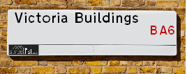
Victoria Buildings is a street located in the town of Glastonbury. It uses the postcode BA6 8BU. The street has a length of approximately 86 metres.
Victoria Buildings is located within the Mendip District Council's jurisdiction. They provide various services, like refuse collection, and manage council tax collection. It's situated in the South West region of the UK.
Victoria Buildings has been assigned the Unique Street Reference Number of 25001389 in the National Street Gazetteer.
Victoria Buildings is located within the county of Somerset, situated in the South West region of the UK. It's 115.43 miles West from central London., 14.73 miles North from Yeovil, 19.22 miles North East from Taunton and 21.77 miles South from Bristol.

Do you know why this road is called Victoria Buildings?
What's it like to live here?
Ask the community a question about Victoria Buildings.
Do you have any questions, memories to share or know any facts about Victoria Buildings? We'd love to know more.
Also on streetlist.co.uk, can you help?
Eldroth Road
15th April 2024
I wondered if anyone has any old pictures of Wenning Bank House in the 1940’s and also Lane Side before of the same era .. we visited today with my Mum in law as she used to live at both these properties. Also any photos of the schools around that time .. thank you.
Can You Help?Napps Way
15th April 2024
Why is the road called Napps Way (belonging to Napp, but minus an
apostrophe as is usual with such nomenclature)? Moreover, who or
what is, or was, “Napp” in the respective, possessive case?
Several years ago, I met an elderly man (probably in his late-eighties)
who lives on Bentham Drive, Liverpool 16, and during a conversation
with him whilst in a Northwest Passenger Transport Ambulance on the
way to the former RLUH (Royal Liverpool University Hospital), he told
me that he could remember (when he was a boy, living in Childwall,
Liverpool 16) that, “Where Napps Way is now, during WW2, there was
a two-man gun emplacement on the, then, open land to protect the
railway line passing over Childwall Valley Road - next to the railway
bridge - when suddenly, as they were loading a live “shell” into the gun’s
breach, the aforementioned “shell” accidentally exploded in the gun’s
breach killing both of the two soldiers, that had been manning the gun,
instantly! (Very sad, of course, but could - perhaps - two ghosts relating
to those two, very unfortunately and prematurely-killed soldiers have
haunted that place of their deaths ever since - and have any residents
of Napps Way - formerly and in its latest incarnation - seen two, WW2
(uniformed) soldiers unexpectedly appear in or near their homes?)
Mauritius Road
15th April 2024
Why is Mauritius Road so called, since when and by whom? Does Greenwich have any particular links with Mauritius? Very interested to know. 🤞🏼
Can You Help?Estate Agents near Victoria Buildings
| Name | Address | Website |
|---|---|---|
| Heritage Estates | 80 High Street, Glastonbury,,BA6 9DZ | Visit Website |
| Cooper & Tanner | 41 High Street, Glastonbury, BA6 9DS | |
| holland & odam | 30 High Street, Glastonbury, BA6 9DX | Visit Website |
We have found 1 postcode for Victoria Buildings
Location Details
| Victoria Buildings | |
|---|---|

| |
| Latitude | 51.147624 |
| Longitude | -2.714003 |
| OS Easting (X): | 350062 |
| OS Northing (Y): | 139007 |
| OS Grid Reference: | ST501390 |
Ordnance Survey Maps for Victoria Buildings
If you purchase a map through the links below, we may earn an affiliate commission.
| Map Series | link | Ordnance Survey |
| Explorer 1:25,000 141 Cheddar Gorge and Mendip Hills West | Check Price on Amazon | Buy Direct from the Ordnance Survey |
| Landranger 1:50,000 182 Weston-super-Mare & Bridgwater | Check Price on Amazon | |
| Landranger 1:50,000 183 Yeovil & Frome | Check Price on Amazon | Buy Direct from the Ordnance Survey |
Neighbourhood Policing |
| Police Force: Avon And Somerset |
 View Neighbourhood Crime and Policing View Neighbourhood Crime and Policing |
| Find a Local Neighbourhood Watch Scheme |
Frequently asked Questions for Victoria Buildings
What Council (Local Authority) is Victoria Buildings in?
Victoria Buildings is located within the local authority area of Mendip Council which is a District Council.
What Parish Council is Victoria Buildings in?
Victoria Buildings is located within the area of Glastonbury Parish Council.
What Electoral Ward is Victoria Buildings in?
Victoria Buildings is located within the ward of Glastonbury St Benedict's.
What County is Victoria Buildings in?
Victoria Buildings is located within the ceremonial county of Somerset.
What Constituency is Victoria Buildings in?
Victoria Buildings is located within the constituency of Wells.
What Part of the UK is Victoria Buildings in?
Victoria Buildings is located within the South West (England) region of the United Kingdom.
What County Council area is Victoria Buildings in?
Victoria Buildings is located within the Somerset Council area.
What Police Force area is Victoria Buildings in?
Victoria Buildings is located within the Avon and Somerset Police area.
Roads that have a Junction with Victoria Buildings
| Street | Junction Type |
|---|---|
| High Street | junction |
| Silver Street | junction |
Sunset and Sunrise times for Victoria Buildings , BA6 8BU
| Sunrise | 05:52 |
|---|---|
| Sunset | 20:25 |
Population Statistics
| ONS Area Code | E00147924 |
|---|---|
| ONS Area Name | Hampered Aspiration |
| Average Age | 44.72 |
| Area Population | 1411.00 |
| Male Population | 692.00 (49%) |
| Female Population | 719.00 (51%) |
| Benefit Claimants | 28 (2%) |
| LSOA Code: | E01029046 |
|---|---|
| LSOA Name: | Mendip 011A |
| SOA Code: | 4b |
| SOA Name: | |
| MSOA Code: | E02006057 |
| MSOA Name: | Mendip 011 |
Nearest Supermarkets
| Morrisons Glastonbury |
|---|
| Street Road, Glastonbury BA6 9ED |
| 01458 831087 |
| Distance: 0.29 Miles |
| Directions from Victoria Buildings to Morrisons Glastonbury |
| Tesco Glastonbury Superstore |
|---|
| Wirral Park Rd, Glastonbury, BA6 9XE |
| 0345 671 9553 |
| Distance: 0.81 Miles |
| Directions from Victoria Buildings to Tesco Glastonbury Superstore |
| Sainsburys Street |
|---|
| Gravenchon Way, Street, England, BA16 0HS |
| 01458 446252 |
| Distance: 2.27 Miles |
| Directions from Victoria Buildings to Sainsburys Street |
| Iceland Street Food Warehouse |
|---|
| UNIT 3, STREET RETAIL PK., GRAVENCHON WAY, STREET, SOMERSET, BA16 0HS |
| 01458446283 |
| Distance: 2.32 Miles |
| Directions from Victoria Buildings to Iceland Street Food Warehouse |
Telephone Information
| Area Code |
|---|
| Area Code: 01458 - Glastonbury |
| Area Code: 01749 - Shepton Mallet |
Broadband Information
| Speed | Average Speed | Median Speed | Maximum Speed | Next-generation access (NGA) | Number of Connections |
|---|---|---|---|---|---|
| Greater than 2 Mbps | 16.2 | 18 | 22.7 | N | 8 |
Local Government
| Local Council Details |
|---|
| Within the area of Mendip |
| Visit the Council's Website |
| Council Offices, Cannards Grave Road, Shepton Mallet, Somerset &BA4 5BT |
| Send email |
| Telephone Number: 03333 043333 |
| Local Member of Parliament |
|---|
| Within the Westminster Parliamentary Constituency of Wells |
| The Member of Parliament is James Heappey |
| Details for the MP James Heappey on parliament.uk |
| Details for the MP James Heappey on theyworkforyou.com |
| In the 2019 General Election James Heappey won with a majority of 9,991 the result was Con hold. The total electorate was 81,898 |
| Wards, Parish Councils and County Councils |
|---|
| Ward: Glastonbury St Benedict's Ward |
| Ceremonial County: Somerset |
Nearest Schools
England Secondary Schools
St Dunstan's School
Address: St Dunstan's School, Wells Road, Glastonbury, Somerset, BA6 9BY
Distance: 0.33 miles
Contact: 01458832943
England Primary Schools
St John's Church of England Voluntary Controlled Infants School
Address: St John's Church of England Voluntary Controlled Infants School, High Street, Glastonbury, Somerset, BA6 9DR
Distance: 0.07 miles
Contact: 01458832085
St Benedict's Church of England Voluntary Aided Junior School
Address: St Benedict's Church of England Voluntary Aided Junior School, Benedict Street, Glastonbury, Somerset, BA6 9EX
Distance: 0.23 miles
Contact: 01458831811
Nearest Hospitals
| Name | Address | Postcode | Distance | Map |
|---|
Nearest Dentists
Dentists near Victoria Buildings
| Name | Address | Postcode | Distance | Map |
|---|
Nearest GP Surgeries
Doctors near Victoria Buildings
GLASTONBURY HEALTH CENTRE - COVID LOCAL VACCINATION SERVICE
Address: GLASTONBURY HEALTH CENTRE, 1 WELLS ROAD, GLASTONBURY, BA6 9DD
Distance: 0.09 miles
Contact: :
GLASTONBURY HEALTH CENTRE
Address: GLASTONBURY HEALTH & DENTAL CLINIC, 1 WELLS ROAD, GLASTONBURY, SOMERSET, BA6 9DD
Distance: 0.09 miles
Contact: tel: 01458 834100
GLASTONBURY SURGERY
Address: FEVERSHAM LANE, GLASTONBURY, SOMERSET, BA6 9LP
Distance: 0.35 miles
Contact: tel: 01458 833666
MILLFIELD PREP SCHOOL
Address: EDGARLEY HALL, GLASTONBURY, SOMERSET, BA6 8LD
Distance: 1.23 miles
Contact: :
VINE SURGERY PARTNERSHIP
Address: VINE SURGERY, HINDHAYES LANE, STREET, SOMERSET, BA16 0ET
Distance: 1.81 miles
Contact: tel: 01458 841122
MILLFIELD SENIOR SCHOOL
Address: BUTLEIGH ROAD, STREET, SOMERSET, BA16 0YD
Distance: 1.81 miles
Contact: :
Nearest Dispensing Chemists
Pharmacies near Victoria Buildings
| Name | Address | Postcode | Telephone | Map | Distance in Km |
|---|
Nearest Opticians
Opticians near Victoria Buildings
SPECSAVERS (STREET)
Address: 93 HIGH STREET, STREET, SOMERSET, BA16 0EZ
Distance: 1.87 miles
Contact: :
EYETECH (STREET) LTD
Address: 100 HIGH STREET, STREET, BA16 0EW
Distance: 1.90 miles
Contact: :
EYE-TECH OPTICIANS
Address: 100 HIGH STREET, STREET, SOMERSET, BA16 0EW
Distance: 1.90 miles
Contact: :
BOOTS OPTICIANS (STREET)
Address: 141A HIGH STREET, STREET, SOMERSET, BA16 0EX
Distance: 1.98 miles
Contact: :
MILLICANS EYE CENTRE
Address: 75 HIGH STREET, WELLS, SOMERSET, BA5 2AQ
Distance: 5.02 miles
Contact: :
BOOTS OPTICIANS (WELLS)
Address: 66 HIGH STREET, WELLS, SOMERSET, BA5 2AJ
Distance: 5.03 miles
Contact: :
Transport
Nearest Rail Stations
Castle Cary Station is 8.93 miles away.
Address: Castle Cary station, Station Wharf, Castle Cary, Somerset, BA7 7PE
Castle Cary is situated on the Reading to Taunton Line|Heart of Wessex Line and is managed by Great Western Railway.
Castle Cary Station is staffed on a part time basis.
Directions from Victoria Buildings to Castle Cary Rail Station
Bruton Station is 11.84 miles away.
Address: Bruton station, Station Approach Road, Bruton, Somerset, BA10 0EH
Bruton is situated on the Reading to Taunton Line|Heart of Wessex Line and is managed by Great Western Railway.
Bruton Station is an unstaffed station.