Map of Blackburn Road
| Postcodes | ||
|---|---|---|
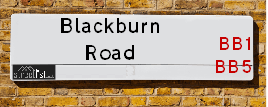
| Icon | Postcodes for Blackburn Road | |
| Walking Distances | ||
| Distance Info | Green Circle = 10 Minutes Walk (800 metres) | |
About Blackburn Road
Blackburn Road is a street located near the town of Blackburn and in the town of Rishton and near the town of Rishton. The street has a length of approximately 2,117 metres.
Blackburn Road is located within the Hyndburn District (B) Council's jurisdiction. They provide various services, like refuse collection, and manage council tax collection. It's situated in the North West region of the UK.
Blackburn Road has been assigned the Unique Street Reference Number of 17900034 in the National Street Gazetteer.
Blackburn Road is located within the county of Lancashire, situated in the North West region of the UK. It's 184.37 miles North West from central London., 21.03 miles North from Manchester, 24.72 miles South East from Lancaster and 33.56 miles North East from Liverpool.

Do you know why this road is called Blackburn Road?
What's it like to live here?
Ask the community a question about Blackburn Road.
Do you have any questions, memories to share or know any facts about Blackburn Road? We'd love to know more.
Also on streetlist.co.uk, can you help?
Eldroth Road
15th April 2024
I wondered if anyone has any old pictures of Wenning Bank House in the 1940’s and also Lane Side before of the same era .. we visited today with my Mum in law as she used to live at both these properties. Also any photos of the schools around that time .. thank you.
Can You Help?Napps Way
15th April 2024
Why is the road called Napps Way (belonging to Napp, but minus an
apostrophe as is usual with such nomenclature)? Moreover, who or
what is, or was, “Napp” in the respective, possessive case?
Several years ago, I met an elderly man (probably in his late-eighties)
who lives on Bentham Drive, Liverpool 16, and during a conversation
with him whilst in a Northwest Passenger Transport Ambulance on the
way to the former RLUH (Royal Liverpool University Hospital), he told
me that he could remember (when he was a boy, living in Childwall,
Liverpool 16) that, “Where Napps Way is now, during WW2, there was
a two-man gun emplacement on the, then, open land to protect the
railway line passing over Childwall Valley Road - next to the railway
bridge - when suddenly, as they were loading a live “shell” into the gun’s
breach, the aforementioned “shell” accidentally exploded in the gun’s
breach killing both of the two soldiers, that had been manning the gun,
instantly! (Very sad, of course, but could - perhaps - two ghosts relating
to those two, very unfortunately and prematurely-killed soldiers have
haunted that place of their deaths ever since - and have any residents
of Napps Way - formerly and in its latest incarnation - seen two, WW2
(uniformed) soldiers unexpectedly appear in or near their homes?)
Mauritius Road
15th April 2024
Why is Mauritius Road so called, since when and by whom? Does Greenwich have any particular links with Mauritius? Very interested to know. 🤞🏼
Can You Help?Estate Agents near Blackburn Road
| Name | Address | Website |
|---|---|---|
| Discover Property Management | 67-69 High Street, Rishton, Lancashire, BB1 4LD | |
| Onward Living | Spring Street, Rishton, BB1 4LP | Visit Website |
| Lea, Hough & Co | Oakshaw House, 2 Capricorn Park, Blakewater Road, Blackburn, BB1 5QR | Visit Website |
We have found 7 postcodes for Blackburn Road
Location Details
| Blackburn Road | |
|---|---|

| |
| Latitude | 53.762309 |
| Longitude | -2.431521 |
| OS Easting (X): | 371555 |
| OS Northing (Y): | 429661 |
| OS Grid Reference: | SD716297 |
Neighbourhood Policing |
| Police Force: Lancashire |
 View Neighbourhood Crime and Policing View Neighbourhood Crime and Policing |
| Find a Local Neighbourhood Watch Scheme |
Frequently asked Questions for Blackburn Road
What Council (Local Authority) is Blackburn Road in?
Blackburn Road is located within the local authority area of Hyndburn Council which is a District Council.
What Parish Council is Blackburn Road in?
Blackburn Road is in an unparished area.
What Electoral Ward is Blackburn Road in?
Blackburn Road is located within the ward of Rishton.
What County is Blackburn Road in?
Blackburn Road is located within the ceremonial county of Lancashire.
What Constituency is Blackburn Road in?
Blackburn Road is located within the constituency of Hyndburn.
What Part of the UK is Blackburn Road in?
Blackburn Road is located within the North West (England) region of the United Kingdom.
What County Council area is Blackburn Road in?
Blackburn Road is located within the Lancashire Council area.
What Police Force area is Blackburn Road in?
Blackburn Road is located within the Lancashire Police area.
Roads that have a Junction with Blackburn Road
| Street | Junction Type |
|---|---|
| High Street (A678) | pseudo node |
| Station Road | junction |
| Highfield Road | junction |
| Westwood Avenue | junction |
| Devonshire Road | junction |
| St Albans Road | junction |
| Somerset Road | junction |
| Churchill Avenue | junction |
| Churchill Avenue | junction |
| Sussex Road | junction |
| Cut Lane | junction |
| Cowhill Lane | junction |
| Sidebeet Lane | junction |
Sunset and Sunrise times for Blackburn Road
| Sunrise | 05:45 |
|---|---|
| Sunset | 20:30 |
Latest Weather Conditions for Blackburn Road
| Observed at Weather Station: | Stonyhurst 24 April 2024 at 09:00 (6.23 miles away) |
|---|---|
| Current Weather: | Clear night |
| Temperature and Humidity: | 7.7°C (54.1%) |
| Wind Direction and Speed: | (0 mph) |
Population Statistics
| ONS Area Code | E00127262, E00127259, E00127240 & E00127242 |
|---|---|
| ONS Area Name | Established Farming Communities, Semi-Detached Ageing, White Suburban Communities & White Professionals |
| Average Age | 45.19 & 43.39 |
| Area Population | 1412.00 & 1289.00 |
| Male Population | 696.00 & 639.00 (49%) |
| Female Population | 716.00 & 650.00 (51%) |
| Benefit Claimants | 7 & 12 (1%) |
| LSOA Code: | E01025074 &E01025073 |
|---|---|
| LSOA Name: | Hyndburn 003E &Hyndburn 003D |
| SOA Code: | 8b &5b |
| SOA Name: | |
| MSOA Code: | E02005214 |
| MSOA Name: | Hyndburn 003 |
Nearest Supermarkets
| Iceland Hyndburn Food Warehouse |
|---|
| UNIT 6B THE PEEL CENTRE, HYNDBURN, , BB1 3HT |
| 01254699554 |
| Distance: 0.63 Miles |
| Directions from Blackburn Road to Iceland Hyndburn Food Warehouse |
| Tesco Blackburn Superstore |
|---|
| Hill St, Blackburn, BB1 3HF |
| 0345 677 9059 |
| Distance: 1.37 Miles |
| Directions from Blackburn Road to Tesco Blackburn Superstore |
| Tesco Oswaldtwistle Mill Express |
|---|
| Mill Ln, Oswaldtwistle, Accrington, BB5 3JB |
| 0345 675 7082 |
| Distance: 1.93 Miles |
| Directions from Blackburn Road to Tesco Oswaldtwistle Mill Express |
| Tesco Blackburn Roe Lee Express |
|---|
| 3 Roe Lee Retail Centre, Whalley New Rd, Blackburn, BB1 9AX |
| 0345 675 7088 |
| Distance: 1.96 Miles |
| Directions from Blackburn Road to Tesco Blackburn Roe Lee Express |
Telephone Information
| Area Code |
|---|
| Area Code: 01254 - Blackburn |
| Area Code: 01282 - Burnley |
| Area Code: 01200 - Clitheroe |
Broadband Information
| Speed | Average Speed | Median Speed | Maximum Speed | Next-generation access (NGA) | Number of Connections |
|---|---|---|---|---|---|
| Greater than 2 Mbps | 4.7 | 4.3 | 6.2 | Y | 4 |
Local Government
| Local Council Details |
|---|
| Within the area of Hyndburn |
| Visit the Council's Website |
| Scaitcliffe House, Ormerod Street, Accrington, Lancashire &BB5 0PF |
| Send email |
| Telephone Number: 01254 388 111 |
| Local Member of Parliament |
|---|
| Within the Westminster Parliamentary Constituency of Hyndburn |
| The Member of Parliament is Sara Britcliffe |
| Details for the MP Sara Britcliffe on parliament.uk |
| Details for the MP Sara Britcliffe on theyworkforyou.com |
| In the 2019 General Election Sara Britcliffe won with a majority of 2,951 the result was Con gain from Lab. The total electorate was 70,842 |
| Wards, Parish Councils and County Councils |
|---|
| Ward: Rishton Ward |
| Ceremonial County: Lancashire |
Nearest Schools
England Primary Schools
St Wulstan's Catholic Primary School, Great Harwood
Address: St Wulstan's Catholic Primary School, Great Harwood, Rushton Street, Great Harwood, Lancashire, BB6 7JQ
Distance: 1.67 miles
Contact: 01254884533
Great Harwood Primary School
Address: Great Harwood Primary School, Rushton Street, Great Harwood, Blackburn, Lancashire, BB6 7JQ
Distance: 1.67 miles
Contact: 01254880810
Great Harwood St John's Church of England Primary School
Address: Great Harwood St John's Church of England Primary School, St John's Street, Great Harwood, Blackburn, Lancashire, BB6 7ES
Distance: 1.70 miles
Contact: 01254885926
Rishton Methodist Primary School
Address: Rishton Methodist Primary School, George Street, Rishton, Blackburn, Lancashire, BB1 4JF
Distance: 0.81 miles
Contact: 01254887223
St Charles' RC School
Address: St Charles' RC School, Knowles Street, Rishton, Blackburn, Lancashire, BB1 4HT
Distance: 0.63 miles
Contact: 01254886110
Rishton St Peter and St Paul's Church of England Primary School
Address: Rishton St Peter and St Paul's Church of England Primary School, Arundel Street, Rishton, Blackburn, Lancashire, BB1 4DT
Distance: 0.69 miles
Contact: 01254884522
Knuzden St Oswald's CofE Voluntary Aided Primary School
Address: Knuzden St Oswald's CofE Voluntary Aided Primary School, Mount St James, Stanhill Road, Knuzden, Blackburn, Lancashire, BB1 2DR
Distance: 1.22 miles
Contact:
St Antony's RC Primary School
Address: St Antony's RC Primary School, Shadsworth Road, Blackburn, Lancashire, BB1 2HP
Distance: 1.53 miles
Contact: 0125454686
Intack Primary School
Address: Intack Primary School, Whitebirk Road, Blackburn, Lancashire, BB1 3HY
Distance: 0.93 miles
Contact: 0125452815
Shadsworth Infant School
Address: Shadsworth Infant School, Rothesay Road, Blackburn, Lancashire, BB1 2EL
Distance: 1.36 miles
Contact: 01254698002
Blackburn St Thomas' Church of England Primary School
Address: Blackburn St Thomas' Church of England Primary School, Newton Street, Blackburn, Lancashire, BB1 1NE
Distance: 1.65 miles
Contact: 0125454706
Daisyfield Primary School
Address: Daisyfield Primary School, Clinton Street, Blackburn, Lancashire, BB1 5LB
Distance: 1.45 miles
Contact: 0125452108
St Stephen's Church of England Primary School
Address: St Stephen's Church of England Primary School, Robinson Street, Blackburn, Lancashire, BB1 5PE
Distance: 1.36 miles
Contact: 01254277350
Roe Lee Park Primary School
Address: Roe Lee Park Primary School, Emerald Avenue, Blackburn, Lancashire, BB1 9RP
Distance: 1.81 miles
Contact: 0125456297
England Secondary Schools
The Hyndburn Academy
Address: The Hyndburn Academy, Stourton Street, Rishton, Blackburn, Lancashire, BB1 4ED
Distance: 0.80 miles
Contact: 01254885378
Norden High School & Sports College
Address: Norden High School & Sports College, Stourton Street, Rishton, Blackburn, Lancashire, BB1 4ED
Distance: 0.80 miles
Contact:
Our Lady and St John Catholic College
Address: Our Lady and St John Catholic College, North Road, Blackburn, Lancashire, BB1 1PY
Distance: 1.73 miles
Contact: 01254588388
Nearest Hospitals
| Name | Address | Postcode | Distance | Map |
|---|
Nearest Dentists
Dentists near Blackburn Road
| Name | Address | Postcode | Distance | Map |
|---|
Nearest GP Surgeries
Doctors near Blackburn Road
HIGH STREET SURGERY
Address: 87-89 HIGH STREET, RISHTON, BLACKBURN, LANCASHIRE, BB1 4LD
Distance: 0.70 miles
Contact: :
GREAT HARWOOD SURGERY
Address: 32 HIGH STREET, RISHTON, BLACKBURN, BB1 4LA
Distance: 0.82 miles
Contact: tel: 01254 617590
THE WEAVERS PRACTICE
Address: HIGH STREET, RISHTON, BLACKBURN, BB1 4LA
Distance: 0.82 miles
Contact: tel: 01254 884217
GREAT HARWOOD SURGERY
Address: 32 HIGH STREET, RISHTON, BLACKBURN, BB1 4LA
Distance: 0.82 miles
Contact: :
STEPPING STONE PRACTICE
Address: LONGTON CLOSE, BLACKBURN, LANCASHIRE, BB1 1XA
Distance: 1.45 miles
Contact: tel: 01254 617411
LITTLE HARWOOD HEALTH CENTRE
Address: PLANE TREE ROAD, BLACKBURN, LANCASHIRE, BB1 6PH
Distance: 1.48 miles
Contact: tel: 01254 617521
Nearest Dispensing Chemists
Pharmacies near Blackburn Road
| Name | Address | Postcode | Telephone | Map | Distance in Km |
|---|
Nearest Opticians
Opticians near Blackburn Road
UNIVISION EYE CENTRE
Address: 41 HIGH STREET, RISHTON, BLACKBURN, BB1 4JZ
Distance: 0.83 miles
Contact: :
BLACKBURN OPTICAL CENTRE GLENFIELD PARK
Address: GLENFIELD PARK, BLAKEWATER ROAD, BLACKBURN, LANCASHIRE, BB1 5QH
Distance: 1.16 miles
Contact: :
LITTLE HARWOOD EYE CLINIC
Address: 147 WHALLEY OLD ROAD, BLACKBURN, BB1 5NZ
Distance: 1.46 miles
Contact: :
THE EYE SHOP (BLACKBURN)
Address: 216 WHALLEY RANGE, BLACKBURN, LANCASHIRE, BB1 6NN
Distance: 1.71 miles
Contact: :
PAUL NUTTALL OPTOMETRISTS (GREAT HARWOOD)
Address: 49 BLACKBURN ROAD, GREAT HARWOOD, BLACKBURN, LANCASHIRE, BB6 7DF
Distance: 1.80 miles
Contact: :
SPECTACLE FACTORY SHOP (OSWALDTWISTLE)
Address: 348 UNION ROAD, OSWALDTWISTLE, ACCRINGTON, LANCASHIRE, BB5 3JD
Distance: 1.90 miles
Contact: :
Transport
Nearest Rail Stations
Rishton Station is 0.47 miles away.
Address: Rishton station, Station Road, Rishton, Lancashire, BB1 4EY
Rishton is situated on the East Lancashire line and is managed by Northern.
Rishton Station is an unstaffed station.
Church & Oswaldtwistle Station is 1.85 miles away.
Address: Church & Oswaldtwistle station, Market Street, Church, Lancashire, BB5 0DP
Church & Oswaldtwistle is situated on the East Lancashire line and is managed by Northern.
Church & Oswaldtwistle Station is an unstaffed station.
Directions from Blackburn Road to Church & Oswaldtwistle Rail Station