Map of Rendel Street
| Postcodes | ||
|---|---|---|
| Icon | Postcodes for Rendel Street | |
| Walking Distances | ||
| Distance Info | Green Circle = 10 Minutes Walk (800 metres) | |
About Rendel Street
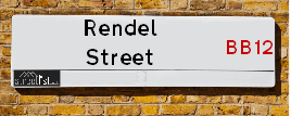
Rendel Street is a street located in the town of Burnley. It uses the postcode BB12 8AQ. The street has a length of approximately 74 metres.
Rendel Street is located within the Burnley District (B) Council's jurisdiction. They provide various services, like refuse collection, and manage council tax collection. It's situated in the North West region of the UK.
Rendel Street has been assigned the Unique Street Reference Number of 5001285 in the National Street Gazetteer.
Rendel Street is located within the county of Lancashire, situated in the North West region of the UK. It's 182.74 miles North West from central London., 21.79 miles North from Manchester, 27.73 miles South East from Lancaster and 29.77 miles West from Leeds.

Do you know why this road is called Rendel Street?
What's it like to live here?
Ask the community a question about Rendel Street.
Do you have any questions, memories to share or know any facts about Rendel Street? We'd love to know more.
Also on streetlist.co.uk, can you help?
Eldroth Road
15th April 2024
I wondered if anyone has any old pictures of Wenning Bank House in the 1940’s and also Lane Side before of the same era .. we visited today with my Mum in law as she used to live at both these properties. Also any photos of the schools around that time .. thank you.
Can You Help?Napps Way
15th April 2024
Why is the road called Napps Way (belonging to Napp, but minus an
apostrophe as is usual with such nomenclature)? Moreover, who or
what is, or was, “Napp” in the respective, possessive case?
Several years ago, I met an elderly man (probably in his late-eighties)
who lives on Bentham Drive, Liverpool 16, and during a conversation
with him whilst in a Northwest Passenger Transport Ambulance on the
way to the former RLUH (Royal Liverpool University Hospital), he told
me that he could remember (when he was a boy, living in Childwall,
Liverpool 16) that, “Where Napps Way is now, during WW2, there was
a two-man gun emplacement on the, then, open land to protect the
railway line passing over Childwall Valley Road - next to the railway
bridge - when suddenly, as they were loading a live “shell” into the gun’s
breach, the aforementioned “shell” accidentally exploded in the gun’s
breach killing both of the two soldiers, that had been manning the gun,
instantly! (Very sad, of course, but could - perhaps - two ghosts relating
to those two, very unfortunately and prematurely-killed soldiers have
haunted that place of their deaths ever since - and have any residents
of Napps Way - formerly and in its latest incarnation - seen two, WW2
(uniformed) soldiers unexpectedly appear in or near their homes?)
Mauritius Road
15th April 2024
Why is Mauritius Road so called, since when and by whom? Does Greenwich have any particular links with Mauritius? Very interested to know. 🤞🏼
Can You Help?Estate Agents near Rendel Street
| Name | Address | Website |
|---|---|---|
| Belvoir | 300 Padiham Road, Burnley, BB12 6ST | Visit Website |
| Petty Commercial | Suite 3, Empire Business Centre, 2 Empire Way, Off Liverpool Road, Burnley ,BB12 6HH | Visit Website |
| E & M Property Solutions | 26 St. Matthew Street, Burnley, BB11 4JJ |
We have found 1 postcode for Rendel Street
Location Details
| Rendel Street | |
|---|---|

| |
| Latitude | 53.794091 |
| Longitude | -2.269866 |
| OS Easting (X): | 382224 |
| OS Northing (Y): | 433144 |
| OS Grid Reference: | SD822331 |
Ordnance Survey Maps for Rendel Street
If you purchase a map through the links below, we may earn an affiliate commission.
| Map Series | link | Ordnance Survey |
| Explorer 1:25,000 ol21 South Pennines | Check Price on Amazon | Buy Direct from the Ordnance Survey |
| Landranger 1:50,000 103 Blackburn & Burnley | Check Price on Amazon | Buy Direct from the Ordnance Survey |
Neighbourhood Policing |
| Police Force: Lancashire |
 View Neighbourhood Crime and Policing View Neighbourhood Crime and Policing |
| Find a Local Neighbourhood Watch Scheme |
Frequently asked Questions for Rendel Street
What Council (Local Authority) is Rendel Street in?
Rendel Street is located within the local authority area of Burnley Council which is a District Council.
What Parish Council is Rendel Street in?
Rendel Street is in an unparished area.
What Electoral Ward is Rendel Street in?
Rendel Street is located within the ward of Gannow.
What County is Rendel Street in?
Rendel Street is located within the ceremonial county of Lancashire.
What Constituency is Rendel Street in?
Rendel Street is located within the constituency of Burnley.
What Part of the UK is Rendel Street in?
Rendel Street is located within the North West (England) region of the United Kingdom.
What County Council area is Rendel Street in?
Rendel Street is located within the Lancashire Council area.
What Police Force area is Rendel Street in?
Rendel Street is located within the Lancashire Police area.
Roads that have a Junction with Rendel Street
| Street | Junction Type |
|---|---|
| Arkwright Street | junction |
| Padiham Road (A671) | junction |
Sunset and Sunrise times for Rendel Street , BB12 8AQ
| Sunrise | 05:42 |
|---|---|
| Sunset | 20:31 |
Latest Weather Conditions for Rendel Street, BB12 8AQ
| Observed at Weather Station: | Stonyhurst 25 April 2024 at 12:00 (8.92 miles away) |
|---|---|
| Current Weather: | Clear night |
| Temperature and Humidity: | 7.1°C (67.5%) |
| Wind Direction and Speed: | (0 mph) |
Population Statistics
| ONS Area Code | E00126277 |
|---|---|
| ONS Area Name | Deprived Blue-Collar Terraces |
| Average Age | 38.44 |
| Area Population | 1425.00 |
| Male Population | 713.00 (50%) |
| Female Population | 712.00 (50%) |
| Benefit Claimants | 45 (3%) |
| LSOA Code: | E01024881 |
|---|---|
| LSOA Name: | Burnley 006A |
| SOA Code: | 5b |
| SOA Name: | |
| MSOA Code: | E02005181 |
| MSOA Name: | Burnley 006 |
Nearest Supermarkets
| Asda Burnley |
|---|
| Princess Way, Burnley, BB12 0EQ |
| 01282 450033 |
| Distance: 1.03 Miles |
| Directions from Rendel Street to Asda Burnley |
| Iceland Burnley |
|---|
| Unit 4 Burnley Retail Pk, Curzon Street, Burnley Lancashire, BB11 1BX |
| 01282435877 |
| Distance: 1.04 Miles |
| Directions from Rendel Street to Iceland Burnley |
| Sainsburys Burnley |
|---|
| Active Way, Burnley, England, BB11 1BS |
| 01282 832033 |
| Distance: 1.14 Miles |
| Directions from Rendel Street to Sainsburys Burnley |
| Iceland Burnley Charter Walk |
|---|
| UNIT 42A THE MALL, CHARTER WALK SHOPPING CTR, BURNLEY, BB11 1AE |
| 01282427577 |
| Distance: 1.21 Miles |
| Directions from Rendel Street to Iceland Burnley Charter Walk |
Telephone Information
| Area Code |
|---|
| Area Code: 01282 - Burnley |
| Area Code: 01200 - Clitheroe |
| Area Code: 01254 - Blackburn |
Broadband Information
| Speed | Average Speed | Median Speed | Maximum Speed | Next-generation access (NGA) | Number of Connections |
|---|---|---|---|---|---|
| Greater than 2 Mbps | >=30 | 20 | >=30 | Y | 7 |
Local Government
| Local Council Details |
|---|
| Within the area of Burnley |
| Visit the Council's Website |
| Town Hall, Burnley, Lancashire &BB11 9SA |
| Send email |
| Telephone Number: 01282 425011 |
| Local Member of Parliament |
|---|
| Within the Westminster Parliamentary Constituency of Burnley |
| The Member of Parliament is Antony Higginbotham |
| Details for the MP Antony Higginbotham on parliament.uk |
| Details for the MP Antony Higginbotham on theyworkforyou.com |
| In the 2019 General Election Antony Higginbotham won with a majority of 1,352 the result was Con gain from Lab. The total electorate was 64,345 |
| Wards, Parish Councils and County Councils |
|---|
| Ward: Gannow Ward |
| Ceremonial County: Lancashire |
Nearest Schools
England Secondary Schools
Blessed Trinity RC College
Address: Blessed Trinity RC College, Ormerod Road, Burnley, Lancashire, BB10 3AA
Distance: 1.58 miles
Contact:
Hameldon Community College
Address: Hameldon Community College, Coal Clough Lane, Burnley, Lancashire, BB11 5BT
Distance: 1.06 miles
Contact:
Burnley High School
Address: Burnley High School, Byron Street, Burnley, Lancashire, BB12 6NX
Distance: 1.04 miles
Contact: 01282681950
Shuttleworth College
Address: Shuttleworth College, Burnley Road, Padiham, Burnley, Lancashire, BB12 8ST
Distance: 1.23 miles
Contact: 01282682300
England Primary Schools
Burnley Springfield Community Primary School
Address: Burnley Springfield Community Primary School, Oxford Road, Burnley, Lancashire, BB11 3HP
Distance: 1.64 miles
Contact: 01282437277
Burnley St Peter's Church of England Primary School
Address: Burnley St Peter's Church of England Primary School, Church Street, Burnley, Lancashire, BB11 2DL
Distance: 1.28 miles
Contact: 01282426873
Rosewood Primary School
Address: Rosewood Primary School, Rosewood Avenue, Rosewood Primary School, Burnley, Lancashire, BB11 2PH
Distance: 1.27 miles
Contact: 01282463790
Christ The King Roman Catholic Primary School, Burnley
Address: Christ The King Roman Catholic Primary School, Burnley, Calderbrook Avenue, Burnley, Lancashire, BB11 4RB
Distance: 1.27 miles
Contact:
Burnley Holy Trinity Church of England Primary School
Address: Burnley Holy Trinity Church of England Primary School, Raglan Road, Burnley, Lancashire, BB11 4LB
Distance: 0.83 miles
Contact: 01282434368
Wellfield Methodist and Anglican Church School
Address: Wellfield Methodist and Anglican Church School, Wellfield Drive, Burnley, Lancashire, BB12 0JD
Distance: 0.35 miles
Contact: 01282436935
St Mary Magdalene's Roman Catholic Primary School, Burnley
Address: St Mary Magdalene's Roman Catholic Primary School, Burnley, Wellfield Drive, Burnley, Lancashire, BB12 0JD
Distance: 0.35 miles
Contact:
Cherry Fold Community Primary School
Address: Cherry Fold Community Primary School, Cog Lane, Burnley, Lancashire, BB11 5JS
Distance: 0.96 miles
Contact: 01282426630
Whittlefield Primary School
Address: Whittlefield Primary School, Tabor Street, Burnley, Lancashire, BB12 0HL
Distance: 0.12 miles
Contact: 01282429419
Burnley Ightenhill Primary School
Address: Burnley Ightenhill Primary School, Alder Street, Burnley, Lancashire, BB12 6ED
Distance: 0.09 miles
Contact: 01282428246
St Augustine of Canterbury Roman Catholic Primary School, Burnley
Address: St Augustine of Canterbury Roman Catholic Primary School, Burnley, Lowerhouse Lane, Burnley, Lancashire, BB12 6HZ
Distance: 0.55 miles
Contact:
Burnley Lowerhouse Junior School
Address: Burnley Lowerhouse Junior School, Liverpool Road, Burnley, Lancashire, BB12 6LN
Distance: 0.70 miles
Contact: 01282426774
Rosegrove Infant School
Address: Rosegrove Infant School, Owen Street, Burnley, Lancashire, BB12 6HW
Distance: 0.61 miles
Contact: 01282424919
Padiham Primary School
Address: Padiham Primary School, Burnley Road, Padiham, Burnley, Lancashire, BB12 8SJ
Distance: 1.45 miles
Contact: 01282772496
Padiham Green Church of England Primary School
Address: Padiham Green Church of England Primary School, St Anne's Street, Padiham, Lancashire, BB12 7AX
Distance: 1.82 miles
Contact: 01282776855
England Higher Schools
Burnley College
Address: Burnley College, Princess Way, Burnley, Lancashire, BB12 0AN
Distance: 0.89 miles
Contact: 01282733373
Nearest Hospitals
| Name | Address | Postcode | Distance | Map |
|---|
Nearest Dentists
Dentists near Rendel Street
| Name | Address | Postcode | Distance | Map |
|---|
Nearest GP Surgeries
Doctors near Rendel Street
IGHTENHILL MEDICAL CENTRE
Address: TABOR STREET, BURNLEY, LANCASHIRE, BB12 0HL
Distance: 0.12 miles
Contact: tel: 01282 424464
ROSEGROVE SURGERY
Address: 225-227 GANNOW LANE, BURNLEY, LANCASHIRE, BB12 6HY
Distance: 0.53 miles
Contact: tel: 01282 731501
FOXCROFT SURGERY
Address: FOXCROFT SURGERY, PENDLE WAY, IGHTENHILL, BURNLEY, LANCASHIRE, BB12 0PY
Distance: 0.55 miles
Contact: tel: 01282 411000
KIDDROW MEDICAL PRACTICE
Address: KIDDROW LANE, BURNLEY, BB12 6LH
Distance: 0.77 miles
Contact: :
MANCHESTER ROAD SURGERY
Address: 187 MANCHESTER ROAD, BURNLEY, LANCASHIRE, BB11 4HP
Distance: 1.02 miles
Contact: :
PARKSIDE SURGERY
Address: PRESTIGE PARK, COLNE ROAD, BURNLEY, LANCASHIRE, BB11 1PS
Distance: 1.17 miles
Contact: tel: 01282 731444
Nearest Dispensing Chemists
Pharmacies near Rendel Street
| Name | Address | Postcode | Telephone | Map | Distance in Km |
|---|
Nearest Opticians
Opticians near Rendel Street
4194 BURNLEY
Address: PRINCESS WAY, BURNLEY, BB12 0EQ
Distance: 0.93 miles
Contact: :
SPECSAVERS (BURNLEY)
Address: UNIT 41, 25 THE MALL, CHARTER WALK SHOPPING CENTRE, BURNLEY, LANCASHIRE, BB11 1BA
Distance: 1.13 miles
Contact: :
J BROWN LTD
Address: 58 ST. JAMES'S STREET, BURNLEY, BB11 1NH
Distance: 1.13 miles
Contact: :
STEPHEN C BYE OPTICIANS
Address: 30 MANCHESTER ROAD, BURNLEY, LANCASHIRE, BB11 1HH
Distance: 1.17 miles
Contact: :
BOOTS OPTICIANS (ST JAMES STREET BURNLEY)
Address: 51 ST. JAMES'S STREET, BURNLEY, LANCASHIRE, BB11 1QL
Distance: 1.22 miles
Contact: :
BURNLEY EXTRA
Address: CENTENARY WAY, FINSLEY GATE, BURNLEY, LANCASHIRE, BB11 2HE
Distance: 1.30 miles
Contact: :
Transport
Nearest Rail Stations
Burnley Barracks Station is 0.52 miles away.
Address: Burnley Barracks station, Junction Street, Burnley Barracks, Lancashire, BB12 0HG
Burnley Barracks is situated on the East Lancashire line|Calder Valley line and is managed by Northern.
Burnley Barracks Station is an unstaffed station.
Directions from Rendel Street to Burnley Barracks Rail Station
Rose Grove Station is 0.72 miles away.
Address: Rose Grove station, Rose Grove Lane, Rose Grove, Lancashire, BB12 6EH
Rose Grove is situated on the East Lancashire line and is managed by Northern.
Rose Grove Station is an unstaffed station.