Map of Whalley Road
| Postcodes | ||
|---|---|---|
| Icon | Postcodes for Whalley Road | |
| Walking Distances | ||
| Distance Info | Green Circle = 10 Minutes Walk (800 metres) | |
About Whalley Road
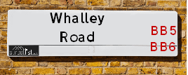
Whalley Road is a street located in the town of Accrington and in the town of Church and in the town of Clayton-le-Moors and in the town of Great Harwood and near the town of Great Harwood. The street has a length of approximately 6,202 metres.
Whalley Road is located within the Hyndburn District (B) Council's jurisdiction. They provide various services, like refuse collection, and manage council tax collection. It's situated in the North West region of the UK.
Whalley Road has been assigned the Unique Street Reference Numbers of 17902937, 17901473, 17901518 and 17955016 in the National Street Gazetteer.
Whalley Road is located within the county of Lancashire, situated in the North West region of the UK. It's 184.02 miles North West from central London., 21.27 miles North from Manchester, 25.34 miles South East from Lancaster and 34.28 miles West from Leeds.

Do you know why this road is called Whalley Road?
What's it like to live here?
Ask the community a question about Whalley Road.
Do you have any questions, memories to share or know any facts about Whalley Road? We'd love to know more.
Also on streetlist.co.uk, can you help?
Eldroth Road
15th April 2024
I wondered if anyone has any old pictures of Wenning Bank House in the 1940’s and also Lane Side before of the same era .. we visited today with my Mum in law as she used to live at both these properties. Also any photos of the schools around that time .. thank you.
Can You Help?Napps Way
15th April 2024
Why is the road called Napps Way (belonging to Napp, but minus an
apostrophe as is usual with such nomenclature)? Moreover, who or
what is, or was, “Napp” in the respective, possessive case?
Several years ago, I met an elderly man (probably in his late-eighties)
who lives on Bentham Drive, Liverpool 16, and during a conversation
with him whilst in a Northwest Passenger Transport Ambulance on the
way to the former RLUH (Royal Liverpool University Hospital), he told
me that he could remember (when he was a boy, living in Childwall,
Liverpool 16) that, “Where Napps Way is now, during WW2, there was
a two-man gun emplacement on the, then, open land to protect the
railway line passing over Childwall Valley Road - next to the railway
bridge - when suddenly, as they were loading a live “shell” into the gun’s
breach, the aforementioned “shell” accidentally exploded in the gun’s
breach killing both of the two soldiers, that had been manning the gun,
instantly! (Very sad, of course, but could - perhaps - two ghosts relating
to those two, very unfortunately and prematurely-killed soldiers have
haunted that place of their deaths ever since - and have any residents
of Napps Way - formerly and in its latest incarnation - seen two, WW2
(uniformed) soldiers unexpectedly appear in or near their homes?)
Mauritius Road
15th April 2024
Why is Mauritius Road so called, since when and by whom? Does Greenwich have any particular links with Mauritius? Very interested to know. 🤞🏼
Can You Help?Estate Agents near Whalley Road
| Name | Address | Website |
|---|---|---|
| H2Homes Lettings And Property Services Ltd | 1-2 Barnes Square, Clayton Le Moors, BB5 5NX | Visit Website |
| Mortimers Chartered Surveyors | 45 Queen Street, Great Harwood, BB6 7QP | Visit Website |
| Onward Living | Spring Street, Rishton, BB1 4LP | Visit Website |
We have found 30 postcodes for Whalley Road
Location Details
| Whalley Road | |
|---|---|

| |
| Latitude | 53.776158 |
| Longitude | -2.379153 |
| OS Easting (X): | 375016 |
| OS Northing (Y): | 431182 |
| OS Grid Reference: | SD750312 |
Ordnance Survey Maps for Whalley Road
If you purchase a map through the links below, we may earn an affiliate commission.
| Map Series | link | Ordnance Survey |
| Explorer 1:25,000 287 West Pennine Moors - Blackburn, Darwen and Accrington | Check Price on Amazon | |
| Landranger 1:50,000 103 Blackburn & Burnley | Check Price on Amazon | Buy Direct from the Ordnance Survey |
Neighbourhood Policing |
| Police Force: Lancashire |
 View Neighbourhood Crime and Policing View Neighbourhood Crime and Policing |
| Find a Local Neighbourhood Watch Scheme |
Frequently asked Questions for Whalley Road
What Council (Local Authority) is Whalley Road in?
Whalley Road is located within the local authority area of Hyndburn Council which is a District Council.
What Parish Council is Whalley Road in?
Whalley Road is located within the area of Altham Parish Council.
What Electoral Ward is Whalley Road in?
Whalley Road is located within the ward of Peel, Barnfield, Milnshaw, Altham, Clayton-le-Moors &Netherton.
What County is Whalley Road in?
Whalley Road is located within the ceremonial county of Lancashire.
What Constituency is Whalley Road in?
Whalley Road is located within the constituency of Hyndburn.
What Part of the UK is Whalley Road in?
Whalley Road is located within the North West (England) region of the United Kingdom.
What County Council area is Whalley Road in?
Whalley Road is located within the Lancashire Council area.
What Police Force area is Whalley Road in?
Whalley Road is located within the Lancashire Police area.
Roads that have a Junction with Whalley Road
Sunset and Sunrise times for Whalley Road
| Sunrise | 05:43 |
|---|---|
| Sunset | 20:31 |
Latest Weather Conditions for Whalley Road
| Observed at Weather Station: | Stonyhurst 25 April 2024 at 14:00 (6.24 miles away) |
|---|---|
| Current Weather: | Clear night |
| Temperature and Humidity: | 9.0°C (56.4%) |
| Wind Direction and Speed: | (0 mph) |
Population Statistics
| ONS Area Code | E00127233, E00127065, E00127226, E00127181, E00127177, E00127171, E00127169, E00127172, E00127183, E00127064, E00127059, E00127054, E00127129, E00127053, E00127139, E00127055, E00127132, E00127050, E00127193 & E00127190 |
|---|---|
| ONS Area Name | Private Renting Young Families, Social Renting New Arrivals, Hampered Aspiration, Deprived Blue-Collar Terraces, Industrious Transitions, White Professionals, Older Workers and Retirement, Renting Hard-Pressed Workers, Ageing Industrious Workers, Semi-Detached Ageing & Older Farming Communities |
| Average Age | 36.86, 38.51, 37.25, 42.63, 46.19, 44.13, 39.43, 42.40, 41.34, 38.70, 44.18 & 50.83 |
| Area Population | 1512.00, 1505.00, 1525.00, 1591.00, 1381.00, 1480.00, 1683.00, 1530.00, 1455.00, 1612.00, 1583.00 & 1449.00 |
| Male Population | 754.00, 804.00, 785.00, 780.00, 625.00, 665.00, 861.00, 742.00, 690.00, 784.00, 792.00 & 681.00 (49%) |
| Female Population | 758.00, 701.00, 740.00, 811.00, 756.00, 815.00, 822.00, 788.00, 765.00, 828.00, 791.00 & 768.00 (51%) |
| Benefit Claimants | 39, 52, 48, 14, 18, 32, 33, 12, 26, 38 & 7 (2%) |
| LSOA Code: | E01025068, E01025036, E01025067, E01025057, E01025058, E01025059, E01025034, E01025050, E01025032, E01025049, E01025048 &E01025061 |
|---|---|
| LSOA Name: | Hyndburn 004G, Hyndburn 008B, Hyndburn 004F, Hyndburn 004C, Hyndburn 004D, Hyndburn 004E, Hyndburn 002C, Hyndburn 002F, Hyndburn 002A, Hyndburn 002E, Hyndburn 002D &Hyndburn 001B |
| SOA Code: | 4b, 5b, 5a, 8c &5c |
| SOA Name: | |
| MSOA Code: | E02005215, E02005219, E02005213 &E02005212 |
| MSOA Name: | Hyndburn 004, Hyndburn 008, Hyndburn 002 &Hyndburn 001 |
Nearest Supermarkets
| Tesco Great Harwood Superstore |
|---|
| Queen St, Great Harwood, BB6 7AT |
| 0345 671 9430 |
| Distance: 1.12 Miles |
| Directions from Whalley Road to Tesco Great Harwood Superstore |
| Morrisons Great Harwood |
|---|
| Queen Street, Great Harwood, Blackburn BB6 7AL |
| 01254 886274 |
| Distance: 1.2 Miles |
| Directions from Whalley Road to Morrisons Great Harwood |
| Asda Accrington |
|---|
| Hyndburn Road, Accrington, BB5 1PY |
| 01254 301111 |
| Distance: 1.39 Miles |
| Directions from Whalley Road to Asda Accrington |
| Iceland Accrington |
|---|
| Unit 28 Arndale Centre, Accrington, Lancashire, BB5 1EX |
| 01254398417 |
| Distance: 1.61 Miles |
| Directions from Whalley Road to Iceland Accrington |
Telephone Information
| Area Code |
|---|
| Area Code: 01254 - Blackburn |
| Area Code: 01282 - Burnley |
| Area Code: 01200 - Clitheroe |
Broadband Information
| Speed | Average Speed | Median Speed | Maximum Speed | Next-generation access (NGA) | Number of Connections |
|---|---|---|---|---|---|
| Less than 2 Mbps | 5 | 4 | 17.4 | N | 12 |
Local Government
| Local Council Details |
|---|
| Within the area of Hyndburn |
| Visit the Council's Website |
| Scaitcliffe House, Ormerod Street, Accrington, Lancashire &BB5 0PF |
| Send email |
| Telephone Number: 01254 388 111 |
| Local Member of Parliament |
|---|
| Within the Westminster Parliamentary Constituency of Hyndburn |
| The Member of Parliament is Sara Britcliffe |
| Details for the MP Sara Britcliffe on parliament.uk |
| Details for the MP Sara Britcliffe on theyworkforyou.com |
| In the 2019 General Election Sara Britcliffe won with a majority of 2,951 the result was Con gain from Lab. The total electorate was 70,842 |
| Wards, Parish Councils and County Councils |
|---|
| Ward: Peel, Barnfield, Milnshaw, Altham, Clayton-le-Moors &Netherton Ward |
| Ceremonial County: Lancashire |
Nearest Schools
England Primary Schools
Altham St James Church of England Primary School
Address: Altham St James Church of England Primary School, Altham St James CE Primary School, Burnley Road, Altham, Accrington, Lancashire, BB5 5UH
Distance: 1.42 miles
Contact: 01282772174
Accrington Peel Park Primary School
Address: Accrington Peel Park Primary School, Alice Street, Accrington, Lancashire, BB5 6QR
Distance: 1.63 miles
Contact: 01254231583
Accrington St John with St Augustine Church of England Primary School
Address: Accrington St John with St Augustine Church of England Primary School, Maudsley Street, Accrington, Lancashire, BB5 6AD
Distance: 1.50 miles
Contact: 01254392717
Accrington St Mary Magdalen's Church of England Primary School
Address: Accrington St Mary Magdalen's Church of England Primary School, Devonshire Street, Accrington, Lancashire, BB5 1DW
Distance: 1.29 miles
Contact: 01254232329
St Mary's Roman Catholic Primary School, Clayton-le-Moors
Address: St Mary's Roman Catholic Primary School, Clayton-le-Moors, Devonshire Drive, Clayton-le-Moors, Accrington, Lancashire, BB5 5RJ
Distance: 0.05 miles
Contact: 01254231277
Clayton-le-Moors All Saints' Church of England Primary School
Address: Clayton-le-Moors All Saints' Church of England Primary School, Church Street, Clayton-le-Moors, Accrington, Lancashire, BB5 5HT
Distance: 0.33 miles
Contact: 01254234562
Clayton-le-Moors All Saints Church of England Primary School
Address: Clayton-le-Moors All Saints Church of England Primary School, Church Street, Clayton-le-Moors, Accrington, Lancashire, BB5 5HT
Distance: 0.33 miles
Contact:
Sacred Heart Roman Catholic Primary School, Church
Address: Sacred Heart Roman Catholic Primary School, Church, Bradshaw Row, Church, Accrington, Lancashire, BB5 4HG
Distance: 1.59 miles
Contact: 01254233382
Clayton-le-Moors Mount Pleasant Primary School
Address: Clayton-le-Moors Mount Pleasant Primary School, Earl Street, Clayton-le-Moors, Accrington, Lancashire, BB5 5NH
Distance: 0.25 miles
Contact: 01254232046
St Nicholas Church of England Primary School
Address: St Nicholas Church of England Primary School, St Nicholas Road, Church, Accrington, Lancashire, BB5 4DN
Distance: 1.19 miles
Contact: 01254381875
Rishton Methodist Primary School
Address: Rishton Methodist Primary School, George Street, Rishton, Blackburn, Lancashire, BB1 4JF
Distance: 1.54 miles
Contact: 01254887223
England Secondary Schools
Accrington Academy
Address: Accrington Academy, Queens Road West, Accrington, Lancashire, BB5 4FF
Distance: 1.06 miles
Contact: 01254304300
Accrington St Christopher's Church of England High School
Address: Accrington St Christopher's Church of England High School, Queen's Road West, Accrington, Lancashire, BB5 4AY
Distance: 1.04 miles
Contact: 01254232992
Nearest Hospitals
| Name | Address | Postcode | Distance | Map |
|---|
Nearest Dentists
Dentists near Whalley Road
| Name | Address | Postcode | Distance | Map |
|---|
Nearest GP Surgeries
Doctors near Whalley Road
THE CLAYTON MEDICAL CTR.
Address: WELLINGTON STREET, CLAYTON LE MOORS, ACCRINGTON, LANCASHIRE, BB5 5HU
Distance: 0.24 miles
Contact: tel: 0844 4771761
PWE ACCRINGTON VICTORIA
Address: ACCRINGTON VICTORIA HOSPITAL, HAYWOOD ROAD, ACCRINGTON, LANCASHIRE, BB5 6AS
Distance: 1.25 miles
Contact: tel: 01254 770480
GREAT HARWOOD HEALTH CENTRE
Address: WATER STREET, GREAT HARWOOD, BLACKBURN, LANCASHIRE, BB6 7QR
Distance: 1.31 miles
Contact: :
THE WEAVERS PRACTICE (GREAT HARWOOD HEALTH CENTRE)
Address: GREAT HARWOOD HEALTH CENTRE, WATER STREET, GREAT HARWOOD, BLACKBURN, LANCASHIRE, BB6 7QR
Distance: 1.31 miles
Contact: :
GREAT HARWOOD MEDICAL GROUP
Address: GREAT HARWOOD HEALTH CENTRE, WATER STREET, GREAT HARWOOD, BLACKBURN, LANCASHIRE, BB6 7QR
Distance: 1.31 miles
Contact: tel: 01254 617570
GREAT HARWOOD SURGERY
Address: 32 HIGH STREET, RISHTON, BLACKBURN, BB1 4LA
Distance: 1.53 miles
Contact: tel: 01254 617590
Nearest Dispensing Chemists
Pharmacies near Whalley Road
| Name | Address | Postcode | Telephone | Map | Distance in Km |
|---|
Nearest Opticians
Opticians near Whalley Road
OPTICAL DIRECT CLM LTD
Address: LONGTON HOUSE, BURNLEY ROAD, CLAYTON LE MOORS, ACCRINGTON, LANCASHIRE, BB5 5TW
Distance: 0.20 miles
Contact: :
EYES OF HARWOOD
Address: 76 QUEEN STREET, GREAT HARWOOD, BLACKBURN, LANCASHIRE, BB6 7AL
Distance: 1.21 miles
Contact: :
PAUL NUTTALL OPTOMETRISTS (GREAT HARWOOD)
Address: 49 BLACKBURN ROAD, GREAT HARWOOD, BLACKBURN, LANCASHIRE, BB6 7DF
Distance: 1.34 miles
Contact: :
CHEC ACCRINGTON
Address: CASTLE HOUSE, EASTGATE, ACCRINGTON, LANCASHIRE, BB5 6EU
Distance: 1.51 miles
Contact: :
UNIVISION EYE CENTRE
Address: 41 HIGH STREET, RISHTON, BLACKBURN, BB1 4JZ
Distance: 1.52 miles
Contact: :
BOOTS OPTICIANS (ACCRINGTON)
Address: UNIT 14, ARNDALE SHOPPING CENTRE, ACCRINGTON, LANCASHIRE, BB5 1PL
Distance: 1.61 miles
Contact: :
Transport
Nearest Rail Stations
Huncoat Station is 1.39 miles away.
Address: Huncoat station, Station Road, Huncoat, Lancashire, BB5 6LT
Huncoat is situated on the East Lancashire line and is managed by Northern.
Huncoat Station is an unstaffed station.
Accrington Station is 1.63 miles away.
Address: Accrington station, Eagle Street, Accrington, Lancashire, BB5 1LJ
Accrington is situated on the East Lancashire line and is managed by Northern.
Accrington Station is staffed on a part time basis.