Map of Barnoldswick Road
| Postcodes | ||
|---|---|---|
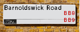
| Icon | Postcodes for Barnoldswick Road | |
| Walking Distances | ||
| Distance Info | Green Circle = 10 Minutes Walk (800 metres) | |
About Barnoldswick Road
Barnoldswick Road is a street located in the town of Barrowford and near the village of Beverley and near the town of Colne. The street has a length of approximately 2,636 metres.
Barnoldswick Road is located within the Pendle District (B) Council's jurisdiction. They provide various services, like refuse collection, and manage council tax collection. It's situated in the North West region of the UK.
Barnoldswick Road has been assigned the Unique Street Reference Number of 29801465 and 29801421 in the National Street Gazetteer.
Barnoldswick Road is located within the county of Lancashire, situated in the North West region of the UK. It's 185.81 miles North West from central London., 26.92 miles North from Manchester, 27.2 miles South East from Lancaster and 27.41 miles West from Leeds.

Do you know why this road is called Barnoldswick Road?
What's it like to live here?
Ask the community a question about Barnoldswick Road.
Do you have any questions, memories to share or know any facts about Barnoldswick Road? We'd love to know more.
Also on streetlist.co.uk, can you help?
Eldroth Road
15th April 2024
I wondered if anyone has any old pictures of Wenning Bank House in the 1940’s and also Lane Side before of the same era .. we visited today with my Mum in law as she used to live at both these properties. Also any photos of the schools around that time .. thank you.
Can You Help?Napps Way
15th April 2024
Why is the road called Napps Way (belonging to Napp, but minus an
apostrophe as is usual with such nomenclature)? Moreover, who or
what is, or was, “Napp” in the respective, possessive case?
Several years ago, I met an elderly man (probably in his late-eighties)
who lives on Bentham Drive, Liverpool 16, and during a conversation
with him whilst in a Northwest Passenger Transport Ambulance on the
way to the former RLUH (Royal Liverpool University Hospital), he told
me that he could remember (when he was a boy, living in Childwall,
Liverpool 16) that, “Where Napps Way is now, during WW2, there was
a two-man gun emplacement on the, then, open land to protect the
railway line passing over Childwall Valley Road - next to the railway
bridge - when suddenly, as they were loading a live “shell” into the gun’s
breach, the aforementioned “shell” accidentally exploded in the gun’s
breach killing both of the two soldiers, that had been manning the gun,
instantly! (Very sad, of course, but could - perhaps - two ghosts relating
to those two, very unfortunately and prematurely-killed soldiers have
haunted that place of their deaths ever since - and have any residents
of Napps Way - formerly and in its latest incarnation - seen two, WW2
(uniformed) soldiers unexpectedly appear in or near their homes?)
Mauritius Road
15th April 2024
Why is Mauritius Road so called, since when and by whom? Does Greenwich have any particular links with Mauritius? Very interested to know. 🤞🏼
Can You Help?Estate Agents near Barnoldswick Road
| Name | Address | Website |
|---|---|---|
| Petty Estate Agents Ltd | 134B Gisburn Road, Barrowford, BB9 6HQ | Visit Website |
| Hilton & Horsfall Estate Agents | 75 Gisburn Road Barrowford BB9 6DX | Visit Website |
| Petty Estate Agents Ltd | 11 Albert Road, Colne, BB8 0RY | Visit Website |
We have found 8 postcodes for Barnoldswick Road
Location Details
| Barnoldswick Road | |
|---|---|

| |
| Latitude | 53.867916 |
| Longitude | -2.202926 |
| OS Easting (X): | 386657 |
| OS Northing (Y): | 441342 |
| OS Grid Reference: | SD867413 |
Neighbourhood Policing |
| Police Force: Lancashire |
 View Neighbourhood Crime and Policing View Neighbourhood Crime and Policing |
| Find a Local Neighbourhood Watch Scheme |
Frequently asked Questions for Barnoldswick Road
What Council (Local Authority) is Barnoldswick Road in?
Barnoldswick Road is located within the local authority area of Pendle Council which is a District Council.
What Parish Council is Barnoldswick Road in?
Barnoldswick Road is located within the area of Foulridge, Barrowford & Blacko Parish Council.
What Electoral Ward is Barnoldswick Road in?
Barnoldswick Road is located within the ward of Boulsworth & Foulridge &Barrowford & Pendleside.
What County is Barnoldswick Road in?
Barnoldswick Road is located within the ceremonial county of Lancashire.
What Constituency is Barnoldswick Road in?
Barnoldswick Road is located within the constituency of Pendle.
What Part of the UK is Barnoldswick Road in?
Barnoldswick Road is located within the North West (England) region of the United Kingdom.
What County Council area is Barnoldswick Road in?
Barnoldswick Road is located within the Lancashire Council area.
What Police Force area is Barnoldswick Road in?
Barnoldswick Road is located within the Lancashire Police area.
Roads that have a Junction with Barnoldswick Road
| Street | Junction Type |
|---|---|
| Gisburn Road (A682) | junction |
| Gisburn Road (A682) | junction |
| Francis Avenue | junction |
| Whittycroft Avenue | junction |
| Stone Edge Road | junction |
| Red Lane | junction |
| Beverley Road | junction |
| Standing Stone Lane | junction |
Sunset and Sunrise times for Barnoldswick Road
| Sunrise | 05:46 |
|---|---|
| Sunset | 20:27 |
Latest Weather Conditions for Barnoldswick Road
| Observed at Weather Station: | Stonyhurst 23 April 2024 at 06:00 (10.83 miles away) |
|---|---|
| Current Weather: | Clear night |
| Temperature and Humidity: | 5.8°C (69.2%) |
| Wind Direction and Speed: | (0 mph) |
Population Statistics
| ONS Area Code | E00127926, E00127789, E00127787 & E00127792 |
|---|---|
| ONS Area Name | Established Farming Communities, Semi-Detached Ageing & White Suburban Communities |
| Average Age | 45.60 & 47.07 |
| Area Population | 1683.00 & 1800.00 |
| Male Population | 850.00 & 879.00 (50%) |
| Female Population | 833.00 & 921.00 (50%) |
| Benefit Claimants | 4 & # (0%) |
| LSOA Code: | E01025203 &E01025177 |
|---|---|
| LSOA Name: | Pendle 006D &Pendle 008D |
| SOA Code: | 2b |
| SOA Name: | |
| MSOA Code: | E02005245 &E02005247 |
| MSOA Name: | Pendle 006 &Pendle 008 |
Nearest Supermarkets
| Asda Colne |
|---|
| Unit 1, Swinden Retail Park Corporation Street, Colne, BB8 8LU |
| 01282 870156 |
| Distance: 1.33 Miles |
| Directions from Barnoldswick Road to Asda Colne |
| Sainsburys Colne |
|---|
| Windy Bank, Colne, England, BB8 9HY |
| 01282 892333 |
| Distance: 1.6 Miles |
| Directions from Barnoldswick Road to Sainsburys Colne |
| Tesco Colne Market St Express |
|---|
| 52 Market St, Colne, BB8 0HS |
| 0345 675 7024 |
| Distance: 1.68 Miles |
| Directions from Barnoldswick Road to Tesco Colne Market St Express |
| Morrisons Nelson |
|---|
| Pendle Street, Nelson BB9 7UZ |
| 01282 449196 |
| Distance: 2.08 Miles |
| Directions from Barnoldswick Road to Morrisons Nelson |
Telephone Information
| Area Code |
|---|
| Area Code: 01282 - Burnley |
| Area Code: 01200 - Clitheroe |
Local Government
| Local Council Details |
|---|
| Within the area of Pendle |
| Visit the Council's Website |
| Market Street, Nelson, Lancashire &BB9 7LG |
| Send email |
| Telephone Number: 01282 661 661 |
| Local Member of Parliament |
|---|
| Within the Westminster Parliamentary Constituency of Pendle |
| The Member of Parliament is Andrew Stephenson |
| Details for the MP Andrew Stephenson on parliament.uk |
| Details for the MP Andrew Stephenson on theyworkforyou.com |
| In the 2019 General Election Andrew Stephenson won with a majority of 6,186 the result was Con hold. The total electorate was 65,292 |
| Wards, Parish Councils and County Councils |
|---|
| Ward: Boulsworth & Foulridge &Barrowford & Pendleside Ward |
| Ceremonial County: Lancashire |
Nearest Schools
England Primary Schools
Blacko Primary School
Address: Blacko Primary School, Gisburn Road, Blacko, Nelson, Lancashire, BB9 6LS
Distance: 0.47 miles
Contact:
Sacred Heart Roman Catholic Primary School, Colne
Address: Sacred Heart Roman Catholic Primary School, Colne, Red Lane, Colne, Lancashire, BB8 7JR
Distance: 1.10 miles
Contact:
Barrowford School
Address: Barrowford School, Rushton Street, Barrowford, Nelson, Lancashire, BB9 6EA
Distance: 1.33 miles
Contact: 01282615644
Barrowford St Thomas Church of England Primary School
Address: Barrowford St Thomas Church of England Primary School, Wheatley Lane Road, Barrowford, Nelson, Lancashire, BB9 6QT
Distance: 1.58 miles
Contact: 01282614462
Nearest Hospitals
| Name | Address | Postcode | Distance | Map |
|---|
Nearest Dentists
Dentists near Barnoldswick Road
| Name | Address | Postcode | Distance | Map |
|---|
Nearest GP Surgeries
Doctors near Barnoldswick Road
BARROWFORD SURGERY
Address: 2A-4 RIDGEWAY, BARROWFORD, NELSON, LANCASHIRE, BB9 8QP
Distance: 1.59 miles
Contact: tel: 01282 612621
BARROWFORD HEALTH CENTRE
Address: LEE STREET, BARROWFORD, NELSON, LANCASHIRE, BB9 8NR
Distance: 1.59 miles
Contact: tel: 01282 619944
COLNE HEALTH CENTRE PHARMACY - COVID LOCAL VACCINATION SERVICE 2
Address: COLNE HEALTH CENTRE, CRADDOCK ROAD, COLNE, BB8 0JZ
Distance: 1.70 miles
Contact: :
COLNE HEALTH CENTRE PHARMACY - COVID LOCAL VACCINATION SERVICE
Address: COLNE HEALTH CENTRE, CRADDOCK ROAD, COLNE, BB8 0JZ
Distance: 1.70 miles
Contact: :
THE RICHMOND HILL PRACTICE
Address: COLNE HEALTH CENTRE, CRADDOCK ROAD, COLNE, BB8 0JZ
Distance: 1.70 miles
Contact: tel: 01282 731731
THE PENDLE MEDICAL PARTNERSHIP
Address: COLNE CORNER SURGERY, COLNE HEALTH CENTRE, CRADDOCK ROAD, COLNE, LANCASHIRE, BB8 0JZ
Distance: 1.70 miles
Contact: :
Nearest Dispensing Chemists
Pharmacies near Barnoldswick Road
| Name | Address | Postcode | Telephone | Map | Distance in Km |
|---|
Nearest Opticians
Opticians near Barnoldswick Road
4948 COLNE
Address: ASDA STORES LTD, CORPORATION STREET, COLNE, LANCASHIRE, BB8 8LU
Distance: 1.37 miles
Contact: :
PLANIT OPTICIANS (COLNE)
Address: 60 ALBERT ROAD, COLNE, LANCASHIRE, BB8 0AD
Distance: 1.42 miles
Contact: :
COLNE OPTICIANS
Address: 6 CHURCH STREET, COLNE, LANCASHIRE, BB8 0LG
Distance: 1.55 miles
Contact: :
COLNE SPECSAVERS LIMITED
Address: SAINSBURY'S, WINDY BANK, COLNE, BB8 9HY
Distance: 1.57 miles
Contact: :
N. P. SHER - BARROWFORD
Address: 1A GISBURN ROAD, BARROWFORD, NELSON, LANCASHIRE, BB9 8NB
Distance: 1.62 miles
Contact: :
BOOTS OPTICIANS (COLNE)
Address: UNIT 3, MARKET HALL, MARKET STREET, COLNE, LANCASHIRE, BB8 0HS
Distance: 1.69 miles
Contact: :
Transport
Nearest Rail Stations
Colne Station is 1.27 miles away.
Address: Colne station, Primet Hill, Colne, Lancashire, BB8 9NX
Colne is situated on the East Lancashire line and is managed by Northern.
Colne Station is an unstaffed station.
Nelson Station is 2.32 miles away.
Address: Nelson station, Hibson Road, Nelson, Lancashire, BB9 9SF
Nelson is situated on the East Lancashire line and is managed by Northern.
Nelson Station is staffed on a part time basis.