Map of Woodlands Street
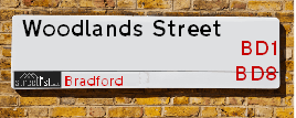
| Postcodes | ||
|---|---|---|
| Icon | Postcodes for Woodlands Street | |
| Walking Distances | ||
| Distance Info | Green Circle = 10 Minutes Walk (800 metres) | |
About Woodlands Street
Woodlands Street is a street located in the city of Bradford. The street has a length of approximately 237 metres.
Woodlands Street is located within the Bradford District (B) Council's jurisdiction. They provide various services, like refuse collection, and manage council tax collection. It's situated in the Yorkshire and The Humber region of the UK.
Woodlands Street has been assigned the Unique Street Reference Number of 7784830 in the National Street Gazetteer.
Woodlands Street is located within the county of West Yorkshire, situated in the Yorkshire and The Humber region of the UK. It's 173.55 miles North West from central London., 9.24 miles West from Leeds, 29.5 miles North East from Manchester and 30.2 miles West from York.

Do you know why this road is called Woodlands Street?
What's it like to live here?
Ask the community a question about Woodlands Street.
Do you have any questions, memories to share or know any facts about Woodlands Street? We'd love to know more.
Also on streetlist.co.uk, can you help?
Eldroth Road
15th April 2024
I wondered if anyone has any old pictures of Wenning Bank House in the 1940’s and also Lane Side before of the same era .. we visited today with my Mum in law as she used to live at both these properties. Also any photos of the schools around that time .. thank you.
Can You Help?Napps Way
15th April 2024
Why is the road called Napps Way (belonging to Napp, but minus an
apostrophe as is usual with such nomenclature)? Moreover, who or
what is, or was, “Napp” in the respective, possessive case?
Several years ago, I met an elderly man (probably in his late-eighties)
who lives on Bentham Drive, Liverpool 16, and during a conversation
with him whilst in a Northwest Passenger Transport Ambulance on the
way to the former RLUH (Royal Liverpool University Hospital), he told
me that he could remember (when he was a boy, living in Childwall,
Liverpool 16) that, “Where Napps Way is now, during WW2, there was
a two-man gun emplacement on the, then, open land to protect the
railway line passing over Childwall Valley Road - next to the railway
bridge - when suddenly, as they were loading a live “shell” into the gun’s
breach, the aforementioned “shell” accidentally exploded in the gun’s
breach killing both of the two soldiers, that had been manning the gun,
instantly! (Very sad, of course, but could - perhaps - two ghosts relating
to those two, very unfortunately and prematurely-killed soldiers have
haunted that place of their deaths ever since - and have any residents
of Napps Way - formerly and in its latest incarnation - seen two, WW2
(uniformed) soldiers unexpectedly appear in or near their homes?)
Mauritius Road
15th April 2024
Why is Mauritius Road so called, since when and by whom? Does Greenwich have any particular links with Mauritius? Very interested to know. 🤞🏼
Can You Help?Estate Agents near Woodlands Street
| Name | Address | Website |
|---|---|---|
| Blackwell Properties | Airlines House, 66 Lumb Lane, Bradford,BD8 7QZ | Visit Website |
| Biscayne Properties | 28 North Parade Bradford BD1 3HZ | Visit Website |
| Locate Homes | 29-31 North Parade Bradford BD1 3JL | Visit Website |
Hotels near Woodlands Street
Budget Hotels near Woodlands Street
| Budget Hotel Name | Distance (miles) |
|---|---|
| 1: Name:Travelodge Bradford Central Address:2 Valley Rd, Bradford, BD1 4AF Telephone:0871 984 6171 Visit Site |
0.74 |
| 2: Name:ibis budget Bradford Address:6 Prince Court, Canal Road Telephone: Visit Site |
0.74 |
| 3: Name:Premier Inn Bradford Central Address:Vicar Lane Telephone: Visit Site |
0.95 |
| 4: Name:Holiday Inn Express Bradford City Centre Address:The Leisure Exchange, Vicar Lane Telephone: Visit Site |
1.01 |
| 5: Name:Travelodge Bradford Address:Mid Point, Bradford, BD3 7AY Telephone:0871 984 6124 Visit Site |
2.57 |
Location Details
| Woodlands Street | |
|---|---|

| |
| Latitude | 53.799058 |
| Longitude | -1.768262 |
| OS Easting (X): | 415261 |
| OS Northing (Y): | 433688 |
| OS Grid Reference: | SE153337 |
Ordnance Survey Maps for Woodlands Street
If you purchase a map through the links below, we may earn an affiliate commission.
| Map Series | link | Ordnance Survey |
| Explorer 1:25,000 288 Bradford and Huddersfield | Check Price on Amazon | Buy Direct from the Ordnance Survey |
| Landranger 1:50,000 104 Leeds & Bradford | Check Price on Amazon | Buy Direct from the Ordnance Survey |
Neighbourhood Policing |
| Police Force: West Yorkshire |
 View Neighbourhood Crime and Policing View Neighbourhood Crime and Policing |
| Find a Local Neighbourhood Watch Scheme |
Frequently asked Questions for Woodlands Street
What Council (Local Authority) is Woodlands Street in?
Woodlands Street is located within the local authority area of Bradford Council which is a Metropolitan District.
What Parish Council is Woodlands Street in?
Woodlands Street is in an unparished area.
What Electoral Ward is Woodlands Street in?
Woodlands Street is located within the ward of Manningham.
What County is Woodlands Street in?
Woodlands Street is located within the ceremonial county of West Yorkshire.
What Constituency is Woodlands Street in?
Woodlands Street is located within the constituency of Bradford West.
What Part of the UK is Woodlands Street in?
Woodlands Street is located within the Yorkshire and The Humber region of the United Kingdom.
What County Council area is Woodlands Street in?
Woodlands Street is located within the West Yorkshire Council area.
What Police Force area is Woodlands Street in?
Woodlands Street is located within the West Yorkshire Police area.
Roads that have a Junction with Woodlands Street
| Street | Junction Type |
|---|---|
| White Abbey Road (B6144) | junction |
| Sunbridge Road | junction |
Sunset and Sunrise times for Woodlands Street
| Sunrise | 05:53 |
|---|---|
| Sunset | 20:18 |
Latest Weather Conditions for Woodlands Street
| Observed at Weather Station: | Bingley Samos 19 April 2024 at 10:00 (4.03 miles away) |
|---|---|
| Current Weather: | Drizzle |
| Temperature and Humidity: | 6.3°C (86.9%) |
| Wind Direction and Speed: | N (13 mph) |
Population Statistics
| ONS Area Code | E00054617 & E00054659 |
|---|---|
| ONS Area Name | Pakistani Communities & Established Renting Families |
| Average Age | 28.99 & |
| Area Population | 1945.00 & |
| Male Population | 1004.00 & (52%) |
| Female Population | 941.00 & (48%) |
| Benefit Claimants | 128 & (7%) |
| LSOA Code: | E01010842 &E01033691 |
|---|---|
| LSOA Name: | Bradford 039E &Bradford 039H |
| SOA Code: | 7b |
| SOA Name: | |
| MSOA Code: | E02002221 |
| MSOA Name: | Bradford 039 |
Nearest Supermarkets
| Tesco Manninghm Ln Bradford Express |
|---|
| Manningham Ln, Bradford, BD8 7HY |
| 0345 026 9840 |
| Distance: 0.37 Miles |
| Directions from Woodlands Street to Tesco Manninghm Ln Bradford Express |
| Asda Living Bradford |
|---|
| Forster Square Retail Park, Bradford, BD1 4JB |
| 01274 381820 |
| Distance: 0.56 Miles |
| Directions from Woodlands Street to Asda Living Bradford |
| Iceland Manningham Food Warehouse |
|---|
| UNITS 3-4, MANNINGHAM LANE RETAIL PK, BRADFORD, BD1 3AH |
| 01274304139 |
| Distance: 0.58 Miles |
| Directions from Woodlands Street to Iceland Manningham Food Warehouse |
| Tesco Bradford Sunbridge Rd Express |
|---|
| 27-29 Sunbridge Rd, Bradford, BD1 2AY |
| 0345 671 9482 |
| Distance: 0.66 Miles |
| Directions from Woodlands Street to Tesco Bradford Sunbridge Rd Express |
Telephone Information
| Area Code |
|---|
| Area Code: 01274 - Bradford |
| Area Code: 01422 - Halifax |
| Area Code: 01943 - Guiseley |
| Area Code: 01535 - Keighley |
Local Government
| Local Council Details |
|---|
| Within the area of Bradford |
| Visit the Council's Website |
| City Hall, Centenary Square, Bradford &BD1 1HY |
| Telephone Number: 01274 432111 |
| Local Member of Parliament |
|---|
| Within the Westminster Parliamentary Constituency of Bradford West |
| The Member of Parliament is Naz Shah |
| Details for the MP Naz Shah on parliament.uk |
| Details for the MP Naz Shah on theyworkforyou.com |
| In the 2019 General Election Naz Shah won with a majority of 27,019 the result was Lab hold. The total electorate was 70,694 |
| Wards, Parish Councils and County Councils |
|---|
| Ward: Manningham Ward |
| Ceremonial County: West Yorkshire |
Nearest Schools
| Name | Address | Postcode | Telephone | Type | Distance (Km) |
|---|
Data accessed from gov.scot 08-08-2019
Nearest Hospitals
| Name | Address | Postcode | Distance | Map |
|---|
Nearest Dentists
Dentists near Woodlands Street
| Name | Address | Postcode | Distance | Map |
|---|
Nearest GP Surgeries
Doctors near Woodlands Street
BILTON MEDICAL CENTRE
Address: 120 CITY ROAD, BRADFORD, WEST YORKSHIRE, BD8 8JT
Distance: 0.07 miles
Contact: tel: 01274 782080
CLARENDON MEDICAL CENTRE
Address: MANNINGHAM HEALTH CENTRE, LUMB LANE, BRADFORD, BD8 7SY
Distance: 0.37 miles
Contact: tel: 01274 736996
CLARENDON MEDICAL CENTRE
Address: MANNINGHAM HEALTH CENTRE, LUMB LANE, BRADFORD, WEST YORKSHIRE, BD8 7SY
Distance: 0.37 miles
Contact: :
PICTON MEDICAL CENTRE
Address: WHETLEY MEDICAL CENTRE, 2 SAPLIN STREET, BRADFORD, BD8 9DW
Distance: 0.50 miles
Contact: tel: 01274 019605
DR U AKBAR
Address: WHETLEY MEDICAL CENTRE, 2 SAPLIN STREET, BRADFORD, WEST YORKSHIRE, BD8 9DW
Distance: 0.50 miles
Contact: tel: 01274 544915
WHETLEY MEDICAL CENTRE
Address: 2 SAPLIN STREET, BRADFORD, BD8 9DW
Distance: 0.50 miles
Contact: :
Nearest Dispensing Chemists
Pharmacies near Woodlands Street
| Name | Address | Postcode | Telephone | Map | Distance in Km |
|---|
Nearest Opticians
Opticians near Woodlands Street
UNIVERSITY OF BRADFORD - THE EYE CLINIC
Address: FORSTER BUILDING, CAMPUS ROAD, LISTERHILLS SCIENCE PARK, BRADFORD, WEST YORKSHIRE, BD7 1HR
Distance: 0.43 miles
Contact: tel: 01274 236250
DENTAL & OPTICAL SERVICES
Address: 5 RAWSON ROAD, BRADFORD, WEST YORKSHIRE, BD1 3SH
Distance: 0.47 miles
Contact: :
OPTIVU EYECARE - JOHN ST
Address: 15 JOHN STREET, BRADFORD, BD1 3JS
Distance: 0.50 miles
Contact: :
LLOYD & ROBINSON
Address: 64 WESTGATE, BRADFORD, WEST YORKSHIRE, BD1 2QR
Distance: 0.54 miles
Contact: :
MAXIVISION OPTICAL CENTRE
Address: 40 WESTGATE, BRADFORD, WEST YORKSHIRE, BD1 2QR
Distance: 0.54 miles
Contact: :
UNIVERSITY OF BRADFORD EYE CLINIC (PHEONIX SW)
Address: UNIVERSITY OF BRADFORD, RICHMOND ROAD, BRADFORD, WEST YORKSHIRE, BD7 1DP
Distance: 0.55 miles
Contact: :
Transport
Nearest Rail Stations
Bradford Forster Square Station is 0.64 miles away.
Address: Bradford Forster Square station, Forster Square, Bradford, West Yorkshire, BD1 4HY
Bradford Forster Square is situated on the Wharfedale Line|Leeds to Bradford lines and is managed by Northern.
Bradford Forster Square Station is staffed on a part time basis.
Directions from Woodlands Street to Bradford Forster Square Rail Station
Bradford Interchange Station is 0.94 miles away.
Address: Bradford Interchange station, Bridge Street, Bradford, West Yorkshire, BD1 1TU
Bradford Interchange is situated on the Calder Valley line and is managed by Northern.
Bradford Interchange Station is staffed on a full time basis.
Directions from Woodlands Street to Bradford Interchange Rail Station