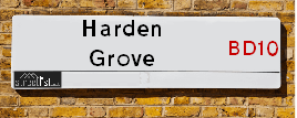
Map of Harden Grove
| Street Crime (updated 06/04/2024) | ||
|---|---|---|
| Location Note | Central Point of Street - Not Actual Location | |
| MSOA Info | For MSOA E02002209 (Statistical Neighbourhood) | |
| Click Hint | Click on a Circle for a detailed breakdown below map. | |
| Crime Levels |
Green = Very Low Yellow = Low Orange = High Red = Very High |
|
| Postcodes | ||
| Icon | Postcodes for Harden Grove | |
| Walking Distances | ||
| Distance Info | Green Circle = 10 Minutes Walk (800 metres) | |
About Harden Grove
Harden Grove is a street located in the city of Bradford. It uses the postcode BD10 0JU. The street has a length of approximately 77 metres.
The street is publicly maintained which means that the road is adopted and Bradford is responsible for the repair and upkeep of the highway.
Harden Grove is located within the Bradford District (B) Council's jurisdiction. They provide various services, like refuse collection, and manage council tax collection. It's situated in the Yorkshire and The Humber region of the UK.
Harden Grove has been assigned the Unique Street Reference Number of 7735170 in the National Street Gazetteer.
Harden Grove is located within the county of West Yorkshire, situated in the Yorkshire and The Humber region of the UK. It's 173.63 miles North West from central London., 6.98 miles West from Leeds, 27.61 miles West from York and 31.14 miles North West from Doncaster.
Harden Grove is within the Post Town of BRADFORD.

Do you know why this road is called Harden Grove?
What's it like to live here?
Ask the community a question about Harden Grove.
Do you have any questions, memories to share or know any facts about Harden Grove? We'd love to know more.
Also on streetlist.co.uk, can you help?
Eldroth Road
15th April 2024
I wondered if anyone has any old pictures of Wenning Bank House in the 1940’s and also Lane Side before of the same era .. we visited today with my Mum in law as she used to live at both these properties. Also any photos of the schools around that time .. thank you.
Can You Help?Napps Way
15th April 2024
Why is the road called Napps Way (belonging to Napp, but minus an
apostrophe as is usual with such nomenclature)? Moreover, who or
what is, or was, “Napp” in the respective, possessive case?
Several years ago, I met an elderly man (probably in his late-eighties)
who lives on Bentham Drive, Liverpool 16, and during a conversation
with him whilst in a Northwest Passenger Transport Ambulance on the
way to the former RLUH (Royal Liverpool University Hospital), he told
me that he could remember (when he was a boy, living in Childwall,
Liverpool 16) that, “Where Napps Way is now, during WW2, there was
a two-man gun emplacement on the, then, open land to protect the
railway line passing over Childwall Valley Road - next to the railway
bridge - when suddenly, as they were loading a live “shell” into the gun’s
breach, the aforementioned “shell” accidentally exploded in the gun’s
breach killing both of the two soldiers, that had been manning the gun,
instantly! (Very sad, of course, but could - perhaps - two ghosts relating
to those two, very unfortunately and prematurely-killed soldiers have
haunted that place of their deaths ever since - and have any residents
of Napps Way - formerly and in its latest incarnation - seen two, WW2
(uniformed) soldiers unexpectedly appear in or near their homes?)
Mauritius Road
15th April 2024
Why is Mauritius Road so called, since when and by whom? Does Greenwich have any particular links with Mauritius? Very interested to know. 🤞🏼
Can You Help?House Sales in Harden Grove
| Year | High | Low | Average | Sales |
|---|---|---|---|---|
| 2013 | £50,000 | £50,000 | £50,000 | 1 |
| 2018 | £62,500 | £62,500 | £62,500 | 1 |
| 2021 | £82,000 | £82,000 | £82,000 | 1 |
Contains HM Land Registry data © Crown copyright and database right 2024. This data is licensed under the Open Government Licence v3.0.
Estate Agents near Harden Grove
| Name | Address | Website |
|---|---|---|
| Keepmoat, Vision | Harrogate Road, Bradford, BD2 3HP | Visit Website |
| WW Estates | 359-361 Idle Road, Bradford, BD2 2AH | Visit Website |
| Robert Watts | 21a Highfield Road, Five Lane Ends, Bradford, BD2 2AU | Visit Website |
We have found 1 postcode for Harden Grove
Location Details
| Harden Grove | |
|---|---|

| |
| Latitude | 53.815334 |
| Longitude | -1.711104 |
| OS Easting (X): | 419018 |
| OS Northing (Y): | 435512 |
| OS Grid Reference: | SE190355 |
Neighbourhood Policing |
| Police Force: West Yorkshire |
 View Neighbourhood Crime and Policing View Neighbourhood Crime and Policing |
| Find a Local Neighbourhood Watch Scheme |
Frequently asked Questions for Harden Grove
What Council (Local Authority) is Harden Grove in?
Harden Grove is located within the local authority area of Bradford Council which is a Metropolitan District.
What Parish Council is Harden Grove in?
Harden Grove is in an unparished area.
What Electoral Ward is Harden Grove in?
Harden Grove is located within the ward of Eccleshill.
What County is Harden Grove in?
Harden Grove is located within the ceremonial county of West Yorkshire.
What Constituency is Harden Grove in?
Harden Grove is located within the constituency of Bradford East.
What Part of the UK is Harden Grove in?
Harden Grove is located within the Yorkshire and The Humber region of the United Kingdom.
What County Council area is Harden Grove in?
Harden Grove is located within the West Yorkshire Council area.
What Police Force area is Harden Grove in?
Harden Grove is located within the West Yorkshire Police area.
Roads that have a Junction with Harden Grove
| Street | Junction Type |
|---|---|
| Falkland Road | junction |
Sunset and Sunrise times for Harden Grove , BD10 0JU
| Sunrise | 05:44 |
|---|---|
| Sunset | 20:25 |
Latest Weather Conditions for Harden Grove, BD10 0JU
| Observed at Weather Station: | Bingley Samos 23 April 2024 at 20:00 (6.29 miles away) |
|---|---|
| Current Weather: | Overcast |
| Temperature and Humidity: | 6.0°C (75.8%) |
| Wind Direction and Speed: | ENE (2 mph) |
Population Statistics
| ONS Area Code | E00053768 |
|---|---|
| ONS Area Name | Private Renting Young Families |
| Average Age | 30.10 |
| Area Population | 1647.00 |
| Male Population | 763.00 (46%) |
| Female Population | 884.00 (54%) |
| Benefit Claimants | 116 (7%) |
| LSOA Code: | E01010650 |
|---|---|
| LSOA Name: | Bradford 027B |
| SOA Code: | 4c |
| SOA Name: | |
| MSOA Code: | E02002209 |
| MSOA Name: | Bradford 027 |
Nearest Supermarkets
| Morrisons Bradford - Thornbury |
|---|
| Rushton Avenue, Thornbury, Bradford BD3 7HZ |
| 01274 661429 |
| Distance: 0.87 Miles |
| Directions from Harden Grove to Morrisons Bradford - Thornbury |
| Iceland Woodhall Road |
|---|
| Unit 2 Woodhall Retail Pk, Woodhall Road, Bradford, BD3 7BW |
| 01274660888 |
| Distance: 0.89 Miles |
| Directions from Harden Grove to Iceland Woodhall Road |
| Tesco Undercliffe Express |
|---|
| 465-469 Otley Rd, Bradford, BD2 4QF |
| 0345 671 9317 |
| Distance: 0.95 Miles |
| Directions from Harden Grove to Tesco Undercliffe Express |
| Sainsburys Bradford |
|---|
| 760 Harrogate Road, Bradford, England, BD10 0QF |
| 01274 614820 |
| Distance: 0.97 Miles |
| Directions from Harden Grove to Sainsburys Bradford |
Telephone Information
| Dialling Code | Telephone Exchange | Telephone Cabinet | Fibre to the Cabinet or Fibre to the Premises |
|---|---|---|---|
| 01274 | UNDERCLIFFE - MYUND | P17 | FTTC |
Broadband Information
| Speed | Average Speed | Median Speed | Maximum Speed | Next-generation access (NGA) | Number of Connections |
|---|---|---|---|---|---|
| Greater than 2 Mbps | 16 | 6.1 | >=30 | Y | 11 |
Local Government
| Local Council Details |
|---|
| Within the area of Bradford |
| Visit the Council's Website |
| City Hall, Centenary Square, Bradford &BD1 1HY |
| Telephone Number: 01274 432111 |
| Local Member of Parliament |
|---|
| Within the Westminster Parliamentary Constituency of Bradford East |
| The Member of Parliament is Imran Hussain |
| Details for the MP Imran Hussain on parliament.uk |
| Details for the MP Imran Hussain on theyworkforyou.com |
| In the 2019 General Election Imran Hussain won with a majority of 18,144 the result was Lab hold. The total electorate was 73,206 |
| Wards, Parish Councils and County Councils |
|---|
| Ward: Eccleshill Ward |
| Parish: Unparished area |
| Ceremonial County: West Yorkshire |
Nearest Schools
England Primary Schools
Peel Park Primary School and Nursery
Address: Peel Park Primary School and Nursery, Peel Park Drive, Undercliffe, Bradford, West Yorkshire, BD2 4PR
Distance: 1.12 miles
Contact: 01274639377
Wellington Primary School
Address: Wellington Primary School, Dudley Hill Road, Bradford, West Yorkshire, BD2 3DE
Distance: 0.84 miles
Contact: 01274774446
St Francis Catholic Primary School
Address: St Francis Catholic Primary School, Myers Lane, Bradford, West Yorkshire, BD2 4ES
Distance: 1.11 miles
Contact:
Swain House Primary School
Address: Swain House Primary School, Radcliffe Avenue, Bradford, West Yorkshire, BD2 1JL
Distance: 1.25 miles
Contact: 01274639049
Parkland Primary School
Address: Parkland Primary School, Old Park Road, Thorpe Edge, Bradford, West Yorkshire, BD10 9BG
Distance: 1.13 miles
Contact:
Greengates Primary School
Address: Greengates Primary School, 31 Stockhill Road, Greengates, Bradford, West Yorkshire, BD10 9AX
Distance: 1.18 miles
Contact:
St Luke's CofE Primary School
Address: St Luke's CofE Primary School, Fagley Lane, Eccleshill, Bradford, West Yorkshire, BD2 3NS
Distance: 0.29 miles
Contact: 01274639374
Holybrook Primary
Address: Holybrook Primary, Rillington Mead, Greengates, Bradford, West Yorkshire, BD10 0EF
Distance: 0.67 miles
Contact:
Our Lady and St Brendan's Catholic Primary School
Address: Our Lady and St Brendan's Catholic Primary School, The Bank, Idle, Bradford, West Yorkshire, BD10 0QA
Distance: 0.75 miles
Contact:
Cavendish Primary School
Address: Cavendish Primary School, Hall Road, Eccleshill, Bradford, West Yorkshire, BD2 2DU
Distance: 0.52 miles
Contact:
Blakehill Primary School
Address: Blakehill Primary School, Highfield Road, Idle, Bradford, West Yorkshire, BD10 8QN
Distance: 1.38 miles
Contact: 01274414355
Nearest Hospitals
| Eccleshill Community Hospital |
|---|
| Address: 450 Harrogate Road, Eccleshill, Bradford, BD10 0JE, |
| NHS Sector |
| Bradford Teaching Hospitals NHS Foundation Trust |
| Telephone: 01274 323200 |
| Distance: 0.86 (miles) |
| Directions from to Eccleshill Community Hospital |
| Optegra Eye Hospital Yorkshire |
|---|
| Address: 937 Harrogate Road, Apperley Bridge, Bradford, BD10 0RD, |
| NHS Sector |
| Optegra UK |
| Telephone: 0808 301 2823 |
| Visit Hospital Website |
| Distance: 1.9 (miles) |
| Directions from to Optegra Eye Hospital Yorkshire |
| Westbourne Green Community Hospital |
|---|
| Address: 26 Heaton Road, Bradford, BD8 8RA, |
| Independent Sector |
| Bradford Teaching Hospitals NHS Foundation Trust |
| Telephone: 1274322093 |
| Distance: 4.36 (miles) |
| Directions from to Westbourne Green Community Hospital |
Nearest Dentists
Dentists near Harden Grove
RILLINGTON MEAD
Address: ECCLESHILL, BRADFORD, BD10 0EB
Distance: 0.72 miles
Contact: :
DENTAL SURGERY
Address: 179 NEW LINE, BRADFORD, WEST YORKSHIRE, BD10 0BN
Distance: 1.03 miles
Contact: :
THORNBURY DENTAL PRACTICE
Address: 1 ROYDSTONE ROAD, BRADFORD, WEST YORKSHIRE, BD3 7EH
Distance: 1.03 miles
Contact: :
DENTAL SURGERY
Address: 460 IDLE ROAD, BRADFORD, WEST YORKSHIRE, BD2 2AR
Distance: 1.10 miles
Contact: :
A ONE DENTAL PRACTICE
Address: 983 LEEDS ROAD, BRADFORD, WEST YORKSHIRE, BD3 7ND
Distance: 1.11 miles
Contact: :
A-LIST DENTISTRY
Address: STUDIO 46, ALBION MILLS, ALBION ROAD, GREENGATES, BRADFORD, WEST YORKSHIRE, BD10 9TQ
Distance: 1.26 miles
Contact: :
Nearest GP Surgeries
Doctors near Harden Grove
ASHCROFT SURGERY
Address: NEWLANDS WAY, ECCLESHILL, BRADFORD, WEST YORKSHIRE, BD10 0JE
Distance: 0.59 miles
Contact: tel: 01274 612279
ECCLESHILL COMMUNITY HOSPITAL
Address: NEWLANDS WAY, BRADFORD, BD10 0JE
Distance: 0.59 miles
Contact: :
ECCLESHILL VILLAGE SURGERY
Address: 14 INSTITUTE ROAD, ECCLESHILL, BRADFORD, WEST YORKSHIRE, BD2 2HX
Distance: 0.72 miles
Contact: tel: 01274 637417
THORNBURY MEDICAL PRACTICE
Address: MORRISONS STORE, RUSHTON AVENUE, BRADFORD, BD3 7HZ
Distance: 0.87 miles
Contact: tel: 01274 662441
MOORSIDE SURGERY - COVID LOCAL VACCINATION SERVICE
Address: MOORSIDE SURGERY, 370 DUDLEY HILL ROAD, ECCLESHILL, BRADFORD, BD2 3AA
Distance: 0.90 miles
Contact: :
MOORSIDE SURGERY
Address: 370 DUDLEY HILL ROAD, BRADFORD, WEST YORKSHIRE, BD2 3AA
Distance: 0.90 miles
Contact: tel: 01274 643576
Nearest Dispensing Chemists
Pharmacies near Harden Grove
KAMSONS PHARMACY
Address: NEWLANDS WAY, ECCLESHILL, BRADFORD, WEST YORKSHIRE, BD10 0JE
Distance: 0.59 miles
Contact: tel: 01274 611613
J ROBERTSON & SON LTD
Address: 5-7 INSTITUTE ROAD, ECCLESHILL, BRADFORD, WEST YORKSHIRE, BD2 2HY
Distance: 0.75 miles
Contact: tel: 01274 638716
FAGLEY PHARMACY
Address: 75 FAGLEY ROAD, BRADFORD, WEST YORKSHIRE, BD2 3LS
Distance: 0.78 miles
Contact: tel: 01274 637007
MORRISONS PHARMACY
Address: WM MORRISON SUPERMARKETS PLC, RUSHTON AVENUE, BRADFORD, WEST YORKSHIRE, BD3 7HZ
Distance: 0.87 miles
Contact: tel: 01274 669466
MOORSIDE PHARMACY
Address: 372 DUDLEY HILL ROAD, BRADFORD, WEST YORKSHIRE, BD2 3AA
Distance: 0.90 miles
Contact: tel: 01274 626012
ROCKWELL - PHARMACY PLUS HEALTH
Address: SUMMERFIELD ROAD, THORPE EDGE, BRADFORD, BD10 8DP
Distance: 1.02 miles
Contact: tel: 01274 611410
Nearest Opticians
Opticians near Harden Grove
GLASSES PLUS OPTICIANS
Address: 209 DUDLEY HILL ROAD, BRADFORD, WEST YORKSHIRE, BD2 3AE
Distance: 0.85 miles
Contact: :
STYLE & VISION LTD (BRADFORD)
Address: 12 HARROGATE ROAD, BRADFORD, WEST YORKSHIRE, BD2 3DU
Distance: 0.86 miles
Contact: :
PREMIER VISION OPTICIANS (THORNBURY)
Address: MORRISONS STORE, RUSHTON AVENUE, THORNBURY, BRADFORD, WEST YORKSHIRE, BD3 7HZ
Distance: 0.87 miles
Contact: :
FCJ OPTICALS LTD
Address: 9 GRENFELL DRIVE, BRADFORD, BD3 7EN
Distance: 1.04 miles
Contact: :
TRUESMITHS (BRADFORD)
Address: MORRISONS ENTERPRISE 5, 275 BRADFORD ROAD, IDLE, BRADFORD, BD10 8EG
Distance: 1.07 miles
Contact: :
A SMITH OPTICIANS (HARROGATE ROAD)
Address: 917 HARROGATE ROAD, BRADFORD, BD10 0QY
Distance: 1.08 miles
Contact: :
Transport
Nearest Rail Stations
New Pudsey Station is 1.45 miles away.
Address: New Pudsey station, Owlcotes Lane, New Pudsey, West Yorkshire, LS28 6QG
New Pudsey is situated on the Calder Valley line and is managed by Northern.
New Pudsey Station is staffed on a full time basis.
Apperley Bridge Station is 1.83 miles away.
Address: Apperley Bridge station, Station Approach, Apperley Bridge, West Yorkshire, BD10 0FD
Apperley Bridge is situated on the Leeds to Bradford lines and is managed by Northern.
Apperley Bridge Station is an unstaffed station.
Directions from Harden Grove to Apperley Bridge Rail Station