Map of Chat Hill Road
| Postcodes | ||
|---|---|---|
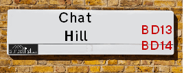
| Icon | Postcodes for Chat Hill Road | |
| Walking Distances | ||
| Distance Info | Green Circle = 10 Minutes Walk (800 metres) | |
About Chat Hill Road
Chat Hill Road is a street located near the city of Bradford and in the village of Thornton. The street has a length of approximately 551 metres.
Chat Hill Road is located within the Bradford District (B) Council's jurisdiction. They provide various services, like refuse collection, and manage council tax collection. It's situated in the Yorkshire and The Humber region of the UK.
Chat Hill Road has been assigned the Unique Street Reference Number of 7717310 and 7796054 in the National Street Gazetteer.
Chat Hill Road is located within the county of West Yorkshire, situated in the Yorkshire and The Humber region of the UK. It's 174.04 miles North West from central London., 11.97 miles West from Leeds, 27.21 miles North East from Manchester and 31.92 miles North West from Sheffield.

Do you know why this road is called Chat Hill Road?
What's it like to live here?
Ask the community a question about Chat Hill Road.
Do you have any questions, memories to share or know any facts about Chat Hill Road? We'd love to know more.
Also on streetlist.co.uk, can you help?
Eldroth Road
15th April 2024
I wondered if anyone has any old pictures of Wenning Bank House in the 1940’s and also Lane Side before of the same era .. we visited today with my Mum in law as she used to live at both these properties. Also any photos of the schools around that time .. thank you.
Can You Help?Napps Way
15th April 2024
Why is the road called Napps Way (belonging to Napp, but minus an
apostrophe as is usual with such nomenclature)? Moreover, who or
what is, or was, “Napp” in the respective, possessive case?
Several years ago, I met an elderly man (probably in his late-eighties)
who lives on Bentham Drive, Liverpool 16, and during a conversation
with him whilst in a Northwest Passenger Transport Ambulance on the
way to the former RLUH (Royal Liverpool University Hospital), he told
me that he could remember (when he was a boy, living in Childwall,
Liverpool 16) that, “Where Napps Way is now, during WW2, there was
a two-man gun emplacement on the, then, open land to protect the
railway line passing over Childwall Valley Road - next to the railway
bridge - when suddenly, as they were loading a live “shell” into the gun’s
breach, the aforementioned “shell” accidentally exploded in the gun’s
breach killing both of the two soldiers, that had been manning the gun,
instantly! (Very sad, of course, but could - perhaps - two ghosts relating
to those two, very unfortunately and prematurely-killed soldiers have
haunted that place of their deaths ever since - and have any residents
of Napps Way - formerly and in its latest incarnation - seen two, WW2
(uniformed) soldiers unexpectedly appear in or near their homes?)
Mauritius Road
15th April 2024
Why is Mauritius Road so called, since when and by whom? Does Greenwich have any particular links with Mauritius? Very interested to know. 🤞🏼
Can You Help?Estate Agents near Chat Hill Road
| Name | Address | Website |
|---|---|---|
| Whitney's | 11 Green End Clayton Bradford BD14 6BA | |
| Patchett Homes | Ryefield House, 180 Highgate Road, Queensbury, Bradford, BD13 1DS | Visit Website |
| Sugdens | 44 High Street, Queensbury, Bradford, BD13 2PA | Visit Website |
Location Details
| Chat Hill Road | |
|---|---|

| |
| Latitude | 53.788750 |
| Longitude | -1.834382 |
| OS Easting (X): | 410909 |
| OS Northing (Y): | 432529 |
| OS Grid Reference: | SE109325 |
Ordnance Survey Maps for Chat Hill Road
If you purchase a map through the links below, we may earn an affiliate commission.
| Map Series | link | Ordnance Survey |
| Explorer 1:25,000 288 Bradford and Huddersfield | Check Price on Amazon | Buy Direct from the Ordnance Survey |
| Landranger 1:50,000 104 Leeds & Bradford | Check Price on Amazon | Buy Direct from the Ordnance Survey |
Neighbourhood Policing |
| Police Force: West Yorkshire |
 View Neighbourhood Crime and Policing View Neighbourhood Crime and Policing |
| Find a Local Neighbourhood Watch Scheme |
Frequently asked Questions for Chat Hill Road
What Council (Local Authority) is Chat Hill Road in?
Chat Hill Road is located within the local authority area of Bradford Council which is a Metropolitan District.
What Parish Council is Chat Hill Road in?
Chat Hill Road is in an unparished area.
What Electoral Ward is Chat Hill Road in?
Chat Hill Road is located within the ward of Thornton and Allerton &Queensbury.
What County is Chat Hill Road in?
Chat Hill Road is located within the ceremonial county of West Yorkshire.
What Constituency is Chat Hill Road in?
Chat Hill Road is located within the constituency of Bradford West &Bradford South.
What Part of the UK is Chat Hill Road in?
Chat Hill Road is located within the Yorkshire and The Humber region of the United Kingdom.
What County Council area is Chat Hill Road in?
Chat Hill Road is located within the West Yorkshire Council area.
What Police Force area is Chat Hill Road in?
Chat Hill Road is located within the West Yorkshire Police area.
Roads that have a Junction with Chat Hill Road
| Street | Junction Type |
|---|---|
| Cockin Lane | junction |
| Low Lane | junction |
| Ox Heys Meadows | junction |
| Westfield | junction |
| Hughendon Drive | junction |
| School Green | junction |
Sunset and Sunrise times for Chat Hill Road
| Sunrise | 05:43 |
|---|---|
| Sunset | 20:27 |
Latest Weather Conditions for Chat Hill Road
| Observed at Weather Station: | Bingley Samos 24 April 2024 at 18:00 (1.98 miles away) |
|---|---|
| Current Weather: | Partly cloudy (day) |
| Temperature and Humidity: | 7.2°C (53.1%) |
| Wind Direction and Speed: | N (0 mph) |
Population Statistics
| ONS Area Code | E00054479 & E00054449 |
|---|---|
| ONS Area Name | Industrious Transitions & Rural White-Collar Workers |
| Average Age | 40.87 |
| Area Population | 1619.00 |
| Male Population | 790.00 (49%) |
| Female Population | 829.00 (51%) |
| Benefit Claimants | 33 (2%) |
| LSOA Code: | E01010796 |
|---|---|
| LSOA Name: | Bradford 043C |
| SOA Code: | 5c |
| SOA Name: | |
| MSOA Code: | E02002225 |
| MSOA Name: | Bradford 043 |
Nearest Supermarkets
| Tesco Leaventhorpe Esso Express |
|---|
| Thornton Rd, Thornton, Bradford, BD13 3DG |
| 0345 674 6387 |
| Distance: 0.3 Miles |
| Directions from Chat Hill Road to Tesco Leaventhorpe Esso Express |
| Tesco Queensbury Superstore |
|---|
| 3 Brighouse Rd, Queensbury, BD13 1QD |
| 0345 026 9667 |
| Distance: 1.45 Miles |
| Directions from Chat Hill Road to Tesco Queensbury Superstore |
| Asda Bradford Cemetery Road |
|---|
| Cemetery Road, Lidget Green, Bradford, BD7 2QX |
| 01274 476230 |
| Distance: 1.87 Miles |
| Directions from Chat Hill Road to Asda Bradford Cemetery Road |
| Tesco Bradford Extra |
|---|
| Great Horton Rd, Bradford, BD7 4EY |
| 0345 026 9541 |
| Distance: 1.95 Miles |
| Directions from Chat Hill Road to Tesco Bradford Extra |
Telephone Information
| Area Code |
|---|
| Area Code: 01274 - Bradford |
| Area Code: 01422 - Halifax |
| Area Code: 01535 - Keighley |
| Area Code: 01943 - Guiseley |
Local Government
| Local Council Details |
|---|
| Within the area of Bradford |
| Visit the Council's Website |
| City Hall, Centenary Square, Bradford &BD1 1HY |
| Telephone Number: 01274 432111 |
| Local Member of Parliament |
|---|
| Within the Westminster Parliamentary Constituency of Bradford West &Bradford South |
| The Member of Parliament is Naz Shah &Judith Cummins |
| Details for the MP Naz Shah &Judith Cummins on parliament.uk |
| Details for the MP Naz Shah &Judith Cummins on theyworkforyou.com |
| In the 2019 General Election Naz Shah &Judith Cummins won with a majority of 27,019 the result was Lab hold. The total electorate was 70,694 |
| Wards, Parish Councils and County Councils |
|---|
| Ward: Thornton and Allerton &Queensbury Ward |
| Ceremonial County: West Yorkshire |
Nearest Schools
England Primary Schools
St Anthony's Catholic Primary School
Address: St Anthony's Catholic Primary School, Bradford Road, Clayton, Bradford, West Yorkshire, BD14 6HW
Distance: 1.13 miles
Contact:
Clayton St John CofE Primary School
Address: Clayton St John CofE Primary School, Bradford Road, Clayton, Bradford, West Yorkshire, BD14 6DD
Distance: 0.78 miles
Contact:
Crossley Hall Primary School
Address: Crossley Hall Primary School, Thornton Road, Bradford, West Yorkshire, BD8 0HJ
Distance: 1.54 miles
Contact:
St Matthew's Catholic Primary School
Address: St Matthew's Catholic Primary School, Saffron Drive, Allerton, Bradford, West Yorkshire, BD15 7NE
Distance: 0.94 miles
Contact:
The Academy At St. James
Address: The Academy At St. James, Chelwood Drive, Allerton, Bradford, West Yorkshire, BD15 7YD
Distance: 0.65 miles
Contact: 01274777095
St James' Church Primary School
Address: St James' Church Primary School, Chelwood Drive, Allerton, Bradford, West Yorkshire, BD15 7YD
Distance: 0.65 miles
Contact:
Ley Top Primary School
Address: Ley Top Primary School, Avenel Road, Allerton, Bradford, West Yorkshire, BD15 7PQ
Distance: 0.97 miles
Contact: 01274541554
Beckfoot Allerton Primary School and Nursery
Address: Beckfoot Allerton Primary School and Nursery, Garforth Street, Allerton, Bradford, West Yorkshire, BD15 7HB
Distance: 1.19 miles
Contact: 01274541587
Allerton Primary School
Address: Allerton Primary School, Garforth Street, Allerton, Bradford, West Yorkshire, BD15 7HB
Distance: 1.19 miles
Contact:
Sandy Lane Primary School
Address: Sandy Lane Primary School, Cottingley Road, Allerton, Bradford, West Yorkshire, BD15 9JU
Distance: 1.95 miles
Contact: 01274546493
Thornton Primary School
Address: Thornton Primary School, Thornton Road, Thornton, Bradford, West Yorkshire, BD13 3NN
Distance: 0.87 miles
Contact: 01274833839
Thornton Primary School
Address: Thornton Primary School, Thornton Road, Thornton, Bradford, West Yorkshire, BD13 3NN
Distance: 0.87 miles
Contact:
England Secondary Schools
Dixons Allerton Academy
Address: Dixons Allerton Academy, Rhodesway, Bradford, West Yorkshire, BD8 0DH
Distance: 1.26 miles
Contact: 01274089890
Beckfoot Thornton
Address: Beckfoot Thornton, Leaventhorpe Lane, Thornton, Bradford, West Yorkshire, BD13 3BH
Distance: 0.55 miles
Contact: 01274881082
Thornton Grammar School
Address: Thornton Grammar School, Leaventhorpe Lane, Thornton, Bradford, West Yorkshire, BD13 3BH
Distance: 0.55 miles
Contact:
Nearest Hospitals
| Name | Address | Postcode | Distance | Map |
|---|
Nearest Dentists
Dentists near Chat Hill Road
| Name | Address | Postcode | Distance | Map |
|---|
Nearest GP Surgeries
Doctors near Chat Hill Road
THORNTON MEDICAL PRACTICE
Address: 4 CRAVEN AVENUE, THORNTON, BRADFORD, BD13 3LG
Distance: 0.54 miles
Contact: :
THORNTON & DENHOLME MEDICAL PRACTICE
Address: 4 CRAVEN AVENUE, OFF MARKET STREET, THORNTON, BRADFORD, WEST YORKSHIRE, BD13 3LG
Distance: 0.54 miles
Contact: tel: 01274 832110
HOLLINS HEALTH & WELLBEING - ALLERTON
Address: ALLERTON HEALTH CENTRE, BELL DEAN ROAD, ALLERTON, BRADFORD, WEST YORKSHIRE, BD15 7WA
Distance: 0.75 miles
Contact: :
PHOENIX MEDICAL PRACTICE
Address: ALLERTON HEALTH CENTRE, BELL DEAN ROAD, ALLERTON, BRADFORD, WEST YORKSHIRE, BD15 7WA
Distance: 0.75 miles
Contact: tel: 08444 773615
DR VE WILSON
Address: LOWER GRANGE MEDICAL CENTRE, 33 BARNBY AVENUE, BRADFORD, WEST YORKSHIRE, BD8 0QN
Distance: 1.01 miles
Contact: tel: 01274 881646
HOLLYNS HEALTH & WELLBEING - CLAYTON
Address: MAYFIELD MEDICAL CENTRE, 4 GLENHOLME PARK, CLAYTON, BRADFORD, WEST YORKSHIRE, BD14 6NF
Distance: 1.05 miles
Contact: tel: 01274 880650
Nearest Dispensing Chemists
Pharmacies near Chat Hill Road
| Name | Address | Postcode | Telephone | Map | Distance in Km |
|---|
Nearest Opticians
Opticians near Chat Hill Road
MYVISION OPTICIANS LTD
Address: 336 ALLERTON ROAD, ALLERTON, BRADFORD, BD15 7BN
Distance: 1.27 miles
Contact: :
VICTORIA GORE OPTOMETRIST
Address: 72-74 HIGH STREET, QUEENSBURY, BRADFORD, WEST YORKSHIRE, BD13 2PA
Distance: 1.47 miles
Contact: :
K S OPTICIAN
Address: 35 BECKSIDE ROAD, LIDGET GREEN, BRADFORD, WEST YORKSHIRE, BD7 2JL
Distance: 1.87 miles
Contact: :
EYE CLINIC OPTICIANS - GREAT HORTON RD
Address: 738 GREAT HORTON ROAD, BRADFORD, WEST YORKSHIRE, BD7 4EE
Distance: 1.97 miles
Contact: :
SPECSAVERS (GIRLINGTON, BRADFORD)
Address: UNIT 12, MORRISONS SUPERMARKET, VICTORIA SHOPPING CENTRE, THORNTON ROAD, BRADFORD, WEST YORKSHIRE, BD8 9BN
Distance: 1.98 miles
Contact: :
PREMIER VISION VICTORIA
Address: INSIDE MORRISONS SUPERMARKET, VICTORIA CENTRE, THORNTON ROAD, BRADFORD, BD8 9BN
Distance: 1.98 miles
Contact: :
Transport
Nearest Rail Stations
Bradford Forster Square Station is 3.37 miles away.
Address: Bradford Forster Square station, Forster Square, Bradford, West Yorkshire, BD1 4HY
Bradford Forster Square is situated on the Wharfedale Line|Leeds to Bradford lines and is managed by Northern.
Bradford Forster Square Station is staffed on a part time basis.
Directions from Chat Hill Road to Bradford Forster Square Rail Station
Frizinghall Station is 3.42 miles away.
Address: Frizinghall station, Frizinghall Road, Frizinghall, West Yorkshire, BD9 4LD
Frizinghall is situated on the Wharfedale Line|Leeds to Bradford lines and is managed by Northern.
Frizinghall Station is an unstaffed station.