Map of Allerton Road
| Postcodes | ||
|---|---|---|
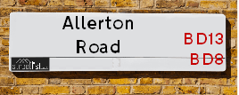
| Icon | Postcodes for Allerton Road | |
| Walking Distances | ||
| Distance Info | Green Circle = 10 Minutes Walk (800 metres) | |
About Allerton Road
Allerton Road is a street located in the city of Bradford and near the village of Thornton. The street has a length of approximately 4,765 metres.
Allerton Road is located within the Bradford District (B) Council's jurisdiction. They provide various services, like refuse collection, and manage council tax collection. It's situated in the Yorkshire and The Humber region of the UK.
Allerton Road has been assigned the Unique Street Reference Numbers of 7701740, 7796038, 7796599, 7796712, 7796828 and 7796919 in the National Street Gazetteer.
Allerton Road is located within the county of West Yorkshire, situated in the Yorkshire and The Humber region of the UK. It's 174.85 miles North West from central London., 11.52 miles West from Leeds, 28.34 miles North East from Manchester and 32.2 miles West from York.

Do you know why this road is called Allerton Road?
What's it like to live here?
Ask the community a question about Allerton Road.
Do you have any questions, memories to share or know any facts about Allerton Road? We'd love to know more.
Also on streetlist.co.uk, can you help?
Eldroth Road
15th April 2024
I wondered if anyone has any old pictures of Wenning Bank House in the 1940’s and also Lane Side before of the same era .. we visited today with my Mum in law as she used to live at both these properties. Also any photos of the schools around that time .. thank you.
Can You Help?Napps Way
15th April 2024
Why is the road called Napps Way (belonging to Napp, but minus an
apostrophe as is usual with such nomenclature)? Moreover, who or
what is, or was, “Napp” in the respective, possessive case?
Several years ago, I met an elderly man (probably in his late-eighties)
who lives on Bentham Drive, Liverpool 16, and during a conversation
with him whilst in a Northwest Passenger Transport Ambulance on the
way to the former RLUH (Royal Liverpool University Hospital), he told
me that he could remember (when he was a boy, living in Childwall,
Liverpool 16) that, “Where Napps Way is now, during WW2, there was
a two-man gun emplacement on the, then, open land to protect the
railway line passing over Childwall Valley Road - next to the railway
bridge - when suddenly, as they were loading a live “shell” into the gun’s
breach, the aforementioned “shell” accidentally exploded in the gun’s
breach killing both of the two soldiers, that had been manning the gun,
instantly! (Very sad, of course, but could - perhaps - two ghosts relating
to those two, very unfortunately and prematurely-killed soldiers have
haunted that place of their deaths ever since - and have any residents
of Napps Way - formerly and in its latest incarnation - seen two, WW2
(uniformed) soldiers unexpectedly appear in or near their homes?)
Mauritius Road
15th April 2024
Why is Mauritius Road so called, since when and by whom? Does Greenwich have any particular links with Mauritius? Very interested to know. 🤞🏼
Can You Help?Estate Agents near Allerton Road
| Name | Address | Website |
|---|---|---|
| Persona North | Haworth Road, Bradford, BD9 6NT | |
| Property Ladder Nationwide | 47 Wilsden Road, Bradford,BD15 9AD | |
| Whitney's | 11 Green End Clayton Bradford BD14 6BA |
We have found 26 postcodes for Allerton Road
Hotels near Allerton Road
Budget Hotels near Allerton Road
| Budget Hotel Name | Distance (miles) |
|---|---|
| 1: Name:ibis budget Bradford Address:6 Prince Court, Canal Road Telephone: Visit Site |
2.96 |
| 2: Name:Travelodge Bradford Central Address:2 Valley Rd, Bradford, BD1 4AF Telephone:0871 984 6171 Visit Site |
3.05 |
| 3: Name:Premier Inn Bradford Central Address:Vicar Lane Telephone: Visit Site |
3.22 |
| 4: Name:Holiday Inn Express Bradford City Centre Address:The Leisure Exchange, Vicar Lane Telephone: Visit Site |
3.26 |
| 5: Name:Premier Inn Bradford North Bingley Address:502 Bradford Road Telephone: Visit Site |
4.37 |
Location Details
| Allerton Road | |
|---|---|

| |
| Latitude | 53.804572 |
| Longitude | -1.824034 |
| OS Easting (X): | 411587 |
| OS Northing (Y): | 434290 |
| OS Grid Reference: | SE116343 |
Ordnance Survey Maps for Allerton Road
If you purchase a map through the links below, we may earn an affiliate commission.
| Map Series | link | Ordnance Survey |
| Explorer 1:25,000 288 Bradford and Huddersfield | Check Price on Amazon | Buy Direct from the Ordnance Survey |
| Landranger 1:50,000 104 Leeds & Bradford | Check Price on Amazon | Buy Direct from the Ordnance Survey |
Neighbourhood Policing |
| Police Force: West Yorkshire |
 View Neighbourhood Crime and Policing View Neighbourhood Crime and Policing |
| Find a Local Neighbourhood Watch Scheme |
Frequently asked Questions for Allerton Road
What Council (Local Authority) is Allerton Road in?
Allerton Road is located within the local authority area of Bradford Council which is a Metropolitan District.
What Parish Council is Allerton Road in?
Allerton Road is in an unparished area.
What Electoral Ward is Allerton Road in?
Allerton Road is located within the ward of Thornton and Allerton, Clayton and Fairweather Green &Toller.
What County is Allerton Road in?
Allerton Road is located within the ceremonial county of West Yorkshire.
What Constituency is Allerton Road in?
Allerton Road is located within the constituency of Bradford West.
What Part of the UK is Allerton Road in?
Allerton Road is located within the Yorkshire and The Humber region of the United Kingdom.
What County Council area is Allerton Road in?
Allerton Road is located within the West Yorkshire Council area.
What Police Force area is Allerton Road in?
Allerton Road is located within the West Yorkshire Police area.
Roads that have a Junction with Allerton Road
Sunset and Sunrise times for Allerton Road
| Sunrise | 05:54 |
|---|---|
| Sunset | 20:18 |
Latest Weather Conditions for Allerton Road
| Observed at Weather Station: | Bingley Samos 19 April 2024 at 05:00 (1.73 miles away) |
|---|---|
| Current Weather: | Overcast |
| Temperature and Humidity: | 7.3°C (90.7%) |
| Wind Direction and Speed: | WNW (15 mph) |
Population Statistics
| ONS Area Code | E00054460, E00053663, E00054454, E00054457, E00054456, E00054451, E00054455, E00054458, E00054453, E00054450, E00054439, E00054513, E00053664, E00053666 & E00054493 |
|---|---|
| ONS Area Name | Achieving Minorities, Hard-Pressed Ethnic Mix, Private Renting Young Families, White Professionals, Rural White-Collar Workers, Multi-Ethnic Suburbia & Pakistani Communities |
| Average Age | 33.51, 33.41, 39.22, 34.65, 33.56, 40.60, 35.75, 37.00 & 30.16 |
| Area Population | 1831.00, 1928.00, 1518.00, 1600.00, 1759.00, 1406.00, 1604.00, 1574.00 & 1809.00 |
| Male Population | 898.00, 920.00, 729.00, 776.00, 819.00, 699.00, 804.00, 751.00 & 968.00 (49%) |
| Female Population | 933.00, 1008.00, 789.00, 824.00, 940.00, 707.00, 800.00, 823.00 & 841.00 (51%) |
| Benefit Claimants | 41, 48, 33, 58, 78, 12, 34, 38 & 120 (3%) |
| LSOA Code: | E01010801, E01010629, E01010799, E01010802, E01010800, E01010797, E01010805, E01010630 &E01010803 |
|---|---|
| LSOA Name: | Bradford 036E, Bradford 040B, Bradford 036C, Bradford 036F, Bradford 036D, Bradford 043D, Bradford 030D, Bradford 040C &Bradford 037A |
| SOA Code: | 7b, 3d, 7a &8c |
| SOA Name: | |
| MSOA Code: | E02002218, E02002222, E02002225, E02002212 &E02002219 |
| MSOA Name: | Bradford 036, Bradford 040, Bradford 043, Bradford 030 &Bradford 037 |
Nearest Supermarkets
| Tesco Heaton Haworth Rd Express |
|---|
| 204-206 Haworth Rd, Heaton, Bradford, BD9 6NJ |
| 0345 671 9259 |
| Distance: 0.87 Miles |
| Directions from Allerton Road to Tesco Heaton Haworth Rd Express |
| Tesco Leaventhorpe Esso Express |
|---|
| Thornton Rd, Thornton, Bradford, BD13 3DG |
| 0345 674 6387 |
| Distance: 0.9 Miles |
| Directions from Allerton Road to Tesco Leaventhorpe Esso Express |
| Morrisons Bradford - Victoria |
|---|
| Victoria Shopping Centre, Young Street, Bradford BD8 9BN |
| 01274 498218 |
| Distance: 1.54 Miles |
| Directions from Allerton Road to Morrisons Bradford - Victoria |
| Asda Bradford Cemetery Road |
|---|
| Cemetery Road, Lidget Green, Bradford, BD7 2QX |
| 01274 476230 |
| Distance: 1.59 Miles |
| Directions from Allerton Road to Asda Bradford Cemetery Road |
Telephone Information
| Area Code |
|---|
| Area Code: 01274 - Bradford |
| Area Code: 01422 - Halifax |
| Area Code: 01535 - Keighley |
| Area Code: 01943 - Guiseley |
Broadband Information
| Speed | Average Speed | Median Speed | Maximum Speed | Next-generation access (NGA) | Number of Connections |
|---|---|---|---|---|---|
| Less than 2 Mbps | 15.2 | 8.6 | >=30 | Y | 20 |
Local Government
| Local Council Details |
|---|
| Within the area of Bradford |
| Visit the Council's Website |
| City Hall, Centenary Square, Bradford &BD1 1HY |
| Telephone Number: 01274 432111 |
| Local Member of Parliament |
|---|
| Within the Westminster Parliamentary Constituency of Bradford West |
| The Member of Parliament is Naz Shah |
| Details for the MP Naz Shah on parliament.uk |
| Details for the MP Naz Shah on theyworkforyou.com |
| In the 2019 General Election Naz Shah won with a majority of 27,019 the result was Lab hold. The total electorate was 70,694 |
| Wards, Parish Councils and County Councils |
|---|
| Ward: Thornton and Allerton, Clayton and Fairweather Green &Toller Ward |
| Ceremonial County: West Yorkshire |
Nearest Schools
| Name | Address | Postcode | Telephone | Type | Distance (Km) |
|---|
Data accessed from gov.scot 08-08-2019
Nearest Hospitals
| Name | Address | Postcode | Distance | Map |
|---|
Nearest Dentists
Dentists near Allerton Road
| Name | Address | Postcode | Distance | Map |
|---|
Nearest GP Surgeries
Doctors near Allerton Road
HOLLINS HEALTH & WELLBEING - ALLERTON
Address: ALLERTON HEALTH CENTRE, BELL DEAN ROAD, ALLERTON, BRADFORD, WEST YORKSHIRE, BD15 7WA
Distance: 0.44 miles
Contact: :
PHOENIX MEDICAL PRACTICE
Address: ALLERTON HEALTH CENTRE, BELL DEAN ROAD, ALLERTON, BRADFORD, WEST YORKSHIRE, BD15 7WA
Distance: 0.44 miles
Contact: tel: 08444 773615
DR VE WILSON
Address: LOWER GRANGE MEDICAL CENTRE, 33 BARNBY AVENUE, BRADFORD, WEST YORKSHIRE, BD8 0QN
Distance: 0.75 miles
Contact: tel: 01274 881646
THE HEATON MEDICAL PRACTICE
Address: HAWORTH ROAD, BRADFORD, BD9 6LL
Distance: 1.04 miles
Contact: :
THORNTON MEDICAL PRACTICE
Address: 4 CRAVEN AVENUE, THORNTON, BRADFORD, BD13 3LG
Distance: 1.36 miles
Contact: :
THORNTON & DENHOLME MEDICAL PRACTICE
Address: 4 CRAVEN AVENUE, OFF MARKET STREET, THORNTON, BRADFORD, WEST YORKSHIRE, BD13 3LG
Distance: 1.36 miles
Contact: tel: 01274 832110
Nearest Dispensing Chemists
Pharmacies near Allerton Road
| Name | Address | Postcode | Telephone | Map | Distance in Km |
|---|
Nearest Opticians
Opticians near Allerton Road
MYVISION OPTICIANS LTD
Address: 336 ALLERTON ROAD, ALLERTON, BRADFORD, BD15 7BN
Distance: 0.11 miles
Contact: :
EYEDEAL OPTICAL (YORKSHIRE) LTD
Address: 45 DUCKWORTH LANE, BRADFORD, WEST YORKSHIRE, BD9 5ET
Distance: 1.39 miles
Contact: :
CROSSROADS OPTICIANS
Address: 54 DUCKWORTH LANE, BRADFORD, WEST YORKSHIRE, BD9 5HB
Distance: 1.40 miles
Contact: :
SPECSAVERS (GIRLINGTON, BRADFORD)
Address: UNIT 12, MORRISONS SUPERMARKET, VICTORIA SHOPPING CENTRE, THORNTON ROAD, BRADFORD, WEST YORKSHIRE, BD8 9BN
Distance: 1.53 miles
Contact: :
PREMIER VISION VICTORIA
Address: INSIDE MORRISONS SUPERMARKET, VICTORIA CENTRE, THORNTON ROAD, BRADFORD, BD8 9BN
Distance: 1.53 miles
Contact: :
SARAH FARRAR LTD
Address: 160 MAIN STREET, WILSDEN, BRADFORD, WEST YORKSHIRE, BD15 0HX
Distance: 1.82 miles
Contact: :
Transport
Nearest Rail Stations
Frizinghall Station is 2.49 miles away.
Address: Frizinghall station, Frizinghall Road, Frizinghall, West Yorkshire, BD9 4LD
Frizinghall is situated on the Wharfedale Line|Leeds to Bradford lines and is managed by Northern.
Frizinghall Station is an unstaffed station.
Saltaire Station is 2.72 miles away.
Address: Saltaire station, Victoria Road, Saltaire, West Yorkshire, BD18 3LQ
Saltaire is situated on the Leeds to Morecambe line and is managed by Northern.
Saltaire Station is an unstaffed station.