Map of Bents Lane
| Postcodes | ||
|---|---|---|
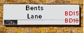
| Icon | Postcodes for Bents Lane | |
| Walking Distances | ||
| Distance Info | Green Circle = 10 Minutes Walk (800 metres) | |
About Bents Lane
Bents Lane is a street located near the village of Harden and in the village of Harecroft and near the village of Harecroft. The street has a length of approximately 1,994 metres.
Bents Lane is located within the Bradford District (B) Council's jurisdiction. They provide various services, like refuse collection, and manage council tax collection. It's situated in the Yorkshire and The Humber region of the UK.
Bents Lane has been assigned the Unique Street Reference Number of 7710180 in the National Street Gazetteer.
Bents Lane is located within the county of West Yorkshire, situated in the Yorkshire and The Humber region of the UK. It's 177.15 miles North West from central London., 13.76 miles West from Leeds, 28.39 miles North East from Manchester and 33.74 miles West from York.

Do you know why this road is called Bents Lane?
What's it like to live here?
Ask the community a question about Bents Lane.
Do you have any questions, memories to share or know any facts about Bents Lane? We'd love to know more.
Also on streetlist.co.uk, can you help?
Eldroth Road
15th April 2024
I wondered if anyone has any old pictures of Wenning Bank House in the 1940’s and also Lane Side before of the same era .. we visited today with my Mum in law as she used to live at both these properties. Also any photos of the schools around that time .. thank you.
Can You Help?Napps Way
15th April 2024
Why is the road called Napps Way (belonging to Napp, but minus an
apostrophe as is usual with such nomenclature)? Moreover, who or
what is, or was, “Napp” in the respective, possessive case?
Several years ago, I met an elderly man (probably in his late-eighties)
who lives on Bentham Drive, Liverpool 16, and during a conversation
with him whilst in a Northwest Passenger Transport Ambulance on the
way to the former RLUH (Royal Liverpool University Hospital), he told
me that he could remember (when he was a boy, living in Childwall,
Liverpool 16) that, “Where Napps Way is now, during WW2, there was
a two-man gun emplacement on the, then, open land to protect the
railway line passing over Childwall Valley Road - next to the railway
bridge - when suddenly, as they were loading a live “shell” into the gun’s
breach, the aforementioned “shell” accidentally exploded in the gun’s
breach killing both of the two soldiers, that had been manning the gun,
instantly! (Very sad, of course, but could - perhaps - two ghosts relating
to those two, very unfortunately and prematurely-killed soldiers have
haunted that place of their deaths ever since - and have any residents
of Napps Way - formerly and in its latest incarnation - seen two, WW2
(uniformed) soldiers unexpectedly appear in or near their homes?)
Mauritius Road
15th April 2024
Why is Mauritius Road so called, since when and by whom? Does Greenwich have any particular links with Mauritius? Very interested to know. 🤞🏼
Can You Help?Estate Agents near Bents Lane
| Name | Address | Website |
|---|---|---|
| Alan Slater Property Services | 143 Main Street, Wilsden, Bradford, BD15 0AQ | |
| Property Ladder Nationwide | 47 Wilsden Road, Bradford,BD15 9AD | |
| Holroyds | 146 Main Street, Bingley, BD16 2HL |
Hotels near Bents Lane
Budget Hotels near Bents Lane
| Budget Hotel Name | Distance (miles) |
|---|---|
| 1: Name:Premier Inn Bradford North Bingley Address:502 Bradford Road Telephone: Visit Site |
2.78 |
| 2: Name:Travelodge Keighley Address:Bradford Rd, Keighley, BD21 4BB Telephone:0871 559 1824 Visit Site |
3.26 |
| 3: Name:ibis budget Bradford Address:6 Prince Court, Canal Road Telephone: Visit Site |
5.32 |
| 4: Name:Travelodge Bradford Central Address:2 Valley Rd, Bradford, BD1 4AF Telephone:0871 984 6171 Visit Site |
5.50 |
| 5: Name:Premier Inn Bradford Central Address:Vicar Lane Telephone: Visit Site |
5.73 |
Location Details
| Bents Lane | |
|---|---|

| |
| Latitude | 53.826854 |
| Longitude | -1.875713 |
| OS Easting (X): | 408179 |
| OS Northing (Y): | 436762 |
| OS Grid Reference: | SE082368 |
Ordnance Survey Maps for Bents Lane
If you purchase a map through the links below, we may earn an affiliate commission.
| Map Series | link | Ordnance Survey |
| Explorer 1:25,000 288 Bradford and Huddersfield | Check Price on Amazon | Buy Direct from the Ordnance Survey |
| Landranger 1:50,000 104 Leeds & Bradford | Check Price on Amazon | Buy Direct from the Ordnance Survey |
Neighbourhood Policing |
| Police Force: West Yorkshire |
 View Neighbourhood Crime and Policing View Neighbourhood Crime and Policing |
| Find a Local Neighbourhood Watch Scheme |
Frequently asked Questions for Bents Lane
What Council (Local Authority) is Bents Lane in?
Bents Lane is located within the local authority area of Bradford Council which is a Metropolitan District.
What Parish Council is Bents Lane in?
Bents Lane is located within the area of Wilsden Parish Council.
What Electoral Ward is Bents Lane in?
Bents Lane is located within the ward of Bingley Rural.
What County is Bents Lane in?
Bents Lane is located within the ceremonial county of West Yorkshire.
What Constituency is Bents Lane in?
Bents Lane is located within the constituency of Shipley.
What Part of the UK is Bents Lane in?
Bents Lane is located within the Yorkshire and The Humber region of the United Kingdom.
What County Council area is Bents Lane in?
Bents Lane is located within the West Yorkshire Council area.
What Police Force area is Bents Lane in?
Bents Lane is located within the West Yorkshire Police area.
Roads that have a Junction with Bents Lane
| Street | Junction Type |
|---|---|
| Haworth Road (B6144) | junction |
| Hallas Lane | junction |
| Harden Lane | junction |
Sunset and Sunrise times for Bents Lane
| Sunrise | 05:51 |
|---|---|
| Sunset | 20:20 |
Latest Weather Conditions for Bents Lane
| Observed at Weather Station: | Bingley Samos 20 April 2024 at 05:00 (1.18 miles away) |
|---|---|
| Current Weather: | Clear night |
| Temperature and Humidity: | 0.5°C (78.5%) |
| Wind Direction and Speed: | WNW (7 mph) |
Population Statistics
| ONS Area Code | E00053458 |
|---|---|
| ONS Area Name | Rural White-Collar Workers |
| Average Age | 41.14 |
| Area Population | 1796.00 |
| Male Population | 844.00 (47%) |
| Female Population | 952.00 (53%) |
| Benefit Claimants | 24 (1%) |
| LSOA Code: | E01010590 |
|---|---|
| LSOA Name: | Bradford 031A |
| SOA Code: | 2b |
| SOA Name: | |
| MSOA Code: | E02002213 |
| MSOA Name: | Bradford 031 |
Nearest Supermarkets
| Sainsburys Bingley Main Street Local |
|---|
| 117 Main Street, Bingley, England, BD16 1AJ |
| 1274552098 |
| Distance: 2.12 Miles |
| Directions from Bents Lane to Sainsburys Bingley Main Street Local |
| Tesco Heaton Haworth Rd Express |
|---|
| 204-206 Haworth Rd, Heaton, Bradford, BD9 6NJ |
| 0345 671 9259 |
| Distance: 2.55 Miles |
| Directions from Bents Lane to Tesco Heaton Haworth Rd Express |
| Tesco Crossflatts Express |
|---|
| 1-2 Keighley Rd, Crossflatts, Bingley, BD16 2DY |
| 0345 026 9127 |
| Distance: 2.79 Miles |
| Directions from Bents Lane to Tesco Crossflatts Express |
| Morrisons Keighley |
|---|
| Worth Way, Keighley BD21 5AE |
| 01535 607554 |
| Distance: 2.89 Miles |
| Directions from Bents Lane to Morrisons Keighley |
Telephone Information
| Area Code |
|---|
| Area Code: 01535 - Keighley |
| Area Code: 01274 - Bradford |
| Area Code: 01422 - Halifax |
| Area Code: 01943 - Guiseley |
Broadband Information
| Speed | Average Speed | Median Speed | Maximum Speed | Next-generation access (NGA) | Number of Connections |
|---|---|---|---|---|---|
| Greater than 2 Mbps | 9 | 8.6 | 11.9 | N | 4 |
Local Government
| Local Council Details |
|---|
| Within the area of Bradford |
| Visit the Council's Website |
| City Hall, Centenary Square, Bradford &BD1 1HY |
| Telephone Number: 01274 432111 |
| Local Member of Parliament |
|---|
| Within the Westminster Parliamentary Constituency of Shipley |
| The Member of Parliament is Philip Davies |
| Details for the MP Philip Davies on parliament.uk |
| Details for the MP Philip Davies on theyworkforyou.com |
| In the 2019 General Election Philip Davies won with a majority of 6,242 the result was Con hold. The total electorate was 74,029 |
| Wards, Parish Councils and County Councils |
|---|
| Ward: Bingley Rural Ward |
| Ceremonial County: West Yorkshire |
Nearest Schools
| Name | Address | Postcode | Telephone | Type | Distance (Km) |
|---|
Data accessed from gov.scot 08-08-2019
Nearest Hospitals
| Name | Address | Postcode | Distance | Map |
|---|
Nearest Dentists
Dentists near Bents Lane
| Name | Address | Postcode | Distance | Map |
|---|
Nearest GP Surgeries
Doctors near Bents Lane
THE WILSDEN MEDICAL PRACTICE
Address: 2 LINGBOB COURT, WILSDEN, BRADFORD, WEST YORKSHIRE, BD15 0NJ
Distance: 0.83 miles
Contact: tel: 01535 273227
BROWN GM
Address: CULLINGWORTH MEDICAL CENTRE, 12 MILL STREET, CULLINGWORTH, BRADFORD, WEST YORKSHIRE, BD13 5HA
Distance: 0.97 miles
Contact: :
COTTINGLEY SURGERY
Address: 10 CANON PINNINGTON MEWS, BINGLEY, BD16 1AQ
Distance: 1.82 miles
Contact: :
DENHOLME MEDICAL PRACTICE
Address: 1 BACK ANN STREET, DENHOLME, BRADFORD, BD13 4AS
Distance: 1.84 miles
Contact: :
CLARK R
Address: THE MEDICAL CENTRE, ANNE STREET, DENHOLME, BRADFORD, WEST YORKSHIRE, BD13 4AN
Distance: 1.86 miles
Contact: :
MODALITY PARTNERSHIP (AWC)
Address: LONG LEE SURGERY, LONG LEE LANE, LONG LEE, KEIGHLEY, BD21 4TT
Distance: 2.29 miles
Contact: tel: 01535 606415
Nearest Dispensing Chemists
Pharmacies near Bents Lane
| Name | Address | Postcode | Telephone | Map | Distance in Km |
|---|
Nearest Opticians
Opticians near Bents Lane
SARAH FARRAR LTD
Address: 160 MAIN STREET, WILSDEN, BRADFORD, WEST YORKSHIRE, BD15 0HX
Distance: 0.79 miles
Contact: :
DAVID KENYON OPTICIANS
Address: 139 MAIN STREET, BINGLEY, WEST YORKSHIRE, BD16 1AJ
Distance: 2.12 miles
Contact: :
SPECSAVERS OPTICIANS (BINGLEY)
Address: 155 MAIN STREET, BINGLEY, WEST YORKSHIRE, BD16 1AJ
Distance: 2.12 miles
Contact: :
DAVID HOWARTH OPTOMETRISTS
Address: 158 MAIN STREET, BINGLEY, WEST YORKSHIRE, BD16 2HR
Distance: 2.13 miles
Contact: :
MYVISION OPTICIANS LTD
Address: 336 ALLERTON ROAD, ALLERTON, BRADFORD, BD15 7BN
Distance: 2.63 miles
Contact: :
YORKSHIRE EYECARE (SHIPLEY)
Address: 14 WEST WAY, SHIPLEY, WEST YORKSHIRE, BD18 4HW
Distance: 2.90 miles
Contact: :
Transport
Nearest Rail Stations
Bingley Station is 2.17 miles away.
Address: Bingley station, Wellington Street, Bingley, West Yorkshire, BD16 2NA
Bingley is situated on the Leeds to Morecambe line and is managed by Northern.
Bingley Station is staffed on a full time basis.
Crossflatts Station is 2.52 miles away.
Address: Crossflatts station, Keighley Road, Crossflatts, West Yorkshire, BD16 2RZ
Crossflatts is situated on the Leeds to Morecambe line and is managed by Northern.
Crossflatts Station is an unstaffed station.