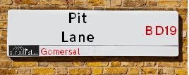
Map of Pit Lane
| Street Crime (updated 06/04/2024) | ||
|---|---|---|
| Location Note | Central Point of Street - Not Actual Location | |
| MSOA Info | For MSOA E02002274 (Statistical Neighbourhood) | |
| Click Hint | Click on a Circle for a detailed breakdown below map. | |
| Crime Levels |
Green = Very Low Yellow = Low Orange = High Red = Very High |
|
| Postcodes | ||
| Icon | Postcodes for Pit Lane | |
| Walking Distances | ||
| Distance Info | Green Circle = 10 Minutes Walk (800 metres) | |
About Pit Lane
Pit Lane is a street located in Gomersal. The street has a length of approximately 192 metres.
Pit Lane is located within the Kirklees District (B) Council's jurisdiction. They provide various services, like refuse collection, and manage council tax collection. It's situated in the Yorkshire and The Humber region of the UK.
Pit Lane has been assigned the Unique Street Reference Number of 19407788 in the National Street Gazetteer.
Pit Lane is located within the county of West Yorkshire, situated in the Yorkshire and The Humber region of the UK. It's 168.25 miles North West from central London., 7.45 miles South West from Leeds, 26.11 miles North from Sheffield and 27.15 miles North West from Doncaster.

Do you know why this road is called Pit Lane?
What's it like to live here?
Ask the community a question about Pit Lane.
Do you have any questions, memories to share or know any facts about Pit Lane? We'd love to know more.
Also on streetlist.co.uk, can you help?
Eldroth Road
15th April 2024
I wondered if anyone has any old pictures of Wenning Bank House in the 1940’s and also Lane Side before of the same era .. we visited today with my Mum in law as she used to live at both these properties. Also any photos of the schools around that time .. thank you.
Can You Help?Napps Way
15th April 2024
Why is the road called Napps Way (belonging to Napp, but minus an
apostrophe as is usual with such nomenclature)? Moreover, who or
what is, or was, “Napp” in the respective, possessive case?
Several years ago, I met an elderly man (probably in his late-eighties)
who lives on Bentham Drive, Liverpool 16, and during a conversation
with him whilst in a Northwest Passenger Transport Ambulance on the
way to the former RLUH (Royal Liverpool University Hospital), he told
me that he could remember (when he was a boy, living in Childwall,
Liverpool 16) that, “Where Napps Way is now, during WW2, there was
a two-man gun emplacement on the, then, open land to protect the
railway line passing over Childwall Valley Road - next to the railway
bridge - when suddenly, as they were loading a live “shell” into the gun’s
breach, the aforementioned “shell” accidentally exploded in the gun’s
breach killing both of the two soldiers, that had been manning the gun,
instantly! (Very sad, of course, but could - perhaps - two ghosts relating
to those two, very unfortunately and prematurely-killed soldiers have
haunted that place of their deaths ever since - and have any residents
of Napps Way - formerly and in its latest incarnation - seen two, WW2
(uniformed) soldiers unexpectedly appear in or near their homes?)
Mauritius Road
15th April 2024
Why is Mauritius Road so called, since when and by whom? Does Greenwich have any particular links with Mauritius? Very interested to know. 🤞🏼
Can You Help?Estate Agents near Pit Lane
| Name | Address | Website |
|---|---|---|
| Barford Property Services | 139 Birkenshaw Lane, Birkenshaw, Bradford,BD11 2HD | |
| Barkers | 4 Old Lane, Birkenshaw, Bradford, BD11 2JX | Visit Website |
| Robert Watts | 704 Bradford Road, Birkenshaw, Bradford, BD11 2AE | Visit Website |
Location Details
| Pit Lane | |
|---|---|

| |
| Latitude | 53.735900 |
| Longitude | -1.689575 |
| OS Easting (X): | 420474 |
| OS Northing (Y): | 426681 |
| OS Grid Reference: | SE205267 |
Neighbourhood Policing |
| Police Force: West Yorkshire |
| Find a Local Neighbourhood Watch Scheme |
Frequently asked Questions for Pit Lane
What Council (Local Authority) is Pit Lane in?
Pit Lane is located within the local authority area of Kirklees Council which is a Metropolitan District.
What Parish Council is Pit Lane in?
Pit Lane is in an unparished area.
What Electoral Ward is Pit Lane in?
Pit Lane is located within the ward of Birstall and Birkenshaw &Liversedge and Gomersal.
What County is Pit Lane in?
Pit Lane is located within the ceremonial county of West Yorkshire.
What Constituency is Pit Lane in?
Pit Lane is located within the constituency of Batley and Spen.
What Part of the UK is Pit Lane in?
Pit Lane is located within the Yorkshire and The Humber region of the United Kingdom.
What County Council area is Pit Lane in?
Pit Lane is located within the West Yorkshire Council area.
What Police Force area is Pit Lane in?
Pit Lane is located within the West Yorkshire Police area.
Roads that have a Junction with Pit Lane
| Street | Junction Type |
|---|---|
| Latham Lane | junction |
| Oxford Road (A651) | junction |
Sunset and Sunrise times for Pit Lane
| Sunrise | 05:42 |
|---|---|
| Sunset | 20:27 |
Latest Weather Conditions for Pit Lane
| Observed at Weather Station: | Bingley Samos 24 April 2024 at 17:00 (8.85 miles away) |
|---|---|
| Current Weather: | Overcast |
| Temperature and Humidity: | 7.2°C (53.1%) |
| Wind Direction and Speed: | NW (6 mph) |
Population Statistics
| ONS Area Code | E00056653 & E00056654 |
|---|---|
| ONS Area Name | Comfortable Suburbia & Ageing in Suburbia |
| Average Age | 41.88 |
| Area Population | 1705.00 |
| Male Population | 844.00 (50%) |
| Female Population | 861.00 (50%) |
| Benefit Claimants | 5 (0%) |
| LSOA Code: | E01011241 |
|---|---|
| LSOA Name: | Kirklees 004A |
| SOA Code: | 8c |
| SOA Name: | |
| MSOA Code: | E02002274 |
| MSOA Name: | Kirklees 004 |
Nearest Supermarkets
| Sainsburys Gomersal Oxford Road Local |
|---|
| 298 Oxford Road, Gomersal, England, BD19 4PX |
| 1274861878 |
| Distance: 0.45 Miles |
| Directions from Pit Lane to Sainsburys Gomersal Oxford Road Local |
| Tesco Birstall Smithies Ln Express |
|---|
| 3 Smithies Ln, Birstall, Batley, WF17 9EH |
| 0345 026 9387 |
| Distance: 1.22 Miles |
| Directions from Pit Lane to Tesco Birstall Smithies Ln Express |
| Tesco Cleckheaton Superstore |
|---|
| 49 Northgate, Cleckheaton, BD19 3HS |
| 0345 677 9167 |
| Distance: 1.27 Miles |
| Directions from Pit Lane to Tesco Cleckheaton Superstore |
| Morrisons Heckmondwike |
|---|
| 17 Union Street, Heckmondwike WF16 0HD |
| 01924 410014 |
| Distance: 2.05 Miles |
| Directions from Pit Lane to Morrisons Heckmondwike |
Telephone Information
| Area Code |
|---|
| Area Code: 01274 - Bradford |
| Area Code: 01422 - Halifax |
| Area Code: 01484 - Huddersfield |
| Area Code: 0113 - Leeds |
Local Government
| Local Council Details |
|---|
| Within the area of Kirklees |
| Visit the Council's Website |
| Civic Centre 3, Market Street, Huddersfield &HD1 1WG |
| Send email |
| Telephone Number: 01484 221 000 |
| Local Member of Parliament |
|---|
| Within the Westminster Parliamentary Constituency of Batley and Spen |
| The Member of Parliament is Tracy Brabin |
| Details for the MP Tracy Brabin on parliament.uk |
| Details for the MP Tracy Brabin on theyworkforyou.com |
| In the 2019 General Election Tracy Brabin won with a majority of 3,525 the result was Lab hold. The total electorate was 79,558 |
| Wards, Parish Councils and County Councils |
|---|
| Ward: Birstall and Birkenshaw &Liversedge and Gomersal Ward |
| Parish: Unparished area |
| Ceremonial County: West Yorkshire |
Nearest Schools
England Primary Schools
Windmill CofE (VC) Primary School
Address: Windmill CofE (VC) Primary School, Upper Batley Lane, Batley, West Yorkshire, WF17 0NP
Distance: 1.83 miles
Contact: 01924470555
Birstall Primary Academy
Address: Birstall Primary Academy, Chapel Lane, Birstall, Batley, West Yorkshire, WF17 9EE
Distance: 1.26 miles
Contact: 01924471372
St Peter's Church of England Voluntary Aided Junior, Infant and Early Years School
Address: St Peter's Church of England Voluntary Aided Junior, Infant and Early Years School, Fieldhead Lane, Birstall, Batley, West Yorkshire, WF17 9HN
Distance: 1.01 miles
Contact: 01924326750
St Patrick's Catholic Primary School, Birstall
Address: St Patrick's Catholic Primary School, Birstall, Nova Lane, Birstall, Batley, West Yorkshire, WF17 9LQ
Distance: 0.88 miles
Contact:
The John Curwen Co-Operative Primary Academy
Address: The John Curwen Co-Operative Primary Academy, Leeds Old Road, Heckmondwike, West Yorkshire, WF16 9BB
Distance: 1.37 miles
Contact:
Drighlington Primary School
Address: Drighlington Primary School, Moorland Road, Drighlington, Bradford, West Yorkshire, BD11 1JY
Distance: 1.63 miles
Contact: 01132853000
Gomersal St Mary's Church of England Voluntary Controlled Primary School
Address: Gomersal St Mary's Church of England Voluntary Controlled Primary School, Shirley Avenue, Gomersal, Cleckheaton, West Yorkshire, BD19 4NA
Distance: 0.56 miles
Contact: 01274874550
Birkenshaw Church of England Voluntary Controlled Primary School
Address: Birkenshaw Church of England Voluntary Controlled Primary School, Station Lane, Birkenshaw, Bradford, West Yorkshire, BD11 2JE
Distance: 1.29 miles
Contact: 01274651232
Gomersal Primary School
Address: Gomersal Primary School, Oxford Road, Gomersal, Cleckheaton, West Yorkshire, BD19 4PX
Distance: 0.42 miles
Contact: 01274879313
Littletown Junior Infant and Nursery School
Address: Littletown Junior Infant and Nursery School, Bradford Road, Liversedge, West Yorkshire, WF15 6LP
Distance: 1.37 miles
Contact: 01274878136
East Bierley Church of England Voluntary Controlled Primary School
Address: East Bierley Church of England Voluntary Controlled Primary School, South View Road, East Bierley, Bradford, West Yorkshire, BD4 6PH
Distance: 1.70 miles
Contact: 01274681235
Howard Park Community School
Address: Howard Park Community School, St. Peg Lane, Cleckheaton, BD19 3SA
Distance: 1.19 miles
Contact: 01274864972
Millbridge, A Share Primary Academy
Address: Millbridge, A Share Primary Academy, Vernon Road, Liversedge, West Yorkshire, WF15 6HU
Distance: 1.81 miles
Contact: 01924668836
Whitechapel Church of England Primary School
Address: Whitechapel Church of England Primary School, Whitechapel Road, Cleckheaton, West Yorkshire, BD19 6HR
Distance: 1.57 miles
Contact: 01274876461
England Secondary Schools
BBG Academy
Address: BBG Academy, Bradford Road, Birkenshaw, West Yorkshire, BD19 4BE
Distance: 0.57 miles
Contact: 01274871225
Nearest Hospitals
| Dewsbury and District Hospital |
|---|
| Address: Halifax Road, Dewsbury, WF13 4HS, |
| NHS Sector |
| Mid Yorkshire Hospitals NHS Trust |
| Telephone: 01924 541000 |
| Visit Hospital Website |
| Distance: 4.49 (miles) |
| Directions from to Dewsbury and District Hospital |
| Cygnet Hospital Bierley |
|---|
| Address: Bierley Lane, Bradford, BD4 6AD, |
| NHS Sector |
| Cygnet Health Care Limited |
| Telephone: 01274 686 767 |
| Visit Hospital Website |
| Distance: 4.58 (miles) |
| Directions from to Cygnet Hospital Bierley |
| Cygnet Hospital Wyke |
|---|
| Address: Blankney Grange, Huddersfield Road, Wyke, Bradford, BD12 8LR, |
| Independent Sector |
| Cygnet Health Care Limited |
| Telephone: 01274 605500 |
| Visit Hospital Website |
| Distance: 5.65 (miles) |
| Directions from to Cygnet Hospital Wyke |
Nearest Dentists
Dentists near Pit Lane
57 BRADFORD ROAD (DENTAL PRACTICE)
Address: 57 BRADFORD ROAD, CLECKHEATON, WEST YORKSHIRE, BD19 3LB
Distance: 1.12 miles
Contact: :
HIGH STREET DENTAL PRACTICE
Address: 1 HIGH STREET, BIRSTALL, BATLEY, WEST YORKSHIRE, WF17 9ES
Distance: 1.24 miles
Contact: :
NORTHGATE DENTAL PRACTICE
Address: 5 NORTHGATE, CLECKHEATON, WEST YORKSHIRE, BD19 3HH
Distance: 1.30 miles
Contact: :
GREENSIDE DENTAL CLINIC
Address: 1 MORTIMER STREET, CLECKHEATON, WEST YORKSHIRE, BD19 5AR
Distance: 1.34 miles
Contact: :
CLECKHEATON HEALTH CENTRE
Address: GREENSIDE, CLECKHEATON, BD19 5AP
Distance: 1.35 miles
Contact: :
OASIS DENTAL CARE
Address: 19 CEMETERY ROAD, HECKMONDWIKE, WEST YORKSHIRE, WF16 9QS
Distance: 2.03 miles
Contact: :
Nearest GP Surgeries
Doctors near Pit Lane
OXFORD ROAD BRANCH SURGERY
Address: 284A OXFORD ROAD, GOMERSAL, CLECKHEATON, WEST YORKSHIRE, BD19 4PY
Distance: 0.54 miles
Contact: tel: 01274 852995
YORK HOUSE
Address: 284A OXFORD ROAD, GOMERSAL, WEST YORKSHIRE, BD19 4PY
Distance: 0.54 miles
Contact: tel: 01274 852985
KIRKGATE SURGERY
Address: 3 KIRKGATE, BIRSTALL, BATLEY, WEST YORKSHIRE, WF17 9HE
Distance: 0.93 miles
Contact: tel: 01924 420242
BLACKBURN RD.MEDICAL CTR.
Address: BLACKBURN ROAD, BIRSTALL, BATLEY, WEST YORKSHIRE, WF17 9PL
Distance: 1.06 miles
Contact: tel: 01924 552200
CLECKHEATON GROUP PRACTICE
Address: CROSS CHURCH STREET, CLECKHEATON, WEST YORKSHIRE, BD19 3RQ
Distance: 1.19 miles
Contact: tel: 01274 957846
BIRKENSHAW HEALTH CENTRE
Address: TOWN STREET, BIRKENSHAW, BRADFORD, WEST YORKSHIRE, BD11 2HX
Distance: 1.19 miles
Contact: tel: 01274 682374
Nearest Dispensing Chemists
Pharmacies near Pit Lane
GOMERSAL PHARMACY
Address: 260 OXFORD ROAD, GOMERSAL, CLECKHEATON, WEST YORKSHIRE, BD19 4PY
Distance: 0.54 miles
Contact: tel: 01274 852321
KNIGHTS OAKWOOD PHARMACY
Address: THE OLD SALVATION HALL, 74 BLACKBURN RD, BIRSTALL, BATLEY, WEST YORKSHIRE, WF17 9PL
Distance: 1.06 miles
Contact: tel: 01924 474244
KIRKLEES PHARMACY
Address: ST. JOHNS HOUSE, CROSS CHURCH STREET, CLECKHEATON, WEST YORKSHIRE, BD19 3RQ
Distance: 1.19 miles
Contact: tel: 01274 879579
BIRKENSHAW PHARMACY
Address: TOWN STREET MEDICAL CENTRE, TOWN STREET, BIRKENSHAW, BRADFORD, BD11 2HX
Distance: 1.19 miles
Contact: tel: 01274 688662
WINER CHEMIST
Address: 1 BOND STREET, BIRSTALL, BATLEY, WEST YORKSHIRE, WF17 9EX
Distance: 1.22 miles
Contact: tel: 01924 472498
BIRSTALL PHARMACY
Address: 8 MARKET PLACE, BIRSTALL, BATLEY, WEST YORKSHIRE, WF17 9EL
Distance: 1.23 miles
Contact: tel: 01924 473315
Nearest Opticians
Opticians near Pit Lane
STYLE & VISION (CLECKHEATON)
Address: 6 BRADFORD ROAD, CLECKHEATON, WEST YORKSHIRE, BD19 3RJ
Distance: 1.21 miles
Contact: :
EYE CARE MATTERS (BATLEY)
Address: 15 LOW LANE, BIRSTALL, BATLEY, WEST YORKSHIRE, WF17 9EW
Distance: 1.24 miles
Contact: :
OPENSHAW OPTICIANS
Address: UNIT 4, 16 CHEAPSIDE, CLECKHEATON, BD19 5AF
Distance: 1.25 miles
Contact: :
SMITH AND HUGHES OPTICIANS
Address: 35-37 NORTHGATE, CLECKHEATON, WEST YORKSHIRE, BD19 3HS
Distance: 1.26 miles
Contact: :
CLECKHEATON SPECSAVERS
Address: 4/4B CENTRAL PARADE, CLECKHEATON, BD19 3RU
Distance: 1.26 miles
Contact: :
SPECSAVERS (CLECKHEATON)
Address: 4-4B CENTRAL PARADE, CLECKHEATON, BD19 3RU
Distance: 1.26 miles
Contact: :
Transport
Nearest Rail Stations
Low Moor Station is 2.76 miles away.
Address: Low Moor station, New Works Road, Low Moor, West Yorkshire, BD12 7BD
Low Moor is situated on the Calder Valley line and is managed by Northern.
Low Moor Station is an unstaffed station.
Batley Station is 3.30 miles away.
Address: Batley station, Upper Station Road, Batley, West Yorkshire, WF17 5TA
Batley is situated on the Huddersfield line and is managed by Northern.
Batley Station is an unstaffed station.