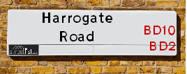
Map of Harrogate Road
| Postcodes | ||
|---|---|---|
| Icon | Postcodes for Harrogate Road | |
| Walking Distances | ||
| Distance Info | Green Circle = 10 Minutes Walk (800 metres) | |
About Harrogate Road
Harrogate Road is a street located in the city of Bradford. The street has a length of approximately 4,495 metres.
Harrogate Road is located within the Bradford District (B) Council's jurisdiction. They provide various services, like refuse collection, and manage council tax collection. It's situated in the Yorkshire and The Humber region of the UK.
Harrogate Road has been assigned the Unique Street Reference Numbers of 7700254, 7796018, 7735620, 7796335, 7796964 and 7797196 in the National Street Gazetteer.
Harrogate Road is located within the county of West Yorkshire, situated in the Yorkshire and The Humber region of the UK. It's 174.23 miles North West from central London., 7.31 miles West from Leeds, 27.62 miles West from York and 31.67 miles North West from Doncaster.

Do you know why this road is called Harrogate Road?
What's it like to live here?
Ask the community a question about Harrogate Road.
Do you have any questions, memories to share or know any facts about Harrogate Road? We'd love to know more.
Also on streetlist.co.uk, can you help?
Eldroth Road
15th April 2024
I wondered if anyone has any old pictures of Wenning Bank House in the 1940’s and also Lane Side before of the same era .. we visited today with my Mum in law as she used to live at both these properties. Also any photos of the schools around that time .. thank you.
Can You Help?Napps Way
15th April 2024
Why is the road called Napps Way (belonging to Napp, but minus an
apostrophe as is usual with such nomenclature)? Moreover, who or
what is, or was, “Napp” in the respective, possessive case?
Several years ago, I met an elderly man (probably in his late-eighties)
who lives on Bentham Drive, Liverpool 16, and during a conversation
with him whilst in a Northwest Passenger Transport Ambulance on the
way to the former RLUH (Royal Liverpool University Hospital), he told
me that he could remember (when he was a boy, living in Childwall,
Liverpool 16) that, “Where Napps Way is now, during WW2, there was
a two-man gun emplacement on the, then, open land to protect the
railway line passing over Childwall Valley Road - next to the railway
bridge - when suddenly, as they were loading a live “shell” into the gun’s
breach, the aforementioned “shell” accidentally exploded in the gun’s
breach killing both of the two soldiers, that had been manning the gun,
instantly! (Very sad, of course, but could - perhaps - two ghosts relating
to those two, very unfortunately and prematurely-killed soldiers have
haunted that place of their deaths ever since - and have any residents
of Napps Way - formerly and in its latest incarnation - seen two, WW2
(uniformed) soldiers unexpectedly appear in or near their homes?)
Mauritius Road
15th April 2024
Why is Mauritius Road so called, since when and by whom? Does Greenwich have any particular links with Mauritius? Very interested to know. 🤞🏼
Can You Help?Estate Agents near Harrogate Road
| Name | Address | Website |
|---|---|---|
| Keepmoat, Vision | Harrogate Road, Bradford, BD2 3HP | Visit Website |
| WW Estates | 359-361 Idle Road, Bradford, BD2 2AH | Visit Website |
| Robert Watts | 21a Highfield Road, Five Lane Ends, Bradford, BD2 2AU | Visit Website |
We have found 34 postcodes for Harrogate Road
Hotels near Harrogate Road
Budget Hotels near Harrogate Road
| Budget Hotel Name | Distance (miles) |
|---|---|
| 1: Name:Travelodge Bradford Address:Mid Point, Bradford, BD3 7AY Telephone:0871 984 6124 Visit Site |
1.81 |
| 2: Name:ibis budget Bradford Address:6 Prince Court, Canal Road Telephone: Visit Site |
2.00 |
| 3: Name:Travelodge Bradford Central Address:2 Valley Rd, Bradford, BD1 4AF Telephone:0871 984 6171 Visit Site |
2.26 |
| 4: Name:Premier Inn Bradford Central Address:Vicar Lane Telephone: Visit Site |
2.45 |
| 5: Name:Holiday Inn Express Bradford City Centre Address:The Leisure Exchange, Vicar Lane Telephone: Visit Site |
2.55 |
Location Details
| Harrogate Road | |
|---|---|

| |
| Latitude | 53.823388 |
| Longitude | -1.716580 |
| OS Easting (X): | 418654 |
| OS Northing (Y): | 436407 |
| OS Grid Reference: | SE187364 |
Ordnance Survey Maps for Harrogate Road
If you purchase a map through the links below, we may earn an affiliate commission.
| Map Series | link | Ordnance Survey |
| Explorer 1:25,000 288 Bradford and Huddersfield | Check Price on Amazon | Buy Direct from the Ordnance Survey |
| Landranger 1:50,000 104 Leeds & Bradford | Check Price on Amazon | Buy Direct from the Ordnance Survey |
Neighbourhood Policing |
| Police Force: West Yorkshire |
 View Neighbourhood Crime and Policing View Neighbourhood Crime and Policing |
| Find a Local Neighbourhood Watch Scheme |
Frequently asked Questions for Harrogate Road
What Council (Local Authority) is Harrogate Road in?
Harrogate Road is located within the local authority area of Bradford Council which is a Metropolitan District.
What Parish Council is Harrogate Road in?
Harrogate Road is in an unparished area.
What Electoral Ward is Harrogate Road in?
Harrogate Road is located within the ward of Eccleshill, Idle and Thackley, Bolton and Undercliffe &Bowling and Barkerend.
What County is Harrogate Road in?
Harrogate Road is located within the ceremonial county of West Yorkshire.
What Constituency is Harrogate Road in?
Harrogate Road is located within the constituency of Bradford East.
What Part of the UK is Harrogate Road in?
Harrogate Road is located within the Yorkshire and The Humber region of the United Kingdom.
What County Council area is Harrogate Road in?
Harrogate Road is located within the West Yorkshire Council area.
What Police Force area is Harrogate Road in?
Harrogate Road is located within the West Yorkshire Police area.
Roads that have a Junction with Harrogate Road
Sunset and Sunrise times for Harrogate Road
| Sunrise | 06:00 |
|---|---|
| Sunset | 20:12 |
Latest Weather Conditions for Harrogate Road
| Observed at Weather Station: | Bingley Samos 16 April 2024 at 12:00 (6.11 miles away) |
|---|---|
| Current Weather: | Cloudy |
| Temperature and Humidity: | 9.4°C (59.1%) |
| Wind Direction and Speed: | N (13 mph) |
Population Statistics
| ONS Area Code | E00053751, E00053780, E00053906, E00053762, E00053889, E00053904, E00053777, E00053897, E00053536, E00054570, E00054606, E00054604, E00054603, E00053774, E00054598, E00053771, E00053769 & E00053742 |
|---|---|
| ONS Area Name | Industrious Transitions, Hard-Pressed Ethnic Mix, Families in Terraces and Flats, Multi-Ethnic Professionals with Families, White Professionals, Social Renting New Arrivals, Retired Independent City Dwellers, Multi-Ethnic Suburbia & Multi-Ethnic Hardship |
| Average Age | 39.24, 37.18, 39.84, 38.88, 41.71, 37.10, 37.46, 39.52, 37.48 & 41.03 |
| Area Population | 1395.00, 1572.00, 1613.00, 1696.00, 1508.00, 1398.00, 1728.00, 1624.00, 1346.00 & 1521.00 |
| Male Population | 694.00, 739.00, 816.00, 819.00, 676.00, 662.00, 857.00, 783.00, 667.00 & 749.00 (48%) |
| Female Population | 701.00, 833.00, 797.00, 877.00, 832.00, 736.00, 871.00, 841.00, 679.00 & 772.00 (52%) |
| Benefit Claimants | 36, 57, 7, 25, 48, 60, 35, 67, 28 & 19 (2%) |
| LSOA Code: | E01010649, E01010653, E01010683, E01010689, E01010682, E01010654, E01010601, E01010828, E01010825 &E01010651 |
|---|---|
| LSOA Name: | Bradford 027A, Bradford 026B, Bradford 017A, Bradford 019F, Bradford 019C, Bradford 027C, Bradford 032A, Bradford 035A, Bradford 032C &Bradford 032B |
| SOA Code: | 4c, 3a, 7a, 3b &8c |
| SOA Name: | |
| MSOA Code: | E02002209, E02002208, E02002199, E02002201, E02002214 &E02002217 |
| MSOA Name: | Bradford 027, Bradford 026, Bradford 017, Bradford 019, Bradford 032 &Bradford 035 |
Nearest Supermarkets
| Sainsburys Bradford |
|---|
| 760 Harrogate Road, Bradford, England, BD10 0QF |
| 01274 614820 |
| Distance: 0.46 Miles |
| Directions from Harrogate Road to Sainsburys Bradford |
| Asda Greengates |
|---|
| 147 New Line, Greengates, Bradford, BD10 0BT |
| 01274 476210 |
| Distance: 0.59 Miles |
| Directions from Harrogate Road to Asda Greengates |
| Morrisons Bradford - Enterprise 5 |
|---|
| 275 Bradford Road, Idle, Bradford BD10 8EG |
| 01274 615496 |
| Distance: 0.62 Miles |
| Directions from Harrogate Road to Morrisons Bradford - Enterprise 5 |
| Tesco Bradford Bolton Express |
|---|
| Bolton Rd, Bradford, BD2 4HP |
| 0345 610 6382 |
| Distance: 1.06 Miles |
| Directions from Harrogate Road to Tesco Bradford Bolton Express |
Telephone Information
| Dialling Code | Telephone Exchange | Telephone Cabinet | Fibre to the Cabinet or Fibre to the Premises |
|---|---|---|---|
| 01274 | UNDERCLIFFE - MYUND | P15 | FTTC |
Local Government
| Local Council Details |
|---|
| Within the area of Bradford |
| Visit the Council's Website |
| City Hall, Centenary Square, Bradford &BD1 1HY |
| Telephone Number: 01274 432111 |
| Local Member of Parliament |
|---|
| Within the Westminster Parliamentary Constituency of Bradford East |
| The Member of Parliament is Imran Hussain |
| Details for the MP Imran Hussain on parliament.uk |
| Details for the MP Imran Hussain on theyworkforyou.com |
| In the 2019 General Election Imran Hussain won with a majority of 18,144 the result was Lab hold. The total electorate was 73,206 |
| Wards, Parish Councils and County Councils |
|---|
| Ward: Eccleshill, Idle and Thackley, Bolton and Undercliffe &Bowling and Barkerend Ward |
| Ceremonial County: West Yorkshire |
Nearest Schools
| Name | Address | Postcode | Telephone | Type | Distance (Km) |
|---|
Data accessed from gov.scot 08-08-2019
Nearest Hospitals
| Name | Address | Postcode | Distance | Map |
|---|
Nearest Dentists
Dentists near Harrogate Road
| Name | Address | Postcode | Distance | Map |
|---|
Nearest GP Surgeries
Doctors near Harrogate Road
ASHCROFT SURGERY
Address: NEWLANDS WAY, ECCLESHILL, BRADFORD, WEST YORKSHIRE, BD10 0JE
Distance: 0.22 miles
Contact: tel: 01274 612279
ECCLESHILL COMMUNITY HOSPITAL
Address: NEWLANDS WAY, BRADFORD, BD10 0JE
Distance: 0.22 miles
Contact: :
ECCLESHILL VILLAGE SURGERY
Address: 14 INSTITUTE ROAD, ECCLESHILL, BRADFORD, WEST YORKSHIRE, BD2 2HX
Distance: 0.40 miles
Contact: tel: 01274 637417
DR WINN
Address: ROCKWELL MEDICAL CENTRE, 2 SUMMERFIELD ROAD, THORPE EDGE, BRADFORD, WEST YORKSHIRE, BD10 8DP
Distance: 0.45 miles
Contact: :
HAIGH HALL MEDICAL PRACTICE
Address: HAIGH HALL ROAD, GREENGATES, BRADFORD, BD10 9AZ
Distance: 0.54 miles
Contact: tel: 01274 613326
WATSON KJ
Address: CALVERLEY MEDICAL CENTRE, 43 UPPER CARR LANE, CALVERLEY, LEEDS, WEST YORKSHIRE, LS28 5PL
Distance: 1.08 miles
Contact: :
Nearest Dispensing Chemists
Pharmacies near Harrogate Road
| Name | Address | Postcode | Telephone | Map | Distance in Km |
|---|
Nearest Opticians
Opticians near Harrogate Road
A SMITH OPTICIANS (HARROGATE ROAD)
Address: 917 HARROGATE ROAD, BRADFORD, BD10 0QY
Distance: 0.54 miles
Contact: :
TRUESMITHS (BRADFORD)
Address: MORRISONS ENTERPRISE 5, 275 BRADFORD ROAD, IDLE, BRADFORD, BD10 8EG
Distance: 0.62 miles
Contact: :
SPECSAVERS (IDLE, BRADFORD)
Address: ENTERPRISE WAY, FIVE LANE ENDS, IDLE, BRADFORD, WEST YORKSHIRE, BD10 8EW
Distance: 0.63 miles
Contact: :
HAMDY LTD
Address: 12 NORTHEDGE MEADOW, BRADFORD, BD10 8SF
Distance: 0.80 miles
Contact: :
GLASSES PLUS OPTICIANS
Address: 209 DUDLEY HILL ROAD, BRADFORD, WEST YORKSHIRE, BD2 3AE
Distance: 1.08 miles
Contact: :
STYLE & VISION LTD (BRADFORD)
Address: 12 HARROGATE ROAD, BRADFORD, WEST YORKSHIRE, BD2 3DU
Distance: 1.12 miles
Contact: :
Transport
Nearest Rail Stations
Apperley Bridge Station is 1.36 miles away.
Address: Apperley Bridge station, Station Approach, Apperley Bridge, West Yorkshire, BD10 0FD
Apperley Bridge is situated on the Leeds to Bradford lines and is managed by Northern.
Apperley Bridge Station is an unstaffed station.
Directions from Harrogate Road to Apperley Bridge Rail Station
New Pudsey Station is 1.96 miles away.
Address: New Pudsey station, Owlcotes Lane, New Pudsey, West Yorkshire, LS28 6QG
New Pudsey is situated on the Calder Valley line and is managed by Northern.
New Pudsey Station is staffed on a full time basis.