Map of Temple Row
| Postcodes | ||
|---|---|---|
| Icon | Postcodes for Temple Row | |
| Walking Distances | ||
| Distance Info | Green Circle = 10 Minutes Walk (800 metres) | |
About Temple Row
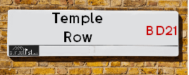
Temple Row is a street located in the town of Keighley. It uses the postcode BD21 2AH. The street has a length of approximately 102 metres.
Temple Row is located within the Bradford District (B) Council's jurisdiction. They provide various services, like refuse collection, and manage council tax collection. It's situated in the Yorkshire and The Humber region of the UK.
Temple Row has been assigned the Unique Street Reference Number of 7774620 in the National Street Gazetteer.
Temple Row is located within the county of West Yorkshire, situated in the Yorkshire and The Humber region of the UK. It's 180.22 miles North West from central London., 15.73 miles West from Leeds, 30.06 miles North East from Manchester and 34.46 miles West from York.

Do you know why this road is called Temple Row?
What's it like to live here?
Ask the community a question about Temple Row.
Do you have any questions, memories to share or know any facts about Temple Row? We'd love to know more.
Also on streetlist.co.uk, can you help?
Eldroth Road
15th April 2024
I wondered if anyone has any old pictures of Wenning Bank House in the 1940’s and also Lane Side before of the same era .. we visited today with my Mum in law as she used to live at both these properties. Also any photos of the schools around that time .. thank you.
Can You Help?Napps Way
15th April 2024
Why is the road called Napps Way (belonging to Napp, but minus an
apostrophe as is usual with such nomenclature)? Moreover, who or
what is, or was, “Napp” in the respective, possessive case?
Several years ago, I met an elderly man (probably in his late-eighties)
who lives on Bentham Drive, Liverpool 16, and during a conversation
with him whilst in a Northwest Passenger Transport Ambulance on the
way to the former RLUH (Royal Liverpool University Hospital), he told
me that he could remember (when he was a boy, living in Childwall,
Liverpool 16) that, “Where Napps Way is now, during WW2, there was
a two-man gun emplacement on the, then, open land to protect the
railway line passing over Childwall Valley Road - next to the railway
bridge - when suddenly, as they were loading a live “shell” into the gun’s
breach, the aforementioned “shell” accidentally exploded in the gun’s
breach killing both of the two soldiers, that had been manning the gun,
instantly! (Very sad, of course, but could - perhaps - two ghosts relating
to those two, very unfortunately and prematurely-killed soldiers have
haunted that place of their deaths ever since - and have any residents
of Napps Way - formerly and in its latest incarnation - seen two, WW2
(uniformed) soldiers unexpectedly appear in or near their homes?)
Mauritius Road
15th April 2024
Why is Mauritius Road so called, since when and by whom? Does Greenwich have any particular links with Mauritius? Very interested to know. 🤞🏼
Can You Help?Estate Agents near Temple Row
| Name | Address | Website |
|---|---|---|
| Holroyds | 59 North Street, Keighley, BD21 3SL | Visit Website |
| Martin & Co | 2 North Street, Keighley, BD21 3SE | Visit Website |
| Your Move | 6 North Street, Keighley, BD21 3SE | Visit Website |
We have found 1 postcode for Temple Row
Hotels near Temple Row
Budget Hotels near Temple Row
| Budget Hotel Name | Distance (miles) |
|---|---|
| 1: Name:Travelodge Keighley Address:Bradford Rd, Keighley, BD21 4BB Telephone:0871 559 1824 Visit Site |
0.69 |
| 2: Name:Premier Inn Bradford North Bingley Address:502 Bradford Road Telephone: Visit Site |
2.25 |
| 3: Name:ibis budget Bradford Address:6 Prince Court, Canal Road Telephone: Visit Site |
7.80 |
| 4: Name:Travelodge Bradford Central Address:2 Valley Rd, Bradford, BD1 4AF Telephone:0871 984 6171 Visit Site |
8.07 |
| 5: Name:Premier Inn Bradford Central Address:Vicar Lane Telephone: Visit Site |
8.35 |
Location Details
| Temple Row | |
|---|---|

| |
| Latitude | 53.866385 |
| Longitude | -1.910110 |
| OS Easting (X): | 405910 |
| OS Northing (Y): | 441156 |
| OS Grid Reference: | SE059412 |
Ordnance Survey Maps for Temple Row
If you purchase a map through the links below, we may earn an affiliate commission.
| Map Series | link | Ordnance Survey |
| Explorer 1:25,000 ol21 South Pennines | Check Price on Amazon | Buy Direct from the Ordnance Survey |
| Explorer 1:25,000 297 Lower Wharfedale and Washburn Valley | Check Price on Amazon | Buy Direct from the Ordnance Survey |
| Landranger 1:50,000 104 Leeds & Bradford | Check Price on Amazon | Buy Direct from the Ordnance Survey |
Neighbourhood Policing |
| Police Force: West Yorkshire |
 View Neighbourhood Crime and Policing View Neighbourhood Crime and Policing |
| Find a Local Neighbourhood Watch Scheme |
Frequently asked Questions for Temple Row
What Council (Local Authority) is Temple Row in?
Temple Row is located within the local authority area of Bradford Council which is a Metropolitan District.
What Parish Council is Temple Row in?
Temple Row is located within the area of Keighley Parish Council.
What Electoral Ward is Temple Row in?
Temple Row is located within the ward of Keighley Central.
What County is Temple Row in?
Temple Row is located within the ceremonial county of West Yorkshire.
What Constituency is Temple Row in?
Temple Row is located within the constituency of Keighley.
What Part of the UK is Temple Row in?
Temple Row is located within the Yorkshire and The Humber region of the United Kingdom.
What County Council area is Temple Row in?
Temple Row is located within the West Yorkshire Council area.
What Police Force area is Temple Row in?
Temple Row is located within the West Yorkshire Police area.
Roads that have a Junction with Temple Row
| Street | Junction Type |
|---|---|
| Russell Street | junction |
| Temple Street | junction |
Sunset and Sunrise times for Temple Row , BD21 2AH
| Sunrise | 05:56 |
|---|---|
| Sunset | 20:17 |
Latest Weather Conditions for Temple Row, BD21 2AH
| Observed at Weather Station: | Bingley Samos 18 April 2024 at 02:00 (4.25 miles away) |
|---|---|
| Current Weather: | Clear night |
| Temperature and Humidity: | 0.8°C (94.3%) |
| Wind Direction and Speed: | WNW (5 mph) |
Population Statistics
| ONS Area Code | E00054040 |
|---|---|
| ONS Area Name | Pakistani Communities |
| Average Age | 33.17 |
| Area Population | 2047.00 |
| Male Population | 1124.00 (55%) |
| Female Population | 923.00 (45%) |
| Benefit Claimants | 173 (8%) |
| LSOA Code: | E01010710 |
|---|---|
| LSOA Name: | Bradford 008G |
| SOA Code: | 7b |
| SOA Name: | |
| MSOA Code: | E02002190 |
| MSOA Name: | Bradford 008 |
Nearest Supermarkets
| Morrisons Keighley |
|---|
| Worth Way, Keighley BD21 5AE |
| 01535 607554 |
| Distance: 0.18 Miles |
| Directions from Temple Row to Morrisons Keighley |
| Iceland Keighley |
|---|
| Gresley Road, Keighley, West Yorkshire, BD21 5JG |
| 01535691096 |
| Distance: 0.27 Miles |
| Directions from Temple Row to Iceland Keighley |
| Sainsburys Keighley |
|---|
| 1 Sainsburys Centre, Cavendish Street, Keighley, England, BD21 3RU |
| 01535 603117 |
| Distance: 0.28 Miles |
| Directions from Temple Row to Sainsburys Keighley |
| Asda Keighley |
|---|
| Bingley Street, Keighley, BD21 3ER |
| 01535 613900 |
| Distance: 0.38 Miles |
| Directions from Temple Row to Asda Keighley |
Telephone Information
| Area Code |
|---|
| Area Code: 01535 - Keighley |
| Area Code: 01756 - Skipton |
| Area Code: 01274 - Bradford |
| Area Code: 01943 - Guiseley |
Local Government
| Local Council Details |
|---|
| Within the area of Bradford |
| Visit the Council's Website |
| City Hall, Centenary Square, Bradford &BD1 1HY |
| Telephone Number: 01274 432111 |
| Local Member of Parliament |
|---|
| Within the Westminster Parliamentary Constituency of Keighley |
| The Member of Parliament is Robbie Moore |
| Details for the MP Robbie Moore on parliament.uk |
| Details for the MP Robbie Moore on theyworkforyou.com |
| In the 2019 General Election Robbie Moore won with a majority of 2,218 the result was Con gain from Lab. The total electorate was 72,778 |
| Wards, Parish Councils and County Councils |
|---|
| Ward: Keighley Central Ward |
| Ceremonial County: West Yorkshire |
Nearest Schools
| Name | Address | Postcode | Telephone | Type | Distance (Km) |
|---|
Data accessed from gov.scot 08-08-2019
Nearest Hospitals
| Name | Address | Postcode | Distance | Map |
|---|
Nearest Dentists
Dentists near Temple Row
| Name | Address | Postcode | Distance | Map |
|---|
Nearest GP Surgeries
Doctors near Temple Row
LING HOUSE MEDICAL CENTRE
Address: 49 SCOTT STREET, KEIGHLEY, WEST YORKSHIRE, BD21 2JH
Distance: 0.14 miles
Contact: tel: 01535 605747
FARFIELD GROUP PRACTICE
Address: ST. ANDREW'S SURGERIES, WEST LANE, KEIGHLEY, BD21 2LD
Distance: 0.14 miles
Contact: :
HOLYCROFT SURGERY
Address: OAKWORTH ROAD, KEIGHLEY, BD21 1SA
Distance: 0.25 miles
Contact: :
MODALITY PARTNERSHIP (AWC)
Address: LONG LEE SURGERY, LONG LEE LANE, LONG LEE, KEIGHLEY, BD21 4TT
Distance: 0.99 miles
Contact: tel: 01535 606415
DR PRESHAW AND PARTNERS
Address: 172A LONG LEE LANE, LONG LEE, KEIGHLEY, WEST YORKSHIRE, BD21 4TT
Distance: 0.99 miles
Contact: tel: 01535 609249
OAKWORTH MEDICAL PRACTICE
Address: 3 LIDGET MILL, LIDGET, OAKWORTH, KEIGHLEY, BD22 7HN
Distance: 2.05 miles
Contact: :
Nearest Dispensing Chemists
Pharmacies near Temple Row
| Name | Address | Postcode | Telephone | Map | Distance in Km |
|---|
Nearest Opticians
Opticians near Temple Row
VISION EXPRESS (KEIGHLEY)
Address: 25 COLLEGE WALK, AIREDALE CENTRE, KEIGHLEY, WEST YORKSHIRE, BD21 3QA
Distance: 0.08 miles
Contact: :
SPECSAVERS (KEIGHLEY)
Address: 11 QUEENSWAY, AIREDALE SHOPPING CENTRE, KEIGHLEY, WEST YORKSHIRE, BD21 3PX
Distance: 0.09 miles
Contact: :
KNOWLE PARK OPTICIANS
Address: 42 DEVONSHIRE STREET, KEIGHLEY, WEST YORKSHIRE, BD21 2AU
Distance: 0.11 miles
Contact: :
BOOTS OPTICIANS (KEIGHLEY)
Address: 30 BOW STREET, KEIGHLEY, WEST YORKSHIRE, BD21 3QD
Distance: 0.12 miles
Contact: :
AIREDALE OPTICIANS
Address: 50 TOWNGATE, KEIGHLEY, WEST YORKSHIRE, BD21 3QE
Distance: 0.14 miles
Contact: :
CLARUS OPTICIANS (KEIGHLEY)
Address: 46 CAVENDISH STREET, KEIGHLEY, WEST YORKSHIRE, BD21 3RL
Distance: 0.21 miles
Contact: :
Transport
Nearest Rail Stations
Keighley Station is 0.38 miles away.
Address: Keighley station, Station Bridge, Keighley, West Yorkshire, BD21 4HP
Keighley is situated on the Leeds to Morecambe line and is managed by Northern.
Keighley Station is staffed on a part time basis.
Crossflatts Station is 2.71 miles away.
Address: Crossflatts station, Keighley Road, Crossflatts, West Yorkshire, BD16 2RZ
Crossflatts is situated on the Leeds to Morecambe line and is managed by Northern.
Crossflatts Station is an unstaffed station.