Map of Harden Road
| Postcodes | ||
|---|---|---|
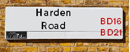
| Icon | Postcodes for Harden Road | |
| Walking Distances | ||
| Distance Info | Green Circle = 10 Minutes Walk (800 metres) | |
About Harden Road
Harden Road is a street located near the town of Bingley and in the village of Harden and near the village of Harden and in the town of Keighley. The street has a length of approximately 3,312 metres.
Harden Road is located within the Bradford District (B) Council's jurisdiction. They provide various services, like refuse collection, and manage council tax collection. It's situated in the Yorkshire and The Humber region of the UK.
Harden Road has been assigned the Unique Street Reference Numbers of 7735210, 7796037, 7796290, 7796603, 7735200 and 7750980 in the National Street Gazetteer.
Harden Road is located within the county of West Yorkshire, situated in the Yorkshire and The Humber region of the UK. It's 178.23 miles North West from central London., 13.55 miles West from Leeds, 29.86 miles North East from Manchester and 32.9 miles West from York.

Do you know why this road is called Harden Road?
What's it like to live here?
Ask the community a question about Harden Road.
Do you have any questions, memories to share or know any facts about Harden Road? We'd love to know more.
Also on streetlist.co.uk, can you help?
Eldroth Road
15th April 2024
I wondered if anyone has any old pictures of Wenning Bank House in the 1940’s and also Lane Side before of the same era .. we visited today with my Mum in law as she used to live at both these properties. Also any photos of the schools around that time .. thank you.
Can You Help?Napps Way
15th April 2024
Why is the road called Napps Way (belonging to Napp, but minus an
apostrophe as is usual with such nomenclature)? Moreover, who or
what is, or was, “Napp” in the respective, possessive case?
Several years ago, I met an elderly man (probably in his late-eighties)
who lives on Bentham Drive, Liverpool 16, and during a conversation
with him whilst in a Northwest Passenger Transport Ambulance on the
way to the former RLUH (Royal Liverpool University Hospital), he told
me that he could remember (when he was a boy, living in Childwall,
Liverpool 16) that, “Where Napps Way is now, during WW2, there was
a two-man gun emplacement on the, then, open land to protect the
railway line passing over Childwall Valley Road - next to the railway
bridge - when suddenly, as they were loading a live “shell” into the gun’s
breach, the aforementioned “shell” accidentally exploded in the gun’s
breach killing both of the two soldiers, that had been manning the gun,
instantly! (Very sad, of course, but could - perhaps - two ghosts relating
to those two, very unfortunately and prematurely-killed soldiers have
haunted that place of their deaths ever since - and have any residents
of Napps Way - formerly and in its latest incarnation - seen two, WW2
(uniformed) soldiers unexpectedly appear in or near their homes?)
Mauritius Road
15th April 2024
Why is Mauritius Road so called, since when and by whom? Does Greenwich have any particular links with Mauritius? Very interested to know. 🤞🏼
Can You Help?Estate Agents near Harden Road
| Name | Address | Website |
|---|---|---|
| Holroyds | 146 Main Street, Bingley, BD16 2HL | |
| Linley & Simpson | 51-53 Main Street, Bingley, BD16 2HZ | Visit Website |
| Dacre Son & Hartley | 93 Main Street Bingley BD16 2JA |
We have found 8 postcodes for Harden Road
Location Details
| Harden Road | |
|---|---|

| |
| Latitude | 53.847552 |
| Longitude | -1.863755 |
| OS Easting (X): | 408962 |
| OS Northing (Y): | 439066 |
| OS Grid Reference: | SE090391 |
Neighbourhood Policing |
| Police Force: West Yorkshire |
 View Neighbourhood Crime and Policing View Neighbourhood Crime and Policing |
| Find a Local Neighbourhood Watch Scheme |
Frequently asked Questions for Harden Road
What Council (Local Authority) is Harden Road in?
Harden Road is located within the local authority area of Bradford Council which is a Metropolitan District.
What Parish Council is Harden Road in?
Harden Road is located within the area of Harden & Keighley Parish Council.
What Electoral Ward is Harden Road in?
Harden Road is located within the ward of Bingley, Bingley Rural &Keighley East.
What County is Harden Road in?
Harden Road is located within the ceremonial county of West Yorkshire.
What Constituency is Harden Road in?
Harden Road is located within the constituency of Shipley &Keighley.
What Part of the UK is Harden Road in?
Harden Road is located within the Yorkshire and The Humber region of the United Kingdom.
What County Council area is Harden Road in?
Harden Road is located within the West Yorkshire Council area.
What Police Force area is Harden Road in?
Harden Road is located within the West Yorkshire Police area.
Roads that have a Junction with Harden Road
| Street | Junction Type |
|---|---|
| Harden Grove | junction |
| Long Lee Lane | junction |
| Long Lane (B6429) | junction |
| Narrow Lane | junction |
| St Ives Road | junction |
| Blind Lane | junction |
| Beckfoot Lane | junction |
| Altar Lane | junction |
| Ireland Street | junction |
| Millgate (B6429) | pseudo node |
Sunset and Sunrise times for Harden Road
| Sunrise | 05:45 |
|---|---|
| Sunset | 20:26 |
Latest Weather Conditions for Harden Road
| Observed at Weather Station: | Bingley Samos 23 April 2024 at 17:00 (2.53 miles away) |
|---|---|
| Current Weather: | Overcast |
| Temperature and Humidity: | 8.1°C (62.1%) |
| Wind Direction and Speed: | NNE (10 mph) |
Population Statistics
| ONS Area Code | E00053415, E00053420, E00053437 & E00054005 |
|---|---|
| ONS Area Name | Self-Sufficient Retirement, Renting Rural Retirement, White Professionals & White Suburban Communities |
| Average Age | 41.67, 45.58 & 38.65 |
| Area Population | 1531.00, 1600.00 & 1461.00 |
| Male Population | 780.00, 790.00 & 759.00 (51%) |
| Female Population | 751.00, 810.00 & 702.00 (49%) |
| Benefit Claimants | 17, 11 & 22 (1%) |
| LSOA Code: | E01010578, E01010586 &E01010704 |
|---|---|
| LSOA Name: | Bradford 015A, Bradford 022A &Bradford 008E |
| SOA Code: | 3c, 8c &5b |
| SOA Name: | |
| MSOA Code: | E02002197, E02002204 &E02002190 |
| MSOA Name: | Bradford 015, Bradford 022 &Bradford 008 |
Nearest Supermarkets
| Sainsburys Bingley Main Street Local |
|---|
| 117 Main Street, Bingley, England, BD16 1AJ |
| 1274552098 |
| Distance: 1.06 Miles |
| Directions from Harden Road to Sainsburys Bingley Main Street Local |
| Tesco Crossflatts Express |
|---|
| 1-2 Keighley Rd, Crossflatts, Bingley, BD16 2DY |
| 0345 026 9127 |
| Distance: 1.28 Miles |
| Directions from Harden Road to Tesco Crossflatts Express |
| Iceland Keighley |
|---|
| Gresley Road, Keighley, West Yorkshire, BD21 5JG |
| 01535691096 |
| Distance: 2.06 Miles |
| Directions from Harden Road to Iceland Keighley |
| Morrisons Keighley |
|---|
| Worth Way, Keighley BD21 5AE |
| 01535 607554 |
| Distance: 2.12 Miles |
| Directions from Harden Road to Morrisons Keighley |
Telephone Information
| Dialling Code | Telephone Exchange | Telephone Cabinet | Fibre to the Cabinet or Fibre to the Premises |
|---|---|---|---|
| 01535 | KEIGHLEY - MYKEI | P19 | FTTC |
Broadband Information
| Speed | Average Speed | Median Speed | Maximum Speed | Next-generation access (NGA) | Number of Connections |
|---|---|---|---|---|---|
| Less than 2 Mbps | 14.7 | 6.9 | >=30 | Y | 5 |
Local Government
| Local Council Details |
|---|
| Within the area of Bradford |
| Visit the Council's Website |
| City Hall, Centenary Square, Bradford &BD1 1HY |
| Telephone Number: 01274 432111 |
| Local Member of Parliament |
|---|
| Within the Westminster Parliamentary Constituency of Shipley &Keighley |
| The Member of Parliament is Philip Davies &Robbie Moore |
| Details for the MP Philip Davies &Robbie Moore on parliament.uk |
| Details for the MP Philip Davies &Robbie Moore on theyworkforyou.com |
| In the 2019 General Election Philip Davies &Robbie Moore won with a majority of 6,242 the result was Con hold &Con gain from Lab. The total electorate was 74,029 |
| Wards, Parish Councils and County Councils |
|---|
| Ward: Bingley, Bingley Rural &Keighley East Ward |
| Ceremonial County: West Yorkshire |
Nearest Schools
England Primary Schools
Wilsden Primary School
Address: Wilsden Primary School, Tweedy Street, Wilsden, Bradford, West Yorkshire, BD15 0AE
Distance: 1.62 miles
Contact:
Long Lee Primary School
Address: Long Lee Primary School, Cherry Tree Rise, Long Lee, Keighley, West Yorkshire, BD21 4RU
Distance: 1.55 miles
Contact: 01535603986
Cullingworth Village Primary School
Address: Cullingworth Village Primary School, New School Lane, Off Halifax Road, Cullingworth, Bradford, West Yorkshire, BD13 5DA
Distance: 2.17 miles
Contact:
Wilsden Primary School
Address: Wilsden Primary School, Tweedy Street, Wilsden, Bradford, West Yorkshire, BD15 0AE
Distance: 1.62 miles
Contact: 01535272263
Harden Primary School
Address: Harden Primary School, Long Lane, Harden, Bingley, West Yorkshire, BD16 1LJ
Distance: 0.58 miles
Contact: 01535273847
England Secondary Schools
Parkside School
Address: Parkside School, Parkside Terrace, Cullingworth, Bradford, West Yorkshire, BD13 5AD
Distance: 1.88 miles
Contact:
Nearest Hospitals
| Name | Address | Postcode | Distance | Map |
|---|
Nearest Dentists
Dentists near Harden Road
| Name | Address | Postcode | Distance | Map |
|---|
Nearest GP Surgeries
Doctors near Harden Road
MODALITY PARTNERSHIP (AWC)
Address: LONG LEE SURGERY, LONG LEE LANE, LONG LEE, KEIGHLEY, BD21 4TT
Distance: 1.31 miles
Contact: tel: 01535 606415
DR PRESHAW AND PARTNERS
Address: 172A LONG LEE LANE, LONG LEE, KEIGHLEY, WEST YORKSHIRE, BD21 4TT
Distance: 1.31 miles
Contact: tel: 01535 609249
CROSSFLATTS SURGERY
Address: THOMPSON COURT, MORTON LANE, CROSSFLATTS, BINGLEY, WEST YORKSHIRE, BD16 2EP
Distance: 1.36 miles
Contact: :
BINGLEY MEDICAL PRACTICE
Address: CANALSIDE HEALTH CARE CENTRE, 2 KINGSWAY, BINGLEY, WEST YORKSHIRE, BD16 4RP
Distance: 1.47 miles
Contact: tel: 01274 568383
THE SPRINGFIELD SURGERY (BINGLEY)
Address: CANALSIDE HEALTH CARE CENTRE, 2 KINGSWAY, BINGLEY, WEST YORKSHIRE, BD16 4RP
Distance: 1.47 miles
Contact: tel: 01274 567991
CANALSIDE HEALTH CARE CENTRE - COVID LOCAL VACCINATION SERVICE
Address: 2 KINGSWAY, BINGLEY, BD16 4RP
Distance: 1.47 miles
Contact: :
Nearest Dispensing Chemists
Pharmacies near Harden Road
| Name | Address | Postcode | Telephone | Map | Distance in Km |
|---|
Nearest Opticians
Opticians near Harden Road
DAVID HOWARTH OPTOMETRISTS
Address: 158 MAIN STREET, BINGLEY, WEST YORKSHIRE, BD16 2HR
Distance: 1.02 miles
Contact: :
DAVID KENYON OPTICIANS
Address: 139 MAIN STREET, BINGLEY, WEST YORKSHIRE, BD16 1AJ
Distance: 1.09 miles
Contact: :
SPECSAVERS OPTICIANS (BINGLEY)
Address: 155 MAIN STREET, BINGLEY, WEST YORKSHIRE, BD16 1AJ
Distance: 1.09 miles
Contact: :
SARAH FARRAR LTD
Address: 160 MAIN STREET, WILSDEN, BRADFORD, WEST YORKSHIRE, BD15 0HX
Distance: 1.88 miles
Contact: :
SPECSAVERS (KEIGHLEY)
Address: 11 QUEENSWAY, AIREDALE SHOPPING CENTRE, KEIGHLEY, WEST YORKSHIRE, BD21 3PX
Distance: 2.22 miles
Contact: :
BOOTS OPTICIANS (KEIGHLEY)
Address: 30 BOW STREET, KEIGHLEY, WEST YORKSHIRE, BD21 3QD
Distance: 2.23 miles
Contact: :
Transport
Nearest Rail Stations
Crossflatts Station is 1.08 miles away.
Address: Crossflatts station, Keighley Road, Crossflatts, West Yorkshire, BD16 2RZ
Crossflatts is situated on the Leeds to Morecambe line and is managed by Northern.
Crossflatts Station is an unstaffed station.
Bingley Station is 1.09 miles away.
Address: Bingley station, Wellington Street, Bingley, West Yorkshire, BD16 2NA
Bingley is situated on the Leeds to Morecambe line and is managed by Northern.
Bingley Station is staffed on a full time basis.