Map of Grey Scar Road
| Postcodes | ||
|---|---|---|
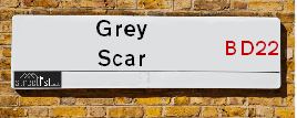
| Icon | Postcodes for Grey Scar Road | |
| Walking Distances | ||
| Distance Info | Green Circle = 10 Minutes Walk (800 metres) | |
About Grey Scar Road
Grey Scar Road is a street located in the village of Oakworth. The street has a length of approximately 611 metres.
Grey Scar Road is located within the Bradford District (B) Council's jurisdiction. They provide various services, like refuse collection, and manage council tax collection. It's situated in the Yorkshire and The Humber region of the UK.
Grey Scar Road has been assigned the Unique Street Reference Numbers of 7733625, 7796299 and 7796462 in the National Street Gazetteer.
Grey Scar Road is located within the county of West Yorkshire, situated in the Yorkshire and The Humber region of the UK. It's 179.94 miles North West from central London., 17.53 miles West from Leeds, 27.87 miles North East from Manchester and 36.7 miles South East from Lancaster.

Do you know why this road is called Grey Scar Road?
What's it like to live here?
Ask the community a question about Grey Scar Road.
Do you have any questions, memories to share or know any facts about Grey Scar Road? We'd love to know more.
Also on streetlist.co.uk, can you help?
Eldroth Road
15th April 2024
I wondered if anyone has any old pictures of Wenning Bank House in the 1940’s and also Lane Side before of the same era .. we visited today with my Mum in law as she used to live at both these properties. Also any photos of the schools around that time .. thank you.
Can You Help?Napps Way
15th April 2024
Why is the road called Napps Way (belonging to Napp, but minus an
apostrophe as is usual with such nomenclature)? Moreover, who or
what is, or was, “Napp” in the respective, possessive case?
Several years ago, I met an elderly man (probably in his late-eighties)
who lives on Bentham Drive, Liverpool 16, and during a conversation
with him whilst in a Northwest Passenger Transport Ambulance on the
way to the former RLUH (Royal Liverpool University Hospital), he told
me that he could remember (when he was a boy, living in Childwall,
Liverpool 16) that, “Where Napps Way is now, during WW2, there was
a two-man gun emplacement on the, then, open land to protect the
railway line passing over Childwall Valley Road - next to the railway
bridge - when suddenly, as they were loading a live “shell” into the gun’s
breach, the aforementioned “shell” accidentally exploded in the gun’s
breach killing both of the two soldiers, that had been manning the gun,
instantly! (Very sad, of course, but could - perhaps - two ghosts relating
to those two, very unfortunately and prematurely-killed soldiers have
haunted that place of their deaths ever since - and have any residents
of Napps Way - formerly and in its latest incarnation - seen two, WW2
(uniformed) soldiers unexpectedly appear in or near their homes?)
Mauritius Road
15th April 2024
Why is Mauritius Road so called, since when and by whom? Does Greenwich have any particular links with Mauritius? Very interested to know. 🤞🏼
Can You Help?Estate Agents near Grey Scar Road
| Name | Address | Website |
|---|---|---|
| Skipton Properties Ltd | Ebor Lane, Haworth, West Yorkshire , BD22 8HR | Visit Website |
| Open House Estate Agents | 246 Oakworth Road, Keighley, BD21 1RB | |
| Jigsaw Property Services | 6a Russell Street, Keighley,BD21 2JP |
Location Details
| Grey Scar Road | |
|---|---|

| |
| Latitude | 53.846418 |
| Longitude | -1.963628 |
| OS Easting (X): | 402392 |
| OS Northing (Y): | 438932 |
| OS Grid Reference: | SE024389 |
Ordnance Survey Maps for Grey Scar Road
If you purchase a map through the links below, we may earn an affiliate commission.
| Map Series | link | Ordnance Survey |
| Explorer 1:25,000 ol21 South Pennines | Check Price on Amazon | Buy Direct from the Ordnance Survey |
| Landranger 1:50,000 104 Leeds & Bradford | Check Price on Amazon | Buy Direct from the Ordnance Survey |
Neighbourhood Policing |
| Police Force: West Yorkshire |
 View Neighbourhood Crime and Policing View Neighbourhood Crime and Policing |
| Find a Local Neighbourhood Watch Scheme |
Frequently asked Questions for Grey Scar Road
What Council (Local Authority) is Grey Scar Road in?
Grey Scar Road is located within the local authority area of Bradford Council which is a Metropolitan District.
What Parish Council is Grey Scar Road in?
Grey Scar Road is located within the area of Keighley Parish Council.
What Electoral Ward is Grey Scar Road in?
Grey Scar Road is located within the ward of Worth Valley.
What County is Grey Scar Road in?
Grey Scar Road is located within the ceremonial county of West Yorkshire.
What Constituency is Grey Scar Road in?
Grey Scar Road is located within the constituency of Keighley.
What Part of the UK is Grey Scar Road in?
Grey Scar Road is located within the Yorkshire and The Humber region of the United Kingdom.
What County Council area is Grey Scar Road in?
Grey Scar Road is located within the West Yorkshire Council area.
What Police Force area is Grey Scar Road in?
Grey Scar Road is located within the West Yorkshire Police area.
Roads that have a Junction with Grey Scar Road
| Street | Junction Type |
|---|---|
| Low Bank Lane | junction |
| Turnshaw Road | pseudo node |
Sunset and Sunrise times for Grey Scar Road
| Sunrise | 05:41 |
|---|---|
| Sunset | 20:30 |
Latest Weather Conditions for Grey Scar Road
| Observed at Weather Station: | Bingley Samos 25 April 2024 at 10:00 (4.71 miles away) |
|---|---|
| Current Weather: | Overcast |
| Temperature and Humidity: | 5.8°C (77.1%) |
| Wind Direction and Speed: | N (10 mph) |
Population Statistics
| ONS Area Code | E00054744 & E00054757 |
|---|---|
| ONS Area Name | White Professionals |
| Average Age | 39.15 |
| Area Population | 1726.00 |
| Male Population | 832.00 (48%) |
| Female Population | 894.00 (52%) |
| Benefit Claimants | 15 (1%) |
| LSOA Code: | E01010862 |
|---|---|
| LSOA Name: | Bradford 014C |
| SOA Code: | 5b |
| SOA Name: | |
| MSOA Code: | E02002196 |
| MSOA Name: | Bradford 014 |
Nearest Supermarkets
| Morrisons Keighley |
|---|
| Worth Way, Keighley BD21 5AE |
| 01535 607554 |
| Distance: 2.61 Miles |
| Directions from Grey Scar Road to Morrisons Keighley |
| Iceland Keighley |
|---|
| Gresley Road, Keighley, West Yorkshire, BD21 5JG |
| 01535691096 |
| Distance: 2.8 Miles |
| Directions from Grey Scar Road to Iceland Keighley |
| Sainsburys Keighley |
|---|
| 1 Sainsburys Centre, Cavendish Street, Keighley, England, BD21 3RU |
| 01535 603117 |
| Distance: 2.86 Miles |
| Directions from Grey Scar Road to Sainsburys Keighley |
| Asda Keighley |
|---|
| Bingley Street, Keighley, BD21 3ER |
| 01535 613900 |
| Distance: 2.96 Miles |
| Directions from Grey Scar Road to Asda Keighley |
Telephone Information
| Area Code |
|---|
| Area Code: 01535 - Keighley |
| Area Code: 01756 - Skipton |
Local Government
| Local Council Details |
|---|
| Within the area of Bradford |
| Visit the Council's Website |
| City Hall, Centenary Square, Bradford &BD1 1HY |
| Telephone Number: 01274 432111 |
| Local Member of Parliament |
|---|
| Within the Westminster Parliamentary Constituency of Keighley |
| The Member of Parliament is Robbie Moore |
| Details for the MP Robbie Moore on parliament.uk |
| Details for the MP Robbie Moore on theyworkforyou.com |
| In the 2019 General Election Robbie Moore won with a majority of 2,218 the result was Con gain from Lab. The total electorate was 72,778 |
| Wards, Parish Councils and County Councils |
|---|
| Ward: Worth Valley Ward |
| Ceremonial County: West Yorkshire |
Nearest Schools
England Primary Schools
Oakworth Primary School
Address: Oakworth Primary School, Station Road, Oakworth, Keighley, West Yorkshire, BD22 7HX
Distance: 0.64 miles
Contact:
Haworth Primary School
Address: Haworth Primary School, Rawdon Road, Haworth, Keighley, West Yorkshire, BD22 8DW
Distance: 1.04 miles
Contact:
Oakworth Primary School
Address: Oakworth Primary School, Station Road, Oakworth, Keighley, West Yorkshire, BD22 7HX
Distance: 0.64 miles
Contact: 01535642309
Haworth Primary School
Address: Haworth Primary School, Rawdon Road, Haworth, Keighley, West Yorkshire, BD22 8DW
Distance: 1.04 miles
Contact: 01535642359
Oldfield Primary School
Address: Oldfield Primary School, Oldfield Lane, Oldfield, Keighley, West Yorkshire, BD22 0HZ
Distance: 1.40 miles
Contact:
Nearest Hospitals
| Name | Address | Postcode | Distance | Map |
|---|
Nearest Dentists
Dentists near Grey Scar Road
| Name | Address | Postcode | Distance | Map |
|---|
Nearest GP Surgeries
Doctors near Grey Scar Road
OAKWORTH MEDICAL PRACTICE
Address: 3 LIDGET MILL, LIDGET, OAKWORTH, KEIGHLEY, BD22 7HN
Distance: 0.68 miles
Contact: :
HAWORTH MEDICAL PRACTICE
Address: HEATHCLIFFE MEWS, HAWORTH, KEIGHLEY, BD22 8DH
Distance: 1.10 miles
Contact: :
HOLYCROFT SURGERY
Address: OAKWORTH ROAD, KEIGHLEY, BD21 1SA
Distance: 2.34 miles
Contact: :
FARFIELD GROUP PRACTICE
Address: ST. ANDREW'S SURGERIES, WEST LANE, KEIGHLEY, BD21 2LD
Distance: 2.45 miles
Contact: :
LING HOUSE MEDICAL CENTRE
Address: 49 SCOTT STREET, KEIGHLEY, WEST YORKSHIRE, BD21 2JH
Distance: 2.65 miles
Contact: tel: 01535 605747
BROWN GM
Address: CULLINGWORTH MEDICAL CENTRE, 12 MILL STREET, CULLINGWORTH, BRADFORD, WEST YORKSHIRE, BD13 5HA
Distance: 2.93 miles
Contact: :
Nearest Dispensing Chemists
Pharmacies near Grey Scar Road
| Name | Address | Postcode | Telephone | Map | Distance in Km |
|---|
Nearest Opticians
Opticians near Grey Scar Road
KNOWLE PARK OPTICIANS
Address: 42 DEVONSHIRE STREET, KEIGHLEY, WEST YORKSHIRE, BD21 2AU
Distance: 2.58 miles
Contact: :
SPECSAVERS (KEIGHLEY)
Address: 11 QUEENSWAY, AIREDALE SHOPPING CENTRE, KEIGHLEY, WEST YORKSHIRE, BD21 3PX
Distance: 2.65 miles
Contact: :
VISION EXPRESS (KEIGHLEY)
Address: 25 COLLEGE WALK, AIREDALE CENTRE, KEIGHLEY, WEST YORKSHIRE, BD21 3QA
Distance: 2.66 miles
Contact: :
BOOTS OPTICIANS (KEIGHLEY)
Address: 30 BOW STREET, KEIGHLEY, WEST YORKSHIRE, BD21 3QD
Distance: 2.70 miles
Contact: :
AIREDALE OPTICIANS
Address: 50 TOWNGATE, KEIGHLEY, WEST YORKSHIRE, BD21 3QE
Distance: 2.72 miles
Contact: :
CLARUS OPTICIANS (KEIGHLEY)
Address: 46 CAVENDISH STREET, KEIGHLEY, WEST YORKSHIRE, BD21 3RL
Distance: 2.79 miles
Contact: :
Transport
Nearest Rail Stations
Keighley Station is 2.95 miles away.
Address: Keighley station, Station Bridge, Keighley, West Yorkshire, BD21 4HP
Keighley is situated on the Leeds to Morecambe line and is managed by Northern.
Keighley Station is staffed on a part time basis.
Steeton & Silsden Station is 3.81 miles away.
Address: Steeton & Silsden station, Station Road, Steeton, West Yorkshire, BD20 6RY
Steeton & Silsden is situated on the Leeds to Morecambe line and is managed by Northern.
Steeton & Silsden Station is an unstaffed station.
Directions from Grey Scar Road to Steeton & Silsden Rail Station