Map of Rooley Lane
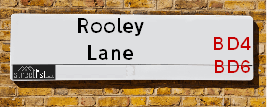
| Postcodes | ||
|---|---|---|
| Icon | Postcodes for Rooley Lane | |
| Walking Distances | ||
| Distance Info | Green Circle = 10 Minutes Walk (800 metres) | |
About Rooley Lane
Rooley Lane is a street located in the city of Bradford. The street has a length of approximately 3,316 metres.
Rooley Lane is located within the Bradford District (B) Council's jurisdiction. They provide various services, like refuse collection, and manage council tax collection. It's situated in the Yorkshire and The Humber region of the UK.
Rooley Lane has been assigned the Unique Street Reference Numbers of 7750040, 7796008, 7764059, 7796081, 7772260 and 7717295 in the National Street Gazetteer.
Rooley Lane is located within the county of West Yorkshire, situated in the Yorkshire and The Humber region of the UK. It's 171.3 miles North West from central London., 8.49 miles West from Leeds, 28.73 miles North East from Manchester and 29.13 miles North West from Sheffield.

Do you know why this road is called Rooley Lane?
What's it like to live here?
Ask the community a question about Rooley Lane.
Do you have any questions, memories to share or know any facts about Rooley Lane? We'd love to know more.
Also on streetlist.co.uk, can you help?
Eldroth Road
15th April 2024
I wondered if anyone has any old pictures of Wenning Bank House in the 1940’s and also Lane Side before of the same era .. we visited today with my Mum in law as she used to live at both these properties. Also any photos of the schools around that time .. thank you.
Can You Help?Napps Way
15th April 2024
Why is the road called Napps Way (belonging to Napp, but minus an
apostrophe as is usual with such nomenclature)? Moreover, who or
what is, or was, “Napp” in the respective, possessive case?
Several years ago, I met an elderly man (probably in his late-eighties)
who lives on Bentham Drive, Liverpool 16, and during a conversation
with him whilst in a Northwest Passenger Transport Ambulance on the
way to the former RLUH (Royal Liverpool University Hospital), he told
me that he could remember (when he was a boy, living in Childwall,
Liverpool 16) that, “Where Napps Way is now, during WW2, there was
a two-man gun emplacement on the, then, open land to protect the
railway line passing over Childwall Valley Road - next to the railway
bridge - when suddenly, as they were loading a live “shell” into the gun’s
breach, the aforementioned “shell” accidentally exploded in the gun’s
breach killing both of the two soldiers, that had been manning the gun,
instantly! (Very sad, of course, but could - perhaps - two ghosts relating
to those two, very unfortunately and prematurely-killed soldiers have
haunted that place of their deaths ever since - and have any residents
of Napps Way - formerly and in its latest incarnation - seen two, WW2
(uniformed) soldiers unexpectedly appear in or near their homes?)
Mauritius Road
15th April 2024
Why is Mauritius Road so called, since when and by whom? Does Greenwich have any particular links with Mauritius? Very interested to know. 🤞🏼
Can You Help?Estate Agents near Rooley Lane
| Name | Address | Website |
|---|---|---|
| Dom Homes | Enterprise Hub 62 Tong Street, Bradford,BD4 9LX | Visit Website |
| Letz Move | 767 Wakefield Road, Bradford West Yorkshire,BD4 7PT | Visit Website |
| Robert Watts | 140 High Street, Wibsey, Bradford, BD6 1JZ | Visit Website |
We have found 17 postcodes for Rooley Lane
Location Details
| Rooley Lane | |
|---|---|

| |
| Latitude | 53.769907 |
| Longitude | -1.743975 |
| OS Easting (X): | 416873 |
| OS Northing (Y): | 430450 |
| OS Grid Reference: | SE169305 |
Neighbourhood Policing |
| Police Force: West Yorkshire |
 View Neighbourhood Crime and Policing View Neighbourhood Crime and Policing |
| Find a Local Neighbourhood Watch Scheme |
Frequently asked Questions for Rooley Lane
What Council (Local Authority) is Rooley Lane in?
Rooley Lane is located within the local authority area of Bradford Council which is a Metropolitan District.
What Parish Council is Rooley Lane in?
Rooley Lane is located within the area of Trident Parish Council.
What Electoral Ward is Rooley Lane in?
Rooley Lane is located within the ward of Tong, Bowling and Barkerend, Wibsey, Wyke &Little Horton.
What County is Rooley Lane in?
Rooley Lane is located within the ceremonial county of West Yorkshire.
What Constituency is Rooley Lane in?
Rooley Lane is located within the constituency of Bradford South &Bradford East.
What Part of the UK is Rooley Lane in?
Rooley Lane is located within the Yorkshire and The Humber region of the United Kingdom.
What County Council area is Rooley Lane in?
Rooley Lane is located within the West Yorkshire Council area.
What Police Force area is Rooley Lane in?
Rooley Lane is located within the West Yorkshire Police area.
Roads that have a Junction with Rooley Lane
| Street | Junction Type |
|---|---|
| Kings Fold | junction |
| Manchester Road (A641) | junction |
| Hallbank Drive | junction |
| Sunny Bank Avenue | junction |
| Mayo Road | junction |
| Rooley Close | junction |
| Woodleigh Avenue | junction |
| Mayo Avenue (A6177) | junction |
| Mayo Avenue (A6177) | junction |
| Low Newall Field | junction |
| Mayo Avenue (A6177) | junction |
| Chase Way (A6177) | roundabout |
| Staithgate Lane | roundabout |
| Rooley Avenue (A6036) | roundabout |
| Chase Way (A6177) | junction |
| Parkway | junction |
| Newhall Way | junction |
| Newhall Way | junction |
| Bude Road | junction |
| Croft Leigh Court | junction |
| Hopefield Way | junction |
| Sangster Way | junction |
| Kaycell Street | junction |
| Rook Lane | junction |
| Rook Lane | junction |
| Bowling Hall Road | junction |
| Gardiner Row | junction |
Sunset and Sunrise times for Rooley Lane
| Sunrise | 05:42 |
|---|---|
| Sunset | 20:27 |
Latest Weather Conditions for Rooley Lane
| Observed at Weather Station: | Bingley Samos 24 April 2024 at 03:00 (5.70 miles away) |
|---|---|
| Current Weather: | Clear night |
| Temperature and Humidity: | 2.7°C (80.3%) |
| Wind Direction and Speed: | N (10 mph) |
Population Statistics
| ONS Area Code | E00053578, E00053580, E00176140, E00053581, E00054174, E00054225, E00053582, E00053583, E00054532, E00054525 & E00054226 |
|---|---|
| ONS Area Name | Families in Terraces and Flats, Achieving Minorities, Pakistani Communities, Multi-Ethnic Professionals with Families, Multi-Ethnic Suburbia & Private Renting Young Families |
| Average Age | 36.96, 33.52, 38.90, 44.67, 32.74 & 36.75 |
| Area Population | 1419.00, 2397.00, 1614.00, 1628.00, 1859.00 & 1856.00 |
| Male Population | 697.00, 1160.00, 793.00, 780.00, 892.00 & 918.00 (49%) |
| Female Population | 722.00, 1237.00, 821.00, 848.00, 967.00 & 938.00 (51%) |
| Benefit Claimants | 21, 65, 36, 26, 66 & 24 (2%) |
| LSOA Code: | E01010615, E01010815, E01010747, E01010746, E01010616 &E01010818 |
|---|---|
| LSOA Name: | Bradford 053A, Bradford 057B, Bradford 056B, Bradford 060A, Bradford 053B &Bradford 057E |
| SOA Code: | 3d, 7a, 8c, 7b &3b |
| SOA Name: | |
| MSOA Code: | E02002235, E02002239, E02002238 &E02002242 |
| MSOA Name: | Bradford 053, Bradford 057, Bradford 056 &Bradford 060 |
Nearest Supermarkets
| Asda Bradford |
|---|
| Rooley Lane, Bradford, BD4 7SR |
| 01274 474000 |
| Distance: 0.51 Miles |
| Directions from Rooley Lane to Asda Bradford |
| Morrisons Bradford - Mayo Avenue |
|---|
| 110 Mayo Avenue, Bradford BD5 8HP |
| 01274 727676 |
| Distance: 0.56 Miles |
| Directions from Rooley Lane to Morrisons Bradford - Mayo Avenue |
| Iceland Bradford |
|---|
| Unit B Weaverthorpe Ctr, Tong Street, Bradford, BD4 9RQ |
| 01274653395 |
| Distance: 1.02 Miles |
| Directions from Rooley Lane to Iceland Bradford |
| Tesco Low Moor Bradford Express |
|---|
| 159 Huddersfield Rd, Bradford, BD12 0TQ |
| 0345 674 6422 |
| Distance: 1.19 Miles |
| Directions from Rooley Lane to Tesco Low Moor Bradford Express |
Telephone Information
| Area Code |
|---|
| Area Code: 01274 - Bradford |
| Area Code: 01422 - Halifax |
| Area Code: 01943 - Guiseley |
| Area Code: 0113 - Leeds |
Broadband Information
| Speed | Average Speed | Median Speed | Maximum Speed | Next-generation access (NGA) | Number of Connections |
|---|---|---|---|---|---|
| Less than 2 Mbps | 17.6 | 4.6 | >=30 | Y | 14 |
Local Government
| Local Council Details |
|---|
| Within the area of Bradford |
| Visit the Council's Website |
| City Hall, Centenary Square, Bradford &BD1 1HY |
| Telephone Number: 01274 432111 |
| Local Member of Parliament |
|---|
| Within the Westminster Parliamentary Constituency of Bradford South &Bradford East |
| The Member of Parliament is Judith Cummins &Imran Hussain |
| Details for the MP Judith Cummins &Imran Hussain on parliament.uk |
| Details for the MP Judith Cummins &Imran Hussain on theyworkforyou.com |
| In the 2019 General Election Judith Cummins &Imran Hussain won with a majority of 2,346 the result was Lab hold. The total electorate was 69,046 |
| Wards, Parish Councils and County Councils |
|---|
| Ward: Tong, Bowling and Barkerend, Wibsey, Wyke &Little Horton Ward |
| Ceremonial County: West Yorkshire |
Nearest Schools
England Primary Schools
Knowleswood Primary School
Address: Knowleswood Primary School, Knowles Lane, Bradford, BD4 9AE
Distance: 1.15 miles
Contact:
St Columba's Catholic Primary School
Address: St Columba's Catholic Primary School, Tong Street, Dudley Hill, Bradford, West Yorkshire, BD4 9PY
Distance: 1.02 miles
Contact:
Newhall Park Primary School
Address: Newhall Park Primary School, Newhall Road, Bierley, Bradford, West Yorkshire, BD4 6AF
Distance: 0.38 miles
Contact: 01274778577
Bowling Park Primary School
Address: Bowling Park Primary School, New Cross Street, West Bowling, Bradford, West Yorkshire, BD5 8BT
Distance: 0.52 miles
Contact:
St Matthew's CofE Primary School and Nursery
Address: St Matthew's CofE Primary School and Nursery, Ivy House Road, Bradford, BD5 8FG
Distance: 0.38 miles
Contact: 01274731693
St Joseph's Catholic Primary School
Address: St Joseph's Catholic Primary School, Park Lane, Bradford, West Yorkshire, BD5 0RB
Distance: 1.10 miles
Contact:
St Stephen's CofE Primary School
Address: St Stephen's CofE Primary School, Gaythorne Road, West Bowling, Bradford, West Yorkshire, BD5 7HU
Distance: 0.74 miles
Contact: 01274731698
Low Moor CofE Primary School
Address: Low Moor CofE Primary School, Park House Road, Low Moor, Bradford, West Yorkshire, BD12 0NN
Distance: 1.07 miles
Contact: 01274600797
Newby Primary School
Address: Newby Primary School, Ryan Street, Manchester Road, Bradford, West Yorkshire, BD5 7DQ
Distance: 0.90 miles
Contact: 01274772208
Bankfoot Primary School
Address: Bankfoot Primary School, Bolingbroke Street, Bankfoot, Bradford, West Yorkshire, BD5 9NR
Distance: 0.82 miles
Contact: 01274732068
Horton Park Primary School
Address: Horton Park Primary School, Dawnay Road, Bradford, West Yorkshire, BD5 9LQ
Distance: 1.41 miles
Contact: 01274574544
Horton Park Primary School
Address: Horton Park Primary School, Dawnay Road, Bradford, West Yorkshire, BD5 9LQ
Distance: 1.41 miles
Contact:
Marshfield Primary School
Address: Marshfield Primary School, Thornton Lane, Little Horton, Bradford, West Yorkshire, BD5 9DS
Distance: 1.06 miles
Contact:
Hill Top CofE Primary School
Address: Hill Top CofE Primary School, Common Road, Low Moor, Bradford, West Yorkshire, BD12 0TL
Distance: 1.49 miles
Contact: 01274678386
St Winefride's Catholic Primary School, A Voluntary Academy
Address: St Winefride's Catholic Primary School, A Voluntary Academy, St Paul's Avenue, Wibsey, Bradford, West Yorkshire, BD6 1SR
Distance: 1.39 miles
Contact: 01274677705
St Winefride's Catholic Primary School
Address: St Winefride's Catholic Primary School, St Paul's Avenue, Wibsey, Bradford, West Yorkshire, BD6 1SR
Distance: 1.39 miles
Contact:
St Paul's CofE Primary School
Address: St Paul's CofE Primary School, St Paul's Avenue, Buttershaw, Bradford, West Yorkshire, BD6 1ST
Distance: 1.51 miles
Contact: 01274679183
Wibsey Primary School
Address: Wibsey Primary School, North Road, Wibsey, Bradford, West Yorkshire, BD6 1RL
Distance: 1.34 miles
Contact: 01274678016
England Higher Schools
Dixons Sixth Form, Bradford
Address: Dixons Sixth Form, Bradford, Bowling Old Lane, Bradford, West Yorkshire, BD5 7JR
Distance: 0.99 miles
Contact: 01274089770
England Secondary Schools
Dixons City Academy
Address: Dixons City Academy, Ripley Street, Bradford, West Yorkshire, BD5 7RR
Distance: 0.91 miles
Contact: 01274776777
Grange Technology College
Address: Grange Technology College, Haycliffe Lane, Bradford, West Yorkshire, BD5 9ET
Distance: 1.39 miles
Contact:
Nearest Hospitals
| Name | Address | Postcode | Distance | Map |
|---|
Nearest Dentists
Dentists near Rooley Lane
| Name | Address | Postcode | Distance | Map |
|---|
Nearest GP Surgeries
Doctors near Rooley Lane
WOODROYD MEDICAL PRACTICE
Address: WOODROYD CENTRE, WOODROYD ROAD, BRADFORD, BD5 8EL
Distance: 0.54 miles
Contact: :
DR GILKAR AND PARTNERS AT WOODROYD CENTRE
Address: WOODROYD CENTRE, WOODROYD ROAD, BRADFORD, WEST YORKSHIRE, BD5 8EL
Distance: 0.54 miles
Contact: :
WOODROYD MEDICAL PRACTICE - COVID LOCAL VACCINATION SERVICE 2
Address: WOODROYD CENTRE, WOODROYD ROAD, BRADFORD, BD5 8EL
Distance: 0.54 miles
Contact: :
BOWLING HALL MED PRACTICE
Address: ROOLEY LANE, FARSLEY, BRADFORD, WEST YORKSHIRE, BD4 7SS
Distance: 0.57 miles
Contact: tel: 01274 224888
ROOLEY LANE MED. CENTRE
Address: ROOLEY LANE, BRADFORD, WEST YORKSHIRE, BD4 7SS
Distance: 0.57 miles
Contact: tel: 01274 223118
NEW HAY SURGERY
Address: NEW HEY SURGERY, 2 BROMPTON ROAD, BRADFORD, WEST YORKSHIRE, BD4 7JD
Distance: 0.88 miles
Contact: tel: 01274 723953
Nearest Dispensing Chemists
Pharmacies near Rooley Lane
| Name | Address | Postcode | Telephone | Map | Distance in Km |
|---|
Nearest Opticians
Opticians near Rooley Lane
HD OPTICARE LTD (BROOM LANE)
Address: ROOLEY LANE, BRADFORD, BD4 7SR
Distance: 0.49 miles
Contact: :
PREMIER VISION OPTICIANS (MAYO AVENUE)
Address: MORRISON SUPERMARKETS, MAYO AVENUE, BRADFORD, WEST YORKSHIRE, BD5 8HP
Distance: 0.61 miles
Contact: :
J R MORTON
Address: 24-26 NEW CROSS STREET, WEST DOWLING, BRADFORD, WEST YORKSHIRE, BD5 8AB
Distance: 0.65 miles
Contact: :
SPECSALES EYECARE
Address: 846 MANCHESTER ROAD, BRADFORD, WEST YORKSHIRE, BD5 8DJ
Distance: 0.76 miles
Contact: :
AK OPHTHALMIC LIMITED
Address: 1 MAYFAIR, BRADFORD, BD5 0LQ
Distance: 1.11 miles
Contact: :
TONG OPTICIANS
Address: 299 TONG STREET, BRADFORD, BD4 9QS
Distance: 1.16 miles
Contact: :
Transport
Nearest Rail Stations
Low Moor Station is 1.42 miles away.
Address: Low Moor station, New Works Road, Low Moor, West Yorkshire, BD12 7BD
Low Moor is situated on the Calder Valley line and is managed by Northern.
Low Moor Station is an unstaffed station.
Bradford Interchange Station is 1.48 miles away.
Address: Bradford Interchange station, Bridge Street, Bradford, West Yorkshire, BD1 1TU
Bradford Interchange is situated on the Calder Valley line and is managed by Northern.
Bradford Interchange Station is staffed on a full time basis.
Directions from Rooley Lane to Bradford Interchange Rail Station