Map of Ashgrove
| Postcodes | ||
|---|---|---|
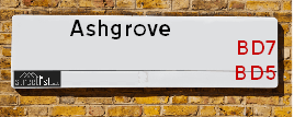
| Icon | Postcodes for Ashgrove | |
| Walking Distances | ||
| Distance Info | Green Circle = 10 Minutes Walk (800 metres) | |
About Ashgrove
Ashgrove is a street located in the city of Bradford. The street has a length of approximately 302 metres.
Ashgrove is located within the Bradford District (B) Council's jurisdiction. They provide various services, like refuse collection, and manage council tax collection. It's situated in the Yorkshire and The Humber region of the UK.
Ashgrove has been assigned the Unique Street Reference Number of 7703500 in the National Street Gazetteer.
Ashgrove is located within the county of West Yorkshire, situated in the Yorkshire and The Humber region of the UK. It's 172.84 miles North West from central London., 9.05 miles West from Leeds, 29.14 miles North East from Manchester and 30.26 miles South West from York.

Do you know why this road is called Ashgrove?
What's it like to live here?
Ask the community a question about Ashgrove.
Do you have any questions, memories to share or know any facts about Ashgrove? We'd love to know more.
Also on streetlist.co.uk, can you help?
Eldroth Road
15th April 2024
I wondered if anyone has any old pictures of Wenning Bank House in the 1940’s and also Lane Side before of the same era .. we visited today with my Mum in law as she used to live at both these properties. Also any photos of the schools around that time .. thank you.
Can You Help?Napps Way
15th April 2024
Why is the road called Napps Way (belonging to Napp, but minus an
apostrophe as is usual with such nomenclature)? Moreover, who or
what is, or was, “Napp” in the respective, possessive case?
Several years ago, I met an elderly man (probably in his late-eighties)
who lives on Bentham Drive, Liverpool 16, and during a conversation
with him whilst in a Northwest Passenger Transport Ambulance on the
way to the former RLUH (Royal Liverpool University Hospital), he told
me that he could remember (when he was a boy, living in Childwall,
Liverpool 16) that, “Where Napps Way is now, during WW2, there was
a two-man gun emplacement on the, then, open land to protect the
railway line passing over Childwall Valley Road - next to the railway
bridge - when suddenly, as they were loading a live “shell” into the gun’s
breach, the aforementioned “shell” accidentally exploded in the gun’s
breach killing both of the two soldiers, that had been manning the gun,
instantly! (Very sad, of course, but could - perhaps - two ghosts relating
to those two, very unfortunately and prematurely-killed soldiers have
haunted that place of their deaths ever since - and have any residents
of Napps Way - formerly and in its latest incarnation - seen two, WW2
(uniformed) soldiers unexpectedly appear in or near their homes?)
Mauritius Road
15th April 2024
Why is Mauritius Road so called, since when and by whom? Does Greenwich have any particular links with Mauritius? Very interested to know. 🤞🏼
Can You Help?Estate Agents near Ashgrove
| Name | Address | Website |
|---|---|---|
| BPR RESIDENTIAL AND COMMERCIAL LTD | 1 Rand Street, Bradford,BD7 1RW | Visit Website |
| Anchor Hanover Group | 2 Godwin Street, Bradford BD1 2ST | Visit Website |
| Anchor Trust, Anchor Trust - Resale Properties | Godwin Street, Bradford, BD1 2ST |
Hotels near Ashgrove
Budget Hotels near Ashgrove
| Budget Hotel Name | Distance (miles) |
|---|---|
| 1: Name:Holiday Inn Express Bradford City Centre Address:The Leisure Exchange, Vicar Lane Telephone: Visit Site |
0.66 |
| 2: Name:Premier Inn Bradford Central Address:Vicar Lane Telephone: Visit Site |
0.68 |
| 3: Name:Travelodge Bradford Central Address:2 Valley Rd, Bradford, BD1 4AF Telephone:0871 984 6171 Visit Site |
0.77 |
| 4: Name:ibis budget Bradford Address:6 Prince Court, Canal Road Telephone: Visit Site |
1.07 |
| 5: Name:Travelodge Bradford Address:Mid Point, Bradford, BD3 7AY Telephone:0871 984 6124 Visit Site |
2.43 |
Location Details
| Ashgrove | |
|---|---|

| |
| Latitude | 53.789221 |
| Longitude | -1.763000 |
| OS Easting (X): | 415612 |
| OS Northing (Y): | 432594 |
| OS Grid Reference: | SE156326 |
Ordnance Survey Maps for Ashgrove
If you purchase a map through the links below, we may earn an affiliate commission.
| Map Series | link | Ordnance Survey |
| Explorer 1:25,000 288 Bradford and Huddersfield | Check Price on Amazon | Buy Direct from the Ordnance Survey |
| Landranger 1:50,000 104 Leeds & Bradford | Check Price on Amazon | Buy Direct from the Ordnance Survey |
Neighbourhood Policing |
| Police Force: West Yorkshire |
 View Neighbourhood Crime and Policing View Neighbourhood Crime and Policing |
| Find a Local Neighbourhood Watch Scheme |
Frequently asked Questions for Ashgrove
What Council (Local Authority) is Ashgrove in?
Ashgrove is located within the local authority area of Bradford Council which is a Metropolitan District.
What Parish Council is Ashgrove in?
Ashgrove is located within the area of Trident Parish Council.
What Electoral Ward is Ashgrove in?
Ashgrove is located within the ward of City.
What County is Ashgrove in?
Ashgrove is located within the ceremonial county of West Yorkshire.
What Constituency is Ashgrove in?
Ashgrove is located within the constituency of Bradford West.
What Part of the UK is Ashgrove in?
Ashgrove is located within the Yorkshire and The Humber region of the United Kingdom.
What County Council area is Ashgrove in?
Ashgrove is located within the West Yorkshire Council area.
What Police Force area is Ashgrove in?
Ashgrove is located within the West Yorkshire Police area.
Roads that have a Junction with Ashgrove
| Street | Junction Type |
|---|---|
| Great Horton Road | junction |
| Morley Street (A647) | junction |
| Lower Ashgrove | junction |
Sunset and Sunrise times for Ashgrove
| Sunrise | 05:51 |
|---|---|
| Sunset | 20:20 |
Population Statistics
| ONS Area Code | E00176132 & E00054622 |
|---|---|
| ONS Area Name | Young Families and Students |
| Average Age | 30.88 & 25.52 |
| Area Population | 1768.00 & 3721.00 |
| Male Population | 1029.00 & 2088.00 (57%) |
| Female Population | 739.00 & 1633.00 (43%) |
| Benefit Claimants | 133 & 122 (5%) |
| LSOA Code: | E01010731 &E01010834 |
|---|---|
| LSOA Name: | Bradford 048A &Bradford 044A |
| SOA Code: | 7b &1a |
| SOA Name: | |
| MSOA Code: | E02002230 &E02002226 |
| MSOA Name: | Bradford 048 &Bradford 044 |
Nearest Supermarkets
| Tesco Bradford Sunbridge Rd Express |
|---|
| 27-29 Sunbridge Rd, Bradford, BD1 2AY |
| 0345 671 9482 |
| Distance: 0.44 Miles |
| Directions from Ashgrove to Tesco Bradford Sunbridge Rd Express |
| Sainsburys Bradford Broadwy Loc |
|---|
| Westfield Brodaway, Bradford, England, BD1 1EY |
| 1274305140 |
| Distance: 0.61 Miles |
| Directions from Ashgrove to Sainsburys Bradford Broadwy Loc |
| Asda Little Horton |
|---|
| Canterbury Avenue, Little Horton, Bradford, BD5 0PX |
| 01274 476200 |
| Distance: 0.62 Miles |
| Directions from Ashgrove to Asda Little Horton |
| Asda Living Bradford |
|---|
| Forster Square Retail Park, Bradford, BD1 4JB |
| 01274 381820 |
| Distance: 0.83 Miles |
| Directions from Ashgrove to Asda Living Bradford |
Telephone Information
| Area Code |
|---|
| Area Code: 01274 - Bradford |
| Area Code: 01422 - Halifax |
| Area Code: 01943 - Guiseley |
| Area Code: 01535 - Keighley |
Broadband Information
| Speed | Average Speed | Median Speed | Maximum Speed | Next-generation access (NGA) | Number of Connections |
|---|---|---|---|---|---|
| Greater than 2 Mbps | >=30 | >=30 | >=30 | Y | 36 |
Local Government
| Local Council Details |
|---|
| Within the area of Bradford |
| Visit the Council's Website |
| City Hall, Centenary Square, Bradford &BD1 1HY |
| Telephone Number: 01274 432111 |
| Local Member of Parliament |
|---|
| Within the Westminster Parliamentary Constituency of Bradford West |
| The Member of Parliament is Naz Shah |
| Details for the MP Naz Shah on parliament.uk |
| Details for the MP Naz Shah on theyworkforyou.com |
| In the 2019 General Election Naz Shah won with a majority of 27,019 the result was Lab hold. The total electorate was 70,694 |
| Wards, Parish Councils and County Councils |
|---|
| Ward: City Ward |
| Ceremonial County: West Yorkshire |
Nearest Schools
| Name | Address | Postcode | Telephone | Type | Distance (Km) |
|---|
Data accessed from gov.scot 08-08-2019
Nearest Hospitals
| Name | Address | Postcode | Distance | Map |
|---|
Nearest Dentists
Dentists near Ashgrove
| Name | Address | Postcode | Distance | Map |
|---|
Nearest GP Surgeries
Doctors near Ashgrove
PARKLANDS MEDICAL PRACTICE (BRANCH)
Address: PARK ROAD, BRADFORD, WEST YORKSHIRE, BD5 0SG
Distance: 0.32 miles
Contact: :
BRADFORD STUDENT HEALTH SERVICE
Address: LAISTERIDGE LANE, BRADFORD, WEST YORKSHIRE, BD5 0HR
Distance: 0.35 miles
Contact: tel: 01274 371380
LITTLE HORTON LANE MEDICAL CENTRE - RAJA
Address: 392 LITTLE HORTON LANE, BRADFORD, WEST YORKSHIRE, BD5 0NX
Distance: 0.48 miles
Contact: tel: 01274 721924
DR GILKAR
Address: 392 LITTLE HORTON LANE, BRADFORD, WEST YORKSHIRE, BD5 0NX
Distance: 0.48 miles
Contact: tel: 01274 731700
HORTON PARK MEDICAL PRACTICE
Address: HORTON PARK CENTRE, 99 HORTON PARK AVENUE, BRADFORD, WEST YORKSHIRE, BD7 3EG
Distance: 0.49 miles
Contact: tel: 01274 504956
DR A AZAM & PARTNERS
Address: PARKSIDE MEDICAL PRACTICE, 99 HORTON PARK AVENUE, BRADFORD, WEST YORKSHIRE, BD7 3EG
Distance: 0.49 miles
Contact: tel: 01274 521111
Nearest Dispensing Chemists
Pharmacies near Ashgrove
| Name | Address | Postcode | Telephone | Map | Distance in Km |
|---|
Nearest Opticians
Opticians near Ashgrove
UNIVERSITY OF BRADFORD EYE CLINIC (PHEONIX SW)
Address: UNIVERSITY OF BRADFORD, RICHMOND ROAD, BRADFORD, WEST YORKSHIRE, BD7 1DP
Distance: 0.17 miles
Contact: :
UNIVERSITY OF BRADFORD - THE EYE CLINIC
Address: FORSTER BUILDING, CAMPUS ROAD, LISTERHILLS SCIENCE PARK, BRADFORD, WEST YORKSHIRE, BD7 1HR
Distance: 0.38 miles
Contact: tel: 01274 236250
DR STEWART MITCHELL OPTOMETRISTS
Address: SIDNEY FRASER OPTICIANS, 81 GODWIN STREET, BRADFORD, WEST YORKSHIRE, BD1 2SH
Distance: 0.43 miles
Contact: :
LLOYD & ROBINSON
Address: 64 WESTGATE, BRADFORD, WEST YORKSHIRE, BD1 2QR
Distance: 0.48 miles
Contact: :
MAXIVISION OPTICAL CENTRE
Address: 40 WESTGATE, BRADFORD, WEST YORKSHIRE, BD1 2QR
Distance: 0.48 miles
Contact: :
CITY EYEWEAR (BRADFORD)
Address: 24 IVEGATE, BRADFORD, WEST YORKSHIRE, BD1 1SW
Distance: 0.49 miles
Contact: :
Transport
Nearest Rail Stations
Bradford Interchange Station is 0.56 miles away.
Address: Bradford Interchange station, Bridge Street, Bradford, West Yorkshire, BD1 1TU
Bradford Interchange is situated on the Calder Valley line and is managed by Northern.
Bradford Interchange Station is staffed on a full time basis.
Directions from Ashgrove to Bradford Interchange Rail Station
Bradford Forster Square Station is 0.67 miles away.
Address: Bradford Forster Square station, Forster Square, Bradford, West Yorkshire, BD1 4HY
Bradford Forster Square is situated on the Wharfedale Line|Leeds to Bradford lines and is managed by Northern.
Bradford Forster Square Station is staffed on a part time basis.
Directions from Ashgrove to Bradford Forster Square Rail Station