Map of Heaton Road
| Postcodes | ||
|---|---|---|
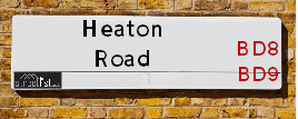
| Icon | Postcodes for Heaton Road | |
| Walking Distances | ||
| Distance Info | Green Circle = 10 Minutes Walk (800 metres) | |
About Heaton Road
Heaton Road is a street located in the city of Bradford. The street has a length of approximately 1,343 metres.
Heaton Road is located within the Bradford District (B) Council's jurisdiction. They provide various services, like refuse collection, and manage council tax collection. It's situated in the Yorkshire and The Humber region of the UK.
Heaton Road has been assigned the Unique Street Reference Numbers of 7737010, 7796622 and 7797092 in the National Street Gazetteer.
Heaton Road is located within the county of West Yorkshire, situated in the Yorkshire and The Humber region of the UK. It's 174.48 miles North West from central London., 9.75 miles West from Leeds, 29.79 miles North East from Manchester and 30.37 miles West from York.

Do you know why this road is called Heaton Road?
What's it like to live here?
Ask the community a question about Heaton Road.
Do you have any questions, memories to share or know any facts about Heaton Road? We'd love to know more.
Also on streetlist.co.uk, can you help?
Eldroth Road
15th April 2024
I wondered if anyone has any old pictures of Wenning Bank House in the 1940’s and also Lane Side before of the same era .. we visited today with my Mum in law as she used to live at both these properties. Also any photos of the schools around that time .. thank you.
Can You Help?Napps Way
15th April 2024
Why is the road called Napps Way (belonging to Napp, but minus an
apostrophe as is usual with such nomenclature)? Moreover, who or
what is, or was, “Napp” in the respective, possessive case?
Several years ago, I met an elderly man (probably in his late-eighties)
who lives on Bentham Drive, Liverpool 16, and during a conversation
with him whilst in a Northwest Passenger Transport Ambulance on the
way to the former RLUH (Royal Liverpool University Hospital), he told
me that he could remember (when he was a boy, living in Childwall,
Liverpool 16) that, “Where Napps Way is now, during WW2, there was
a two-man gun emplacement on the, then, open land to protect the
railway line passing over Childwall Valley Road - next to the railway
bridge - when suddenly, as they were loading a live “shell” into the gun’s
breach, the aforementioned “shell” accidentally exploded in the gun’s
breach killing both of the two soldiers, that had been manning the gun,
instantly! (Very sad, of course, but could - perhaps - two ghosts relating
to those two, very unfortunately and prematurely-killed soldiers have
haunted that place of their deaths ever since - and have any residents
of Napps Way - formerly and in its latest incarnation - seen two, WW2
(uniformed) soldiers unexpectedly appear in or near their homes?)
Mauritius Road
15th April 2024
Why is Mauritius Road so called, since when and by whom? Does Greenwich have any particular links with Mauritius? Very interested to know. 🤞🏼
Can You Help?Estate Agents near Heaton Road
| Name | Address | Website |
|---|---|---|
| Bradford Estates | 218 Lilycroft Road, Bradford,BD9 5AL | Visit Website |
| Your Choice Estate Agents | 86 Toller Lane, Bradford, BD8 9DA | Visit Website |
| Supreme Estates | 157 Toller Lane, Bradford,BD8 9HL | Visit Website |
We have found 13 postcodes for Heaton Road
Hotels near Heaton Road
Budget Hotels near Heaton Road
| Budget Hotel Name | Distance (miles) |
|---|---|
| 1: Name:ibis budget Bradford Address:6 Prince Court, Canal Road Telephone: Visit Site |
1.28 |
| 2: Name:Travelodge Bradford Central Address:2 Valley Rd, Bradford, BD1 4AF Telephone:0871 984 6171 Visit Site |
1.52 |
| 3: Name:Premier Inn Bradford Central Address:Vicar Lane Telephone: Visit Site |
1.81 |
| 4: Name:Holiday Inn Express Bradford City Centre Address:The Leisure Exchange, Vicar Lane Telephone: Visit Site |
1.90 |
| 5: Name:Travelodge Bradford Address:Mid Point, Bradford, BD3 7AY Telephone:0871 984 6124 Visit Site |
3.18 |
Location Details
| Heaton Road | |
|---|---|

| |
| Latitude | 53.810624 |
| Longitude | -1.780194 |
| OS Easting (X): | 414472 |
| OS Northing (Y): | 434972 |
| OS Grid Reference: | SE145350 |
Ordnance Survey Maps for Heaton Road
If you purchase a map through the links below, we may earn an affiliate commission.
| Map Series | link | Ordnance Survey |
| Explorer 1:25,000 288 Bradford and Huddersfield | Check Price on Amazon | Buy Direct from the Ordnance Survey |
| Landranger 1:50,000 104 Leeds & Bradford | Check Price on Amazon | Buy Direct from the Ordnance Survey |
Neighbourhood Policing |
| Police Force: West Yorkshire |
 View Neighbourhood Crime and Policing View Neighbourhood Crime and Policing |
| Find a Local Neighbourhood Watch Scheme |
Frequently asked Questions for Heaton Road
What Council (Local Authority) is Heaton Road in?
Heaton Road is located within the local authority area of Bradford Council which is a Metropolitan District.
What Parish Council is Heaton Road in?
Heaton Road is in an unparished area.
What Electoral Ward is Heaton Road in?
Heaton Road is located within the ward of Manningham, Heaton &Toller.
What County is Heaton Road in?
Heaton Road is located within the ceremonial county of West Yorkshire.
What Constituency is Heaton Road in?
Heaton Road is located within the constituency of Bradford West.
What Part of the UK is Heaton Road in?
Heaton Road is located within the Yorkshire and The Humber region of the United Kingdom.
What County Council area is Heaton Road in?
Heaton Road is located within the West Yorkshire Council area.
What Police Force area is Heaton Road in?
Heaton Road is located within the West Yorkshire Police area.
Roads that have a Junction with Heaton Road
| Street | Junction Type |
|---|---|
| Highgate | junction |
| Syke Road | junction |
| Heaton Park Drive | junction |
| Milford Place | junction |
| Parkside Drive | junction |
| Scotchman Road | junction |
| Park View Road | junction |
| Beamsley Road | junction |
| Victor Road | junction |
| Lilycroft Road | junction |
| Lilycroft Road | junction |
| Lily Croft | junction |
| Home View Terrace | junction |
| Springcliffe Street | junction |
| Morningside | junction |
| Church Street | junction |
Sunset and Sunrise times for Heaton Road
| Sunrise | 06:00 |
|---|---|
| Sunset | 20:12 |
Latest Weather Conditions for Heaton Road
| Observed at Weather Station: | Bingley Samos 16 April 2024 at 04:00 (3.46 miles away) |
|---|---|
| Current Weather: | Clear night |
| Temperature and Humidity: | 5.2°C (81.4%) |
| Wind Direction and Speed: | WNW (14 mph) |
Population Statistics
| ONS Area Code | E00054645, E00054647, E00054646, E00053843, E00053863, E00176210, E00053854, E00053853 & E00176122 |
|---|---|
| ONS Area Name | Pakistani Communities, Achieving Minorities & Constrained Neighbourhoods |
| Average Age | 35.51, 35.74, 30.19, 28.90 & 32.68 |
| Area Population | 1664.00, 1699.00, 1816.00, 2439.00 & 2094.00 |
| Male Population | 808.00, 888.00, 903.00, 1165.00 & 1068.00 (50%) |
| Female Population | 856.00, 811.00, 913.00, 1274.00 & 1026.00 (50%) |
| Benefit Claimants | 85, 43, 94, 108 & 88 (4%) |
| LSOA Code: | E01010840, E01010670, E01010673, E01010676 &E01010807 |
|---|---|
| LSOA Name: | Bradford 034D, Bradford 029A, Bradford 029C, Bradford 034A &Bradford 033C |
| SOA Code: | 7b &3b |
| SOA Name: | |
| MSOA Code: | E02002216, E02002211 &E02002215 |
| MSOA Name: | Bradford 034, Bradford 029 &Bradford 033 |
Nearest Supermarkets
| Iceland Manningham Food Warehouse |
|---|
| UNITS 3-4, MANNINGHAM LANE RETAIL PK, BRADFORD, BD1 3AH |
| 01274304139 |
| Distance: 0.58 Miles |
| Directions from Heaton Road to Iceland Manningham Food Warehouse |
| Tesco Manninghm Ln Bradford Express |
|---|
| Manningham Ln, Bradford, BD8 7HY |
| 0345 026 9840 |
| Distance: 0.93 Miles |
| Directions from Heaton Road to Tesco Manninghm Ln Bradford Express |
| Morrisons Bradford - Victoria |
|---|
| Victoria Shopping Centre, Young Street, Bradford BD8 9BN |
| 01274 498218 |
| Distance: 0.94 Miles |
| Directions from Heaton Road to Morrisons Bradford - Victoria |
| Tesco Bradford Peel Centre Superstore |
|---|
| Peel Centre, Valley Rd, Bradford, BD1 4RB |
| 0345 677 9098 |
| Distance: 1.15 Miles |
| Directions from Heaton Road to Tesco Bradford Peel Centre Superstore |
Telephone Information
| Area Code |
|---|
| Area Code: 01274 - Bradford |
| Area Code: 01943 - Guiseley |
| Area Code: 01422 - Halifax |
| Area Code: 01535 - Keighley |
Broadband Information
| Speed | Average Speed | Median Speed | Maximum Speed | Next-generation access (NGA) | Number of Connections |
|---|---|---|---|---|---|
| Greater than 2 Mbps | 23.3 | 20 | >=30 | Y | 16 |
Local Government
| Local Council Details |
|---|
| Within the area of Bradford |
| Visit the Council's Website |
| City Hall, Centenary Square, Bradford &BD1 1HY |
| Telephone Number: 01274 432111 |
| Local Member of Parliament |
|---|
| Within the Westminster Parliamentary Constituency of Bradford West |
| The Member of Parliament is Naz Shah |
| Details for the MP Naz Shah on parliament.uk |
| Details for the MP Naz Shah on theyworkforyou.com |
| In the 2019 General Election Naz Shah won with a majority of 27,019 the result was Lab hold. The total electorate was 70,694 |
| Wards, Parish Councils and County Councils |
|---|
| Ward: Manningham, Heaton &Toller Ward |
| Ceremonial County: West Yorkshire |
Nearest Schools
| Name | Address | Postcode | Telephone | Type | Distance (Km) |
|---|
Data accessed from gov.scot 08-08-2019
Nearest Hospitals
| Name | Address | Postcode | Distance | Map |
|---|
Nearest Dentists
Dentists near Heaton Road
| Name | Address | Postcode | Distance | Map |
|---|
Nearest GP Surgeries
Doctors near Heaton Road
OAK LANE SURGERY
Address: WESTBOURNE GREEN COMMUNITY HC, 50 HEATON ROAD, BRADFORD, WEST YORKSHIRE, BD8 8RA
Distance: 0.28 miles
Contact: :
THE LISTER SURGERY
Address: 50 HEATON ROAD, BRADFORD, WEST YORKSHIRE, BD8 8RA
Distance: 0.28 miles
Contact: tel: 01274 202495
THE CITY MEDICAL PRACTICE
Address: WESTBOURNE GREEN CHC CENTRE, 50 HEATON ROAD, BRADFORD, BD8 8RA
Distance: 0.28 miles
Contact: tel: 01274 256213
ASHWELL MEDICAL CENTRE
Address: ASHWELL ROAD, MANNINGHAM, BRADFORD, WEST YORKSHIRE, BD8 9DP
Distance: 0.48 miles
Contact: tel: 01274 490409
ASHWELL MEDICAL CENTRE - COVID LOCAL VACCINATION SERVICE
Address: ASHWELL ROAD, MANNINGHAM, BRADFORD, BD8 9DP
Distance: 0.48 miles
Contact: :
PICTON MEDICAL CENTRE
Address: WHETLEY MEDICAL CENTRE, 2 SAPLIN STREET, BRADFORD, BD8 9DW
Distance: 0.50 miles
Contact: tel: 01274 019605
Nearest Dispensing Chemists
Pharmacies near Heaton Road
| Name | Address | Postcode | Telephone | Map | Distance in Km |
|---|
Nearest Opticians
Opticians near Heaton Road
OAKLANE OPTICIANS
Address: 68 OAK LANE, BRADFORD, WEST YORKSHIRE, BD9 4QX
Distance: 0.24 miles
Contact: :
FINELINE EYECARE (UK) LIMITED (SSECS)
Address: 19 OAK LANE, BRADFORD, WEST YORKSHIRE, BD9 4PU
Distance: 0.48 miles
Contact: :
FINELINE EYECARE
Address: 19 OAK LANE, BRADFORD, WEST YORKSHIRE, BD9 4PU
Distance: 0.48 miles
Contact: :
CROSSROADS OPTICIANS
Address: 54 DUCKWORTH LANE, BRADFORD, WEST YORKSHIRE, BD9 5HB
Distance: 0.51 miles
Contact: :
EYEDEAL OPTICAL (YORKSHIRE) LTD
Address: 45 DUCKWORTH LANE, BRADFORD, WEST YORKSHIRE, BD9 5ET
Distance: 0.52 miles
Contact: :
SPECSAVERS (GIRLINGTON, BRADFORD)
Address: UNIT 12, MORRISONS SUPERMARKET, VICTORIA SHOPPING CENTRE, THORNTON ROAD, BRADFORD, WEST YORKSHIRE, BD8 9BN
Distance: 0.94 miles
Contact: :
Transport
Nearest Rail Stations
Frizinghall Station is 0.78 miles away.
Address: Frizinghall station, Frizinghall Road, Frizinghall, West Yorkshire, BD9 4LD
Frizinghall is situated on the Wharfedale Line|Leeds to Bradford lines and is managed by Northern.
Frizinghall Station is an unstaffed station.
Bradford Forster Square Station is 1.46 miles away.
Address: Bradford Forster Square station, Forster Square, Bradford, West Yorkshire, BD1 4HY
Bradford Forster Square is situated on the Wharfedale Line|Leeds to Bradford lines and is managed by Northern.
Bradford Forster Square Station is staffed on a part time basis.
Directions from Heaton Road to Bradford Forster Square Rail Station