Map of Hamilton Road
| Postcodes | ||
|---|---|---|
| Icon | Postcodes for Hamilton Road | |
| Walking Distances | ||
| Distance Info | Green Circle = 10 Minutes Walk (800 metres) | |
About Hamilton Road
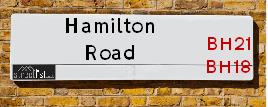
Hamilton Road is a street located in the village of Corfe Mullen. It uses the postcode BH21 3PH. The street has a length of approximately 266 metres.
Hamilton Road is located within the Dorset Council's jurisdiction. They provide various services, like refuse collection, and manage council tax collection. It's situated in the South West region of the UK.
Hamilton Road has been assigned the Unique Street Reference Number of 12200029 in the National Street Gazetteer.
Hamilton Road is located within the county of Dorset, situated in the South West region of the UK. It's 97.15 miles South West from central London., 7.16 miles North West from Bournemouth, 18.88 miles East from Dorchester and 23.04 miles South West from Salisbury.

Do you know why this road is called Hamilton Road?
What's it like to live here?
Ask the community a question about Hamilton Road.
Do you have any questions, memories to share or know any facts about Hamilton Road? We'd love to know more.
Also on streetlist.co.uk, can you help?
Eldroth Road
15th April 2024
I wondered if anyone has any old pictures of Wenning Bank House in the 1940’s and also Lane Side before of the same era .. we visited today with my Mum in law as she used to live at both these properties. Also any photos of the schools around that time .. thank you.
Can You Help?Napps Way
15th April 2024
Why is the road called Napps Way (belonging to Napp, but minus an
apostrophe as is usual with such nomenclature)? Moreover, who or
what is, or was, “Napp” in the respective, possessive case?
Several years ago, I met an elderly man (probably in his late-eighties)
who lives on Bentham Drive, Liverpool 16, and during a conversation
with him whilst in a Northwest Passenger Transport Ambulance on the
way to the former RLUH (Royal Liverpool University Hospital), he told
me that he could remember (when he was a boy, living in Childwall,
Liverpool 16) that, “Where Napps Way is now, during WW2, there was
a two-man gun emplacement on the, then, open land to protect the
railway line passing over Childwall Valley Road - next to the railway
bridge - when suddenly, as they were loading a live “shell” into the gun’s
breach, the aforementioned “shell” accidentally exploded in the gun’s
breach killing both of the two soldiers, that had been manning the gun,
instantly! (Very sad, of course, but could - perhaps - two ghosts relating
to those two, very unfortunately and prematurely-killed soldiers have
haunted that place of their deaths ever since - and have any residents
of Napps Way - formerly and in its latest incarnation - seen two, WW2
(uniformed) soldiers unexpectedly appear in or near their homes?)
Mauritius Road
15th April 2024
Why is Mauritius Road so called, since when and by whom? Does Greenwich have any particular links with Mauritius? Very interested to know. 🤞🏼
Can You Help?Estate Agents near Hamilton Road
| Name | Address | Website |
|---|---|---|
| Meyers Estate Agents - Wimborne and Broadstone | 153 Phelipps Road, Corfe Mullen,BH21 3NL | Visit Website |
| Richards Estate Agents | 147 Wareham Road, Corfe Mullen, Wimborne, Dorset, BH21 3LA | Visit Website |
| Wilson Thomas Limited | 219 Lower Blandford Road, Broadstone, BH18 8DN | Visit Website |
We have found 1 postcode for Hamilton Road
Hotels near Hamilton Road
Budget Hotels near Hamilton Road
| Budget Hotel Name | Distance (miles) |
|---|---|
| 1: Name:Premier Inn Poole North Address:Cabot Lane Telephone: Visit Site |
1.62 |
| 2: Name:Premier Inn Poole Centre - Holes Bay Address:Holes Bay Road Telephone: Visit Site |
2.95 |
| 3: Name:Travelodge Poole Address:Holes Bay Rd, Poole, BH15 1LS Telephone:0871 559 1880 Visit Site |
3.46 |
| 4: Name:Holiday Inn Express Poole Address:Walking Fields Lane Telephone: Visit Site |
3.77 |
| 5: Name:Premier Inn Bournemouth Westcliff Address:8 Poole Road Telephone: Visit Site |
5.90 |
Location Details
| Hamilton Road | |
|---|---|

| |
| Latitude | 50.765418 |
| Longitude | -2.013110 |
| OS Easting (X): | 399075 |
| OS Northing (Y): | 96266 |
| OS Grid Reference: | SY991963 |
Ordnance Survey Maps for Hamilton Road
If you purchase a map through the links below, we may earn an affiliate commission.
| Map Series | link | Ordnance Survey |
| Explorer 1:25,000 118 Shaftesbury, Cranbourne Chase, Poole, Wimbourne Minster and Blandford | Check Price on Amazon | Buy Direct from the Ordnance Survey |
| Landranger 1:50,000 195 Bournemouth & Purbeck | Check Price on Amazon | Buy Direct from the Ordnance Survey |
Neighbourhood Policing |
| Police Force: Dorset |
 View Neighbourhood Crime and Policing View Neighbourhood Crime and Policing |
| Find a Local Neighbourhood Watch Scheme |
Frequently asked Questions for Hamilton Road
What Council (Local Authority) is Hamilton Road in?
Hamilton Road is located within the local authority area of Dorset Council which is a Unitary Authority.
What Parish Council is Hamilton Road in?
Hamilton Road is located within the area of Corfe Mullen Parish Council.
What Electoral Ward is Hamilton Road in?
Hamilton Road is located within the ward of Corfe Mullen.
What County is Hamilton Road in?
Hamilton Road is located within the ceremonial county of Dorset.
What Constituency is Hamilton Road in?
Hamilton Road is located within the constituency of Mid Dorset and North Poole.
What Part of the UK is Hamilton Road in?
Hamilton Road is located within the Array region of the United Kingdom.
What County Council area is Hamilton Road in?
Hamilton Road is located within the Dorset Council area.
What Police Force area is Hamilton Road in?
Hamilton Road is located within the Dorset Police area.
Roads that have a Junction with Hamilton Road
| Street | Junction Type |
|---|---|
| Highfield Road | junction |
Sunset and Sunrise times for Hamilton Road , BH21 3PH
| Sunrise | 06:02 |
|---|---|
| Sunset | 20:11 |
Latest Weather Conditions for Hamilton Road, BH21 3PH
| Observed at Weather Station: | Bournemouth Airport 19 April 2024 at 17:00 (7.84 miles away) |
|---|---|
| Current Weather: | Cloudy |
| Temperature and Humidity: | 14.0°C (70.1%) |
| Wind Direction and Speed: | NW (13 mph) |
Population Statistics
| ONS Area Code | E00103280 |
|---|---|
| ONS Area Name | Detached Retirement Living |
| Average Age | 48.60 |
| Area Population | 1756.00 |
| Male Population | 866.00 (49%) |
| Female Population | 890.00 (51%) |
| Benefit Claimants | 8 (0%) |
| LSOA Code: | E01020383 |
|---|---|
| LSOA Name: | East Dorset 012B |
| SOA Code: | 8b |
| SOA Name: | |
| MSOA Code: | E02004254 |
| MSOA Name: | East Dorset 012 |
Nearest Supermarkets
| Tesco Broadstone Express |
|---|
| 184 Lower Blandford Rd, Broadstone, BH18 8DP |
| 0345 026 9194 |
| Distance: 0.93 Miles |
| Directions from Hamilton Road to Tesco Broadstone Express |
| Tesco Poole Fleets Corner Extra |
|---|
| Waterloo Rd, Poole, BH17 7EJ |
| 0345 677 9551 |
| Distance: 2.01 Miles |
| Directions from Hamilton Road to Tesco Poole Fleets Corner Extra |
| Asda Canford Heath |
|---|
| Culliford Crescent - Canford Heath, Poole, BH17 9DW |
| 01202 605700 |
| Distance: 2.23 Miles |
| Directions from Hamilton Road to Asda Canford Heath |
| Iceland Canford Heath |
|---|
| 2 Adastral Square, Poole, , BH17 8SA |
| 01202683475 |
| Distance: 2.67 Miles |
| Directions from Hamilton Road to Iceland Canford Heath |
Telephone Information
| Area Code |
|---|
| Area Code: 01202 - Bournemouth |
| Area Code: 01929 - Wareham |
| Area Code: 01258 - Blandford Forum |
Broadband Information
| Speed | Average Speed | Median Speed | Maximum Speed | Next-generation access (NGA) | Number of Connections |
|---|---|---|---|---|---|
| Less than 2 Mbps | 9.9 | 5.9 | >=30 | Y | 19 |
Local Government
| Local Council Details |
|---|
| Within the area of Dorset |
| Local Member of Parliament |
|---|
| Within the Westminster Parliamentary Constituency of Mid Dorset and North Poole |
| The Member of Parliament is Michael Tomlinson |
| Details for the MP Michael Tomlinson on parliament.uk |
| Details for the MP Michael Tomlinson on theyworkforyou.com |
| In the 2019 General Election Michael Tomlinson won with a majority of 14,898 the result was Con hold. The total electorate was 65,427 |
| Wards, Parish Councils and County Councils |
|---|
| Ward: Corfe Mullen Ward |
| Ceremonial County: Dorset |
Nearest Schools
| Name | Address | Postcode | Telephone | Type | Distance (Km) |
|---|
Data accessed from gov.scot 08-08-2019
Nearest Hospitals
| Name | Address | Postcode | Distance | Map |
|---|
Nearest Dentists
Dentists near Hamilton Road
| Name | Address | Postcode | Distance | Map |
|---|
Nearest GP Surgeries
Doctors near Hamilton Road
HADLEIGH LODGE
Address: 216A WAREHAM ROAD, CORFE MULLEN, WIMBORNE, DORSET, BH21 3LN
Distance: 0.44 miles
Contact: :
THE HADLEIGH PRACTICE
Address: HADLEIGH PRACTICE, 20 KIRKWAY, BROADSTONE, DORSET, BH18 8EE
Distance: 0.91 miles
Contact: tel: 01202 692268
THE HARVEY PRACTICE
Address: 18 KIRKWAY, BROADSTONE, DORSET, BH18 8EE
Distance: 0.91 miles
Contact: tel: 01202 697307
THE CREEKMOOR SURGERY
Address: 1 BORLEY ROAD, POOLE, DORSET, BH17 7DT
Distance: 1.61 miles
Contact: :
THE BIRCHWOOD PRACTICE
Address: NORTHMEAD DRIVE, CREEKMOOR, POOLE, DORSET, BH17 7XW
Distance: 1.86 miles
Contact: tel: 01202 697639
THE ADAM PRACTICE - UPTON SURGERY
Address: UPTON CROSS, POOLE, DORSET, BH16 5PW
Distance: 1.94 miles
Contact: :
Nearest Dispensing Chemists
Pharmacies near Hamilton Road
| Name | Address | Postcode | Telephone | Map | Distance in Km |
|---|
Nearest Opticians
Opticians near Hamilton Road
SCRIVENS OPTICIANS (BROADSTONE)
Address: 169/171 THE BROADWAY, BROADSTONE, DORSET, BH18 8DS
Distance: 0.88 miles
Contact: :
HARROLD OPTICIANS (BROADSTONE)
Address: 184C LOWER BLANDFORD ROAD, BROADSTONE, BH18 8DP
Distance: 0.90 miles
Contact: :
OPTIQUE 2000 LTD
Address: 7A WEST STREET, WIMBORNE, DORSET, BH21 1JN
Distance: 2.61 miles
Contact: :
SPECSAVERS - WIMBORNE MINSTER
Address: 5-6 CROWN MEAD, WIMBORNE, BH21 1ED
Distance: 2.61 miles
Contact: :
BOOTS OPTICIANS (WIMBORNE)
Address: 1 THE SQUARE, WIMBORNE, DORSET, BH21 1JA
Distance: 2.65 miles
Contact: :
SCRIVENS OPTICIANS (WIMBORNE)
Address: 6 THE SQUARE, WIMBORNE, BH21 1JA
Distance: 2.65 miles
Contact: :
Transport
Nearest Rail Stations
Hamworthy Station is 2.79 miles away.
Address: Hamworthy station, Junction Road, Hamworthy, Dorset, BH16 5AA
Hamworthy is situated on the Portsmouth Direct line|South Western Main Line and is managed by South Western Railway.
Hamworthy Station is staffed on a part time basis.
Poole Station is 3.44 miles away.
Address: Poole station, Serpentine Road, Poole, Dorset, BH15 2BQ
Poole is situated on the Portsmouth Direct line|South Western Main Line and is managed by South Western Railway.
Poole Station is staffed on a part time basis.