Map of Castleman Way
| Postcodes | ||
|---|---|---|
| Icon | Postcodes for Castleman Way | |
| Walking Distances | ||
| Distance Info | Green Circle = 10 Minutes Walk (800 metres) | |
About Castleman Way
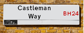
Castleman Way is a street located in the town of Ringwood. It uses the postcode BH24 3BA. The street has a length of approximately 658 metres.
Castleman Way is located within the New Forest District Council's jurisdiction. They provide various services, like refuse collection, and manage council tax collection. It's situated in the South East region of the UK.
Castleman Way has been assigned the Unique Street Reference Number of 26721539 in the National Street Gazetteer.
Castleman Way is located within the county of Hampshire, situated in the South East region of the UK. It's 85.81 miles South West from central London., 9.04 miles North East from Bournemouth, 15.67 miles South from Salisbury and 17.14 miles West from Southampton.

Do you know why this road is called Castleman Way?
What's it like to live here?
Ask the community a question about Castleman Way.
Do you have any questions, memories to share or know any facts about Castleman Way? We'd love to know more.
Also on streetlist.co.uk, can you help?
Eldroth Road
15th April 2024
I wondered if anyone has any old pictures of Wenning Bank House in the 1940’s and also Lane Side before of the same era .. we visited today with my Mum in law as she used to live at both these properties. Also any photos of the schools around that time .. thank you.
Can You Help?Napps Way
15th April 2024
Why is the road called Napps Way (belonging to Napp, but minus an
apostrophe as is usual with such nomenclature)? Moreover, who or
what is, or was, “Napp” in the respective, possessive case?
Several years ago, I met an elderly man (probably in his late-eighties)
who lives on Bentham Drive, Liverpool 16, and during a conversation
with him whilst in a Northwest Passenger Transport Ambulance on the
way to the former RLUH (Royal Liverpool University Hospital), he told
me that he could remember (when he was a boy, living in Childwall,
Liverpool 16) that, “Where Napps Way is now, during WW2, there was
a two-man gun emplacement on the, then, open land to protect the
railway line passing over Childwall Valley Road - next to the railway
bridge - when suddenly, as they were loading a live “shell” into the gun’s
breach, the aforementioned “shell” accidentally exploded in the gun’s
breach killing both of the two soldiers, that had been manning the gun,
instantly! (Very sad, of course, but could - perhaps - two ghosts relating
to those two, very unfortunately and prematurely-killed soldiers have
haunted that place of their deaths ever since - and have any residents
of Napps Way - formerly and in its latest incarnation - seen two, WW2
(uniformed) soldiers unexpectedly appear in or near their homes?)
Mauritius Road
15th April 2024
Why is Mauritius Road so called, since when and by whom? Does Greenwich have any particular links with Mauritius? Very interested to know. 🤞🏼
Can You Help?Estate Agents near Castleman Way
| Name | Address | Website |
|---|---|---|
| Stratton & King Ltd | Churchill House, Parkside, Ringwood, BH24 3SG | Visit Website |
| VIRTUAL GPM BRANCH | Churchill House, Parkside, Ringwood, BH24 3SG | |
| Woolley & Wallis | 23 High Street, Ringwood, BH24 1AB |
We have found 1 postcode for Castleman Way
Location Details
| Castleman Way | |
|---|---|

| |
| Latitude | 50.842091 |
| Longitude | -1.783181 |
| OS Easting (X): | 415264 |
| OS Northing (Y): | 104814 |
| OS Grid Reference: | SU153048 |
Neighbourhood Policing |
| Police Force: Hampshire |
 View Neighbourhood Crime and Policing View Neighbourhood Crime and Policing |
| Find a Local Neighbourhood Watch Scheme |
Frequently asked Questions for Castleman Way
What Council (Local Authority) is Castleman Way in?
Castleman Way is located within the local authority area of New Forest Council which is a District Council.
What Parish Council is Castleman Way in?
Castleman Way is located within the area of Ringwood Parish Council.
What Electoral Ward is Castleman Way in?
Castleman Way is located within the ward of Ringwood South.
What County is Castleman Way in?
Castleman Way is located within the ceremonial county of Hampshire.
What Constituency is Castleman Way in?
Castleman Way is located within the constituency of New Forest West.
What Part of the UK is Castleman Way in?
Castleman Way is located within the South East (England) region of the United Kingdom.
What County Council area is Castleman Way in?
Castleman Way is located within the Hampshire Council area.
What Police Force area is Castleman Way in?
Castleman Way is located within the Hampshire Police area.
Roads that have a Junction with Castleman Way
| Street | Junction Type |
|---|---|
| Hightown Road | roundabout |
| Crow Arch Lane | junction |
| Embankment Way | junction |
| Waterloo Way | junction |
| New Street | junction |
| Bickerley Road | roundabout |
Sunset and Sunrise times for Castleman Way , BH24 3BA
| Sunrise | 05:53 |
|---|---|
| Sunset | 20:17 |
Latest Weather Conditions for Castleman Way, BH24 3BA
| Observed at Weather Station: | Bournemouth Airport 23 April 2024 at 12:00 (4.91 miles away) |
|---|---|
| Current Weather: | Overcast |
| Temperature and Humidity: | 11.9°C (64.0%) |
| Wind Direction and Speed: | N (14 mph) |
Population Statistics
| ONS Area Code | E00117228 |
|---|---|
| ONS Area Name | White Professionals |
| Average Age | 49.27 |
| Area Population | 1773.00 |
| Male Population | 800.00 (45%) |
| Female Population | 973.00 (55%) |
| Benefit Claimants | 9 (1%) |
| LSOA Code: | E01023070 |
|---|---|
| LSOA Name: | New Forest 012D |
| SOA Code: | 5a |
| SOA Name: | |
| MSOA Code: | E02004790 |
| MSOA Name: | New Forest 012 |
Nearest Supermarkets
| Iceland Ringwood |
|---|
| 29 Southampton Road, Ringwood, Hampshire, BH24 1HB |
| 01425474432 |
| Distance: 0.48 Miles |
| Directions from Castleman Way to Iceland Ringwood |
| Sainsburys Ringwood |
|---|
| 24 Meeting House Lane, Ringwood, England, BH24 1EY |
| 01425 461619 |
| Distance: 0.5 Miles |
| Directions from Castleman Way to Sainsburys Ringwood |
| Waitrose Ringwood |
|---|
| The Furlong, Ringwood, Hampshire, BH24 1AT |
| 01425 477729 |
| Distance: 0.57 Miles |
| Directions from Castleman Way to Waitrose Ringwood |
| Tesco Poulner Express |
|---|
| 1 Butlers Ln, Poulner, Ringwood, BH24 1UB |
| 0345 026 9408 |
| Distance: 1.1 Miles |
| Directions from Castleman Way to Tesco Poulner Express |
Telephone Information
| Dialling Code | Telephone Exchange | Telephone Cabinet | Fibre to the Cabinet or Fibre to the Premises |
|---|---|---|---|
| 01425 | RINGWOOD - STRINGW | P9 | FTTC |
Local Government
| Local Council Details |
|---|
| Within the area of New Forest |
| Visit the Council's Website |
| Appletree Court, Lyndhurst, Hampshire &SO43 7PA |
| Send email |
| Telephone Number: 023 8028 5000 |
| Local Member of Parliament |
|---|
| Within the Westminster Parliamentary Constituency of New Forest West |
| The Member of Parliament is Desmond Swayne |
| Details for the MP Desmond Swayne on parliament.uk |
| Details for the MP Desmond Swayne on theyworkforyou.com |
| In the 2019 General Election Desmond Swayne won with a majority of 24,403 the result was Con hold. The total electorate was 70,869 |
| Wards, Parish Councils and County Councils |
|---|
| Ward: Ringwood South Ward |
| Ceremonial County: Hampshire |
Nearest Schools
England Primary Schools
Poulner Infant School and Nursery
Address: Poulner Infant School and Nursery, North Poulner Road, Ringwood, Hampshire, BH24 3LA
Distance: 1.28 miles
Contact: 01425472338
Poulner Junior School
Address: Poulner Junior School, North Poulner Road, North Poulner, Ringwood, Hampshire, BH24 3LA
Distance: 1.28 miles
Contact: 01425474590
Ringwood Junior School
Address: Ringwood Junior School, Hightown Road, Ringwood, Hampshire, BH24 1NH
Distance: 0.13 miles
Contact: 01425473554
Ringwood Church of England Infant School
Address: Ringwood Church of England Infant School, School Lane, Ringwood, Hampshire, BH24 1LG
Distance: 0.29 miles
Contact: 01425473829
St Ives Primary & Nursery School
Address: St Ives Primary & Nursery School, Sandy Lane, St. Ives, Ringwood, Hampshire, BH24 2LE
Distance: 1.74 miles
Contact: 01425475478
St Ives Primary School
Address: St Ives Primary School, Sandy Lane, St Ives, Ringwood, Hampshire, BH24 2LE
Distance: 1.74 miles
Contact:
England Secondary Schools
Ringwood School Academy
Address: Ringwood School Academy, Parsonage Barn Lane, Ringwood, Hampshire, BH24 1SE
Distance: 0.43 miles
Contact: 01425475000
Nearest Hospitals
| Name | Address | Postcode | Distance | Map |
|---|
Nearest Dentists
Dentists near Castleman Way
| Name | Address | Postcode | Distance | Map |
|---|
Nearest GP Surgeries
Doctors near Castleman Way
RINGWOOD MEDICAL CENTRE
Address: THE CLOSE, RINGWOOD, HAMPSHIRE, BH24 1JY
Distance: 0.39 miles
Contact: tel: 01425 478901
CORNERWAYS MEDICAL CENTRE - COVID LOCAL VACCINATION SERVICE 2
Address: PARKERS CLOSE, RINGWOOD, BH24 1SD
Distance: 0.98 miles
Contact: :
CORNERWAYS MEDICAL CENTRE
Address: 5 PARKERS CLOSE, NORTH POULNER, RINGWOOD, HAMPSHIRE, BH24 1SD
Distance: 0.98 miles
Contact: tel: 01425 472515
CORNERWAYS MEDICAL CENTRE - COVID LOCAL VACCINATION SERVICE
Address: PARKERS CLOSE, RINGWOOD, BH24 1SD
Distance: 0.98 miles
Contact: :
ST LEONARDS SURGERY
Address: 1 PINE DRIVE, RINGWOOD, HAMPSHIRE, BH24 2LN
Distance: 2.40 miles
Contact: :
PARK VIEW SURGERY
Address: 1 ESDAILS LANE, RINGWOOD ROAD, RINGWOOD, HAMPSHIRE, BH24 4AF
Distance: 3.58 miles
Contact: :
Nearest Dispensing Chemists
Pharmacies near Castleman Way
| Name | Address | Postcode | Telephone | Map | Distance in Km |
|---|
Nearest Opticians
Opticians near Castleman Way
EYESEEEYE OPTICIANS
Address: 17 CHRISTCHURCH ROAD, RINGWOOD, HAMPSHIRE, BH24 1DG
Distance: 0.38 miles
Contact: :
KELLY EYECARE OPTICIANS (RINGWOOD)
Address: 17 HIGH STREET, RINGWOOD, HAMPSHIRE, BH24 1AB
Distance: 0.45 miles
Contact: :
SCRIVENS OPTICIANS (RINGWOOD)
Address: 31 SOUTHAMPTON ROAD, RINGWOOD, HAMPSHIRE, BH24 1HB
Distance: 0.47 miles
Contact: :
SPECSAVERS (RINGWOOD)
Address: 2 THE FURLONG, RINGWOOD, HAMPSHIRE, BH24 1AT
Distance: 0.57 miles
Contact: :
PBS OPTICAL
Address: CORNERWAYS COTTAGE, GORLEY ROAD, RINGWOOD, HAMPSHIRE, BH24 1TW
Distance: 1.03 miles
Contact: :
CLARE DORKINS - NICHOLSON EYECARE
Address: 1 RUNNYMEADE, RINGWOOD ROAD, BRANSGORE, CHRISTCHURCH, BH23 8NJ
Distance: 4.65 miles
Contact: :
Transport
Nearest Rail Stations
Hinton Admiral Station is 6.88 miles away.
Address: Hinton Admiral station, Hinton Wood Lane, Hinton Admiral, Dorset, BH23 7DW
Hinton Admiral is situated on the Portsmouth Direct line|South Western Main Line and is managed by South Western Railway.
Hinton Admiral Station is staffed on a part time basis.
Directions from Castleman Way to Hinton Admiral Rail Station
Christchurch Station is 7.18 miles away.
Address: Christchurch station, Stour Road, Christchurch, Dorset, BH23 1PL
Christchurch is situated on the Portsmouth Direct line|South Western Main Line and is managed by South Western Railway.
Christchurch Station is staffed on a part time basis.