Map of Avenue Road
| Postcodes | ||
|---|---|---|
| Icon | Postcodes for Avenue Road | |
| Walking Distances | ||
| Distance Info | Green Circle = 10 Minutes Walk (800 metres) | |
About Avenue Road
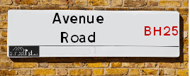
Avenue Road is a street located in the town of New Milton. It uses the postcode BH25 5JP. The street has a length of approximately 328 metres.
Avenue Road is located within the New Forest District Council's jurisdiction. They provide various services, like refuse collection, and manage council tax collection. It's situated in the South East region of the UK.
Avenue Road has been assigned the Unique Street Reference Number of 26719380 in the National Street Gazetteer.
Avenue Road is located within the county of Hampshire, situated in the South East region of the UK. It's 84.74 miles South West from central London., 9.38 miles East from Bournemouth, 15.03 miles South West from Southampton and 16.52 miles West from Newport (IOW).

Do you know why this road is called Avenue Road?
What's it like to live here?
Ask the community a question about Avenue Road.
Do you have any questions, memories to share or know any facts about Avenue Road? We'd love to know more.
Also on streetlist.co.uk, can you help?
Eldroth Road
15th April 2024
I wondered if anyone has any old pictures of Wenning Bank House in the 1940’s and also Lane Side before of the same era .. we visited today with my Mum in law as she used to live at both these properties. Also any photos of the schools around that time .. thank you.
Can You Help?Napps Way
15th April 2024
Why is the road called Napps Way (belonging to Napp, but minus an
apostrophe as is usual with such nomenclature)? Moreover, who or
what is, or was, “Napp” in the respective, possessive case?
Several years ago, I met an elderly man (probably in his late-eighties)
who lives on Bentham Drive, Liverpool 16, and during a conversation
with him whilst in a Northwest Passenger Transport Ambulance on the
way to the former RLUH (Royal Liverpool University Hospital), he told
me that he could remember (when he was a boy, living in Childwall,
Liverpool 16) that, “Where Napps Way is now, during WW2, there was
a two-man gun emplacement on the, then, open land to protect the
railway line passing over Childwall Valley Road - next to the railway
bridge - when suddenly, as they were loading a live “shell” into the gun’s
breach, the aforementioned “shell” accidentally exploded in the gun’s
breach killing both of the two soldiers, that had been manning the gun,
instantly! (Very sad, of course, but could - perhaps - two ghosts relating
to those two, very unfortunately and prematurely-killed soldiers have
haunted that place of their deaths ever since - and have any residents
of Napps Way - formerly and in its latest incarnation - seen two, WW2
(uniformed) soldiers unexpectedly appear in or near their homes?)
Mauritius Road
15th April 2024
Why is Mauritius Road so called, since when and by whom? Does Greenwich have any particular links with Mauritius? Very interested to know. 🤞🏼
Can You Help?Estate Agents near Avenue Road
| Name | Address | Website |
|---|---|---|
| Harrison Estate Agents | 7 Whitefield Road, New Milton,BH25 6DE | Visit Website |
| Weldon & King | 57 Station Road, New Milton,BH25 6HY | Visit Website |
| Mitchells Estate Agents | 8 Old Milton Road, New Milton, Hampshire, BH25 6DT | Visit Website |
We have found 1 postcode for Avenue Road
Location Details
| Avenue Road | |
|---|---|

| |
| Latitude | 50.756641 |
| Longitude | -1.658002 |
| OS Easting (X): | 424120 |
| OS Northing (Y): | 95346 |
| OS Grid Reference: | SZ241953 |
Ordnance Survey Maps for Avenue Road
If you purchase a map through the links below, we may earn an affiliate commission.
| Map Series | link | Ordnance Survey |
| Explorer 1:25,000 ol22 New Forest, Southampton, Ringwood, Ferndown, Lymington, Christchurch and Bournemouth | Check Price on Amazon | Buy Direct from the Ordnance Survey |
| Landranger 1:50,000 195 Bournemouth & Purbeck | Check Price on Amazon | Buy Direct from the Ordnance Survey |
Neighbourhood Policing |
| Police Force: Hampshire |
 View Neighbourhood Crime and Policing View Neighbourhood Crime and Policing |
| Find a Local Neighbourhood Watch Scheme |
Frequently asked Questions for Avenue Road
What Council (Local Authority) is Avenue Road in?
Avenue Road is located within the local authority area of New Forest Council which is a District Council.
What Parish Council is Avenue Road in?
Avenue Road is located within the area of New Milton Parish Council.
What Electoral Ward is Avenue Road in?
Avenue Road is located within the ward of Fernhill.
What County is Avenue Road in?
Avenue Road is located within the ceremonial county of Hampshire.
What Constituency is Avenue Road in?
Avenue Road is located within the constituency of New Forest West.
What Part of the UK is Avenue Road in?
Avenue Road is located within the South East (England) region of the United Kingdom.
What County Council area is Avenue Road in?
Avenue Road is located within the Hampshire Council area.
What Police Force area is Avenue Road in?
Avenue Road is located within the Hampshire Police area.
Roads that have a Junction with Avenue Road
| Street | Junction Type |
|---|---|
| Kennard Road | junction |
| Fernhill Road | junction |
| Leigh Road | junction |
| Station Road | junction |
| Fernhill Lane (B3058) | junction |
Sunset and Sunrise times for Avenue Road , BH25 5JP
| Sunrise | 05:48 |
|---|---|
| Sunset | 20:20 |
Latest Weather Conditions for Avenue Road, BH25 5JP
| Observed at Weather Station: | Bournemouth Airport 25 April 2024 at 15:00 (7.89 miles away) |
|---|---|
| Current Weather: | Light rain |
| Temperature and Humidity: | 9.7°C (89.1%) |
| Wind Direction and Speed: | WSW (10 mph) |
Population Statistics
| ONS Area Code | E00116959 |
|---|---|
| ONS Area Name | Communal Retirement |
| Average Age | 47.05 |
| Area Population | 1432.00 |
| Male Population | 669.00 (47%) |
| Female Population | 763.00 (53%) |
| Benefit Claimants | 17 (1%) |
| LSOA Code: | E01023018 |
|---|---|
| LSOA Name: | New Forest 020B |
| SOA Code: | 5a |
| SOA Name: | |
| MSOA Code: | E02004798 |
| MSOA Name: | New Forest 020 |
Nearest Supermarkets
| Morrisons New Milton |
|---|
| Station Road, New Milton BH25 6HY |
| 01425 639075 |
| Distance: 0.22 Miles |
| Directions from Avenue Road to Morrisons New Milton |
| Tesco Old Milton Rd Express |
|---|
| 61 Old Milton Rd, New Milton, BH25 6DN |
| 0345 674 6495 |
| Distance: 0.33 Miles |
| Directions from Avenue Road to Tesco Old Milton Rd Express |
| Tesco New Milton Superstore |
|---|
| Caird Ave, New Milton, BH25 6BP |
| 0345 677 9489 |
| Distance: 0.69 Miles |
| Directions from Avenue Road to Tesco New Milton Superstore |
| Tesco Christchurch Highcliffe Express |
|---|
| Lymington Rd Highcliffe, Christchurch, BH23 5HD |
| 0345 671 9281 |
| Distance: 2 Miles |
| Directions from Avenue Road to Tesco Christchurch Highcliffe Express |
Telephone Information
| Dialling Code | Telephone Exchange | Telephone Cabinet | Fibre to the Cabinet or Fibre to the Premises |
|---|---|---|---|
| 01425 | NEW MILTON - STNEWMN | P6 | FTTC |
Broadband Information
| Speed | Average Speed | Median Speed | Maximum Speed | Next-generation access (NGA) | Number of Connections |
|---|---|---|---|---|---|
| Less than 2 Mbps | 25.6 | 17.9 | >=30 | Y | 26 |
Local Government
| Local Council Details |
|---|
| Within the area of New Forest |
| Visit the Council's Website |
| Appletree Court, Lyndhurst, Hampshire &SO43 7PA |
| Send email |
| Telephone Number: 023 8028 5000 |
| Local Member of Parliament |
|---|
| Within the Westminster Parliamentary Constituency of New Forest West |
| The Member of Parliament is Desmond Swayne |
| Details for the MP Desmond Swayne on parliament.uk |
| Details for the MP Desmond Swayne on theyworkforyou.com |
| In the 2019 General Election Desmond Swayne won with a majority of 24,403 the result was Con hold. The total electorate was 70,869 |
| Wards, Parish Councils and County Councils |
|---|
| Ward: Fernhill Ward |
| Ceremonial County: Hampshire |
Nearest Schools
England Primary Schools
Ashley Infant School
Address: Ashley Infant School, Lower Ashley Road, Ashley, New Milton, Hampshire, BH25 5AA
Distance: 0.96 miles
Contact: 01425611321
Ashley Junior School
Address: Ashley Junior School, Normans Way, Ashley Road, Ashley, New Milton, Hampshire, BH25 5FN
Distance: 0.75 miles
Contact: 01425616510
Tiptoe Primary School
Address: Tiptoe Primary School, Wootton Road, Tiptoe, Lymington, Hampshire, SO41 6FU
Distance: 1.77 miles
Contact: 01590682375
New Milton Junior School
Address: New Milton Junior School, Old Milton Road, New Milton, Hampshire, BH25 6DS
Distance: 0.52 miles
Contact: 01425614633
New Milton Infant School
Address: New Milton Infant School, Lymington Road, New Milton, Hampshire, BH25 6PZ
Distance: 0.66 miles
Contact: 01425610568
England Secondary Schools
The Arnewood School
Address: The Arnewood School, Gore Road, New Milton, Hampshire, BH25 6RS
Distance: 0.49 miles
Contact: 01425625400
Nearest Hospitals
| Name | Address | Postcode | Distance | Map |
|---|
Nearest Dentists
Dentists near Avenue Road
| Name | Address | Postcode | Distance | Map |
|---|
Nearest GP Surgeries
Doctors near Avenue Road
COASTAL MEDICAL PARTNERSHIP
Address: MILTON MEDICAL CENTRE, AVENUE ROAD, NEW MILTON, BH25 5JP
Distance: 0.01 miles
Contact: tel: 01425 620393
NEW MILTON HEALTH CENTRE - COVID LOCAL VACCINATION SERVICE 2
Address: SPENCER ROAD, NEW MILTON, BH25 6EN
Distance: 0.18 miles
Contact: :
NEW MILTON HEALTH CENTRE - COVID LOCAL VACCINATION SERVICE
Address: SPENCER ROAD, NEW MILTON, BH25 6EN
Distance: 0.18 miles
Contact: :
NEW MILTON HEALTH CENTRE
Address: SPENCER ROAD, NEW MILTON, BH25 6EN
Distance: 0.18 miles
Contact: :
BARTON SURGERY
Address: 1 EDMUNDS CLOSE, BARTON ON SEA, NEW MILTON, BH25 7EN
Distance: 0.76 miles
Contact: :
HIGHCLIFFE MEDICAL CENTRE
Address: 248 LYMINGTON ROAD, HIGHCLIFFE, CHRISTCHURCH, DORSET, BH23 5ET
Distance: 2.19 miles
Contact: tel: 01425 272203
Nearest Dispensing Chemists
Pharmacies near Avenue Road
| Name | Address | Postcode | Telephone | Map | Distance in Km |
|---|
Nearest Opticians
Opticians near Avenue Road
BOOTS OPTICIANS (NEW MILTON)
Address: 20 STATION ROAD, NEW MILTON, BH25 6JX
Distance: 0.17 miles
Contact: :
SPECSAVERS - NEW MILTON
Address: 55 STATION ROAD, NEW MILTON, HAMPSHIRE, BH25 6HY
Distance: 0.22 miles
Contact: :
SCRIVENS OPTICIANS (NEW MILTON)
Address: 3 MALLARD BUILDINGS, STATION ROAD, NEW MILTON, HAMPSHIRE, BH25 6HY
Distance: 0.22 miles
Contact: :
VISION EXPRESS (NEW MILTON)
Address: 78-80 STATION ROAD, NEW MILTON, HAMPSHIRE, BH25 6LE
Distance: 0.24 miles
Contact: :
NEW MILTON EXTRA
Address: CAIRD AVENUE, NEW MILTON, HAMPSHIRE, BH25 6BP
Distance: 0.69 miles
Contact: :
HOWIE & TICKNER OPTICIANS
Address: 6 HIGHCLIFFE CORNER, LYMINGTON ROAD, HIGHCLIFFE, CHRISTCHURCH, DORSET, BH23 5EL
Distance: 1.95 miles
Contact: :
Transport
Nearest Rail Stations
New Milton Station is 0.06 miles away.
Address: New Milton station, Station Approach, New Milton, Hampshire, BH25 6JS
New Milton is situated on the Portsmouth Direct line|South Western Main Line and is managed by South Western Railway.
New Milton Station is staffed on a part time basis.
Hinton Admiral Station is 2.47 miles away.
Address: Hinton Admiral station, Hinton Wood Lane, Hinton Admiral, Dorset, BH23 7DW
Hinton Admiral is situated on the Portsmouth Direct line|South Western Main Line and is managed by South Western Railway.
Hinton Admiral Station is staffed on a part time basis.