Map of Ringwood Road
| Postcodes | ||
|---|---|---|
| Icon | Postcodes for Ringwood Road | |
| Walking Distances | ||
| Distance Info | Green Circle = 10 Minutes Walk (800 metres) | |
About Ringwood Road
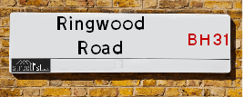
Ringwood Road is a street located in the town of Verwood and near the town of Verwood. The street has a length of approximately 2,692 metres.
Ringwood Road is located within the Dorset and New Forest District Council's jurisdiction. They provide various services, like refuse collection, and manage council tax collection. It's situated in the South West region of the UK.
Ringwood Road has been assigned the Unique Street Reference Number of 12200833 and 26723808 in the National Street Gazetteer.
Ringwood Road is located within the county of Dorset, situated in the South West region of the UK. It's 87.52 miles South West from central London., 10.68 miles North from Bournemouth, 13.61 miles South from Salisbury and 20.15 miles West from Southampton.

Do you know why this road is called Ringwood Road?
What's it like to live here?
Ask the community a question about Ringwood Road.
Do you have any questions, memories to share or know any facts about Ringwood Road? We'd love to know more.
Also on streetlist.co.uk, can you help?
Eldroth Road
15th April 2024
I wondered if anyone has any old pictures of Wenning Bank House in the 1940’s and also Lane Side before of the same era .. we visited today with my Mum in law as she used to live at both these properties. Also any photos of the schools around that time .. thank you.
Can You Help?Napps Way
15th April 2024
Why is the road called Napps Way (belonging to Napp, but minus an
apostrophe as is usual with such nomenclature)? Moreover, who or
what is, or was, “Napp” in the respective, possessive case?
Several years ago, I met an elderly man (probably in his late-eighties)
who lives on Bentham Drive, Liverpool 16, and during a conversation
with him whilst in a Northwest Passenger Transport Ambulance on the
way to the former RLUH (Royal Liverpool University Hospital), he told
me that he could remember (when he was a boy, living in Childwall,
Liverpool 16) that, “Where Napps Way is now, during WW2, there was
a two-man gun emplacement on the, then, open land to protect the
railway line passing over Childwall Valley Road - next to the railway
bridge - when suddenly, as they were loading a live “shell” into the gun’s
breach, the aforementioned “shell” accidentally exploded in the gun’s
breach killing both of the two soldiers, that had been manning the gun,
instantly! (Very sad, of course, but could - perhaps - two ghosts relating
to those two, very unfortunately and prematurely-killed soldiers have
haunted that place of their deaths ever since - and have any residents
of Napps Way - formerly and in its latest incarnation - seen two, WW2
(uniformed) soldiers unexpectedly appear in or near their homes?)
Mauritius Road
15th April 2024
Why is Mauritius Road so called, since when and by whom? Does Greenwich have any particular links with Mauritius? Very interested to know. 🤞🏼
Can You Help?Estate Agents near Ringwood Road
| Name | Address | Website |
|---|---|---|
| Edwards | 11-13 Ringwood Road, Verwood, BH31 7AA | Visit Website |
| Goadsby | The Parade, 7 Ringwood Road, Verwood, BH31 7AA | Visit Website |
| Castleman Estate Agents | 7 Station Road Verwood BH31 7PY | Visit Website |
We have found 15 postcodes for Ringwood Road
Hotels near Ringwood Road
Budget Hotels near Ringwood Road
| Budget Hotel Name | Distance (miles) |
|---|---|
| 1: Name:Travelodge Ringwood Address:A31 Eastbound, St Leonards, Ringwood, BH24 2NR Telephone:0871 984 6237 Visit Site |
3.43 |
| 2: Name:Premier Inn Ringwood Address:Forest Gate Business Park Telephone: Visit Site |
4.33 |
| 3: Name:Premier Inn Bournemouth Ferndown Address:504 Ringwood Road Telephone: Visit Site |
4.57 |
| 4: Name:Travelodge Bournemouth Cooper Dean Address:Cooper Dean Roundabout, Castle Lane East, Bournemouth, BH7 7DP Telephone:0871 559 1808 Visit Site |
9.05 |
| 5: Name:Travelodge Christchurch Address:Saxon Square, Fountain Way, Christchurch, BH23 1QN Telephone:0871 984 6505 Visit Site |
10.39 |
Location Details
| Ringwood Road | |
|---|---|

| |
| Latitude | 50.876531 |
| Longitude | -1.862104 |
| OS Easting (X): | 409700 |
| OS Northing (Y): | 108630 |
| OS Grid Reference: | SU097086 |
Ordnance Survey Maps for Ringwood Road
If you purchase a map through the links below, we may earn an affiliate commission.
| Map Series | link | Ordnance Survey |
| Explorer 1:25,000 ol22 New Forest, Southampton, Ringwood, Ferndown, Lymington, Christchurch and Bournemouth | Check Price on Amazon | Buy Direct from the Ordnance Survey |
| Landranger 1:50,000 195 Bournemouth & Purbeck | Check Price on Amazon | Buy Direct from the Ordnance Survey |
Neighbourhood Policing |
| Police Force: Dorset &Hampshire |
| Find a Local Neighbourhood Watch Scheme |
Frequently asked Questions for Ringwood Road
What Council (Local Authority) is Ringwood Road in?
Ringwood Road is located within the local authority area of Dorset &New Forest Council which is a Unitary Authority &District Council.
What Parish Council is Ringwood Road in?
Ringwood Road is located within the area of Ellingham & Harbridge and Ibsley Parish Council.
What Electoral Ward is Ringwood Road in?
Ringwood Road is located within the ward of Verwood &Forest North West.
What County is Ringwood Road in?
Ringwood Road is located within the ceremonial county of Dorset.
What Constituency is Ringwood Road in?
Ringwood Road is located within the constituency of North Dorset &New Forest West.
What Part of the UK is Ringwood Road in?
Ringwood Road is located within the &South East (England) region of the United Kingdom.
What County Council area is Ringwood Road in?
Ringwood Road is located within the Dorset &Hampshire Council area.
What Police Force area is Ringwood Road in?
Ringwood Road is located within the Dorset &Hampshire Police area.
Roads that have a Junction with Ringwood Road
| Street | Junction Type |
|---|---|
| Moneyfly Road | junction |
| Southernhay Road | junction |
| Noon Hill Road | junction |
| Lake Road | junction |
| Sherwood Drive | junction |
| Black Hill | junction |
| Heathlands Close | junction |
| St Stephens Lane | junction |
| Newtown Road | junction |
| Hillside Road | junction |
| Merryfield Close | junction |
| Vicarage Road | junction |
| Black Moor Road | junction |
| Parkland Close | junction |
| Heather Gardens | junction |
| Virginia Close | junction |
| The Forestside | junction |
| Black Moor Road | junction |
| The Chase | junction |
| The Chase | junction |
| Woodlinken Drive | junction |
Sunset and Sunrise times for Ringwood Road
| Sunrise | 05:59 |
|---|---|
| Sunset | 20:13 |
Latest Weather Conditions for Ringwood Road
| Observed at Weather Station: | Bournemouth Airport 20 April 2024 at 02:00 (6.84 miles away) |
|---|---|
| Current Weather: | Partly cloudy (night) |
| Temperature and Humidity: | 7.0°C (79.2%) |
| Wind Direction and Speed: | NE (11 mph) |
Population Statistics
| ONS Area Code | E00103465, E00103474, E00103463, E00103467, E00171468, E00103468, E00103440 & E00116997 |
|---|---|
| ONS Area Name | Ageing in Suburbia, Detached Retirement Living, Older Farming Communities, Comfortable Suburbia, Ageing Industrious Workers & Established Farming Communities |
| Average Age | 44.68, 54.75, 45.66, 43.40 & 46.02 |
| Area Population | 1334.00, 1455.00, 1865.00, 1992.00 & 1171.00 |
| Male Population | 650.00, 670.00, 906.00, 956.00 & 583.00 (48%) |
| Female Population | 684.00, 785.00, 959.00, 1036.00 & 588.00 (52%) |
| Benefit Claimants | #, 4, 3 & 8 (0%) |
| LSOA Code: | E01020420, E01020418, E01020419, E01020414 &E01023026 |
|---|---|
| LSOA Name: | East Dorset 002E, East Dorset 002C, East Dorset 002D, East Dorset 003D &New Forest 010A |
| SOA Code: | 8a, 8b &2a |
| SOA Name: | |
| MSOA Code: | E02004244, E02004245 &E02004788 |
| MSOA Name: | East Dorset 002, East Dorset 003 &New Forest 010 |
Nearest Supermarkets
| Morrisons Verwood |
|---|
| Chiltern Drive, Verwood BH31 6UQ |
| 01202 822622. |
| Distance: 0.58 Miles |
| Directions from Ringwood Road to Morrisons Verwood |
| Tesco Verwood Express |
|---|
| 2-4 Ringwood Rd, Verwood, BH31 7AQ |
| 0345 675 7169 |
| Distance: 0.73 Miles |
| Directions from Ringwood Road to Tesco Verwood Express |
| Waitrose Ringwood |
|---|
| The Furlong, Ringwood, Hampshire, BH24 1AT |
| 01425 477729 |
| Distance: 3.61 Miles |
| Directions from Ringwood Road to Waitrose Ringwood |
| Sainsburys Ringwood |
|---|
| 24 Meeting House Lane, Ringwood, England, BH24 1EY |
| 01425 461619 |
| Distance: 3.69 Miles |
| Directions from Ringwood Road to Sainsburys Ringwood |
Telephone Information
| Dialling Code | Telephone Exchange | Telephone Cabinet | Fibre to the Cabinet or Fibre to the Premises |
|---|---|---|---|
| 01202 | VERWOOD - STVERWD | P5 | FTTC |
Broadband Information
| Speed | Average Speed | Median Speed | Maximum Speed | Next-generation access (NGA) | Number of Connections |
|---|---|---|---|---|---|
| Greater than 2 Mbps | 24.8 | 15.4 | >=30 | Y | 6 |
Local Government
| Local Council Details |
|---|
| Within the area of Dorset &New Forest |
| Visit the Council's Website |
| Visit the Council's Website |
| , Appletree Court, Lyndhurst, Hampshire &SO43 7PA |
| Send email |
| Telephone Number: &023 8028 5000 |
| Local Member of Parliament |
|---|
| Within the Westminster Parliamentary Constituency of North Dorset &New Forest West |
| The Member of Parliament is Simon Hoare &Desmond Swayne |
| Details for the MP Simon Hoare &Desmond Swayne on parliament.uk |
| Details for the MP Simon Hoare &Desmond Swayne on theyworkforyou.com |
| In the 2019 General Election Simon Hoare &Desmond Swayne won with a majority of 24,301 the result was Con hold. The total electorate was 76,765 |
| Wards, Parish Councils and County Councils |
|---|
| Ward: Verwood &Forest North West Ward |
| Ceremonial County: Dorset |
Nearest Schools
| Name | Address | Postcode | Telephone | Type | Distance (Km) |
|---|
Data accessed from gov.scot 08-08-2019
Nearest Hospitals
| Name | Address | Postcode | Distance | Map |
|---|
Nearest Dentists
Dentists near Ringwood Road
| Name | Address | Postcode | Distance | Map |
|---|
Nearest GP Surgeries
Doctors near Ringwood Road
LAKE ROAD SURGERY
Address: LAKE ROAD, VERWOOD, DORSET, BH31 6EH
Distance: 0.57 miles
Contact: :
LAKE ROAD SURGERY - COVID LOCAL VACCINATION SERVICE
Address: LAKE ROAD, VERWOOD, BH31 6EH
Distance: 0.57 miles
Contact: :
THE VERWOOD SURGERY
Address: 15 STATION ROAD, VERWOOD, DORSET, BH31 7PY
Distance: 0.89 miles
Contact: tel: 01202 825353
RUSHMORE HOUSE
Address: 67-71 CHURCH ROAD, THREE LEGGED CROSS, WIMBORNE, DORSET, BH21 6RQ
Distance: 1.88 miles
Contact: :
THE VILLAGE HALL
Address: ALDERHOLT, FORDINGBRIDGE, HAMPSHIRE, SP6 3EP
Distance: 2.75 miles
Contact: :
THE SURGERY
Address: 12 PARK LANE, ALDERHOLT, FORDINGBRIDGE, HAMPSHIRE, SP6 3AJ
Distance: 2.80 miles
Contact: :
Nearest Dispensing Chemists
Pharmacies near Ringwood Road
| Name | Address | Postcode | Telephone | Map | Distance in Km |
|---|
Nearest Opticians
Opticians near Ringwood Road
PEACOCK AND MURPHY OPTICIANS
Address: 27 VICARAGE ROAD, VERWOOD, DORSET, BH31 6DR
Distance: 0.72 miles
Contact: :
SPECSAVERS (RINGWOOD)
Address: 2 THE FURLONG, RINGWOOD, HAMPSHIRE, BH24 1AT
Distance: 3.61 miles
Contact: :
SCRIVENS OPTICIANS (RINGWOOD)
Address: 31 SOUTHAMPTON ROAD, RINGWOOD, HAMPSHIRE, BH24 1HB
Distance: 3.72 miles
Contact: :
KELLY EYECARE OPTICIANS (RINGWOOD)
Address: 17 HIGH STREET, RINGWOOD, HAMPSHIRE, BH24 1AB
Distance: 3.73 miles
Contact: :
EYESTYLE CENTRE (FERNDOWN)
Address: 141-143 STATION ROAD, WEST MOORS, FERNDOWN, DORSET, BH22 0HT
Distance: 3.77 miles
Contact: :
EYESEEEYE OPTICIANS
Address: 17 CHRISTCHURCH ROAD, RINGWOOD, HAMPSHIRE, BH24 1DG
Distance: 3.80 miles
Contact: :
Transport
Nearest Rail Stations
Christchurch Station is 10.14 miles away.
Address: Christchurch station, Stour Road, Christchurch, Dorset, BH23 1PL
Christchurch is situated on the Portsmouth Direct line|South Western Main Line and is managed by South Western Railway.
Christchurch Station is staffed on a part time basis.
Pokesdown Station is 10.18 miles away.
Address: Pokesdown station, Christchurch Road, Pokesdown, Dorset, BH7 6DL
Pokesdown is situated on the Portsmouth Direct line|South Western Main Line and is managed by South Western Railway.
Pokesdown Station is staffed on a part time basis.