Map of Grafton Street
| Postcodes | ||
|---|---|---|
| Icon | Postcodes for Grafton Street | |
| Walking Distances | ||
| Distance Info | Green Circle = 10 Minutes Walk (800 metres) | |
About Grafton Street
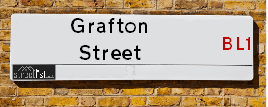
Grafton Street is a street located in the town of Bolton. It uses the postcode BL1 4BH. The street has a length of approximately 92 metres.
Grafton Street is located within the Bolton District (B) Council's jurisdiction. They provide various services, like refuse collection, and manage council tax collection. It's situated in the North West region of the UK.
Grafton Street has been assigned the Unique Street Reference Number of 3401671 in the National Street Gazetteer.
Grafton Street is located within the county of Greater Manchester, situated in the North West region of the UK. It's 174.44 miles North West from central London., 10.99 miles North West from Manchester, 25.43 miles North East from Liverpool and 32.81 miles North East from Chester.

Do you know why this road is called Grafton Street?
What's it like to live here?
Ask the community a question about Grafton Street.
Do you have any questions, memories to share or know any facts about Grafton Street? We'd love to know more.
Also on streetlist.co.uk, can you help?
Eldroth Road
15th April 2024
I wondered if anyone has any old pictures of Wenning Bank House in the 1940’s and also Lane Side before of the same era .. we visited today with my Mum in law as she used to live at both these properties. Also any photos of the schools around that time .. thank you.
Can You Help?Napps Way
15th April 2024
Why is the road called Napps Way (belonging to Napp, but minus an
apostrophe as is usual with such nomenclature)? Moreover, who or
what is, or was, “Napp” in the respective, possessive case?
Several years ago, I met an elderly man (probably in his late-eighties)
who lives on Bentham Drive, Liverpool 16, and during a conversation
with him whilst in a Northwest Passenger Transport Ambulance on the
way to the former RLUH (Royal Liverpool University Hospital), he told
me that he could remember (when he was a boy, living in Childwall,
Liverpool 16) that, “Where Napps Way is now, during WW2, there was
a two-man gun emplacement on the, then, open land to protect the
railway line passing over Childwall Valley Road - next to the railway
bridge - when suddenly, as they were loading a live “shell” into the gun’s
breach, the aforementioned “shell” accidentally exploded in the gun’s
breach killing both of the two soldiers, that had been manning the gun,
instantly! (Very sad, of course, but could - perhaps - two ghosts relating
to those two, very unfortunately and prematurely-killed soldiers have
haunted that place of their deaths ever since - and have any residents
of Napps Way - formerly and in its latest incarnation - seen two, WW2
(uniformed) soldiers unexpectedly appear in or near their homes?)
Mauritius Road
15th April 2024
Why is Mauritius Road so called, since when and by whom? Does Greenwich have any particular links with Mauritius? Very interested to know. 🤞🏼
Can You Help?Estate Agents near Grafton Street
| Name | Address | Website |
|---|---|---|
| Northwood | 3 Marsden Road, Bolton, BL1 4AA | Visit Website |
| Newton & Co Ltd | 6th Floor 120 Bark Street Bolton Greater Manchester BL1 2AX | Visit Website |
| Manhattan Estates | 329 Halliwell Road, Bolton, BL1 3PF | Visit Website |
We have found 1 postcode for Grafton Street
Hotels near Grafton Street
Budget Hotels near Grafton Street
| Budget Hotel Name | Distance (miles) |
|---|---|
| 1: Name:Travelodge Bolton Central River Street Address:River St, Bolton, BL2 1BX Telephone:0871 984 6520 Visit Site |
1.14 |
| 2: Name:Premier Inn Bolton Stadium Arena Address:Arena Approach 3 Telephone: Visit Site |
3.81 |
| 3: Name:Premier Inn Manchester Bury Address:5 Knowsley Place Telephone: Visit Site |
6.01 |
| 4: Name:Travelodge Bury Address:Leisure park, Pilsworth Rd, Little 66, Bury, BL9 8RS Telephone:0871 984 6302 Visit Site |
7.00 |
| 5: Name:Premier Inn Manchester Prestwich Address:Bury New Road Telephone: Visit Site |
7.19 |
Location Details
| Grafton Street | |
|---|---|

| |
| Latitude | 53.583402 |
| Longitude | -2.445326 |
| OS Easting (X): | 370521 |
| OS Northing (Y): | 409764 |
| OS Grid Reference: | SD705098 |
Ordnance Survey Maps for Grafton Street
If you purchase a map through the links below, we may earn an affiliate commission.
| Map Series | link | Ordnance Survey |
| Explorer 1:25,000 276 Bolton, Wigan and Warrington | Check Price on Amazon | |
| Explorer 1:25,000 287 West Pennine Moors - Blackburn, Darwen and Accrington | Check Price on Amazon | |
| Landranger 1:50,000 109 Manchester Bolton & Warrington | Check Price on Amazon |
Neighbourhood Policing |
| Police Force: Greater Manchester |
 View Neighbourhood Crime and Policing View Neighbourhood Crime and Policing |
| Find a Local Neighbourhood Watch Scheme |
Frequently asked Questions for Grafton Street
What Council (Local Authority) is Grafton Street in?
Grafton Street is located within the local authority area of Bolton Council which is a Metropolitan District.
What Parish Council is Grafton Street in?
Grafton Street is in an unparished area.
What Electoral Ward is Grafton Street in?
Grafton Street is located within the ward of Halliwell.
What County is Grafton Street in?
Grafton Street is located within the ceremonial county of Greater Manchester.
What Constituency is Grafton Street in?
Grafton Street is located within the constituency of Bolton North East.
What Part of the UK is Grafton Street in?
Grafton Street is located within the North West (England) region of the United Kingdom.
What County Council area is Grafton Street in?
Grafton Street is located within the Greater Manchester Council area.
What Police Force area is Grafton Street in?
Grafton Street is located within the Greater Manchester Police area.
Roads that have a Junction with Grafton Street
| Street | Junction Type |
|---|---|
| Chorley Old Road (B6226) | junction |
| Park Hill Street | junction |
| Gower Street | junction |
Sunset and Sunrise times for Grafton Street , BL1 4BH
| Sunrise | 05:57 |
|---|---|
| Sunset | 20:20 |
Latest Weather Conditions for Grafton Street, BL1 4BH
| Observed at Weather Station: | Rostherne No 2 19 April 2024 at 11:00 (15.68 miles away) |
|---|---|
| Current Weather: | Partly cloudy (day) |
| Temperature and Humidity: | 12.0°C (68.3%) |
| Wind Direction and Speed: | NW (16 mph) |
Population Statistics
| ONS Area Code | E00024620 |
|---|---|
| ONS Area Name | Pakistani Communities |
| Average Age | 38.30 |
| Area Population | 1889.00 |
| Male Population | 1029.00 (54%) |
| Female Population | 860.00 (46%) |
| Benefit Claimants | 102 (5%) |
| LSOA Code: | E01004870 |
|---|---|
| LSOA Name: | Bolton 015C |
| SOA Code: | 7b |
| SOA Name: | |
| MSOA Code: | E02000998 |
| MSOA Name: | Bolton 015 |
Nearest Supermarkets
| Morrisons Bolton - Atlas Mills |
|---|
| Mornington Road, Bolton BL1 4EU |
| 01204 848687 |
| Distance: 0.37 Miles |
| Directions from Grafton Street to Morrisons Bolton - Atlas Mills |
| Morrisons Bolton |
|---|
| Blackhorse Street, Bolton Dawes, Bolton BL1 1PQ |
| 01204 362661 |
| Distance: 0.89 Miles |
| Directions from Grafton Street to Morrisons Bolton |
| Tesco Bolton Wigan Rd Esso Express |
|---|
| Wigan Rd, Haslam Park, Bolton, BL3 5PX |
| 0345 026 9934 |
| Distance: 0.94 Miles |
| Directions from Grafton Street to Tesco Bolton Wigan Rd Esso Express |
| Sainsburys Bolton |
|---|
| Trinity Street, Bolton, England, BL3 6DH |
| 01204 397746 |
| Distance: 0.99 Miles |
| Directions from Grafton Street to Sainsburys Bolton |
Telephone Information
| Dialling Code | Telephone Exchange | Telephone Cabinet | Fibre to the Cabinet or Fibre to the Premises |
|---|---|---|---|
| 01204 | BOLTON - LCBOL | P86 | FTTC |
Broadband Information
| Speed | Average Speed | Median Speed | Maximum Speed | Next-generation access (NGA) | Number of Connections |
|---|---|---|---|---|---|
| Greater than 2 Mbps | 19 | 20 | >=30 | Y | 7 |
Local Government
| Local Council Details |
|---|
| Within the area of Bolton |
| Visit the Council's Website |
| Town Hall, Victoria Square, Bolton, Lancashire &BL1 1RU |
| Send email |
| Telephone Number: 01204 333 333 |
| Local Member of Parliament |
|---|
| Within the Westminster Parliamentary Constituency of Bolton North East |
| The Member of Parliament is Mark Logan |
| Details for the MP Mark Logan on parliament.uk |
| Details for the MP Mark Logan on theyworkforyou.com |
| In the 2019 General Election Mark Logan won with a majority of 378 the result was Con gain from Lab. The total electorate was 67,564 |
| Wards, Parish Councils and County Councils |
|---|
| Ward: Halliwell Ward |
| Ceremonial County: Greater Manchester |
Nearest Schools
| Name | Address | Postcode | Telephone | Type | Distance (Km) |
|---|
Data accessed from gov.scot 08-08-2019
Nearest Hospitals
| Name | Address | Postcode | Distance | Map |
|---|
Nearest Dentists
Dentists near Grafton Street
| Name | Address | Postcode | Distance | Map |
|---|
Nearest GP Surgeries
Doctors near Grafton Street
WYRESDALE ROAD SURGERY
Address: 46 WYRESDALE ROAD, BOLTON, LANCASHIRE, BL1 4DN
Distance: 0.31 miles
Contact: tel: 01204 494133
DALEFIELD SURGERY
Address: AVONDALE HEALTH CENTRE, AVONDALE STREET, BOLTON, LANCASHIRE, BL1 4JP
Distance: 0.42 miles
Contact: tel: 01204 462880
BOLTON GENERAL PRACTICE
Address: 2-4 MOOR LANE, BOLTON, LANCASHIRE, BL1 4TH
Distance: 0.58 miles
Contact: tel: 01204 521000
CORNERSTONE SURGERY
Address: 469 CHORLEY OLD ROAD, BOLTON, LANCASHIRE, BL1 6AH
Distance: 0.59 miles
Contact: tel: 01204 325125
HALLIWELL SURGERY 1
Address: LINDFIELD DRIVE, BOLTON, LANCASHIRE, BL1 3RG
Distance: 0.65 miles
Contact: tel: 01204 523642
HALLIWELL SURGERY 2
Address: LINDFIELD DRIVE, HALLIWELL, BOLTON, LANCASHIRE, BL1 3RG
Distance: 0.65 miles
Contact: tel: 01204 523813
Nearest Dispensing Chemists
Pharmacies near Grafton Street
| Name | Address | Postcode | Telephone | Map | Distance in Km |
|---|
Nearest Opticians
Opticians near Grafton Street
ANDREW FLETCHER EYECARE
Address: 37 CHORLEY NEW ROAD, BOLTON, BL1 4QR
Distance: 0.19 miles
Contact: :
I & M EYECARE OPTICIANS
Address: 232 CHORLEY OLD ROAD, BOLTON, LANCASHIRE, BL1 3BW
Distance: 0.26 miles
Contact: :
VISION EXPRESS (BOLTON)
Address: UNIT G MARKET HALL, MARKET PLACE SHOPPING CENTRE, BOLTON, LANCASHIRE, BL1 2AL
Distance: 0.66 miles
Contact: :
SCRIVENS OPTICIANS (BOLTON)
Address: UNIT 12, KNOWSLEY HOUSE, KNOWSLEY STREET, BOLTON, LANCASHIRE, BL1 2AH
Distance: 0.67 miles
Contact: :
SPECSAVERS - BOLTON
Address: UNIT 5B -5C, VICTORIA PLAZA, OXFORD STREET, BOLTON, BL1 1RD
Distance: 0.68 miles
Contact: :
UNIVISION EYE CENTRE
Address: 341 HALLIWELL ROAD, BOLTON, LANCASHIRE, BL1 8DF
Distance: 0.71 miles
Contact: :
Transport
Nearest Rail Stations
Bolton Station is 1.02 miles away.
Address: Bolton station, Trinity Street, Bolton, Lancashire, BL2 1BE
Bolton is situated on the Manchester to Preston line|Ribble Valley line and is managed by Northern.
Bolton Station is staffed on a full time basis.
Hall-i'-th'-Wood Station is 1.62 miles away.
Address: Hall-i'-th'-Wood station, Crompton Way, Hall-i'-th'-Wood, Lancashire, BL1 8UF
Hall-i'-th'-Wood is situated on the Ribble Valley line and is managed by Northern.
Hall-i'-th'-Wood Station is an unstaffed station.
Directions from Grafton Street to Hall-i'-th'-Wood Rail Station