Map of Harwood Road
| Postcodes | ||
|---|---|---|
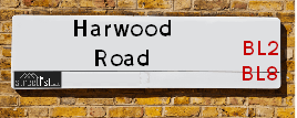
| Icon | Postcodes for Harwood Road | |
| Walking Distances | ||
| Distance Info | Green Circle = 10 Minutes Walk (800 metres) | |
About Harwood Road
Harwood Road is a street located near the town of Bolton and in the town of Bury and near the town of Bury. The street has a length of approximately 2,494 metres.
Harwood Road is located within the Bury District (B) Council's jurisdiction. They provide various services, like refuse collection, and manage council tax collection. It's situated in the North West region of the UK.
Harwood Road has been assigned the Unique Street Reference Numbers of 5103640, 5104572, 5103641 and 5100973 in the National Street Gazetteer.
Harwood Road is located within the county of Greater Manchester, situated in the North West region of the UK. It's 173.82 miles North West from central London., 10.1 miles North West from Manchester, 29.56 miles North East from Liverpool and 35.26 miles South East from Lancaster.

Do you know why this road is called Harwood Road?
What's it like to live here?
Ask the community a question about Harwood Road.
Do you have any questions, memories to share or know any facts about Harwood Road? We'd love to know more.
Also on streetlist.co.uk, can you help?
Eldroth Road
15th April 2024
I wondered if anyone has any old pictures of Wenning Bank House in the 1940’s and also Lane Side before of the same era .. we visited today with my Mum in law as she used to live at both these properties. Also any photos of the schools around that time .. thank you.
Can You Help?Napps Way
15th April 2024
Why is the road called Napps Way (belonging to Napp, but minus an
apostrophe as is usual with such nomenclature)? Moreover, who or
what is, or was, “Napp” in the respective, possessive case?
Several years ago, I met an elderly man (probably in his late-eighties)
who lives on Bentham Drive, Liverpool 16, and during a conversation
with him whilst in a Northwest Passenger Transport Ambulance on the
way to the former RLUH (Royal Liverpool University Hospital), he told
me that he could remember (when he was a boy, living in Childwall,
Liverpool 16) that, “Where Napps Way is now, during WW2, there was
a two-man gun emplacement on the, then, open land to protect the
railway line passing over Childwall Valley Road - next to the railway
bridge - when suddenly, as they were loading a live “shell” into the gun’s
breach, the aforementioned “shell” accidentally exploded in the gun’s
breach killing both of the two soldiers, that had been manning the gun,
instantly! (Very sad, of course, but could - perhaps - two ghosts relating
to those two, very unfortunately and prematurely-killed soldiers have
haunted that place of their deaths ever since - and have any residents
of Napps Way - formerly and in its latest incarnation - seen two, WW2
(uniformed) soldiers unexpectedly appear in or near their homes?)
Mauritius Road
15th April 2024
Why is Mauritius Road so called, since when and by whom? Does Greenwich have any particular links with Mauritius? Very interested to know. 🤞🏼
Can You Help?Estate Agents near Harwood Road
| Name | Address | Website |
|---|---|---|
| JH Sales and Lettings | 10 Market Street, Tottington, Bury, BL8 4AD | Visit Website |
| Kristian Allan | Stoneholme, 42 High Street, Walshaw, Bury, BL8 3AN | Visit Website |
| Miller Metcalfe | 87a Lea Gate, Harwood, Bolton, BL2 4BQ | Visit Website |
Hotels near Harwood Road
Budget Hotels near Harwood Road
| Budget Hotel Name | Distance (miles) |
|---|---|
| 1: Name:Premier Inn Manchester Bury Address:5 Knowsley Place Telephone: Visit Site |
2.66 |
| 2: Name:Travelodge Bolton Central River Street Address:River St, Bolton, BL2 1BX Telephone:0871 984 6520 Visit Site |
3.56 |
| 3: Name:Travelodge Bury Address:Leisure park, Pilsworth Rd, Little 66, Bury, BL9 8RS Telephone:0871 984 6302 Visit Site |
3.92 |
| 4: Name:Premier Inn Manchester Prestwich Address:Bury New Road Telephone: Visit Site |
5.73 |
| 5: Name:Travelodge Manchester Birch M62 Eastbound Address:Moto Service Area, M62, Heywood, OL10 2QH Telephone:0871 984 6262 Visit Site |
5.75 |
Location Details
| Harwood Road | |
|---|---|

| |
| Latitude | 53.609581 |
| Longitude | -2.354816 |
| OS Easting (X): | 376527 |
| OS Northing (Y): | 412643 |
| OS Grid Reference: | SD765126 |
Ordnance Survey Maps for Harwood Road
If you purchase a map through the links below, we may earn an affiliate commission.
| Map Series | link | Ordnance Survey |
| Explorer 1:25,000 277 Manchester and Salford | Check Price on Amazon | Buy Direct from the Ordnance Survey |
| Explorer 1:25,000 287 West Pennine Moors - Blackburn, Darwen and Accrington | Check Price on Amazon | |
| Landranger 1:50,000 109 Manchester Bolton & Warrington | Check Price on Amazon |
Neighbourhood Policing |
| Police Force: Greater Manchester |
 View Neighbourhood Crime and Policing View Neighbourhood Crime and Policing |
| Find a Local Neighbourhood Watch Scheme |
Frequently asked Questions for Harwood Road
What Council (Local Authority) is Harwood Road in?
Harwood Road is located within the local authority area of Bury Council which is a Metropolitan District.
What Parish Council is Harwood Road in?
Harwood Road is in an unparished area.
What Electoral Ward is Harwood Road in?
Harwood Road is located within the ward of Tottington.
What County is Harwood Road in?
Harwood Road is located within the ceremonial county of Greater Manchester.
What Constituency is Harwood Road in?
Harwood Road is located within the constituency of Bury North.
What Part of the UK is Harwood Road in?
Harwood Road is located within the North West (England) region of the United Kingdom.
What County Council area is Harwood Road in?
Harwood Road is located within the Greater Manchester Council area.
What Police Force area is Harwood Road in?
Harwood Road is located within the Greater Manchester Police area.
Roads that have a Junction with Harwood Road
| Street | Junction Type |
|---|---|
| Roading Brook Road | pseudo node |
| Bentley Hall Road | junction |
| Bradshaw Road | junction |
| Victoria Street | junction |
| Worsley Street | junction |
| Harwood Crescent | junction |
| Turton Road (B6213) | junction |
Sunset and Sunrise times for Harwood Road
| Sunrise | 05:56 |
|---|---|
| Sunset | 20:20 |
Latest Weather Conditions for Harwood Road
| Observed at Weather Station: | Stonyhurst 19 April 2024 at 19:00 (17.23 miles away) |
|---|---|
| Current Weather: | Clear night |
| Temperature and Humidity: | 8.8°C (58.4%) |
| Wind Direction and Speed: | (0 mph) |
Population Statistics
| ONS Area Code | E00025548, E00025555 & E00025550 |
|---|---|
| ONS Area Name | Detached Rural Retirement, Ageing Communities and Families & White Suburban Communities |
| Average Age | 47.44 & 42.25 |
| Area Population | 1475.00 & 1574.00 |
| Male Population | 702.00 & 739.00 (47%) |
| Female Population | 773.00 & 835.00 (53%) |
| Benefit Claimants | 3 & 15 (1%) |
| LSOA Code: | E01005047 &E01005051 |
|---|---|
| LSOA Name: | Bury 003C &Bury 003E |
| SOA Code: | 8a &5a |
| SOA Name: | |
| MSOA Code: | E02001021 |
| MSOA Name: | Bury 003 |
Nearest Supermarkets
| Tesco Bury Tottington Rd Express |
|---|
| Tottington Rd, Bury, BL8 1TS |
| 0345 675 7070 |
| Distance: 1.43 Miles |
| Directions from Harwood Road to Tesco Bury Tottington Rd Express |
| Tesco Brandlesholme Express |
|---|
| Brandlesholme Rd, Brandlesholme, Bury, BL8 1HS |
| 0345 026 9027 |
| Distance: 1.69 Miles |
| Directions from Harwood Road to Tesco Brandlesholme Express |
| Morrisons Harwood |
|---|
| Lea Gate, Harwood, Bolton BL2 3HN |
| 01204 594158 |
| Distance: 1.76 Miles |
| Directions from Harwood Road to Morrisons Harwood |
| Tesco Bury Esso Express |
|---|
| Bolton Rd, Bury, BL8 2NZ |
| 0345 677 9774 |
| Distance: 2.06 Miles |
| Directions from Harwood Road to Tesco Bury Esso Express |
Telephone Information
| Area Code |
|---|
| Area Code: 01204 - Bolton |
| Area Code: 01706 - Rochdale |
Broadband Information
| Speed | Average Speed | Median Speed | Maximum Speed | Next-generation access (NGA) | Number of Connections |
|---|---|---|---|---|---|
| Greater than 2 Mbps | 7.3 | 7.8 | 8.1 | N | 10 |
Local Government
| Local Council Details |
|---|
| Within the area of Bury |
| Visit the Council's Website |
| Town Hall, Knowsley Street, Bury, Lancashire &BL9 OSW |
| Send email |
| Telephone Number: 01612 535 000 |
| Local Member of Parliament |
|---|
| Within the Westminster Parliamentary Constituency of Bury North |
| The Member of Parliament is James Daly |
| Details for the MP James Daly on parliament.uk |
| Details for the MP James Daly on theyworkforyou.com |
| In the 2019 General Election James Daly won with a majority of 105 the result was Con gain from Lab. The total electorate was 68,802 |
| Wards, Parish Councils and County Councils |
|---|
| Ward: Tottington Ward |
| Ceremonial County: Greater Manchester |
Nearest Schools
| Name | Address | Postcode | Telephone | Type | Distance (Km) |
|---|
Data accessed from gov.scot 08-08-2019
Nearest Hospitals
| Name | Address | Postcode | Distance | Map |
|---|
Nearest Dentists
Dentists near Harwood Road
| Name | Address | Postcode | Distance | Map |
|---|
Nearest GP Surgeries
Doctors near Harwood Road
TOWER FAMILY HEALTHCARE
Address: 16 MARKET STREET, TOTTINGTON, BURY, BL8 4AD
Distance: 0.65 miles
Contact: tel: 01204 885106
TOWER FAMILY HEALTHCARE - GREENMOUNT
Address: 9 BRANDLESHOLME ROAD, GREENMOUNT, BURY, LANCASHIRE, BL8 4DR
Distance: 1.26 miles
Contact: :
GARDEN CITY MEDICAL CENTRE
Address: 1A GARDEN CITY, RAMSBOTTOM, BURY, LANCASHIRE, BL0 9TN
Distance: 1.70 miles
Contact: tel: 01204 884710
MILE LANE HEALTH CENTRE
Address: 80 MILE LANE, BURY, LANCASHIRE, BL8 2JR
Distance: 1.70 miles
Contact: tel: 0161 7647804
HARWOOD MEDICAL CENTRE
Address: HOUGH FOLD WAY, HARWOOD, BOLTON, LANCASHIRE, BL2 3HQ
Distance: 1.82 miles
Contact: tel: 01204 300033
WOODBANK SURGERY
Address: 2 HUNSTANTON DRIVE, BURY, LANCASHIRE, BL8 1EG
Distance: 1.91 miles
Contact: tel: 0161 7051630
Nearest Dispensing Chemists
Pharmacies near Harwood Road
| Name | Address | Postcode | Telephone | Map | Distance in Km |
|---|
Nearest Opticians
Opticians near Harwood Road
HARWOOD EYECARE
Address: 117 LEA GATE, HARWOOD, BOLTON, LANCASHIRE, BL2 4BQ
Distance: 1.72 miles
Contact: :
HARWOOD EYECARE
Address: 117 LEA GATE, BOLTON, BL2 4BQ
Distance: 1.72 miles
Contact: :
LEIGHTONS OPTICIANS (BURY)
Address: 7 HOLCOMBE PRECINCT, RAMSBOTTOM, BURY, LANCASHIRE, BL0 9SH
Distance: 1.78 miles
Contact: :
GREENHALGH OPTICIANS (BOLTON)
Address: 834 BURY ROAD, BOLTON, LANCASHIRE, BL2 6PA
Distance: 2.36 miles
Contact: :
ROSE & TARRANT OPTICIANS
Address: 14 CROMPTON STREET, BURY, LANCASHIRE, BL9 0AD
Distance: 2.64 miles
Contact: :
SPECSAVERS (BURY)
Address: UNIT 35, THE HAYMARKET, MILLGATE SHOPPING CENTRE, BURY, LANCASHIRE, BL9 0BX
Distance: 2.67 miles
Contact: :
Transport
Nearest Rail Stations
Bromley Cross (Lancs) Station is 2.26 miles away.
Address: Bromley Cross station, Chapeltown Road, Bromley Cross, Lancashire, BL7 9AG
Bromley Cross (Lancs) is situated on the Ribble Valley line and is managed by Northern.
Bromley Cross (Lancs) Station is staffed on a part time basis.
Directions from Harwood Road to Bromley Cross (Lancs) Rail Station
Hall-i'-th'-Wood Station is 2.56 miles away.
Address: Hall-i'-th'-Wood station, Crompton Way, Hall-i'-th'-Wood, Lancashire, BL1 8UF
Hall-i'-th'-Wood is situated on the Ribble Valley line and is managed by Northern.
Hall-i'-th'-Wood Station is an unstaffed station.
Directions from Harwood Road to Hall-i'-th'-Wood Rail Station