Map of Leigh Road
| Postcodes | ||
|---|---|---|
| Icon | Postcodes for Leigh Road | |
| Walking Distances | ||
| Distance Info | Green Circle = 10 Minutes Walk (800 metres) | |
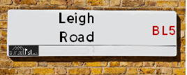
About Leigh Road
Leigh Road is a street located in the town of Westhoughton. The street has a length of approximately 1,621 metres.
Leigh Road is located within the Bolton District (B) Council's jurisdiction. They provide various services, like refuse collection, and manage council tax collection. It's situated in the North West region of the UK.
Leigh Road has been assigned the Unique Street Reference Numbers of 3402372, 3499766 and 3402526 in the National Street Gazetteer.
Leigh Road is located within the county of Greater Manchester, situated in the North West region of the UK. It's 173.84 miles North West from central London., 12.05 miles West from Manchester, 21.49 miles North East from Liverpool and 28.78 miles North East from Chester.

Do you know why this road is called Leigh Road?
What's it like to live here?
Ask the community a question about Leigh Road.
Do you have any questions, memories to share or know any facts about Leigh Road? We'd love to know more.
Also on streetlist.co.uk, can you help?
Eldroth Road
15th April 2024
I wondered if anyone has any old pictures of Wenning Bank House in the 1940’s and also Lane Side before of the same era .. we visited today with my Mum in law as she used to live at both these properties. Also any photos of the schools around that time .. thank you.
Can You Help?Napps Way
15th April 2024
Why is the road called Napps Way (belonging to Napp, but minus an
apostrophe as is usual with such nomenclature)? Moreover, who or
what is, or was, “Napp” in the respective, possessive case?
Several years ago, I met an elderly man (probably in his late-eighties)
who lives on Bentham Drive, Liverpool 16, and during a conversation
with him whilst in a Northwest Passenger Transport Ambulance on the
way to the former RLUH (Royal Liverpool University Hospital), he told
me that he could remember (when he was a boy, living in Childwall,
Liverpool 16) that, “Where Napps Way is now, during WW2, there was
a two-man gun emplacement on the, then, open land to protect the
railway line passing over Childwall Valley Road - next to the railway
bridge - when suddenly, as they were loading a live “shell” into the gun’s
breach, the aforementioned “shell” accidentally exploded in the gun’s
breach killing both of the two soldiers, that had been manning the gun,
instantly! (Very sad, of course, but could - perhaps - two ghosts relating
to those two, very unfortunately and prematurely-killed soldiers have
haunted that place of their deaths ever since - and have any residents
of Napps Way - formerly and in its latest incarnation - seen two, WW2
(uniformed) soldiers unexpectedly appear in or near their homes?)
Mauritius Road
15th April 2024
Why is Mauritius Road so called, since when and by whom? Does Greenwich have any particular links with Mauritius? Very interested to know. 🤞🏼
Can You Help?Estate Agents near Leigh Road
| Name | Address | Website |
|---|---|---|
| Entwistle Green | 11 Pavilion Square, Westhoughton, Bolton, BL5 3AJ | Visit Website |
| Hazelwells | first floor 47 market street, Westhoughton,BL5 3AG | Visit Website |
| Easy Move | 112 Market Street, Westhoughton, Bolton,BL5 3AZ |
We have found 13 postcodes for Leigh Road
Location Details
| Leigh Road | |
|---|---|

| |
| Latitude | 53.541685 |
| Longitude | -2.516935 |
| OS Easting (X): | 365747 |
| OS Northing (Y): | 405156 |
| OS Grid Reference: | SD657052 |
Ordnance Survey Maps for Leigh Road
If you purchase a map through the links below, we may earn an affiliate commission.
| Map Series | link | Ordnance Survey |
| Explorer 1:25,000 276 Bolton, Wigan and Warrington | Check Price on Amazon | |
| Landranger 1:50,000 109 Manchester Bolton & Warrington | Check Price on Amazon |
Neighbourhood Policing |
| Police Force: Greater Manchester |
 View Neighbourhood Crime and Policing View Neighbourhood Crime and Policing |
| Find a Local Neighbourhood Watch Scheme |
Frequently asked Questions for Leigh Road
What Council (Local Authority) is Leigh Road in?
Leigh Road is located within the local authority area of Bolton Council which is a Metropolitan District.
What Parish Council is Leigh Road in?
Leigh Road is located within the area of Westhoughton Parish Council.
What Electoral Ward is Leigh Road in?
Leigh Road is located within the ward of Westhoughton South &Westhoughton North and Chew Moor.
What County is Leigh Road in?
Leigh Road is located within the ceremonial county of Greater Manchester.
What Constituency is Leigh Road in?
Leigh Road is located within the constituency of Bolton West.
What Part of the UK is Leigh Road in?
Leigh Road is located within the North West (England) region of the United Kingdom.
What County Council area is Leigh Road in?
Leigh Road is located within the Greater Manchester Council area.
What Police Force area is Leigh Road in?
Leigh Road is located within the Greater Manchester Police area.
Roads that have a Junction with Leigh Road
| Street | Junction Type |
|---|---|
| Hindley Road | junction |
| Lower Leigh Road | junction |
| Caldwell Street | junction |
| Bracken Lea | junction |
| Lower Leigh Road (B5235) | junction |
| Cricketers Way (A58) | junction |
| Rosebery Street | junction |
| Cricketers Way (A58) | junction |
| Cricketers Way (A58) | junction |
| Park Road | junction |
| George Street | pseudo node |
| Lower Leigh Road (B5235) | roundabout |
| Abelia Road | junction |
| Mabel Street | junction |
| Industrial Street | junction |
| Lower Landedmans | junction |
| Washacre | junction |
| Bank Side | junction |
Sunset and Sunrise times for Leigh Road
| Sunrise | 05:44 |
|---|---|
| Sunset | 20:31 |
Latest Weather Conditions for Leigh Road
| Observed at Weather Station: | Rostherne No 2 25 April 2024 at 11:00 (13.76 miles away) |
|---|---|
| Current Weather: | Overcast |
| Temperature and Humidity: | 7.1°C (82.4%) |
| Wind Direction and Speed: | ENE (3 mph) |
Population Statistics
| ONS Area Code | E00025004, E00024789, E00024791, E00024793 & E00024809 |
|---|---|
| ONS Area Name | White Professionals & White Suburban Communities |
| Average Age | 36.76, 39.65 & 41.77 |
| Area Population | 1770.00, 1840.00 & 1325.00 |
| Male Population | 839.00, 904.00 & 621.00 (48%) |
| Female Population | 931.00, 936.00 & 704.00 (52%) |
| Benefit Claimants | 27, 16 & 23 (1%) |
| LSOA Code: | E01004935, E01004894 &E01004895 |
|---|---|
| LSOA Name: | Bolton 035C, Bolton 028C &Bolton 031B |
| SOA Code: | 8c, 5b &5d |
| SOA Name: | |
| MSOA Code: | E02001018, E02001011 &E02001014 |
| MSOA Name: | Bolton 035, Bolton 028 &Bolton 031 |
Nearest Supermarkets
| Sainsburys Westhoughton |
|---|
| Cricketers Way, Westhoughton, Bolton, England, BL5 3ZS |
| 01942 507850 |
| Distance: 0.45 Miles |
| Directions from Leigh Road to Sainsburys Westhoughton |
| Tesco Westhoughton Express |
|---|
| Manchester Rd, Westhoughton, Bolton, BL5 3JS |
| 0345 674 6531 |
| Distance: 0.95 Miles |
| Directions from Leigh Road to Tesco Westhoughton Express |
| Asda Atherton |
|---|
| Bolton Road, Atherton, Manchester, M46 9JZ |
| 01942 751710 |
| Distance: 1.68 Miles |
| Directions from Leigh Road to Asda Atherton |
| Tesco Atherton Superstore |
|---|
| Crabtree Ln, Atherton, M46 0AG |
| 0345 677 9718 |
| Distance: 1.73 Miles |
| Directions from Leigh Road to Tesco Atherton Superstore |
Telephone Information
| Area Code |
|---|
| Area Code: 01942 - Wigan |
| Area Code: 01204 - Bolton |
| Area Code: 01257 - Coppull |
Broadband Information
| Speed | Average Speed | Median Speed | Maximum Speed | Next-generation access (NGA) | Number of Connections |
|---|---|---|---|---|---|
| Greater than 2 Mbps | 21.4 | 16.7 | >=30 | Y | 5 |
Local Government
| Local Council Details |
|---|
| Within the area of Bolton |
| Visit the Council's Website |
| Town Hall, Victoria Square, Bolton, Lancashire &BL1 1RU |
| Send email |
| Telephone Number: 01204 333 333 |
| Local Member of Parliament |
|---|
| Within the Westminster Parliamentary Constituency of Bolton West |
| The Member of Parliament is Chris Green |
| Details for the MP Chris Green on parliament.uk |
| Details for the MP Chris Green on theyworkforyou.com |
| In the 2019 General Election Chris Green won with a majority of 8,855 the result was Con hold. The total electorate was 73,191 |
| Wards, Parish Councils and County Councils |
|---|
| Ward: Westhoughton South &Westhoughton North and Chew Moor Ward |
| Ceremonial County: Greater Manchester |
Nearest Schools
England Primary Schools
St Michael's CofE Primary School, Howe Bridge
Address: St Michael's CofE Primary School, Howe Bridge, Leigh Road, Atherton, Manchester, Lancashire, M46 0PA
Distance: 1.65 miles
Contact: 01942883118
St James CofE Primary School, Daisy Hill
Address: St James CofE Primary School, Daisy Hill, Hindley Road, Daisy Hill, Westhoughton, Bolton, Lancashire, BL5 2JU
Distance: 0.50 miles
Contact: 01942634688
Eatock Primary School
Address: Eatock Primary School, St George's Avenue, Daisy Hill, Westhoughton, Bolton, Lancashire, BL5 2ER
Distance: 0.43 miles
Contact: 01942634672
St Thomas CofE Primary School
Address: St Thomas CofE Primary School, Molyneux Road, Westhoughton, Bolton, Lancashire, BL5 3HP
Distance: 0.79 miles
Contact: 01942634666
Washacre Primary School
Address: Washacre Primary School, Clough Avenue, Westhoughton, Bolton, Lancashire, BL5 2NJ
Distance: 0.15 miles
Contact: 01942634756
Sacred Heart R.C. Primary School
Address: Sacred Heart R.C. Primary School, Central Drive, Westhoughton, Bolton, Lancashire, BL5 3DU
Distance: 0.77 miles
Contact: 01942634681
St Bartholomew's CofE Primary School
Address: St Bartholomew's CofE Primary School, The Fairways, Westhoughton, Bolton, Lancashire, BL5 3NZ
Distance: 0.65 miles
Contact: 01942634717
The Gates Primary School
Address: The Gates Primary School, Bristle Hall Way, Westhoughton, Bolton, Lancashire, BL5 3QA
Distance: 1.15 miles
Contact: 01942634734
St George's CofE Primary School
Address: St George's CofE Primary School, The Hoskers, Westhoughton, Bolton, Lancashire, BL5 2FB
Distance: 0.74 miles
Contact: 01942813069
Sacred Heart Catholic Primary School, Hindley Green
Address: Sacred Heart Catholic Primary School, Hindley Green, Swan Lane, Hindley Green, Wigan, Lancashire, WN2 4HD
Distance: 1.62 miles
Contact: 01942767768
England Secondary Schools
Westhoughton High School
Address: Westhoughton High School, Bolton Road, Westhoughton, Bolton, Lancashire, BL5 3BZ
Distance: 0.48 miles
Contact: 01942814122
Nearest Hospitals
| Name | Address | Postcode | Distance | Map |
|---|
Nearest Dentists
Dentists near Leigh Road
| Name | Address | Postcode | Distance | Map |
|---|
Nearest GP Surgeries
Doctors near Leigh Road
PETER HOUSE SURGERY - COVID LOCAL VACCINATION SERVICE 2
Address: PETER HOUSE, CAPTAIN LEES ROAD, WESTHOUGHTON, BOLTON, BL5 3UB
Distance: 0.70 miles
Contact: :
UNSWORTH GROUP PRACTICE
Address: PETER HOUSE, CAPTAIN LEES ROAD, WESTHOUGHTON, BOLTON, LANCASHIRE, BL5 3UB
Distance: 0.70 miles
Contact: tel: 01942 812525
STABLE FOLD SURGERY
Address: 119 CHURCH STREET, WESTHOUGHTON, BOLTON, LANCASHIRE, BL5 3SF
Distance: 0.79 miles
Contact: tel: 01942 813678
KORLIPARA K
Address: WESTHOUGHTON BRANCH SURGERY, 294 CHURCH STREET, WESTHOUGHTON, BOLTON, LANCASHIRE, BL5 3QQ
Distance: 1.18 miles
Contact: tel: 01942 813466
MEADOWVIEW SURGERY
Address: ORMEROD HOUSE, ATHERTON HEALTH CENTRE, NELSON ST, ATHERTON, MANCHESTER, GREATER MANCHESTER, M46 0LE
Distance: 1.18 miles
Contact: tel: 01942 481060
DR VASANTH
Address: ATHERTON HEALTH CENTRE, NELSON STREET, ATHERTON, MANCHESTER, GREATER MANCHESTER, M46 0LE
Distance: 1.18 miles
Contact: tel: 01942 481040
Nearest Dispensing Chemists
Pharmacies near Leigh Road
| Name | Address | Postcode | Telephone | Map | Distance in Km |
|---|
Nearest Opticians
Opticians near Leigh Road
SUSAN HILTON OPTICIANS - MARSDEN STREET
Address: 10 MARSDEN STREET, WESTHOUGHTON, BOLTON, LANCASHIRE, BL5 3AQ
Distance: 0.53 miles
Contact: :
SIGHT CALL OPTICAL SERVICES
Address: 140 MARKET STREET, ATHERTON, MANCHESTER, M46 0DX
Distance: 1.51 miles
Contact: :
SEDDONS OPTICIANS
Address: 14 MARKET STREET, ATHERTON, MANCHESTER, LANCASHIRE, M46 0DN
Distance: 1.65 miles
Contact: :
HEPWORTH & HALL OPTICIANS (ATHERTON)
Address: 15 CHURCH STREET, ATHERTON, MANCHESTER, GREATER MANCHESTER, M46 9DE
Distance: 1.67 miles
Contact: :
GREENHALGH OPTICIANS (WIGAN)
Address: 59 MARKET STREET, HINDLEY, WIGAN, LANCASHIRE, WN2 3AE
Distance: 2.50 miles
Contact: :
B GLEAVE OPTICIANS
Address: 102 MARKET STREET, ST HINDLEY, WIGAN, LANCASHIRE, WN2 3AY
Distance: 2.65 miles
Contact: :
Transport
Nearest Rail Stations
Daisy Hill Station is 0.16 miles away.
Address: Daisy Hill station, Leigh Road, Daisy Hill, Lancashire, BL5 2JQ
Daisy Hill is situated on the Manchester Southport Line and is managed by Northern.
Daisy Hill Station is staffed on a full time basis.
Westhoughton Station is 1.03 miles away.
Address: Westhoughton station, Church Street, Westhoughton, Greater Manchester, BL5 3LE
Westhoughton is situated on the Manchester to Preston line and is managed by Northern.
Westhoughton Station is an unstaffed station.