Map of Sheephouse Lane
| Postcodes | ||
|---|---|---|
| Icon | Postcodes for Sheephouse Lane | |
| Walking Distances | ||
| Distance Info | Green Circle = 10 Minutes Walk (800 metres) | |
About Sheephouse Lane
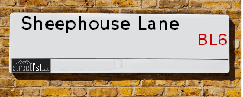
Sheephouse Lane is a street located near Rivington. It uses the postcode BL6 7SD. The street has a length of approximately 971 metres.
Sheephouse Lane is located within the Chorley District (B) Council's jurisdiction. They provide various services, like refuse collection, and manage council tax collection. It's situated in the North West region of the UK.
Sheephouse Lane has been assigned the Unique Street Reference Number of 7401370 and 7400103 in the National Street Gazetteer.
Sheephouse Lane is located within the county of Lancashire, situated in the North West region of the UK. It's 179.82 miles North West from central London., 16.64 miles North West from Manchester, 23.55 miles North East from Liverpool and 30.39 miles South from Lancaster.

Do you know why this road is called Sheephouse Lane?
What's it like to live here?
Ask the community a question about Sheephouse Lane.
Do you have any questions, memories to share or know any facts about Sheephouse Lane? We'd love to know more.
Also on streetlist.co.uk, can you help?
Eldroth Road
15th April 2024
I wondered if anyone has any old pictures of Wenning Bank House in the 1940’s and also Lane Side before of the same era .. we visited today with my Mum in law as she used to live at both these properties. Also any photos of the schools around that time .. thank you.
Can You Help?Napps Way
15th April 2024
Why is the road called Napps Way (belonging to Napp, but minus an
apostrophe as is usual with such nomenclature)? Moreover, who or
what is, or was, “Napp” in the respective, possessive case?
Several years ago, I met an elderly man (probably in his late-eighties)
who lives on Bentham Drive, Liverpool 16, and during a conversation
with him whilst in a Northwest Passenger Transport Ambulance on the
way to the former RLUH (Royal Liverpool University Hospital), he told
me that he could remember (when he was a boy, living in Childwall,
Liverpool 16) that, “Where Napps Way is now, during WW2, there was
a two-man gun emplacement on the, then, open land to protect the
railway line passing over Childwall Valley Road - next to the railway
bridge - when suddenly, as they were loading a live “shell” into the gun’s
breach, the aforementioned “shell” accidentally exploded in the gun’s
breach killing both of the two soldiers, that had been manning the gun,
instantly! (Very sad, of course, but could - perhaps - two ghosts relating
to those two, very unfortunately and prematurely-killed soldiers have
haunted that place of their deaths ever since - and have any residents
of Napps Way - formerly and in its latest incarnation - seen two, WW2
(uniformed) soldiers unexpectedly appear in or near their homes?)
Mauritius Road
15th April 2024
Why is Mauritius Road so called, since when and by whom? Does Greenwich have any particular links with Mauritius? Very interested to know. 🤞🏼
Can You Help?Estate Agents near Sheephouse Lane
| Name | Address | Website |
|---|---|---|
| Wynn and Walker Estates | 166 Chorley Road, Adlington, Chorley, PR6 9LQ | Visit Website |
| Regency Estates | 29 Lee Lane Horwich BL6 7AY | Visit Website |
| Miller Metcalfe | 15/17 Winter Hey Lane Horwich Bolton BL6 7AD | Visit Website |
We have found 1 postcode for Sheephouse Lane
Hotels near Sheephouse Lane
Budget Hotels near Sheephouse Lane
| Budget Hotel Name | Distance (miles) |
|---|---|
| 1: Name:Premier Inn Chorley South Address:Bolton Road Telephone: Visit Site |
2.55 |
| 2: Name:Premier Inn Bolton Stadium Arena Address:Arena Approach 3 Telephone: Visit Site |
3.71 |
| 3: Name:Premier Inn Chorley North Address:Malthouse Farm Telephone: Visit Site |
4.25 |
| 4: Name:Days Inn Charnock Richard M6 Address:Motorway Services Area/Mill La J27-28 M6 Telephone: Visit Site |
5.54 |
| 5: Name:Premier Inn Wigan M6 Jct 27 Address:Almond Brook Road Telephone: Visit Site |
5.86 |
Location Details
| Sheephouse Lane | |
|---|---|

| |
| Latitude | 53.631461 |
| Longitude | -2.557015 |
| OS Easting (X): | 363169 |
| OS Northing (Y): | 415162 |
| OS Grid Reference: | SD632152 |
Ordnance Survey Maps for Sheephouse Lane
If you purchase a map through the links below, we may earn an affiliate commission.
| Map Series | link | Ordnance Survey |
| Explorer 1:25,000 285 Southport and Chorley | Check Price on Amazon | Buy Direct from the Ordnance Survey |
| Explorer 1:25,000 287 West Pennine Moors - Blackburn, Darwen and Accrington | Check Price on Amazon | |
| Landranger 1:50,000 109 Manchester Bolton & Warrington | Check Price on Amazon |
Neighbourhood Policing |
| Police Force: Lancashire |
 View Neighbourhood Crime and Policing View Neighbourhood Crime and Policing |
| Find a Local Neighbourhood Watch Scheme |
Frequently asked Questions for Sheephouse Lane
What Council (Local Authority) is Sheephouse Lane in?
Sheephouse Lane is located within the local authority area of Chorley Council which is a District Council.
What Parish Council is Sheephouse Lane in?
Sheephouse Lane is located within the area of Rivington Parish Council.
What Electoral Ward is Sheephouse Lane in?
Sheephouse Lane is located within the ward of Adlington & Anderton.
What County is Sheephouse Lane in?
Sheephouse Lane is located within the ceremonial county of Lancashire.
What Constituency is Sheephouse Lane in?
Sheephouse Lane is located within the constituency of Chorley.
What Part of the UK is Sheephouse Lane in?
Sheephouse Lane is located within the North West (England) region of the United Kingdom.
What County Council area is Sheephouse Lane in?
Sheephouse Lane is located within the Lancashire Council area.
What Police Force area is Sheephouse Lane in?
Sheephouse Lane is located within the Lancashire Police area.
Roads that have a Junction with Sheephouse Lane
| Street | Junction Type |
|---|---|
| Deanhead Lane | pseudo node |
| Sheep House Lane | junction |
Sunset and Sunrise times for Sheephouse Lane , BL6 7SD
| Sunrise | 05:57 |
|---|---|
| Sunset | 20:20 |
Latest Weather Conditions for Sheephouse Lane, BL6 7SD
| Observed at Weather Station: | Stonyhurst 19 April 2024 at 14:00 (15.54 miles away) |
|---|---|
| Current Weather: | Clear night |
| Temperature and Humidity: | 13.0°C (51.3%) |
| Wind Direction and Speed: | (0 mph) |
Population Statistics
| ONS Area Code | E00126755 |
|---|---|
| ONS Area Name | Renting Rural Retirement |
| Average Age | 45.63 |
| Area Population | 2135.00 |
| Male Population | 1047.00 (49%) |
| Female Population | 1088.00 (51%) |
| Benefit Claimants | 13 (1%) |
| LSOA Code: | E01024973 |
|---|---|
| LSOA Name: | Chorley 014E |
| SOA Code: | 2b |
| SOA Name: | |
| MSOA Code: | E02005202 |
| MSOA Name: | Chorley 014 |
Nearest Supermarkets
| Tesco Chorley Rd Express |
|---|
| 176 Chorley Rd, Adlington, PR6 9LQ |
| 0345 610 6351 |
| Distance: 1.94 Miles |
| Directions from Sheephouse Lane to Tesco Chorley Rd Express |
| Sainsburys Horwich Local |
|---|
| 72-76 Lee Lane, Horwich, Bolton, England, BL6 7AE |
| 1204696630 |
| Distance: 2.19 Miles |
| Directions from Sheephouse Lane to Sainsburys Horwich Local |
| Iceland Horwich |
|---|
| Chorley New Road, Horwich, Manchester, BL6 5QH |
| 01204669704 |
| Distance: 2.42 Miles |
| Directions from Sheephouse Lane to Iceland Horwich |
| Morrisons Chorley |
|---|
| Brooke Street, Chorley PR7 3BE |
| 01257 233699 |
| Distance: 3.05 Miles |
| Directions from Sheephouse Lane to Morrisons Chorley |
Telephone Information
| Area Code |
|---|
| Area Code: 01257 - Coppull |
| Area Code: 01204 - Bolton |
| Area Code: 01942 - Wigan |
| Area Code: 01254 - Blackburn |
Local Government
| Local Council Details |
|---|
| Within the area of Chorley |
| Visit the Council's Website |
| Civic Offices, Union Street, Chorley, Lancashire &PR7 1AL |
| Send email |
| Telephone Number: 01257 515 151 |
| Local Member of Parliament |
|---|
| Within the Westminster Parliamentary Constituency of Chorley |
| The Member of Parliament is Lindsay Hoyle |
| Details for the MP Lindsay Hoyle on parliament.uk |
| Details for the MP Lindsay Hoyle on theyworkforyou.com |
| In the 2019 General Election Lindsay Hoyle won with a majority of 17,392 the result was Spk gain from Lab. The total electorate was 77,072 |
| Wards, Parish Councils and County Councils |
|---|
| Ward: Adlington & Anderton Ward |
| Ceremonial County: Lancashire |
Nearest Schools
| Name | Address | Postcode | Telephone | Type | Distance (Km) |
|---|
Data accessed from gov.scot 08-08-2019
Nearest Hospitals
| Name | Address | Postcode | Distance | Map |
|---|
Nearest Dentists
Dentists near Sheephouse Lane
| Name | Address | Postcode | Distance | Map |
|---|
Nearest GP Surgeries
Doctors near Sheephouse Lane
ADLINGTON MEDICAL CENTRE
Address: 22-24 BABYLON LANE, ANDERTON, CHORLEY, LANCASHIRE, PR6 9NW
Distance: 1.83 miles
Contact: tel: 01257 482076
GRANVILLE HOUSE MED CTRE
Address: GRANVILLE STREET, ADLINGTON, CHORLEY, LANCASHIRE, PR6 9PY
Distance: 2.03 miles
Contact: tel: 01257 481917
DR MALHOTRA & PARTNERS
Address: PIKE VIEW MEDICAL CENTRE, ALBERT STREET, HORWICH, BOLTON, LANCASHIRE, BL6 7AS
Distance: 2.11 miles
Contact: tel: 01204 322888
BOLTON COMMUNITY PRACTICE CIC - THE MARKET SURGERY
Address: MARKET SURGERY, 103 CHORLEY NEW ROAD, HORWICH, BOLTON, LANCASHIRE, BL6 5QF
Distance: 2.25 miles
Contact: :
KILDONAN HOUSE - COVID LOCAL VACCINATION SERVICE
Address: RAMSBOTTOM ROAD, HORWICH, BOLTON, BL6 5NW
Distance: 2.58 miles
Contact: :
KILDONAN HOUSE
Address: RAMSBOTTOM ROAD, HORWICH, BOLTON, LANCASHIRE, BL6 5NW
Distance: 2.58 miles
Contact: tel: 01204 468161
Nearest Dispensing Chemists
Pharmacies near Sheephouse Lane
| Name | Address | Postcode | Telephone | Map | Distance in Km |
|---|
Nearest Opticians
Opticians near Sheephouse Lane
SUSAN HILTON OPTICIANS - RAILWAY ROAD
Address: RAINBOW HOUSE, RAILWAY ROAD, CHORLEY, PR6 9RB
Distance: 2.09 miles
Contact: :
EYECARE FOR YOU
Address: 63 LONGWORTH ROAD, HORWICH, BOLTON, BL6 7BL
Distance: 2.22 miles
Contact: :
JUSTIN KELLETT OPTICIANS (HORWICH)
Address: 70 WINTER HEY LANE, HORWICH, BOLTON, BL6 7NZ
Distance: 2.33 miles
Contact: :
4364 CHORLEY
Address: ASDA STORES LTD, BOLTON STREET, CHORLEY, LANCASHIRE, PR7 3DL
Distance: 3.21 miles
Contact: :
BOOTS OPTICIANS (MARKET WALK - CHORLEY)
Address: UNIT 25, MARKET WALK, CHORLEY, LANCASHIRE, PR7 1DE
Distance: 3.33 miles
Contact: :
SUTCLIFFES OPTICIANS
Address: 25 ST. GEORGES STREET, CHORLEY, LANCASHIRE, PR7 2AA
Distance: 3.34 miles
Contact: :
Transport
Nearest Rail Stations
Adlington (Lancashire) Station is 2.28 miles away.
Address: Adlington station, Railway Road, Adlington, Lancashire, PR6 9RS
Adlington (Lancashire) is situated on the Manchester to Preston line and is managed by Northern.
Adlington (Lancashire) Station is staffed on a part time basis.
Directions from Sheephouse Lane to Adlington (Lancashire) Rail Station
Blackrod Station is 2.81 miles away.
Address: Blackrod station, Station Road, Blackrod, Lancashire, BL6 5JH
Blackrod is situated on the Manchester to Preston line and is managed by Northern.
Blackrod Station is an unstaffed station.