Map of South Cross Street
| Postcodes | ||
|---|---|---|
| Icon | Postcodes for South Cross Street | |
| Walking Distances | ||
| Distance Info | Green Circle = 10 Minutes Walk (800 metres) | |
About South Cross Street
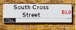
South Cross Street is a street located in the town of Bury. It uses the postcode BL9 0RS. The street has a length of approximately 372 metres.
South Cross Street is located within the Bury District (B) Council's jurisdiction. They provide various services, like refuse collection, and manage council tax collection. It's situated in the North West region of the UK.
South Cross Street has been assigned the Unique Street Reference Number of 5102028 in the National Street Gazetteer.
South Cross Street is located within the county of Greater Manchester, situated in the North West region of the UK. It's 171.27 miles North West from central London., 7.96 miles North from Manchester, 31.42 miles North East from Liverpool and 33.85 miles South West from Leeds.

Do you know why this road is called South Cross Street?
What's it like to live here?
Ask the community a question about South Cross Street.
Do you have any questions, memories to share or know any facts about South Cross Street? We'd love to know more.
Also on streetlist.co.uk, can you help?
Eldroth Road
15th April 2024
I wondered if anyone has any old pictures of Wenning Bank House in the 1940’s and also Lane Side before of the same era .. we visited today with my Mum in law as she used to live at both these properties. Also any photos of the schools around that time .. thank you.
Can You Help?Napps Way
15th April 2024
Why is the road called Napps Way (belonging to Napp, but minus an
apostrophe as is usual with such nomenclature)? Moreover, who or
what is, or was, “Napp” in the respective, possessive case?
Several years ago, I met an elderly man (probably in his late-eighties)
who lives on Bentham Drive, Liverpool 16, and during a conversation
with him whilst in a Northwest Passenger Transport Ambulance on the
way to the former RLUH (Royal Liverpool University Hospital), he told
me that he could remember (when he was a boy, living in Childwall,
Liverpool 16) that, “Where Napps Way is now, during WW2, there was
a two-man gun emplacement on the, then, open land to protect the
railway line passing over Childwall Valley Road - next to the railway
bridge - when suddenly, as they were loading a live “shell” into the gun’s
breach, the aforementioned “shell” accidentally exploded in the gun’s
breach killing both of the two soldiers, that had been manning the gun,
instantly! (Very sad, of course, but could - perhaps - two ghosts relating
to those two, very unfortunately and prematurely-killed soldiers have
haunted that place of their deaths ever since - and have any residents
of Napps Way - formerly and in its latest incarnation - seen two, WW2
(uniformed) soldiers unexpectedly appear in or near their homes?)
Mauritius Road
15th April 2024
Why is Mauritius Road so called, since when and by whom? Does Greenwich have any particular links with Mauritius? Very interested to know. 🤞🏼
Can You Help?Estate Agents near South Cross Street
| Name | Address | Website |
|---|---|---|
| Entwistle Green | 10 The Rock, Bury, BL9 0NT | Visit Website |
| Keenans Estate Agents | 2 The Rock, Bury, BL9 0NT | Visit Website |
| Your Move | 18/20 The Rock, Bury, BL9 0NT | Visit Website |
We have found 1 postcode for South Cross Street
Hotels near South Cross Street
Budget Hotels near South Cross Street
| Budget Hotel Name | Distance (miles) |
|---|---|
| 1: Name:Premier Inn Manchester Bury Address:5 Knowsley Place Telephone: Visit Site |
0.41 |
| 2: Name:Travelodge Bury Address:Leisure park, Pilsworth Rd, Little 66, Bury, BL9 8RS Telephone:0871 984 6302 Visit Site |
1.06 |
| 3: Name:Travelodge Manchester Birch M62 Eastbound Address:Moto Service Area, M62, Heywood, OL10 2QH Telephone:0871 984 6262 Visit Site |
2.80 |
| 4: Name:Travelodge Manchester Birch M62 Westbound Address:Moto Service Area, M62, Middleton, Heywood, OL10 2QH Telephone:0871 984 6161 Visit Site |
2.93 |
| 5: Name:Premier Inn Manchester Prestwich Address:Bury New Road Telephone: Visit Site |
3.77 |
Location Details
| South Cross Street | |
|---|---|

| |
| Latitude | 53.591072 |
| Longitude | -2.289395 |
| OS Easting (X): | 380846 |
| OS Northing (Y): | 410564 |
| OS Grid Reference: | SD808106 |
Ordnance Survey Maps for South Cross Street
If you purchase a map through the links below, we may earn an affiliate commission.
| Map Series | link | Ordnance Survey |
| Explorer 1:25,000 277 Manchester and Salford | Check Price on Amazon | Buy Direct from the Ordnance Survey |
| Landranger 1:50,000 109 Manchester Bolton & Warrington | Check Price on Amazon |
Neighbourhood Policing |
| Police Force: Greater Manchester |
 View Neighbourhood Crime and Policing View Neighbourhood Crime and Policing |
| Find a Local Neighbourhood Watch Scheme |
Frequently asked Questions for South Cross Street
What Council (Local Authority) is South Cross Street in?
South Cross Street is located within the local authority area of Bury Council which is a Metropolitan District.
What Parish Council is South Cross Street in?
South Cross Street is in an unparished area.
What Electoral Ward is South Cross Street in?
South Cross Street is located within the ward of East.
What County is South Cross Street in?
South Cross Street is located within the ceremonial county of Greater Manchester.
What Constituency is South Cross Street in?
South Cross Street is located within the constituency of Bury North.
What Part of the UK is South Cross Street in?
South Cross Street is located within the North West (England) region of the United Kingdom.
What County Council area is South Cross Street in?
South Cross Street is located within the Greater Manchester Council area.
What Police Force area is South Cross Street in?
South Cross Street is located within the Greater Manchester Police area.
Roads that have a Junction with South Cross Street
| Street | Junction Type |
|---|---|
| George Street | junction |
| Foundry Street | junction |
| Lord Street | junction |
| Back Heywood Street West | junction |
| Heywood Street (B6219) | junction |
Sunset and Sunrise times for South Cross Street , BL9 0RS
| Sunrise | 05:56 |
|---|---|
| Sunset | 20:19 |
Latest Weather Conditions for South Cross Street, BL9 0RS
| Observed at Weather Station: | Rostherne No 2 19 April 2024 at 15:00 (16.41 miles away) |
|---|---|
| Current Weather: | Overcast |
| Temperature and Humidity: | 11.4°C (60.5%) |
| Wind Direction and Speed: | NW (15 mph) |
Population Statistics
| ONS Area Code | E00025426 |
|---|---|
| ONS Area Name | Pakistani Communities |
| Average Age | 33.01 |
| Area Population | 1447.00 |
| Male Population | 709.00 (49%) |
| Female Population | 738.00 (51%) |
| Benefit Claimants | 62 (4%) |
| LSOA Code: | E01005024 |
|---|---|
| LSOA Name: | Bury 008E |
| SOA Code: | 7b |
| SOA Name: | |
| MSOA Code: | E02001026 |
| MSOA Name: | Bury 008 |
Nearest Supermarkets
| Asda Bury Marketside |
|---|
| Spring Street, Bury, BL9 0RN |
| 0161 763 1261 |
| Distance: 0.1 Miles |
| Directions from South Cross Street to Asda Bury Marketside |
| Iceland Bury |
|---|
| 112/126 Rochdale Road, Bury, Lancashire, BL9 7AY |
| 01617645786 |
| Distance: 0.18 Miles |
| Directions from South Cross Street to Iceland Bury |
| Tesco Bury Superstore |
|---|
| Woodfield Retail Park, Peel Way, Bury, BL9 5BY |
| 0345 677 9080 |
| Distance: 0.49 Miles |
| Directions from South Cross Street to Tesco Bury Superstore |
| Asda Pilsworth |
|---|
| Pilsworth Road, Bury, BL9 8RS |
| 0161 351 2500 |
| Distance: 1.13 Miles |
| Directions from South Cross Street to Asda Pilsworth |
Telephone Information
| Dialling Code | Telephone Exchange | Telephone Cabinet | Fibre to the Cabinet or Fibre to the Premises |
|---|---|---|---|
| 0161 | BURY; GREATER MANCHESTER - MRBUR | P48 | FTTC |
Broadband Information
| Speed | Average Speed | Median Speed | Maximum Speed | Next-generation access (NGA) | Number of Connections |
|---|---|---|---|---|---|
| Less than 2 Mbps | 21.7 | 20 | >=30 | Y | 27 |
Local Government
| Local Council Details |
|---|
| Within the area of Bury |
| Visit the Council's Website |
| Town Hall, Knowsley Street, Bury, Lancashire &BL9 OSW |
| Send email |
| Telephone Number: 01612 535 000 |
| Local Member of Parliament |
|---|
| Within the Westminster Parliamentary Constituency of Bury North |
| The Member of Parliament is James Daly |
| Details for the MP James Daly on parliament.uk |
| Details for the MP James Daly on theyworkforyou.com |
| In the 2019 General Election James Daly won with a majority of 105 the result was Con gain from Lab. The total electorate was 68,802 |
| Wards, Parish Councils and County Councils |
|---|
| Ward: East Ward |
| Ceremonial County: Greater Manchester |
Nearest Schools
| Name | Address | Postcode | Telephone | Type | Distance (Km) |
|---|
Data accessed from gov.scot 08-08-2019
Nearest Hospitals
| Name | Address | Postcode | Distance | Map |
|---|
Nearest Dentists
Dentists near South Cross Street
| Name | Address | Postcode | Distance | Map |
|---|
Nearest GP Surgeries
Doctors near South Cross Street
TOWER FAMILY HEALTHCARE - MINDEN
Address: 22 DERBY WAY, BURY, BL9 0NJ
Distance: 0.31 miles
Contact: :
MOORGATE PCC - COVID LOCAL VACCINATION SERVICE
Address: 22 DERBY WAY, BURY, LANCASHIRE, BL9 0NJ
Distance: 0.31 miles
Contact: :
ROCK HEALTHCARE LIMITED
Address: 22 DERBY WAY, BURY, LANCASHIRE, BL9 0NJ
Distance: 0.31 miles
Contact: tel: 0161 4479820
MOORGATE PCC 2 - COVID LOCAL VACCINATION SERVICE
Address: 22 DERBY WAY, BURY, LANCASHIRE, BL9 0NJ
Distance: 0.31 miles
Contact: :
PEEL GPS
Address: TOWNSIDE PCC, KNOWSLEY PLACE, KNOWSLEY STREET, BURY, LANCASHIRE, BL9 0SN
Distance: 0.40 miles
Contact: tel: 0161 7621515
TOWNSIDE SURGERY
Address: TOWNSIDE PRIMARY CARE CENTRE, KNOWSLEY PLACE, BURY, LANCASHIRE, BL9 0SN
Distance: 0.40 miles
Contact: tel: 0161 7621600
Nearest Dispensing Chemists
Pharmacies near South Cross Street
| Name | Address | Postcode | Telephone | Map | Distance in Km |
|---|
Nearest Opticians
Opticians near South Cross Street
YATES & SUDDELL OPTICIANS (BURY)
Address: 15-19 MINDEN PARADE, BURY, LANCASHIRE, BL9 0QG
Distance: 0.24 miles
Contact: :
MONTREAL GROUP LTD
Address: 15 PRINCESS PARADE, BURY, BL9 0QL
Distance: 0.24 miles
Contact: :
BOOTS OPTICIANS (UNION ARCADE - BURY)
Address: UNIT 7, UNION ARCADE, BURY, LANCASHIRE, BL9 0QF
Distance: 0.25 miles
Contact: :
BURY V.E. LTD
Address: 19 CENTRAL STREET, BURY, BL9 0JN
Distance: 0.28 miles
Contact: :
SPECSAVERS (BURY)
Address: UNIT 35, THE HAYMARKET, MILLGATE SHOPPING CENTRE, BURY, LANCASHIRE, BL9 0BX
Distance: 0.30 miles
Contact: :
SPECSCART (UNION STREET)
Address: 10 UNION STREET, BURY, BL9 0NY
Distance: 0.30 miles
Contact: :
Transport
Nearest Rail Stations
Castleton (Manchester) Station is 4.56 miles away.
Address: Castleton station, Railway Approach, Castleton, Lancashire, OL11 3EB
Castleton (Manchester) is situated on the Calder Valley line and is managed by Northern.
Castleton (Manchester) Station is an unstaffed station.
Directions from South Cross Street to Castleton (Manchester) Rail Station
Kearsley (Manchester) Station is 4.78 miles away.
Address: Kearsley station, Stoneclough Road, Kearsley, Greater Manchester, BL4 8DU
Kearsley (Manchester) is situated on the Manchester to Preston line|Ribble Valley line and is managed by Northern.
Kearsley (Manchester) Station is an unstaffed station.
Directions from South Cross Street to Kearsley (Manchester) Rail Station