Map of George Street
| Postcodes | ||
|---|---|---|
| Icon | Postcodes for George Street | |
| Walking Distances | ||
| Distance Info | Green Circle = 10 Minutes Walk (800 metres) | |
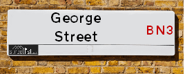
About George Street
George Street is a street located in Brighton and Hove. The street has a length of approximately 335 metres.
George Street is located within the The City of Brighton and Hove (B) Council's jurisdiction. They provide various services, like refuse collection, and manage council tax collection. It's situated in the South East region of the UK.
George Street has been assigned the Unique Street Reference Number of 4401471 in the National Street Gazetteer.
George Street is located within the county of East Sussex, situated in the South East region of the UK. It's 46.42 miles South from central London., 1.46 miles West from Brighton, 8.86 miles West from Lewes and 26.44 miles East from Chichester.

Do you know why this road is called George Street?
What's it like to live here?
Ask the community a question about George Street.
Do you have any questions, memories to share or know any facts about George Street? We'd love to know more.
Also on streetlist.co.uk, can you help?
Eldroth Road
15th April 2024
I wondered if anyone has any old pictures of Wenning Bank House in the 1940’s and also Lane Side before of the same era .. we visited today with my Mum in law as she used to live at both these properties. Also any photos of the schools around that time .. thank you.
Can You Help?Napps Way
15th April 2024
Why is the road called Napps Way (belonging to Napp, but minus an
apostrophe as is usual with such nomenclature)? Moreover, who or
what is, or was, “Napp” in the respective, possessive case?
Several years ago, I met an elderly man (probably in his late-eighties)
who lives on Bentham Drive, Liverpool 16, and during a conversation
with him whilst in a Northwest Passenger Transport Ambulance on the
way to the former RLUH (Royal Liverpool University Hospital), he told
me that he could remember (when he was a boy, living in Childwall,
Liverpool 16) that, “Where Napps Way is now, during WW2, there was
a two-man gun emplacement on the, then, open land to protect the
railway line passing over Childwall Valley Road - next to the railway
bridge - when suddenly, as they were loading a live “shell” into the gun’s
breach, the aforementioned “shell” accidentally exploded in the gun’s
breach killing both of the two soldiers, that had been manning the gun,
instantly! (Very sad, of course, but could - perhaps - two ghosts relating
to those two, very unfortunately and prematurely-killed soldiers have
haunted that place of their deaths ever since - and have any residents
of Napps Way - formerly and in its latest incarnation - seen two, WW2
(uniformed) soldiers unexpectedly appear in or near their homes?)
Mauritius Road
15th April 2024
Why is Mauritius Road so called, since when and by whom? Does Greenwich have any particular links with Mauritius? Very interested to know. 🤞🏼
Can You Help?Estate Agents near George Street
| Name | Address | Website |
|---|---|---|
| Hamlyn Smith | 1 Hova Villas, Hove, BN3 3DH | |
| Fox & Sons | 161 Church Road, Hove, East Sussex, BN3 2AD | |
| Goldin Lemcke | 160-162 Church Road, Hove, BN3 2DL | Visit Website |
Location Details
| George Street | |
|---|---|

| |
| Latitude | 50.829580 |
| Longitude | -0.173528 |
| OS Easting (X): | 528615 |
| OS Northing (Y): | 104990 |
| OS Grid Reference: | TQ286050 |
Ordnance Survey Maps for George Street
If you purchase a map through the links below, we may earn an affiliate commission.
| Map Series | link | Ordnance Survey |
| Explorer 1:25,000 ol11 Brighton & Hove | Check Price on Amazon | Buy Direct from the Ordnance Survey |
| Landranger 1:50,000 198 Brighton & Lewes | Check Price on Amazon |
Neighbourhood Policing |
| Police Force: Sussex |
 View Neighbourhood Crime and Policing View Neighbourhood Crime and Policing |
| Find a Local Neighbourhood Watch Scheme |
Frequently asked Questions for George Street
What Council (Local Authority) is George Street in?
George Street is located within the local authority area of Brighton and Hove Council which is a Unitary Authority.
What Parish Council is George Street in?
George Street is in an unparished area.
What Electoral Ward is George Street in?
George Street is located within the ward of Central Hove.
What County is George Street in?
George Street is located within the ceremonial county of East Sussex.
What Constituency is George Street in?
George Street is located within the constituency of Hove.
What Part of the UK is George Street in?
George Street is located within the South East (England) region of the United Kingdom.
What County Council area is George Street in?
George Street is located within the Brighton and Hove Council area.
What Police Force area is George Street in?
George Street is located within the Sussex Police area.
Roads that have a Junction with George Street
| Street | Junction Type |
|---|---|
| Blatchington Road | junction |
| Church Road (B2066) | junction |
Sunset and Sunrise times for George Street
| Sunrise | 05:42 |
|---|---|
| Sunset | 20:14 |
Latest Weather Conditions for George Street
| Observed at Weather Station: | Shoreham 25 April 2024 at 12:00 (5.19 miles away) |
|---|---|
| Current Weather: | Clear night |
| Temperature and Humidity: | 11.0°C (55.6%) |
| Wind Direction and Speed: | NW (11 mph) |
Population Statistics
| ONS Area Code | E00085082 & E00085071 |
|---|---|
| ONS Area Name | Professional Service Cosmopolitans |
| Average Age | 37.33 |
| Area Population | 1733.00 |
| Male Population | 957.00 (55%) |
| Female Population | 776.00 (45%) |
| Benefit Claimants | 38 (2%) |
| LSOA Code: | E01016855 |
|---|---|
| LSOA Name: | Brighton and Hove 026D |
| SOA Code: | 1a |
| SOA Name: | |
| MSOA Code: | E02003516 |
| MSOA Name: | Brighton and Hove 026 |
Nearest Supermarkets
| Tesco Hove Superstore |
|---|
| Church Rd, Hove, BN3 2DL |
| 0345 677 9796 |
| Distance: 0.12 Miles |
| Directions from George Street to Tesco Hove Superstore |
| Iceland Hove |
|---|
| 54 Blatchington Road, Hove, Brighton, BN3 3YH |
| 01273327388 |
| Distance: 0.12 Miles |
| Directions from George Street to Iceland Hove |
| Tesco Hove Denmark Villas Express |
|---|
| 84-86 Denmark Villas, Hove, BN3 3TJ |
| 0345 026 9018 |
| Distance: 0.39 Miles |
| Directions from George Street to Tesco Hove Denmark Villas Express |
| Sainsburys Hove Portland Road Local |
|---|
| 123-125 Portland Road, Hove, England, BN3 5QY |
| 1273327698 |
| Distance: 0.53 Miles |
| Directions from George Street to Sainsburys Hove Portland Road Local |
Telephone Information
| Dialling Code | Telephone Exchange | Telephone Cabinet | Fibre to the Cabinet or Fibre to the Premises |
|---|---|---|---|
| 01273 | BRIGHTON HOVE - SDHV | P38 | FTTC |
Local Government
| Local Council Details |
|---|
| Within the area of Brighton and Hove |
| Visit the Council's Website |
| Kings House, Grand Avenue, Hove, East Sussex &BN3 2LS |
| Send email |
| Telephone Number: 01273 290000 |
| Local Member of Parliament |
|---|
| Within the Westminster Parliamentary Constituency of Hove |
| The Member of Parliament is Peter Kyle |
| Details for the MP Peter Kyle on parliament.uk |
| Details for the MP Peter Kyle on theyworkforyou.com |
| In the 2019 General Election Peter Kyle won with a majority of 17,044 the result was Lab hold. The total electorate was 74,313 |
| Wards, Parish Councils and County Councils |
|---|
| Ward: Central Hove Ward |
| Ceremonial County: East Sussex |
Nearest Schools
England Primary Schools
St Mary Magdalen Catholic Primary School
Address: St Mary Magdalen Catholic Primary School, Spring Street, Brighton, East Sussex, BN1 3EF
Distance: 1.11 miles
Contact: 01273327533
Brunswick Primary School
Address: Brunswick Primary School, Somerhill Road, Hove, East Sussex, BN3 1RP
Distance: 0.68 miles
Contact: 01273711816
Cottesmore St Mary's Catholic Primary School
Address: Cottesmore St Mary's Catholic Primary School, The Upper Drive, Hove, East Sussex, BN3 6NB
Distance: 0.86 miles
Contact: 01273555811
Aldrington CofE Primary School
Address: Aldrington CofE Primary School, Eridge Road, Hove, East Sussex, BN3 7QD
Distance: 1.05 miles
Contact: 01273542656
Bilingual Primary School - Brighton & Hove
Address: Bilingual Primary School - Brighton & Hove, The Droveway, Hove, Brighton and Hove, East Sussex, BN3 7QA
Distance: 1.02 miles
Contact: 01273916212
St Andrew's CofE (Aided) Primary School
Address: St Andrew's CofE (Aided) Primary School, Belfast Street, Hove, East Sussex, BN3 3YT
Distance: 0.08 miles
Contact: 01273770082
West Hove Infant School
Address: West Hove Infant School, Portland Road, Hove, East Sussex, BN3 5JA
Distance: 0.77 miles
Contact: 01273733386
Hove Junior School
Address: Hove Junior School, Portland Road, Hove, East Sussex, BN3 5JA
Distance: 0.77 miles
Contact: 01273916609
England Higher Schools
Brighton Hove and Sussex Sixth Form College
Address: Brighton Hove and Sussex Sixth Form College, 205 Dyke Road, Hove, East Sussex, BN3 6EG
Distance: 1.00 miles
Contact: 01273552200
England Secondary Schools
Cardinal Newman Catholic School
Address: Cardinal Newman Catholic School, The Upper Drive, Hove, East Sussex, BN3 6ND
Distance: 0.83 miles
Contact: 01273558551
Blatchington Mill School
Address: Blatchington Mill School, Nevill Avenue, Hove, East Sussex, BN3 7BW
Distance: 1.18 miles
Contact: 01273736244
Hove Park School and Sixth Form Centre
Address: Hove Park School and Sixth Form Centre, Nevill Road, Hove, East Sussex, BN3 7BN
Distance: 0.82 miles
Contact: 01273082870
Nearest Hospitals
| Name | Address | Postcode | Distance | Map |
|---|
Nearest Dentists
Dentists near George Street
| Name | Address | Postcode | Distance | Map |
|---|
Nearest GP Surgeries
Doctors near George Street
TRINITY MEDICAL CENTRE
Address: 1 GOLDSTONE VILLAS, HOVE, EAST SUSSEX, BN3 3AT
Distance: 0.13 miles
Contact: tel: 01273 724648
CHARTER MEDICAL CENTRE - ADMIN BUILDING
Address: GROUND FLOOR SUITE, 125 DAVIGDOR ROAD, HOVE, EAST SUSSEX, BN3 1RE
Distance: 0.70 miles
Contact: :
CHARTER MEDICAL CENTRE
Address: 88 DAVIGDOR ROAD, HOVE, EAST SUSSEX, BN3 1RF
Distance: 0.74 miles
Contact: tel: 01273 770555
WISH PARK SURGERY
Address: 191-193 PORTLAND ROAD, HOVE, EAST SUSSEX, BN3 5JA
Distance: 0.77 miles
Contact: tel: 01273 729194
WELLBN HEALTHCARE
Address: 18-19 WESTERN ROAD, HOVE, EAST SUSSEX, BN3 1AE
Distance: 0.82 miles
Contact: tel: 01273 772020
MONTPELIER SURGERY
Address: 2 VICTORIA ROAD, BRIGHTON, EAST SUSSEX, BN1 3FS
Distance: 1.08 miles
Contact: tel: 01273 328950
Nearest Dispensing Chemists
Pharmacies near George Street
| Name | Address | Postcode | Telephone | Map | Distance in Km |
|---|
Nearest Opticians
Opticians near George Street
SPECSAVERS (HOVE)
Address: 84 GEORGE STREET, HOVE, EAST SUSSEX, BN3 3YE
Distance: 0.01 miles
Contact: :
BOOTS OPTICIANS (HOVE)
Address: 25 GEORGE STREET, HOVE, EAST SUSSEX, BN3 3YA
Distance: 0.03 miles
Contact: :
THE EYECARE CENTRE
Address: 156 CHURCH ROAD, HOVE, EAST SUSSEX, BN3 2DL
Distance: 0.12 miles
Contact: :
PETER MARSON OPTOMETRIST
Address: 188 CHURCH ROAD, HOVE, EAST SUSSEX, BN3 2DJ
Distance: 0.19 miles
Contact: :
VISION CARE FOR HOMELESS PEOPLE (BHT DAY CENTRE)
Address: FIRST BASE DAY CENTRE, ST STEPHENS HALL, MONTPELIER PLACE, BRIGHTON, EAST SUSSEX, BN1 3BF
Distance: 0.91 miles
Contact: :
VISION EXPRESS (CHURCHILL SQ, BRIGHTON)
Address: UNIT 60, CHURCHILL SQUARE, BRIGHTON, EAST SUSSEX, BN1 2TE
Distance: 1.29 miles
Contact: :
Transport
Nearest Rail Stations
Hove Station is 0.41 miles away.
Address: Hove station, Goldstone Villas, Hove, East Sussex, BN3 3RU
Hove is situated on the West Coastway Line and is managed by Southern.
Hove Station is staffed on a full time basis.
Aldrington Station is 0.58 miles away.
Address: Aldrington station, Amhurst Crescent, Aldrington, East Sussex, BN3 5AE
Aldrington is situated on the West Coastway Line and is managed by Southern.
Aldrington Station is an unstaffed station.