Map of St Mary's Road
| Postcodes | ||
|---|---|---|
| Icon | Postcodes for St Mary's Road | |
| Walking Distances | ||
| Distance Info | Green Circle = 10 Minutes Walk (800 metres) | |
About St Mary's Road
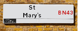
St Mary's Road is a street located in the town of Shoreham-by-Sea. It uses the postcode BN43 5ZA. The street has a length of approximately 138 metres.
St Mary's Road is located within the Adur District Council's jurisdiction. They provide various services, like refuse collection, and manage council tax collection. It's situated in the South East region of the UK.
St Mary's Road has been assigned the Unique Street Reference Number of 200382 in the National Street Gazetteer.
St Mary's Road is located within the county of West Sussex, situated in the South East region of the UK. It's 46.64 miles South from central London., 5.81 miles West from Brighton, 13.02 miles West from Lewes and 22.04 miles East from Chichester.

Do you know why this road is called St Mary's Road?
What's it like to live here?
Ask the community a question about St Mary's Road.
Do you have any questions, memories to share or know any facts about St Mary's Road? We'd love to know more.
Also on streetlist.co.uk, can you help?
Eldroth Road
15th April 2024
I wondered if anyone has any old pictures of Wenning Bank House in the 1940’s and also Lane Side before of the same era .. we visited today with my Mum in law as she used to live at both these properties. Also any photos of the schools around that time .. thank you.
Can You Help?Napps Way
15th April 2024
Why is the road called Napps Way (belonging to Napp, but minus an
apostrophe as is usual with such nomenclature)? Moreover, who or
what is, or was, “Napp” in the respective, possessive case?
Several years ago, I met an elderly man (probably in his late-eighties)
who lives on Bentham Drive, Liverpool 16, and during a conversation
with him whilst in a Northwest Passenger Transport Ambulance on the
way to the former RLUH (Royal Liverpool University Hospital), he told
me that he could remember (when he was a boy, living in Childwall,
Liverpool 16) that, “Where Napps Way is now, during WW2, there was
a two-man gun emplacement on the, then, open land to protect the
railway line passing over Childwall Valley Road - next to the railway
bridge - when suddenly, as they were loading a live “shell” into the gun’s
breach, the aforementioned “shell” accidentally exploded in the gun’s
breach killing both of the two soldiers, that had been manning the gun,
instantly! (Very sad, of course, but could - perhaps - two ghosts relating
to those two, very unfortunately and prematurely-killed soldiers have
haunted that place of their deaths ever since - and have any residents
of Napps Way - formerly and in its latest incarnation - seen two, WW2
(uniformed) soldiers unexpectedly appear in or near their homes?)
Mauritius Road
15th April 2024
Why is Mauritius Road so called, since when and by whom? Does Greenwich have any particular links with Mauritius? Very interested to know. 🤞🏼
Can You Help?Estate Agents near St Mary's Road
| Name | Address | Website |
|---|---|---|
| Fox & Sons | 3 The Vinery, St Marys Road, Shoreham - By - Sea, West Sussex, BN43 5ZA | |
| Harrison Brant | 6 Brunswick Road, Shoreham-by-Sea, West Sussex, BN43 5WB | Visit Website |
| Osborn Humphreys | 32/34 Brunswick Road, Shoreham-By-Sea, BN43 5WB | Visit Website |
We have found 1 postcode for St Mary's Road
Location Details
| St Mary's Road | |
|---|---|

| |
| Latitude | 50.833292 |
| Longitude | -0.274044 |
| OS Easting (X): | 521527 |
| OS Northing (Y): | 105232 |
| OS Grid Reference: | TQ215052 |
Neighbourhood Policing |
| Police Force: Sussex |
 View Neighbourhood Crime and Policing View Neighbourhood Crime and Policing |
| Find a Local Neighbourhood Watch Scheme |
Frequently asked Questions for St Mary's Road
What Council (Local Authority) is St Mary's Road in?
St Mary's Road is located within the local authority area of Adur Council which is a District Council.
What Parish Council is St Mary's Road in?
St Mary's Road is in an unparished area.
What Electoral Ward is St Mary's Road in?
St Mary's Road is located within the ward of St Mary's.
What County is St Mary's Road in?
St Mary's Road is located within the ceremonial county of West Sussex.
What Constituency is St Mary's Road in?
St Mary's Road is located within the constituency of East Worthing and Shoreham.
What Part of the UK is St Mary's Road in?
St Mary's Road is located within the South East (England) region of the United Kingdom.
What County Council area is St Mary's Road in?
St Mary's Road is located within the West Sussex Council area.
What Police Force area is St Mary's Road in?
St Mary's Road is located within the Sussex Police area.
Roads that have a Junction with St Mary's Road
| Street | Junction Type |
|---|---|
| Brunswick Road | junction |
| East Street | junction |
| St Mary's Close | junction |
| Pond Road | junction |
Sunset and Sunrise times for St Mary's Road , BN43 5ZA
| Sunrise | 05:45 |
|---|---|
| Sunset | 20:13 |
Latest Weather Conditions for St Mary's Road, BN43 5ZA
| Observed at Weather Station: | Shoreham 23 April 2024 at 23:00 (0.81 miles away) |
|---|---|
| Current Weather: | Clear night |
| Temperature and Humidity: | 6.3°C (76.3%) |
| Wind Direction and Speed: | N (5 mph) |
Population Statistics
| ONS Area Code | E00159929 |
|---|---|
| ONS Area Name | Families in Terraces and Flats |
| Average Age | 42.23 |
| Area Population | 1455.00 |
| Male Population | 700.00 (48%) |
| Female Population | 755.00 (52%) |
| Benefit Claimants | 31 (2%) |
| LSOA Code: | E01031364 |
|---|---|
| LSOA Name: | Adur 005C |
| SOA Code: | 4b |
| SOA Name: | |
| MSOA Code: | E02006538 |
| MSOA Name: | Adur 005 |
Nearest Supermarkets
| Tesco Upper Shoreham Express |
|---|
| 225 Upper Shoreham Rd, Shoreham By Sea, Shoreham, BN43 6BE |
| 0345 671 9631 |
| Distance: 0.62 Miles |
| Directions from St Mary's Road to Tesco Upper Shoreham Express |
| Tesco Shoreham-by-sea Extra |
|---|
| Holmbush Centre, Upper Shoreham Rd, Shoreham-By-Sea, BN43 6TD |
| 0345 677 9618 |
| Distance: 1.36 Miles |
| Directions from St Mary's Road to Tesco Shoreham-by-sea Extra |
| Asda Lancing |
|---|
| South Street, Lancing, Brighton, BN15 8AG |
| 01903 855220 |
| Distance: 2.22 Miles |
| Directions from St Mary's Road to Asda Lancing |
| Tesco Portslade Metro |
|---|
| 19-20 Boundary Road, Portslade, Brighton, BN41 1GB |
| 0345 677 9558 |
| Distance: 2.93 Miles |
| Directions from St Mary's Road to Tesco Portslade Metro |
Telephone Information
| Dialling Code | Telephone Exchange | Telephone Cabinet | Fibre to the Cabinet or Fibre to the Premises |
|---|---|---|---|
| 01273 | SHOREHAM - SDSHRHM | P13 | FTTC |
Broadband Information
| Speed | Average Speed | Median Speed | Maximum Speed | Next-generation access (NGA) | Number of Connections |
|---|---|---|---|---|---|
| Greater than 2 Mbps | 18.9 | 15.6 | >=30 | Y | 11 |
Local Government
| Local Council Details |
|---|
| Within the area of Adur |
| Visit the Council's Website |
| Adur Civic Centre, Ham Road, Shoreham-by-Sea, West Sussex &BN43 6PR |
| Send email |
| Telephone Number: 01273 263 000 |
| Local Member of Parliament |
|---|
| Within the Westminster Parliamentary Constituency of East Worthing and Shoreham |
| The Member of Parliament is Tim Loughton |
| Details for the MP Tim Loughton on parliament.uk |
| Details for the MP Tim Loughton on theyworkforyou.com |
| In the 2019 General Election Tim Loughton won with a majority of 7,474 the result was Con hold. The total electorate was 75,194 |
| Wards, Parish Councils and County Councils |
|---|
| Ward: St Mary's Ward |
| Ceremonial County: West Sussex |
Nearest Schools
England Primary Schools
St Peter's Catholic Primary School, Shoreham-by-Sea
Address: St Peter's Catholic Primary School, Shoreham-by-Sea, Sullington Way, Shoreham-by-Sea, West Sussex, BN43 6PJ
Distance: 0.53 miles
Contact:
Glebe Primary School
Address: Glebe Primary School, Church Lane, Southwick, Brighton, West Sussex, BN42 4GB
Distance: 1.37 miles
Contact: 01273592163
St Nicolas & St Mary CofE(Aided) Primary School
Address: St Nicolas & St Mary CofE(Aided) Primary School, Eastern Avenue, Shoreham-by-Sea, West Sussex, BN43 6PE
Distance: 0.53 miles
Contact:
Buckingham Park Primary School
Address: Buckingham Park Primary School, Buckingham Road, Buckingham Park Primary, Shoreham-by-Sea, West Sussex, BN43 5UD
Distance: 0.39 miles
Contact: 01273453515
Shoreham Beach Primary School
Address: Shoreham Beach Primary School, Shingle Road, Shoreham-by-Sea, West Sussex, BN43 5RH
Distance: 0.46 miles
Contact: 01273462688
Swiss Gardens Primary School
Address: Swiss Gardens Primary School, Swiss Gardens, Shoreham-by-Sea, West Sussex, BN43 5WH
Distance: 0.27 miles
Contact: 01273453176
Nearest Hospitals
| Name | Address | Postcode | Distance | Map |
|---|
Nearest Dentists
Dentists near St Mary's Road
| Name | Address | Postcode | Distance | Map |
|---|
Nearest GP Surgeries
Doctors near St Mary's Road
ADUR HEALTH PARTNERSHIP
Address: THE HEALTH CENTRE, POND ROAD, SHOREHAM-BY-SEA, WEST SUSSEX, BN43 5US
Distance: 0.04 miles
Contact: tel: 01273 466052
NORTHBOURNE MEDICAL CENTRE
Address: 193A UPPER SHOREHAM ROAD, SHOREHAM-BY-SEA, BN43 6BT
Distance: 0.80 miles
Contact: :
NORTHBOURNE MEDICAL CENTRE - COVID LOCAL VACCINATION SERVICE 3
Address: 193A UPPER SHOREHAM ROAD, SHOREHAM-BY-SEA, BN43 6BT
Distance: 0.80 miles
Contact: :
LANCING COLLEGE SANATORIUM
Address: LANCING COLLEGE, LANCING, WEST SUSSEX, BN15 0RW
Distance: 1.60 miles
Contact: :
THE MANOR PRACTICE
Address: SOUTHWICK STREET, SOUTHWICK, BRIGHTON, BN42 4TA
Distance: 1.71 miles
Contact: :
3 DOWNSWAY, SOUTHWICK
Address: 3 DOWNSWAY, SOUTHWICK, EAST SUSSEX, BN42 4WA
Distance: 1.93 miles
Contact: tel: 01273 592764
Nearest Dispensing Chemists
Pharmacies near St Mary's Road
| Name | Address | Postcode | Telephone | Map | Distance in Km |
|---|
Nearest Opticians
Opticians near St Mary's Road
EDMINSON BUTLER DISPENSING OPTICIAN
Address: 2 THE VINERY, ST. MARYS ROAD, SHOREHAM-BY-SEA, WEST SUSSEX, BN43 5ZA
Distance: 0.03 miles
Contact: :
EDMINSON BUTLER
Address: 2 THE VINERY, ST. MARYS ROAD, SHOREHAM-BY-SEA, WEST SUSSEX, BN43 5ZA
Distance: 0.03 miles
Contact: :
THOMAS H COLLISON LTD (SHOREHAM)
Address: 33 BRUNSWICK ROAD, SHOREHAM-BY-SEA, WEST SUSSEX, BN43 5WA
Distance: 0.07 miles
Contact: :
THE EYE COMPANY
Address: 48 HIGH STREET, SHOREHAM-BY-SEA, WEST SUSSEX, BN43 5DA
Distance: 0.12 miles
Contact: :
SHOREHAM EXTRA
Address: HOLMBUSH CENTRE, UPPER SHOREHAM ROAD, SHOREHAM-BY-SEA, WEST SUSSEX, BN43 6TD
Distance: 1.14 miles
Contact: :
M&S OPTICIANS - SHOREHAM-BY-SEA
Address: HOLMBUSH CENTRE, UPPER SHOREHAM ROAD, SHOREHAM-BY-SEA, BN43 6TD
Distance: 1.14 miles
Contact: :
Transport
Nearest Rail Stations
Shoreham-by-Sea Station is 0.13 miles away.
Address: Shoreham-by-sea station, Station Approach, Shoreham-by-sea, West Sussex, BN43 5WX
Shoreham-by-Sea is situated on the West Coastway Line and is managed by Southern.
Shoreham-by-Sea Station is staffed on a part time basis.
Directions from St Mary's Road to Shoreham-by-Sea Rail Station
Southwick Station is 1.61 miles away.
Address: Southwick station, Station Road, Southwick, West Sussex, BN42 4AE
Southwick is situated on the West Coastway Line and is managed by Southern.
Southwick Station is staffed on a part time basis.