Map of Beechwood Lane
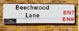
| Postcodes | ||
|---|---|---|
| Icon | Postcodes for Beechwood Lane | |
| Walking Distances | ||
| Distance Info | Green Circle = 10 Minutes Walk (800 metres) | |
About Beechwood Lane
Beechwood Lane is a street located near Chiltington and near the village of Cooksbridge. The street has a length of approximately 2,030 metres.
Beechwood Lane is located within the Lewes District Council's jurisdiction. They provide various services, like refuse collection, and manage council tax collection. It's situated in the South East region of the UK.
Beechwood Lane has been assigned the Unique Street Reference Number of 23300534 in the National Street Gazetteer.
Beechwood Lane is located within the county of East Sussex, situated in the South East region of the UK. It's 41.1 miles South from central London., 2.83 miles North West from Lewes, 8.07 miles North East from Brighton and 33.06 miles South East from Guildford.

Do you know why this road is called Beechwood Lane?
What's it like to live here?
Ask the community a question about Beechwood Lane.
Do you have any questions, memories to share or know any facts about Beechwood Lane? We'd love to know more.
Also on streetlist.co.uk, can you help?
Eldroth Road
15th April 2024
I wondered if anyone has any old pictures of Wenning Bank House in the 1940’s and also Lane Side before of the same era .. we visited today with my Mum in law as she used to live at both these properties. Also any photos of the schools around that time .. thank you.
Can You Help?Napps Way
15th April 2024
Why is the road called Napps Way (belonging to Napp, but minus an
apostrophe as is usual with such nomenclature)? Moreover, who or
what is, or was, “Napp” in the respective, possessive case?
Several years ago, I met an elderly man (probably in his late-eighties)
who lives on Bentham Drive, Liverpool 16, and during a conversation
with him whilst in a Northwest Passenger Transport Ambulance on the
way to the former RLUH (Royal Liverpool University Hospital), he told
me that he could remember (when he was a boy, living in Childwall,
Liverpool 16) that, “Where Napps Way is now, during WW2, there was
a two-man gun emplacement on the, then, open land to protect the
railway line passing over Childwall Valley Road - next to the railway
bridge - when suddenly, as they were loading a live “shell” into the gun’s
breach, the aforementioned “shell” accidentally exploded in the gun’s
breach killing both of the two soldiers, that had been manning the gun,
instantly! (Very sad, of course, but could - perhaps - two ghosts relating
to those two, very unfortunately and prematurely-killed soldiers have
haunted that place of their deaths ever since - and have any residents
of Napps Way - formerly and in its latest incarnation - seen two, WW2
(uniformed) soldiers unexpectedly appear in or near their homes?)
Mauritius Road
15th April 2024
Why is Mauritius Road so called, since when and by whom? Does Greenwich have any particular links with Mauritius? Very interested to know. 🤞🏼
Can You Help?Estate Agents near Beechwood Lane
| Name | Address | Website |
|---|---|---|
| Stanley & Partners | 1 Fisher Street, Lewes, BN7 2DG | Visit Website |
| Fox & Sons | 192 High Street, Lewes, East Sussex, BN7 2NS | |
| Strutt & Parker | 201 High Street, Lewes, BN7 2NR | Visit Website |
Hotels near Beechwood Lane
Budget Hotels near Beechwood Lane
| Budget Hotel Name | Distance (miles) |
|---|---|
| 1: Name:Premier Inn Lewes Town Centre Address:The Old Courtroom Telephone: Visit Site |
2.78 |
| 2: Name:Premier Inn Burgess Hill Address:Charles Avenue, Burgess Hill Telephone: Visit Site |
6.49 |
| 3: Name:Travelodge Brighton Address:165-167 Preston Rd, Brighton, BN1 6AU Telephone:0871 984 6017 Visit Site |
7.42 |
| 4: Name:Premier Inn Haywards Heath Address:Perrymount Heath Telephone: Visit Site |
7.60 |
| 5: Name:Premier Inn Brighton City Centre Address:144 North Street Telephone: Visit Site |
7.94 |
Location Details
| Beechwood Lane | |
|---|---|

| |
| Latitude | 50.907965 |
| Longitude | -0.018236 |
| OS Easting (X): | 539315 |
| OS Northing (Y): | 113986 |
| OS Grid Reference: | TQ393140 |
Ordnance Survey Maps for Beechwood Lane
If you purchase a map through the links below, we may earn an affiliate commission.
| Map Series | link | Ordnance Survey |
| Explorer 1:25,000 ol11 Brighton & Hove | Check Price on Amazon | Buy Direct from the Ordnance Survey |
| Landranger 1:50,000 198 Brighton & Lewes | Check Price on Amazon |
Neighbourhood Policing |
| Police Force: Sussex |
 View Neighbourhood Crime and Policing View Neighbourhood Crime and Policing |
| Find a Local Neighbourhood Watch Scheme |
Frequently asked Questions for Beechwood Lane
What Council (Local Authority) is Beechwood Lane in?
Beechwood Lane is located within the local authority area of Lewes Council which is a District Council.
What Parish Council is Beechwood Lane in?
Beechwood Lane is located within the area of Hamsey, East Chiltington & St. John (Without) Parish Council.
What Electoral Ward is Beechwood Lane in?
Beechwood Lane is located within the ward of Chailey, Barcombe & Hamsey, Plumpton, Streat &East Chiltington & St John.
What County is Beechwood Lane in?
Beechwood Lane is located within the ceremonial county of East Sussex.
What Constituency is Beechwood Lane in?
Beechwood Lane is located within the constituency of Lewes.
What Part of the UK is Beechwood Lane in?
Beechwood Lane is located within the South East (England) region of the United Kingdom.
What County Council area is Beechwood Lane in?
Beechwood Lane is located within the East Sussex Council area.
What Police Force area is Beechwood Lane in?
Beechwood Lane is located within the Sussex Police area.
Roads that have a Junction with Beechwood Lane
| Street | Junction Type |
|---|---|
| Wickham Lane | junction |
| Allington Lane | junction |
Sunset and Sunrise times for Beechwood Lane
| Sunrise | 05:54 |
|---|---|
| Sunset | 20:04 |
Latest Weather Conditions for Beechwood Lane
| Observed at Weather Station: | Shoreham 19 April 2024 at 20:00 (12.93 miles away) |
|---|---|
| Current Weather: | Clear night |
| Temperature and Humidity: | 8.0°C (75.6%) |
| Wind Direction and Speed: | NE (5 mph) |
Population Statistics
| ONS Area Code | E00106768 & E00106993 |
|---|---|
| ONS Area Name | Rural White-Collar Workers |
| Average Age | 42.30 & 41.31 |
| Area Population | 2105.00 & 1153.00 |
| Male Population | 1009.00 & 565.00 (48%) |
| Female Population | 1096.00 & 588.00 (52%) |
| Benefit Claimants | 10 & 5 (0%) |
| LSOA Code: | E01021022 &E01021068 |
|---|---|
| LSOA Name: | Lewes 001A &Lewes 002E |
| SOA Code: | 2b &2a |
| SOA Name: | |
| MSOA Code: | E02004379 &E02004380 |
| MSOA Name: | Lewes 001 &Lewes 002 |
Nearest Supermarkets
| Tesco Lewes Superstore |
|---|
| Brooks Rd, Lewes, BN7 2BY |
| 0345 677 9420 |
| Distance: 2.56 Miles |
| Directions from Beechwood Lane to Tesco Lewes Superstore |
| Waitrose Lewes |
|---|
| Eastgate Street, Lewes, East Sussex, BN7 2LP |
| 01273 486286 |
| Distance: 2.68 Miles |
| Directions from Beechwood Lane to Waitrose Lewes |
| Asda Brighton Hollingbury |
|---|
| Unit 1 Crowhurst Road, off Carden Avenue, Brighton, BN1 8AS |
| 01273 541166 |
| Distance: 5.41 Miles |
| Directions from Beechwood Lane to Asda Brighton Hollingbury |
| Sainsburys Hassocks Keymer Road Local |
|---|
| 22 - 24 Keymer Road, Hassocks, England, BN6 8AN |
| 1273842430 |
| Distance: 5.56 Miles |
| Directions from Beechwood Lane to Sainsburys Hassocks Keymer Road Local |
Telephone Information
| Area Code |
|---|
| Area Code: 01825 - Uckfield |
| Area Code: 01273 - Brighton |
| Area Code: 01444 - Haywards Heath |
Local Government
| Local Council Details |
|---|
| Within the area of Lewes |
| Visit the Council's Website |
| 32 High Street, Lewes, East Sussex &BN7 2LX |
| Send email |
| Telephone Number: 01273 471 600 |
| Local Member of Parliament |
|---|
| Within the Westminster Parliamentary Constituency of Lewes |
| The Member of Parliament is Maria Caulfield |
| Details for the MP Maria Caulfield on parliament.uk |
| Details for the MP Maria Caulfield on theyworkforyou.com |
| In the 2019 General Election Maria Caulfield won with a majority of 2,457 the result was Con hold. The total electorate was 71,503 |
| Wards, Parish Councils and County Councils |
|---|
| Ward: Chailey, Barcombe & Hamsey, Plumpton, Streat &East Chiltington & St John Ward |
| Ceremonial County: East Sussex |
Nearest Schools
| Name | Address | Postcode | Telephone | Type | Distance (Km) |
|---|
Data accessed from gov.scot 08-08-2019
Nearest Hospitals
| Name | Address | Postcode | Distance | Map |
|---|
Nearest Dentists
Dentists near Beechwood Lane
| Name | Address | Postcode | Distance | Map |
|---|
Nearest GP Surgeries
Doctors near Beechwood Lane
SOUTH CHAILEY SURGERY
Address: MILL LANE, SOUTH CHAILEY, LEWES, EAST SUSSEX, BN8 4PY
Distance: 2.10 miles
Contact: tel: 01273 892999
LEWES VICTORIA HOSPITAL
Address: NEVILL ROAD, LEWES, BN7 1PE
Distance: 2.33 miles
Contact: :
FOUNDRY HEALTHCARE LEWES
Address: SCHOOL HILL PRACTICE, SCHOOL HILL H, 33 HIGH STREET, LEWES, EAST SUSSEX, BN7 2LU
Distance: 2.72 miles
Contact: tel: 01273 480888
RIVER LODGE SURGERY
Address: MALLING STREET, LEWES, BN7 2RD
Distance: 2.80 miles
Contact: :
RIVER LODGE SURGERY - COVID LOCAL VACCINATION SERVICE 2
Address: MALLING STREET, LEWES, BN7 2RD
Distance: 2.80 miles
Contact: :
RIVER LODGE SURGERY - COVID LOCAL VACCINATION SERVICE
Address: MALLING STREET, LEWES, BN7 2RD
Distance: 2.80 miles
Contact: :
Nearest Dispensing Chemists
Pharmacies near Beechwood Lane
| Name | Address | Postcode | Telephone | Map | Distance in Km |
|---|
Nearest Opticians
Opticians near Beechwood Lane
WILSON WILSON & HANCOCK LTD (LEWES)
Address: 223A HIGH STREET, LEWES, EAST SUSSEX, BN7 2AF
Distance: 2.75 miles
Contact: :
SPECSAVERS (LEWES)
Address: 218 HIGH STREET, LEWES, EAST SUSSEX, BN7 2AF
Distance: 2.75 miles
Contact: :
SPECTRUM EYECARE
Address: 24-25 CLIFFE HIGH STREET, LEWES, EAST SUSSEX, BN7 2AH
Distance: 2.80 miles
Contact: :
4646 BRIGHTON HOLLINGBURY
Address: ASDA STORES LTD, 1 CROWHURST ROAD, HOLLINGBURY, BRIGHTON, EAST SUSSEX, BN1 8AS
Distance: 5.37 miles
Contact: :
HASSOCKS (KEYMER ROAD)
Address: 17 KEYMER ROAD, HASSOCKS, BN6 8AD
Distance: 5.55 miles
Contact: :
HASSAM LTD T/A EARLY AND EDMONDS
Address: 7 KEYMER PARADE, KEYMER ROAD, BURGESS HILL, WEST SUSSEX, RH15 0AB
Distance: 5.66 miles
Contact: :
Transport
Nearest Rail Stations
Cooksbridge Station is 0.49 miles away.
Address: Cooksbridge station, A275, Main Road, Cooksbridge, East Sussex, BN7 3QG
Cooksbridge is situated on the East Coastway Line and is managed by Southern.
Cooksbridge Station is an unstaffed station.
Plumpton Station is 2.32 miles away.
Address: Plumpton station, Station Road, Plumpton Green, East Sussex, BN7 3DB
Plumpton is situated on the East Coastway Line and is managed by Southern.
Plumpton Station is staffed on a part time basis.